Category:Chandler's Ford
Jump to navigation
Jump to search
largely residential area and civil parish in the Borough of Eastleigh in Hampshire, England  | |||||
| Upload media | |||||
| Instance of | |||||
|---|---|---|---|---|---|
| Location | Eastleigh, Hampshire, South East England, England | ||||
 | |||||
English: Chandler's Ford (originally The Ford and historically Chandlersford) is a largely residential area in the borough of Eastleigh in southern England, with a population of 6,361 in the 2001 UK Census.
Subcategories
This category has the following 14 subcategories, out of 14 total.
B
C
- Chandler's Ford railway station (20 F)
- Chandler's Ford War Memorial (1 F)
S
- Scantabout (23 F)
V
Media in category "Chandler's Ford"
The following 200 files are in this category, out of 272 total.
(previous page) (next page)-

-

-
 Art Deco Café, Chandler's Ford - geograph.org.uk - 5476743.jpg 800 × 640; 125 KB
-
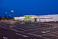
 ASDA superstore Chandlers Ford - geograph.org.uk - 3669389.jpg 640 × 394; 49 KB
-
 Asda superstore, Chandler's Ford - geograph.org.uk - 1205392.jpg 640 × 426; 125 KB
-
 ASDA superstore, Eastleigh - geograph.org.uk - 2817982.jpg 640 × 480; 56 KB
-
 Asda Superstore, Eastleigh - geograph.org.uk - 3161756.jpg 640 × 482; 89 KB
-
 Ashbourne Motor Company, Chandler's Ford - geograph.org.uk - 5477320.jpg 800 × 623; 124 KB
-
 Ashdown Drive entrance off Hocombe Road - geograph.org.uk - 3425002.jpg 640 × 518; 140 KB
-

-

-
 B ^ Q Corporate Headquarters building - geograph.org.uk - 2581352.jpg 640 × 427; 123 KB
-

-
 Bampton Court, Chandler's Ford - geograph.org.uk - 5486397.jpg 800 × 529; 107 KB
-

-
 Bin day in Kingsway - geograph.org.uk - 3462828.jpg 640 × 482; 110 KB
-

-

-

-
 Bournemouth Road from The Hut - geograph.org.uk - 3669709.jpg 640 × 490; 50 KB
-
 Bournemouth Road from Velmore Road - geograph.org.uk - 3669700.jpg 640 × 454; 72 KB
-

-
 Bournemouth Road, Eastleigh - geograph.org.uk - 5804380.jpg 1,024 × 684; 297 KB
-

-
 Bridge Beauty, Chandler's Ford - geograph.org.uk - 5478036.jpg 800 × 701; 105 KB
-

-
 British Gas Solar, Chandler's Ford - geograph.org.uk - 5478034.jpg 800 × 613; 142 KB
-
 Brownhill Road - geograph.org.uk - 2328789.jpg 640 × 425; 230 KB
-

-

-

-
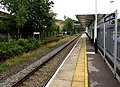 Chandler's Ford railway station - geograph.org.uk - 5625569.jpg 800 × 577; 157 KB
-

-
 Chandler's Ford railway station, Hampshire - geograph.org.uk - 4742659.jpg 1,600 × 1,200; 492 KB
-
 Chandler's Ford Station - geograph.org.uk - 2909658.jpg 1,024 × 768; 190 KB
-
 Chandler's Ford, Audi dealership - geograph.org.uk - 2909684.jpg 1,024 × 768; 130 KB
-
 Chandler's Ford, Central Precinct - geograph.org.uk - 2909640.jpg 1,024 × 768; 172 KB
-
 Chandler's Ford, Monks Brook - geograph.org.uk - 2909623.jpg 1,024 × 768; 300 KB
-
 Chandler's Ford, Monks Brook - geograph.org.uk - 2909672.jpg 1,024 × 768; 161 KB
-
 Chandler's Ford, railway line - geograph.org.uk - 2909652.jpg 1,024 × 768; 301 KB
-
 Chandler's Ford, The Hut - geograph.org.uk - 2909713.jpg 1,024 × 768; 162 KB
-
 Chandlers Ford - Zionshill Copse - geograph.org.uk - 677810.jpg 640 × 480; 157 KB
-
 Chandlers Ford Industrial Estate - geograph.org.uk - 4383457.jpg 1,280 × 853; 405 KB
-
 Chandlers Ford Velmore Evangelical Church - geograph.org.uk - 2419490.jpg 1,600 × 1,007; 373 KB
-
 Chandlers Gate, Chandler's Ford - geograph.org.uk - 5478028.jpg 800 × 495; 95 KB
-
 Children's Playground on Fryern Hill - geograph.org.uk - 3385249.jpg 640 × 427; 120 KB
-
 Craven Road, Chandler's Ford - geograph.org.uk - 3385213.jpg 640 × 427; 97 KB
-

-

-

-

-
 Devon Drive, Eastleigh - geograph.org.uk - 2607482.jpg 640 × 480; 82 KB
-

-
-

-

-
 Down Station Lane, Chandler's Ford - geograph.org.uk - 5625537.jpg 800 × 795; 158 KB
-

-
 End of Highfield Road, Chandler's Ford - geograph.org.uk - 3385258.jpg 640 × 427; 153 KB
-

-
 Falkland Road, Eastleigh - geograph.org.uk - 2607483.jpg 640 × 480; 58 KB
-
 Farmers' market in Fryern arcade - geograph.org.uk - 1716375.jpg 2,848 × 2,144; 1.56 MB
-
 Farmhouse pub - geograph.org.uk - 393109.jpg 640 × 480; 114 KB
-
 Fence by the railway - geograph.org.uk - 2328775.jpg 640 × 445; 268 KB
-

-
 Fishy Co in Chandler's Ford - geograph.org.uk - 5476761.jpg 800 × 657; 165 KB
-

-
 Footbridge over the M3 at Eastleigh - geograph.org.uk - 3285369.jpg 640 × 480; 401 KB
-

-
-
 Forest Road, Chandler's Ford - geograph.org.uk - 3461133.jpg 640 × 480; 81 KB
-

-

-
 Former Primitive Methodist Chapel, Chandlers Ford - geograph.org.uk - 3580929.jpg 2,119 × 2,734; 1.11 MB
-
 Fryern Arcade, Chandler's Ford - geograph.org.uk - 555127.jpg 640 × 427; 111 KB
-
 Fryern Close - geograph.org.uk - 3385222.jpg 640 × 427; 115 KB
-
 Fryern Hill Recreation Ground - geograph.org.uk - 3385210.jpg 640 × 427; 115 KB
-

-

-

-

-

-
 GoPhysio in Chandler's Ford - geograph.org.uk - 5476697.jpg 800 × 631; 123 KB
-
 Hampson Opticians, Chandler's Ford - geograph.org.uk - 5478037.jpg 788 × 800; 148 KB
-

-

-
 Hiltingbury Lakes - geograph.org.uk - 3461138.jpg 640 × 480; 90 KB
-

-

-
 Hocombe Bridge - geograph.org.uk - 2960881.jpg 640 × 482; 152 KB
-
 Hocombe Mead Nature Reserve entrance - geograph.org.uk - 3669853.jpg 640 × 366; 77 KB
-
 Hocombe Road at Lakewood Road - geograph.org.uk - 3110973.jpg 640 × 481; 110 KB
-
 Hocombe Road at roundabout by the M3 - geograph.org.uk - 3425011.jpg 640 × 453; 67 KB
-

-
 Hocombe Road looking east - geograph.org.uk - 3110921.jpg 640 × 480; 104 KB
-
 Hodder Close, Chandlers Ford - geograph.org.uk - 1567369.jpg 640 × 480; 90 KB
-

-

-
 Hursley Road at Common Road junction - geograph.org.uk - 3669782.jpg 640 × 479; 100 KB
-
 Hursley Road at Pine Road junction - geograph.org.uk - 3669793.jpg 640 × 461; 74 KB
-
-
 Hursley Road, Chandler's Ford - geograph.org.uk - 5625553.jpg 800 × 475; 124 KB
-
 Incident at Kingsway shops - geograph.org.uk - 3669840.jpg 640 × 432; 53 KB
-
 Industrial Estate - geograph.org.uk - 4383480.jpg 1,280 × 853; 346 KB
-
 Junction 12, M3 - geograph.org.uk - 2821148.jpg 640 × 430; 33 KB
-

-

-

-

-

-

-
 Kingsway in Chandlers Ford - geograph.org.uk - 5294847.jpg 4,000 × 3,000; 3.38 MB
-

-
-
 Lapwings in Flight - geograph.org.uk - 2870646.jpg 768 × 1,024; 220 KB
-
 Light sculpture, B^Q HQ - geograph.org.uk - 2770419.jpg 640 × 480; 58 KB
-

-

-

-

-

-
 M3 motorway crossing Chestnut Avenue - geograph.org.uk - 4725406.jpg 640 × 416; 132 KB
-
 M3 north of Junction 12 - geograph.org.uk - 2960911.jpg 640 × 482; 78 KB
-
 M3 north of Junction 13 - geograph.org.uk - 4237153.jpg 640 × 481; 47 KB
-

-
 M3 northbound - footbridge - geograph.org.uk - 5725285.jpg 640 × 428; 88 KB
-
 M3 northbound - geograph.org.uk - 5725293.jpg 640 × 428; 90 KB
-
 M3 northbound - geograph.org.uk - 5725300.jpg 640 × 428; 94 KB
-
 M3 northbound at Junction 12 - geograph.org.uk - 4237166.jpg 640 × 480; 37 KB
-

-
 M3 northbound nearing junction 12 - geograph.org.uk - 5725267.jpg 640 × 428; 82 KB
-
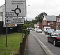
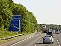
 M3 Signs, Chandler's Ford - geograph.org.uk - 5486474.jpg 800 × 600; 92 KB
-
 M3 southbound - geograph.org.uk - 2821157.jpg 640 × 357; 32 KB
-
 M3, Broomhill - geograph.org.uk - 3637773.jpg 640 × 398; 50 KB
-
 M3, Eastleigh - geograph.org.uk - 3285370.jpg 640 × 480; 425 KB
-
 M3, junction 12 - geograph.org.uk - 3637772.jpg 640 × 430; 42 KB
-
 Marlborough Road - geograph.org.uk - 2960908.jpg 640 × 482; 74 KB
-
 Marlborough Road, Hiltingbury - geograph.org.uk - 2814286.jpg 480 × 640; 77 KB
-

-
 Maya Fine Indian Dining, Chandler's Ford - geograph.org.uk - 5476633.jpg 800 × 756; 142 KB
-
 Mayflower Close, Eastleigh - geograph.org.uk - 2607497.jpg 640 × 480; 74 KB
-
 Mead Road, Chandler's Ford - geograph.org.uk - 5478038.jpg 800 × 600; 130 KB
-
 Meon Crescent, Chandler's Ford - geograph.org.uk - 2607545.jpg 640 × 480; 60 KB
-
 Midhurst Court, Chandler's Ford - geograph.org.uk - 5281369.jpg 640 × 480; 156 KB
-
 Modern flats, Chandler's Ford - geograph.org.uk - 5486416.jpg 800 × 554; 103 KB
-
 Monks Brook - geograph.org.uk - 4226629.jpg 2,272 × 1,704; 1.8 MB
-
 Monks Brook - geograph.org.uk - 5281382.jpg 640 × 480; 197 KB
-
 Monks Brook Industrial Park, School Close - geograph.org.uk - 863592.jpg 640 × 427; 171 KB
-

-
 Monks Brook pub, Chandler's Ford - geograph.org.uk - 5478042.jpg 800 × 730; 131 KB
-
 Monks Brook pub.jpg 640 × 426; 127 KB
-
 Monks Brook, Chandler's Ford - geograph.org.uk - 5478033.jpg 800 × 744; 252 KB
-
 Nail Look, Chandler's Ford - geograph.org.uk - 5476612.jpg 800 × 614; 140 KB
-

-

-

-

-
 Northbound M3 at Junction 12 - geograph.org.uk - 3285371.jpg 640 × 480; 422 KB
-
 Northbound M3, Eastleigh - geograph.org.uk - 3285368.jpg 640 × 480; 416 KB
-
 Northbound M3, Eastleigh - geograph.org.uk - 3706458.jpg 640 × 480; 301 KB
-
 Northbound M3, Exit at Junction 12 - geograph.org.uk - 4981087.jpg 640 × 480; 415 KB
-
 Northbound M3, Exit at Junction 13 - geograph.org.uk - 3706457.jpg 640 × 480; 241 KB
-
 Northbound M3, Junction 14 - geograph.org.uk - 3285367.jpg 640 × 480; 425 KB
-

-
 Nursery Gardens - geograph.org.uk - 2712672.jpg 640 × 480; 78 KB
-
 Oakmount Road at Constantine Avenue - geograph.org.uk - 3669810.jpg 640 × 428; 49 KB
-

-
 Office blocks in Stoney Croft Rise - geograph.org.uk - 2581275.jpg 528 × 640; 139 KB
-

-
 Ordnance Survey Flush Bracket 2790 - geograph.org.uk - 5356157.jpg 4,000 × 3,000; 3.37 MB
-
 Ordnance Survey Flush Bracket G5239 - geograph.org.uk - 5356154.jpg 4,000 × 3,000; 2.06 MB
-
 Park Road, Chandler's Ford - geograph.org.uk - 5478040.jpg 800 × 680; 143 KB
-
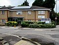
 Park Surgery, Chandler's Ford - geograph.org.uk - 5478078.jpg 800 × 556; 108 KB
-
 Path between houses on Shannon Way - geograph.org.uk - 2417912.jpg 640 × 482; 130 KB
-
 Path by Monks Brook - geograph.org.uk - 4226627.jpg 2,272 × 1,704; 3.32 MB
-

-
 Path in Valley Park - geograph.org.uk - 803344.jpg 427 × 640; 142 KB
-
-
 Peter Hansford Cycles, Chandler's Ford - geograph.org.uk - 5478092.jpg 800 × 725; 114 KB
-
 Peverells Road, Chandler's Ford - geograph.org.uk - 3385216.jpg 640 × 427; 141 KB
-

-
 Queens Road, Hiltingbury - geograph.org.uk - 3461120.jpg 640 × 480; 130 KB
-

-
 Ramalley Cemetery - geograph.org.uk - 2328784.jpg 640 × 426; 281 KB
-
 Ramalley Cemetery - geograph.org.uk - 2328786.jpg 640 × 427; 223 KB
-

-

-
 RMJ Dental, Chandler's Ford - geograph.org.uk - 5486455.jpg 800 × 659; 98 KB
-
 Road junction at The Monks Brook - geograph.org.uk - 3669728.jpg 640 × 441; 59 KB
-
 Romsey to Eastleigh railway line - geograph.org.uk - 2328780.jpg 640 × 427; 205 KB
-

-

-
 Roundabout at a Chandler's Ford junction - geograph.org.uk - 5625549.jpg 800 × 522; 103 KB
-
 Roundabout in Chandler's Ford - geograph.org.uk - 1106565.jpg 640 × 482; 74 KB
-
 Roundabout on B3043, Chandler's Ford - geograph.org.uk - 864071.jpg 640 × 427; 155 KB
-
-
 Royal Court, Chandler's Ford - geograph.org.uk - 5478113.jpg 800 × 658; 185 KB
-

-

-


