Category:Cerastium arvense in Ruhland
Jump to navigation
Jump to search
| Object location | | View all coordinates using: OpenStreetMap |
|---|
Acker-Hornkraut (Cerastium arvense) in Ruhland[edit]
Deutsch: Diese Kategorie erfasst Acker-Hornkraut (Cerastium arvense) in Ruhland mit Ortsteil Arnsdorf.
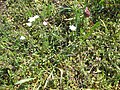
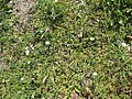
English: This category contains Cerastium arvense, commonly known as chick weed, or field mouse-ear, in Ruhland with urban district Arnsdorf.
Media in category "Cerastium arvense in Ruhland"
The following 23 files are in this category, out of 23 total.
-

-
-
-

-
 Ruhland, Kamenzer Str., Feldecke bei der Luther-Eiche, Frühlings-Ehrenpreis blühend, 01.jpg 2,736 × 3,648; 6.81 MB
-
 Ruhland, Kamenzer Str., Feldecke bei der Luther-Eiche, Frühlings-Ehrenpreis blühend, 02.jpg 3,648 × 2,736; 4.34 MB
-

-

-

-

-

-

-

-
 Ruhland, Ortrander Str. zwischen Hausnr. 6 und Turnhalle, Acker-Hornkraut, Frühling, 02.jpg 2,272 × 1,704; 1,013 KB
-

-

-
 Ruhland, Ortrander Str., Acker-Hornkraut am Sportplatz-Zaun, Frühling, 01.jpg 1,704 × 2,272; 970 KB
-
 Ruhland, Querstr. zwischen Hausnr. 1a+2, Acker-Hornkraut blühend, Frühling, 01.jpg 2,736 × 3,648; 4.26 MB
-

-

-
 Ruhland, Wildblumenwiese bei der Luther-Eiche, Nordansicht, Spätfrühling 2019, 01.jpg 3,648 × 2,736; 5.28 MB
-
 Ruhland, Wildblumenwiese bei der Luther-Eiche, Nordnordostansicht, Spätfrühling 2019, 03.jpg 3,648 × 2,736; 5.58 MB
-
 Ruhland, Wildblumenwiese bei der Luther-Eiche, Ostansicht, Frühling 2020.jpg 3,648 × 2,736; 7.83 MB


