Category:Cemeteries in Dumfries and Galloway
Jump to navigation
Jump to search
Subcategories
This category has the following 4 subcategories, out of 4 total.
K
- Keir Chapel Cemetery (6 F)
- Kirkchrist Kirkyard (12 F)
O
- Old Graveyard (Unthank) (6 F)
Media in category "Cemeteries in Dumfries and Galloway"
The following 59 files are in this category, out of 59 total.
-
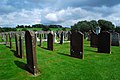
 Annan Cemetery - geograph.org.uk - 670883.jpg 640 × 480; 119 KB
-
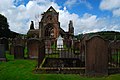
 Anwoth Old Kirk and Kirkyard - geograph.org.uk - 890377.jpg 640 × 480; 87 KB
-
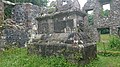 AnwothOK Memorial.jpg 4,984 × 2,803; 5.25 MB
-

-

-

-
 Buittle Cemetery - geograph.org.uk - 697698.jpg 640 × 480; 95 KB
-
 Castle Douglas Cemetery - geograph.org.uk - 697740.jpg 640 × 442; 112 KB
-
 Cemetery - geograph.org.uk - 463094.jpg 640 × 480; 90 KB
-
 Cemetery at Gatehouse of Fleet - geograph.org.uk - 1423282.jpg 640 × 480; 81 KB
-

-
 Clachan of Penninghame - geograph.org.uk - 677528.jpg 640 × 480; 116 KB
-
 Closeburn Cemetery - geograph.org.uk - 697761.jpg 640 × 444; 87 KB
-
 Corstock Kirk.jpg 1,280 × 960; 717 KB
-

-

-
 Dumfries Cemetery - geograph.org.uk - 697982.jpg 640 × 480; 97 KB
-
 Dundrennan Graveyard, April 2009.jpg 3,872 × 2,592; 4.64 MB
-
 Dunrod Church and Graveyard - geograph.org.uk - 694740.jpg 640 × 480; 82 KB
-
 Eastriggs Cemetery - geograph.org.uk - 473712.jpg 640 × 457; 140 KB
-
 Gamerigg Cemetery - geograph.org.uk - 699100.jpg 640 × 480; 85 KB
-
 Glenjorrie Cemetery Gates, Glenluce - geograph.org.uk - 698498.jpg 640 × 480; 102 KB
-
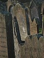 Gravestones - geograph.org.uk - 308582.jpg 480 × 640; 62 KB
-
 High Kirk Cemetery, Stranraer - geograph.org.uk - 1299241.jpg 640 × 366; 77 KB
-
 Hoddom Bridge and Hallguards - geograph.org.uk - 394143.jpg 612 × 408; 317 KB
-
 Hoddom Graveyard - geograph.org.uk - 394138.jpg 433 × 577; 257 KB
-
 Kelton Cemetery - geograph.org.uk - 444294.jpg 640 × 480; 146 KB
-
 Kilblane Cemetery - geograph.org.uk - 767488.jpg 640 × 480; 73 KB
-
 Kirkconnel Cemetery - geograph.org.uk - 672498.jpg 640 × 480; 72 KB
-
 Kirkcudbright Cemetery - geograph.org.uk - 698536.jpg 640 × 480; 102 KB
-
 Lag's Tomb, Farthingwell - geograph.org.uk - 761583.jpg 640 × 480; 69 KB
-
 Morton Cemetery, Thornhill - geograph.org.uk - 699166.jpg 640 × 480; 76 KB
-
 New Life - geograph.org.uk - 704468.jpg 640 × 480; 101 KB
-
 Old Churchyard, Moffat.JPG 2,288 × 1,712; 2.34 MB
-
 Old Parish Church, High Street, Moffat ruin.jpg 3,456 × 4,608; 4.6 MB
-
 Old Parish Churchyard, High Street, Moffat.jpg 4,608 × 3,456; 5.36 MB
-
 Pennersaugh or Penersax Graveyard - geograph.org.uk - 806611.jpg 640 × 480; 115 KB
-
 Road past graves at Tynron - geograph.org.uk - 706835.jpg 640 × 480; 134 KB
-
 St Mungo - graveyard - geograph.org.uk - 486038.jpg 640 × 480; 126 KB
-
 Stoneykirk Cemetery - geograph.org.uk - 699145.jpg 640 × 480; 83 KB
-
 Sweetheart Abbey - panoramio (1).jpg 3,872 × 2,592; 5.69 MB
-
 Sweetheart Abbey - panoramio (3).jpg 3,872 × 2,592; 7.08 MB
-
 Sweetheart Abbey - panoramio (5).jpg 3,872 × 2,592; 6.22 MB
-
 Sweetheart Abbey - panoramio (6).jpg 3,872 × 2,592; 6.7 MB
-
 Sweetheart Abbey - panoramio (7).jpg 3,872 × 2,592; 6.77 MB
-
 Sweetheart Abbey - panoramio (8).jpg 3,872 × 2,592; 6.22 MB
-
 Sweetheart Abbey - panoramio (9).jpg 3,872 × 2,592; 6.23 MB
-
 The High Kirk cemetery - geograph.org.uk - 613586.jpg 640 × 480; 70 KB
-
 Tower-of-Sark grave yard - geograph.org.uk - 340470.jpg 640 × 480; 124 KB
-
 Troqueer Cemetery (South) - geograph.org.uk - 692950.jpg 640 × 480; 89 KB
-
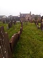
 Tundergarth Parish Churchyard - geograph.org.uk - 1034233.jpg 640 × 427; 138 KB
-
 Wigtown Cemetery - geograph.org.uk - 699907.jpg 640 × 480; 88 KB
-

-

-
 Cemetery near Skipper's Bridge - geograph.org.uk - 363535.jpg 640 × 480; 122 KB
-
 Lochmaben Cemetery - geograph.org.uk - 39020.jpg 640 × 480; 117 KB
-
 Machermore Cemetery - geograph.org.uk - 219728.jpg 640 × 476; 137 KB
-
 Moffat Cemetery - geograph.org.uk - 163690.jpg 640 × 480; 80 KB
-
 Newton Stewart Cemetery - geograph.org.uk - 173114.jpg 640 × 480; 71 KB


.jpg)
.jpg)
.jpg)
.jpg)
.jpg)
.jpg)
.jpg)


_-_geograph.org.uk_-_692950.jpg)


