Category:Caversfield
Jump to navigation
Jump to search
village and civil parish in Cherwell district, Oxfordshire, England  | |||||
| Upload media | |||||
| Instance of | |||||
|---|---|---|---|---|---|
| Location | Cherwell, Oxfordshire, South East England, England | ||||
| Population |
| ||||
| Area |
| ||||
 | |||||
English: Caversfield is a village and civil parish about north of the centre of Bicester. In 1844 Caversfield became part of Oxfordshire, but until then it was always an exclave of Buckinghamshire entirely surrounded by Oxfordshire.
Subcategories
This category has only the following subcategory.
L
Media in category "Caversfield"
The following 48 files are in this category, out of 48 total.
-
 Apartments in the Garden Quarter - geograph.org.uk - 4318862.jpg 1,500 × 999; 158 KB
-
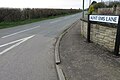 Aunt Ems Lane - geograph.org.uk - 4902317.jpg 1,600 × 1,066; 396 KB
-
 Bainton Ford - geograph.org.uk - 3269373.jpg 3,872 × 2,592; 2.33 MB
-
 Bainton Ford - geograph.org.uk - 5827801.jpg 1,600 × 1,066; 572 KB
-

-
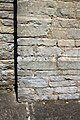
 Benchmark on Northside Lodge - geograph.org.uk - 4037797.jpg 683 × 1,024; 272 KB
-
 Benchmark on The Old Vicarage - geograph.org.uk - 4028339.jpg 683 × 1,024; 312 KB
-
 Benchmark on Watergate Lodge - geograph.org.uk - 4028315.jpg 651 × 1,024; 258 KB
-
 Bicester, The Old Vicarage - geograph.org.uk - 1824600.jpg 686 × 1,024; 189 KB
-
 Boundary Stone, Roman Road, Bicester - geograph.org.uk - 1820658.jpg 1,024 × 686; 263 KB
-

-
 Copse by the B4100 - geograph.org.uk - 5827806.jpg 1,600 × 1,066; 511 KB
-
 Cottages in the Garden Quarter - geograph.org.uk - 4318864.jpg 1,500 × 999; 196 KB
-
 Crumbling structure on the edge of Bicester Airfield - geograph.org.uk - 4902354.jpg 1,600 × 1,066; 528 KB
-
 Entrance to the Garden Quarter on Skimmingdish Lane - geograph.org.uk - 4902341.jpg 1,600 × 1,066; 348 KB
-
 Footpath across the field to Bainton - geograph.org.uk - 4902345.jpg 1,600 × 1,066; 508 KB
-
 Footpath into Bainton - geograph.org.uk - 5819141.jpg 1,600 × 1,066; 450 KB
-
 Footpath to Bainton - geograph.org.uk - 4902344.jpg 1,600 × 1,066; 594 KB
-
 Footpath to Bainton - geograph.org.uk - 5819130.jpg 1,600 × 1,066; 582 KB
-
 Footpath to the A4421 - geograph.org.uk - 4902359.jpg 1,600 × 1,066; 661 KB
-
 Footpath towards Caversfield - geograph.org.uk - 4902356.jpg 1,066 × 1,600; 714 KB
-
 Former Military Buildings, Skimmingdish Lane - geograph.org.uk - 4682658.jpg 4,000 × 2,664; 3.21 MB
-
 Gates to Caversfield House - geograph.org.uk - 4669673.jpg 3,700 × 2,308; 1.75 MB
-
 Horne, Caversfield - geograph.org.uk - 3331943.jpg 640 × 480; 114 KB
-
 Kebab van on The A4421, Bicester - geograph.org.uk - 6176437.jpg 1,876 × 1,212; 1.84 MB
-
 Lane by Bricknell's Farm - geograph.org.uk - 4902335.jpg 1,600 × 1,066; 586 KB
-
 M.O.D. structure by the footpath - geograph.org.uk - 4902347.jpg 1,067 × 1,600; 595 KB
-
 Northside Lodge, Caversfield - geograph.org.uk - 4037844.jpg 1,024 × 683; 223 KB
-
 Old School Close, Caversfield - geograph.org.uk - 4686650.jpg 3,820 × 2,036; 4.28 MB
-
 Path round the field edge - geograph.org.uk - 4902363.jpg 1,600 × 1,066; 667 KB
-
 Skimmingdish Lane in Caversfield - geograph.org.uk - 4318853.jpg 1,500 × 999; 173 KB
-
 St Laurence's Church with gravestones - geograph.org.uk - 4102922.jpg 1,024 × 683; 168 KB
-
 Stand of trees at the end of Skimmingdish Lane - geograph.org.uk - 4902350.jpg 1,600 × 1,066; 691 KB
-
 Temporary speed limit on B4100 at layby - geograph.org.uk - 4028178.jpg 1,024 × 683; 227 KB
-
 The A4421 into Bicester - geograph.org.uk - 4318866.jpg 1,500 × 981; 166 KB
-
 The A4421, Bicester - geograph.org.uk - 6176372.jpg 1,872 × 1,204; 1.65 MB
-
 The Bunker in the Garden Quarter - geograph.org.uk - 4318865.jpg 1,500 × 999; 231 KB
-
 The Garden Quarter 1 - geograph.org.uk - 4682649.jpg 3,782 × 2,244; 1.68 MB
-
 The Garden Quarter 2 - geograph.org.uk - 4682652.jpg 4,000 × 2,664; 2.03 MB
-
 The Garden Quarter on Skimmingdish Lane - geograph.org.uk - 4318851.jpg 1,500 × 999; 149 KB
-
 The Garden Quarter on Skimmingdish Lane - geograph.org.uk - 4318855.jpg 1,500 × 999; 192 KB
-
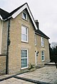
 The Old Vicarage - geograph.org.uk - 4028351.jpg 1,024 × 683; 175 KB
-
 The Sergeants Quarters in the Garden Quarter - geograph.org.uk - 4318858.jpg 1,500 × 999; 192 KB
-
 Tower of St Laurence's Church - geograph.org.uk - 4102914.jpg 683 × 1,024; 279 KB
-
 Turning off A4421 for housing estates at Caversfield - geograph.org.uk - 5528912.jpg 1,600 × 1,280; 757 KB
-
 Water tower on Bicester Airfield - geograph.org.uk - 4902352.jpg 1,066 × 1,600; 474 KB
-
 Watergate Lodge (1878) - geograph.org.uk - 4028324.jpg 1,024 × 683; 212 KB
-
 Lay-by off B4100 - geograph.org.uk - 64202.jpg 640 × 480; 185 KB


_-_geograph.org.uk_-_4028324.jpg)
