Category:Caundle Marsh
Jump to navigation
Jump to search
English: Caundle Marsh is a hamlet in north west Dorset, England, situated in the Blackmore Vale, four miles south east of Sherborne. The village has a population of 58 (2001).
village in United Kingdom  | |||||
| Upload media | |||||
| Instance of | |||||
|---|---|---|---|---|---|
| Location | Dorset, South West England, England | ||||
 | |||||
Subcategories
This category has only the following subcategory.
Media in category "Caundle Marsh"
The following 27 files are in this category, out of 27 total.
-
 A lone tree opposite Hawkins Farm - geograph.org.uk - 4832127.jpg 1,600 × 1,067; 298 KB
-
 A3030 at entrance to Manor Farm - geograph.org.uk - 4045306.jpg 640 × 417; 43 KB
-
 Alweston Ford - geograph.org.uk - 4550232.jpg 1,084 × 725; 397 KB
-
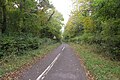
 Alweston to Tut Hill Road - geograph.org.uk - 1206894.jpg 640 × 457; 106 KB
-
 Ashcombe Farm - geograph.org.uk - 2815270.jpg 640 × 480; 79 KB
-
 Ashcombe Lane - geograph.org.uk - 5417304.jpg 640 × 480; 156 KB
-

-
 Caundle Marsh Churchyard - geograph.org.uk - 3969433.jpg 640 × 480; 82 KB
-
 Caundle Marsh, entrance sign - geograph.org.uk - 2415028.jpg 640 × 394; 76 KB
-
 Caundle Marsh, postbox No. DT9 19 - geograph.org.uk - 1553873.jpg 640 × 480; 74 KB
-
 Countryside near Caundle Marsh - geograph.org.uk - 1206892.jpg 640 × 428; 65 KB
-
 Countryside near Caundle Marsh - geograph.org.uk - 1206893.jpg 640 × 428; 62 KB
-
 Footpath near Marsh Court - geograph.org.uk - 5180297.jpg 426 × 640; 120 KB
-
 Ford near Marsh Court, Alweston - geograph.org.uk - 5180352.jpg 640 × 426; 115 KB
-
 Hedgerow oak - geograph.org.uk - 5417248.jpg 640 × 480; 100 KB
-
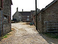 Manor Farm - Caundle Marsh - geograph.org.uk - 408895.jpg 640 × 480; 189 KB
-
-
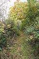
 Muddy track through the woods - geograph.org.uk - 1206895.jpg 640 × 475; 179 KB
-
 New Lane, near Alweston - geograph.org.uk - 5180383.jpg 426 × 640; 128 KB
-
 Poll Bridge Farm - geograph.org.uk - 1588634.jpg 640 × 480; 68 KB
-

-
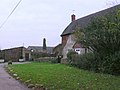
 Cottage at Bishop's Down - geograph.org.uk - 553024.jpg 640 × 480; 132 KB
-
 Entrance to Hawkins Farm - geograph.org.uk - 549156.jpg 640 × 480; 182 KB
-
 Open Farmland near Bishop's Caundle - geograph.org.uk - 549168.jpg 640 × 480; 117 KB
-
 Prytown Farm Farmhouse - geograph.org.uk - 420888.jpg 640 × 480; 179 KB
-
 Tut Hill Farm from the west - geograph.org.uk - 420862.jpg 640 × 480; 182 KB
-
 Tut Hill Farmhouse - geograph.org.uk - 420867.jpg 640 × 480; 154 KB


