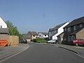
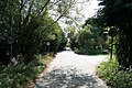
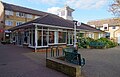
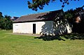
Category:Carterton, Oxfordshire
Jump to navigation
Jump to search
town and civil parish in West Oxfordshire, England  | |||||
| Upload media | |||||
| Instance of |
| ||||
|---|---|---|---|---|---|
| Location | West Oxfordshire, Oxfordshire, South East England, England | ||||
| Different from | |||||
| Said to be the same as | Carterton (Wikimedia duplicated page, civil parish) | ||||
| official website | |||||
 | |||||
English: Carterton is a town in Oxfordshire, England. It is about 8 kilometres (5 miles) west of Witney, on the B4020 and B4477 roads. It is close to the A40 road. It is one of the newest towns in Oxfordshire. Despite this, Carterton is the second largest settlement in the West Oxfordshire District. Its population is approximately 20,000
Español: Carterton es una localidad británica perteneciente al Condado de Oxon, 24 km al oeste de Oxford. Tenía una población de 15.000 habitantes.
Français : Carterton est une ville dans l' Oxfordshire, en Angleterre. Elle se trouve à 24 kilometres d'Oxford.
Italiano: Carterton è una cittadina di 18.000 abitanti della contea dell' Oxfordshire, in Inghilterra.
Polski: Carterton - miasto w Wielkiej Brytanii, w Anglii, w regionie South East England, w hrabstwie Oxfordshire. W 2001r. miasto tto zamieszkiwało 20120 osób.
Română: Carterton este un oraş în comitatul Oxfordshire, regiunea South East, Anglia. Oraşul se află în districtul West Oxfordshire.
Subcategories
This category has the following 3 subcategories, out of 3 total.
Media in category "Carterton, Oxfordshire"
The following 200 files are in this category, out of 266 total.
(previous page) (next page)-
 "The Dell" Carterton - geograph.org.uk - 1527366.jpg 640 × 427; 70 KB
-
 2-3 Tower Centre, Alvescot Road, Carterton, Oxon - geograph.org.uk - 5641509.jpg 1,024 × 672; 185 KB
-
 8 Sellwood Drive, Carterton - geograph.org.uk - 4362312.jpg 640 × 480; 69 KB
-

-
 Abingdon Road, Carterton - geograph.org.uk - 2650259.jpg 640 × 478; 92 KB
-
 Aeroplane above Brize Norton - geograph.org.uk - 325227.jpg 640 × 480; 65 KB
-
 Aldi supermarket on Alvescot Road - geograph.org.uk - 3400998.jpg 1,500 × 1,000; 123 KB
-
 Aldi, Alvescot Road, Carterton, Oxon - geograph.org.uk - 5859254.jpg 1,024 × 681; 189 KB
-
 Allotments access road, near Carterton, Oxon - geograph.org.uk - 4543963.jpg 1,024 × 683; 199 KB
-
 Alvescot Road in Carterton - geograph.org.uk - 3400999.jpg 1,500 × 1,000; 185 KB
-

-
 Alvescot Road, Carterton - geograph.org.uk - 1484980.jpg 640 × 480; 50 KB
-
 Arkell Avenue, Carterton - geograph.org.uk - 2399884.jpg 640 × 480; 88 KB
-
 Arkell Avenue, Carterton, Oxon - geograph.org.uk - 5072923.jpg 1,024 × 683; 169 KB
-

-

-

-
 Asda, Black Bourton Road, Carterton - geograph.org.uk - 5055412.jpg 3,264 × 2,448; 1.98 MB
-
 ASDA, Black Bourton Road, Carterton, Oxon - geograph.org.uk - 5366535.jpg 1,024 × 671; 122 KB
-
 Ashfield Place, Carterton - geograph.org.uk - 1565998.jpg 640 × 480; 54 KB
-
 Ashfield Road, Carterton - geograph.org.uk - 2382051.jpg 640 × 480; 40 KB
-
 B4477 Alvescot Road enters Carterton - geograph.org.uk - 3053829.jpg 3,102 × 2,414; 1.36 MB
-

-
 Barclays Bank, Carterton - geograph.org.uk - 1511760.jpg 640 × 480; 47 KB
-
 Bench seat, Carterton ,Oxon - geograph.org.uk - 5406816.jpg 1,024 × 681; 270 KB
-
 Benchmark on 'Rock Cottage', ^1 Lawton Avenue - geograph.org.uk - 5168489.jpg 683 × 1,024; 231 KB
-
 Benchmark on Carterton Primary School - geograph.org.uk - 5175785.jpg 683 × 1,024; 173 KB
-

-
 Benchmark on drain cover at ^1 Kestrel Close - geograph.org.uk - 5160212.jpg 683 × 1,024; 348 KB
-
 Benchmark on milestone outside ^20a Shilton Road - geograph.org.uk - 5289489.jpg 683 × 1,024; 233 KB
-

-

-
 Benchmark on ^150 Britannia Close - geograph.org.uk - 5175812.jpg 683 × 1,024; 269 KB
-
 Bend in Kilkenny Lane, Carterton - geograph.org.uk - 1514634.jpg 640 × 427; 56 KB
-
 Black Bourton Road, Carterton (2) - geograph.org.uk - 1565988.jpg 640 × 480; 70 KB
-
 Black Bourton Road, Carterton - geograph.org.uk - 1565965.jpg 640 × 480; 70 KB
-
 Blue plaque on the Town Hall - geograph.org.uk - 3400997.jpg 1,500 × 1,082; 185 KB
-
 Bluebell Way, Shilton Park, Carterton, Oxon - geograph.org.uk - 4894384.jpg 1,024 × 666; 184 KB
-
 Bovingdon Road, Carterton, Oxon - geograph.org.uk - 6003513.jpg 1,024 × 681; 161 KB
-
 Brize Norton road, Carterton - geograph.org.uk - 1527351.jpg 640 × 427; 56 KB
-
 Brize Norton Road, Carterton, Oxon - geograph.org.uk - 4505738.jpg 1,024 × 753; 180 KB
-
 Brize Norton Road, Carterton, Oxon - geograph.org.uk - 6003539.jpg 1,024 × 681; 198 KB
-
 Burford Road - geograph.org.uk - 4362307.jpg 640 × 480; 102 KB
-
 Burford Road in Carterton - geograph.org.uk - 3400990.jpg 1,500 × 975; 121 KB
-
 Burford Road, Carterton - geograph.org.uk - 1514600.jpg 640 × 427; 73 KB
-
-
-
 Car park on the edge of Carterton - geograph.org.uk - 1249554.jpg 640 × 427; 89 KB
-
 Carteron, shops near the Crossroads - geograph.org.uk - 347819.jpg 640 × 438; 124 KB
-
 Burford Road, Carterton in the snow. - geograph.org.uk - 339708.jpg 640 × 439; 116 KB
-
 Car park in Carterton - geograph.org.uk - 1613831.jpg 640 × 480; 60 KB
-
 Car park in Carterton - geograph.org.uk - 1639184.jpg 640 × 480; 76 KB
-

-
 Old Milestone by the B4020, Shilton Road, Carterton (geograph 6045520).jpg 686 × 1,329; 132 KB
-
 Postbox in Carterton - geograph.org.uk - 1291741.jpg 480 × 640; 91 KB
-
 Carterton Chinese Takeaway - geograph.org.uk - 347814.jpg 640 × 450; 104 KB
-
 Carterton Co Op car park - geograph.org.uk - 1513455.jpg 640 × 427; 74 KB
-

-

-
 Carterton crossroads - geograph.org.uk - 2261552.jpg 640 × 480; 63 KB
-
 Carterton Crossroads - geograph.org.uk - 347812.jpg 640 × 424; 108 KB
-
 Carterton Leisure Centre - geograph.org.uk - 1843033.jpg 640 × 480; 62 KB
-

-

-
 Carterton Methodist Church - geograph.org.uk - 1291711.jpg 640 × 480; 80 KB
-
 Carterton recreation ground - geograph.org.uk - 1291779.jpg 640 × 480; 53 KB
-
 Carterton recreation ground - geograph.org.uk - 1291790.jpg 640 × 480; 81 KB
-
 Carterton Shops - geograph.org.uk - 361110.jpg 640 × 430; 97 KB
-
 Carterton Telephone Exchange, Oxon - geograph.org.uk - 6128305.jpg 2,592 × 1,944; 1.32 MB
-
 Carterton TowerCentre landscape.jpg 1,023 × 1,280; 678 KB
-
 Carterton TowerCentre portrait.jpg 1,280 × 778; 589 KB
-
 Carterton Town Hall - geograph.org.uk - 1501661.jpg 640 × 427; 77 KB
-
 Carterton Town Hall - geograph.org.uk - 3400993.jpg 1,500 × 991; 189 KB
-
 Carterton town library - geograph.org.uk - 1639180.jpg 640 × 480; 101 KB
-

-

-
 Carterton, Church View - geograph.org.uk - 347816.jpg 640 × 424; 113 KB
-
 Carterton, Number 100 bus to Oxford - geograph.org.uk - 347821.jpg 640 × 423; 86 KB
-
 Carterton, Rock Farm Cottages - geograph.org.uk - 361104.jpg 640 × 471; 143 KB
-
 Carterton, The Parade - geograph.org.uk - 347818.jpg 640 × 424; 112 KB
-
-

-
-
-

-
 Church View, Carterton, Oxon - geograph.org.uk - 5694520.jpg 1,024 × 681; 219 KB
-

-

-
 Corbett Road, Carterton - geograph.org.uk - 1513486.jpg 640 × 427; 53 KB
-
 Costa Coffee, 9 Burford Road, Carterton, Oxon - geograph.org.uk - 5372332.jpg 1,024 × 655; 133 KB
-

-

-

-
 Dog waste bin and sign, near Carterton, Oxon - geograph.org.uk - 5136291.jpg 683 × 1,024; 318 KB
-
-
 Domino's Pizza, 5 Burford Road, Carterton, Oxon - geograph.org.uk - 5363397.jpg 730 × 1,024; 180 KB
-
-
 Elmhurst Way, Shilton Park, Carterton, Oxon - geograph.org.uk - 5711668.jpg 1,024 × 768; 169 KB
-

-
 Empty shop, 1a Alvescot Road, Carterton, Oxon - geograph.org.uk - 5812984.jpg 1,024 × 681; 176 KB
-

-

-
 Entrance to Carterton Primary School - geograph.org.uk - 5175804.jpg 1,024 × 683; 240 KB
-
 Field adjacent to Squash Club, Carterton, Oxon - geograph.org.uk - 5406852.jpg 1,024 × 671; 174 KB
-
 Fields near Kilkenny Lane, near Carterton,Oxon - geograph.org.uk - 4545400.jpg 1,024 × 670; 233 KB
-

-
 Flowerbed, Brize Norton Road, Carterton, Oxon - geograph.org.uk - 6003547.jpg 1,024 × 681; 264 KB
-
 Football pitch near Upavon Way, Carterton, Oxon - geograph.org.uk - 5188995.jpg 1,024 × 670; 203 KB
-

-

-

-

-
-
-
-

-
 Footpath to Northwood Crescent, Carterton, Oxon - geograph.org.uk - 5711725.jpg 1,024 × 768; 327 KB
-
 Footpath to The Crescent, Carterton, Oxon - geograph.org.uk - 5133887.jpg 664 × 1,024; 271 KB
-

-
 Foxcroft Drive, Carterton - geograph.org.uk - 2382066.jpg 640 × 480; 47 KB
-

-

-
 Hardstanding, Raynham Close, Carterton, Oxon - geograph.org.uk - 5196077.jpg 1,024 × 673; 168 KB
-
 Heading into Carterton on Kilkenny Lane - geograph.org.uk - 1514690.jpg 640 × 427; 111 KB
-
 Heading out of Carterton - geograph.org.uk - 1477815.jpg 640 × 427; 65 KB
-
 Home Close, Carterton, Oxon - geograph.org.uk - 5095869.jpg 1,024 × 683; 210 KB
-

-
 Houses at the north end of Home Close - geograph.org.uk - 5168649.jpg 1,024 × 683; 227 KB
-
 Houses in Bovingdon Road, Carterton, Oxon - geograph.org.uk - 4504791.jpg 1,024 × 756; 152 KB
-

-
 Houses on Britannia Close - geograph.org.uk - 5175827.jpg 1,024 × 683; 230 KB
-
 Houses on Kestrel Close - geograph.org.uk - 5160220.jpg 1,024 × 661; 141 KB
-
 Housing estate, Carterton - geograph.org.uk - 294625.jpg 640 × 427; 47 KB
-
 Housing in Carterton - geograph.org.uk - 294644.jpg 640 × 427; 85 KB
-
-

-

-
-

-

-
 Junction of Upavon Way and Burford Road - geograph.org.uk - 5289463.jpg 1,024 × 683; 249 KB
-
 Just Barbers, 4B Alvescot Road, Carterton, Oxon - geograph.org.uk - 5641342.jpg 1,024 × 664; 177 KB
-
 Kenn's Farm - geograph.org.uk - 1249530.jpg 640 × 427; 36 KB
-
 Kilkenny Lane, Carterton, Oxon - geograph.org.uk - 5661218.jpg 1,024 × 678; 198 KB
-
 Kilkenny Lane, near Carterton, Oxon - geograph.org.uk - 4544079.jpg 1,024 × 683; 226 KB
-
 Lawton Avenue, Carterton, Oxon - geograph.org.uk - 5070234.jpg 1,024 × 670; 225 KB
-
 Lawton Avenue, Carterton, Oxon - geograph.org.uk - 5095851.jpg 1,024 × 682; 202 KB
-
 Lawton Avenue, Carterton, Oxon - geograph.org.uk - 5095900.jpg 1,024 × 683; 221 KB
-
 Lilypond mosaic in Carterton Town Square.jpg 2,376 × 3,568; 4.1 MB
-

-

-
 Lloyds Bank, Burford Road, Carterton, Oxon - geograph.org.uk - 5363365.jpg 1,024 × 683; 163 KB
-
 Lloyds Pharmacy, 7 Burford Road, Carterton, Oxon - geograph.org.uk - 5372251.jpg 1,024 × 683; 211 KB
-
 Marigold Square, Shilton Park, Carterton, Oxon - geograph.org.uk - 4810964.jpg 1,024 × 493; 126 KB
-

-

-
 More housing in Carterton - geograph.org.uk - 294648.jpg 640 × 427; 57 KB
-
 Morrisons, Black Bourton Road, Carterton, Oxon - geograph.org.uk - 4960253.jpg 1,024 × 683; 136 KB
-

-
 Near Kilkenny Lane Carterton - geograph.org.uk - 1155065.jpg 640 × 427; 110 KB
-

-
 New Morrisons under construction - geograph.org.uk - 3583955.jpg 640 × 478; 57 KB
-
 Northwood Crescent, Carterton, Oxon - geograph.org.uk - 5195365.jpg 1,024 × 683; 234 KB
-
 Northwood Crescent, Carterton, Oxon - geograph.org.uk - 6004343.jpg 1,024 × 681; 193 KB
-

-
 Oakfield Road, Carterton - geograph.org.uk - 2382062.jpg 640 × 480; 51 KB
-
 Offices to let - geograph.org.uk - 1843035.jpg 640 × 480; 83 KB
-
 Old Milestone by Black Bourton Road, Carterton (geograph 6038738).jpg 847 × 1,050; 150 KB
-
 Onward march of new housing - geograph.org.uk - 294653.jpg 640 × 427; 62 KB
-
 Optare Solo SR OU13 DZD Carterton.jpg 1,280 × 720; 542 KB
-
 Optare SoloSR YJ14BWM Carterton.jpg 839 × 559; 214 KB
-
 Path from the recreation ground - geograph.org.uk - 1613840.jpg 640 × 480; 83 KB
-

-

-
-
 Public footpath near Carterton, Oxon - geograph.org.uk - 5135188.jpg 660 × 1,024; 277 KB
-
 Public footpath near Carterton, Oxon - geograph.org.uk - 5135191.jpg 674 × 1,024; 275 KB
-
 Public footpath near Carterton, Oxon - geograph.org.uk - 5136265.jpg 660 × 1,024; 303 KB
-
 Public footpath near Carterton, Oxon - geograph.org.uk - 5136305.jpg 679 × 1,024; 271 KB
-
 Public footpath to Carterton, Oxon - geograph.org.uk - 5135136.jpg 669 × 1,024; 290 KB
-
 Public footpath to Carterton, Oxon - geograph.org.uk - 5135195.jpg 673 × 1,024; 260 KB
-
 Public footpath to Carterton, Oxon - geograph.org.uk - 5136310.jpg 676 × 1,024; 245 KB
-
 R.A.F. Brize Norton - geograph.org.uk - 324598.jpg 640 × 480; 72 KB
-

-

-

-
 Recycling bins - geograph.org.uk - 2650391.jpg 640 × 478; 76 KB
-
 Red sky over Carterton (1), Oxon - geograph.org.uk - 5606585.jpg 1,024 × 683; 152 KB
-
 Red sky over Carterton (2), Oxon - geograph.org.uk - 5606595.jpg 1,024 × 683; 167 KB
-

-

-
 Road junction, Norton Way, Carterton, Oxon - geograph.org.uk - 5313023.jpg 1,024 × 667; 192 KB
-

-
 Road's End, Carterton - geograph.org.uk - 294620.jpg 640 × 427; 56 KB
-

-
 Rock Close, Carterton, Oxon - geograph.org.uk - 5094592.jpg 1,024 × 668; 156 KB
-
 Roundabout in Carterton - geograph.org.uk - 1484970.jpg 640 × 480; 66 KB
-
 Row of shops, Carterton - geograph.org.uk - 4362304.jpg 640 × 444; 80 KB
-

-


,_off_Brize_Norton_Road,_Carterton,_Oxon_-_geograph.org.uk_-_5367396.jpg)
,_off_Brize_Norton_Road,_Carterton,_Oxon_-_geograph.org.uk_-_5367410.jpg)


_-_geograph.org.uk_-_1565988.jpg)


.jpg)


,_Marigold_Square,_Shilton_Park,_Carterton,_Oxon_-_geograph.org.uk_-_4894422.jpg)
,_Marigold_Square,_Shilton_Park,_Carterton,_Oxon_-_geograph.org.uk_-_4894438.jpg)


,_6_Alvescot_Road,_Carterton,_Oxon_-_geograph.org.uk_-_5641479.jpg)
,_6_Alvescot_Road,_Carterton,_Oxon_-_geograph.org.uk_-_5641487.jpg)


,_Market_Square,_Alvescot_Road,_Carterton,_Oxon_-_geograph.org.uk_-_5039860.jpg)
,_Market_Square,_Alvescot_Road,_Carterton,_Oxon_-_geograph.org.uk_-_5039897.jpg)


,_6_Burford_Road,_Carterton,_Oxon_-_geograph.org.uk_-_5374015.jpg)
,_6_Burford_Road,_Carterton,_Oxon_-_geograph.org.uk_-_5374038.jpg)
_-_noticeboard,_6_Burford_Road,_Carterton,_Oxon_-_geograph.org.uk_-_5374045.jpg)


.jpg)


,_The_Tower_Centre,_Alvescot_Road,_Carterton,_Oxon_-_geograph.org.uk_-_5363297.jpg)
,_The_Tower_Centre,_Alvescot_Road,_Carterton,_Oxon_-_geograph.org.uk_-_5363306.jpg)
,_Alvescot_Road_Recreation_Ground,_Alvescot_Road,_Carterton,_Oxon_-_geograph.org.uk_-_5069528.jpg)
,_Alvescot_Road_Recreation_Ground,_Alvescot_Road,_Carterton,_Oxon_-_geograph.org.uk_-_5069536.jpg)


,_Market_Square,_Alvescot_Road,_Carterton,_Oxon_-_geograph.org.uk_-_5694530.jpg)
,_Market_Square,_Alvescot_Road,_Carterton,_Oxon_-_geograph.org.uk_-_5694547.jpg)


.jpg)


,_Oxon_-_geograph.org.uk_-_5606585.jpg)
,_Oxon_-_geograph.org.uk_-_5606595.jpg)


,_Wycombe_Way,_Carterton,_Oxon_-_geograph.org.uk_-_4960290.jpg)
,_Wycombe_Way,_Carterton,_Oxon_-_geograph.org.uk_-_4960315.jpg)