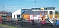
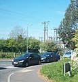
Category:Carrowdore
Jump to navigation
Jump to search
village in United Kingdom  | |||||
| Upload media | |||||
| Instance of | |||||
|---|---|---|---|---|---|
| Location | Northern Ireland | ||||
 | |||||
English: Carrowdore is a village on the Ards Peninsula in the Ards Borough Council area of County Down, Northern Ireland.
Nederlands: Carrowdore ( Iers: Ceathrú Dobhair) is een plaats in het Noord-Ierse County Down. Carrowdore telt 813 inwoners. Van de bevolking is 93% protestant en 2,1% katholiek.
Subcategories
This category has the following 2 subcategories, out of 2 total.
B
- Ballyboley, County Down (11 F)
C
- Christ Church, Carrowdore (7 F)
Media in category "Carrowdore"
The following 24 files are in this category, out of 24 total.
-
 Cardy Road, Cardy - geograph.org.uk - 2907041.jpg 640 × 480; 65 KB
-
 Towards Christ Church, Carrowdore - geograph.org.uk - 703020.jpg 640 × 480; 149 KB
-
-
 Development site, Carrowdore (1) - geograph.org.uk - 2943370.jpg 640 × 345; 76 KB
-
 Development site, Carrowdore (2) - geograph.org.uk - 2943389.jpg 640 × 374; 99 KB
-
 Farmland west of the Manse Road - geograph.org.uk - 2992848.jpg 1,024 × 436; 98 KB
-
 Ganaway Bay near Ballyferis (1) - geograph.org.uk - 227552.jpg 640 × 426; 135 KB
-

-
 The Ballydoonan Road near Carrowdore - geograph.org.uk - 1863753.jpg 640 × 480; 385 KB
-
 The Kilbright Road near Carrowdore - geograph.org.uk - 227663.jpg 640 × 426; 168 KB
-
 The Maranatha Hall, Carrowdore - geograph.org.uk - 2943425.jpg 640 × 376; 72 KB
-
 The southern end of Ballyblack Road East - geograph.org.uk - 2992837.jpg 978 × 1,024; 210 KB
-
 Abbey Road near Carrowdore - geograph.org.uk - 703015.jpg 640 × 480; 144 KB
-
 Drumfad Road near Carrowdore - geograph.org.uk - 703023.jpg 640 × 480; 138 KB
-
 Dunover Road North - geograph.org.uk - 703043.jpg 480 × 640; 184 KB
-
 Farm, Kilbright - geograph.org.uk - 703029.jpg 640 × 480; 146 KB
-
 Fields, Kilbright - geograph.org.uk - 703026.jpg 640 × 480; 140 KB
-
 Fields, near Millisle (2) - geograph.org.uk - 702984.jpg 640 × 480; 135 KB
-
 Fields, near Millisle - geograph.org.uk - 702980.jpg 640 × 480; 129 KB
-
 Gates to Carrowdore Castle - geograph.org.uk - 703012.jpg 640 × 480; 192 KB
-
 Kilbright Road - geograph.org.uk - 703031.jpg 640 × 480; 125 KB
-
 Lane, Christ Church, Carrowdore - geograph.org.uk - 309977.jpg 640 × 426; 162 KB
-
 Moss Road, near Millisle - geograph.org.uk - 702877.jpg 640 × 480; 115 KB
-
 Moss Road, near Millisle - geograph.org.uk - 702988.jpg 640 × 480; 148 KB


_-_geograph.org.uk_-_2943370.jpg)
_-_geograph.org.uk_-_2943389.jpg)

_-_geograph.org.uk_-_227552.jpg)


_-_geograph.org.uk_-_702984.jpg)


