Category:Carl Zimmermann (cartographer)
Jump to navigation
Jump to search
German general and cartographer | |||||
| Upload media | |||||
| Date of birth | 8 May 1813, 1813 Drawno | ||||
|---|---|---|---|---|---|
| Date of death | 16 August 1889, 1861 Charlottenburg | ||||
| Occupation | |||||
| Award received | |||||
| |||||
Pages in category "Carl Zimmermann (cartographer)"
This category contains only the following page.
Media in category "Carl Zimmermann (cartographer)"
The following 22 files are in this category, out of 22 total.
-
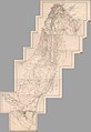 1850 Atlas von Palaestina und der Sinai Halbinsel (composite of 15 sectional sheets).jpg 22,313 × 32,413; 53.78 MB
-
 Carl Zimmermann, Durchschnitts-Profile zu den Terrainkarten I U. II (FL164011347 2368221).jpg 15,316 × 11,925; 169.33 MB
-

-
 Carl Zimmermann, Terrainkarte von Jerusalem und Umgebung vor der Besiedelung (FL51415413 2761974).jpg 11,764 × 15,347; 267.35 MB
-
 Carl Zimmermann, Versuch einer Construction der Karte von Galiläa (FL19569712 3705620).jpg 13,984 × 16,332; 294.98 MB
-
 Index Map and Sectional Title Page, Atlas of Palestine and the Sinai Peninsula (cropped).jpg 7,766 × 7,194; 5.04 MB
-
 Index Map and Sectional Title Page, Atlas of Palestine and the Sinai Peninsula.jpg 11,712 × 8,483; 10.62 MB
-
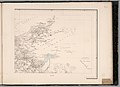
 Sect. I. Beirut. Atlas of Palestine and the Sinai Peninsula.jpg 11,712 × 8,483; 16.03 MB
-
 Sect. II. Damascus. Atlas of Palestine and the Sinai Peninsula.jpg 11,712 × 8,483; 11.81 MB
-
 Sect. III. Tiberias. Atlas of Palestine and the Sinai Peninsula.jpg 11,712 × 8,483; 15.01 MB
-
 Sect. IV. El Mezareib. Atlas of Palestine and the Sinai Peninsula.jpg 11,648 × 8,483; 13.61 MB
-
 Sect. IX. Mayha. Atlas of Palestine and the Sinai Peninsula.jpg 11,696 × 8,483; 11.81 MB
-
 Sect. V. Jerusalem. Atlas of Palestine and the Sinai Peninsula.jpg 11,712 × 8,483; 14.95 MB
-
 Sect. VI. Kulat Zerka. Atlas of Palestine and the Sinai Peninsula.jpg 11,712 × 8,483; 12.12 MB
-
 Sect. VII. El Khulil (Hebron). Atlas of Palestine and the Sinai Peninsula.jpg 11,576 × 8,483; 12.79 MB
-
 Sect. VIII. Todtes Meer. Atlas of Palestine and the Sinai Peninsula.jpg 11,664 × 8,483; 12.7 MB
-
 Sect. X. Petra. Atlas of Palestine and the Sinai Peninsula.jpg 11,680 × 8,483; 12.5 MB
-
 Sect. XI. Pfuhl. Atlas of Palestine and the Sinai Peninsula.jpg 11,672 × 8,483; 11.99 MB
-
 Sect. XII. Akabah. Atlas of Palestine and the Sinai Peninsula.jpg 11,672 × 8,483; 12.63 MB
-
 Sect. XIII. Menetfah. Atlas of Palestine and the Sinai Peninsula.jpg 11,640 × 8,483; 12.53 MB
-
 Sect. XIV. Abu Suiveirah. Atlas of Palestine and the Sinai Peninsula.jpg 11,584 × 8,483; 12.47 MB
-

.jpg)
.jpg)
.jpg)
.jpg)
.jpg)
.jpg)


._Atlas_of_Palestine_and_the_Sinai_Peninsula.jpg)


).jpg)