Category:Cape Jourimain National Wildlife Area
Jump to navigation
Jump to search
protected area in New-Brunswick  | |||||
| Upload media | |||||
| Instance of | |||||
|---|---|---|---|---|---|
| Location | Westmorland County, New Brunswick, Canada | ||||
| Operator |
| ||||
| Maintained by |
| ||||
| IUCN protected areas category | |||||
| Inception |
| ||||
| Area |
| ||||
| official website | |||||
 | |||||
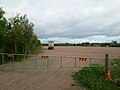
English: The Cape Jourimain National Wildlife Area consists of two islands (Jourimain Island and Trenholm Island) and portions of the north coast of continental New Brunswick, as well as sand dunes and marine areas including brackish marshes and swamps. There are four trails in the NWA: the Gunning Trail on the west side of Jourimain Island, the Lighthouse Trail on the east side of Jourimain Island, the Trenholm Trail on the eat side of Trenholm Island, and the Cape Jourimain Nature Trail connecting the eastern trails from Cape Jourimain Nature Centre to New Brunswick Route 955.
Subcategories
This category has the following 3 subcategories, out of 3 total.
Media in category "Cape Jourimain National Wildlife Area"
The following 6 files are in this category, out of 6 total.
-
 1992 Pontiac Sunbird Convertible at Confederation Bridge.jpg 2,250 × 2,000; 495 KB
-
 Cap Jourimain 2.JPG 1,600 × 1,200; 580 KB
-
 Cap Jourimain.JPG 1,600 × 1,200; 464 KB
-
 Cape Jourimain Marsh, NB (33238013454).jpg 4,608 × 3,456; 3.66 MB
-
 Lighthouse Trail, Cape Jourimain, NB (40388715053).jpg 1,800 × 1,200; 848 KB
-
 Weigh Station, Cape Jourimain, NB (44276307264).jpg 4,608 × 3,456; 20.12 MB


.jpg)
.jpg)
.jpg)