Category:Cape Burkhan
Jump to navigation
Jump to search
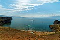
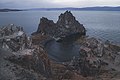
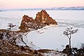
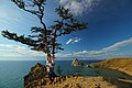
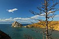
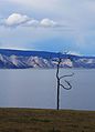
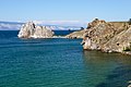
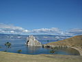
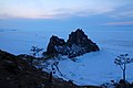
Русский: Мыс Бурхан представляет собой полуостров шириной 70 м и длиной до 150 метров, расположенный к северу от посёлка Хужир на острове Ольхон озера Байкал. Северо-западную часть мыса венчает беломраморная скала Шаманка. Иногда понятия "мыс Бурхан" и "скала Шаманка" используются для обозначения одного и того же места.
| Object location | | View all coordinates using: OpenStreetMap |
|---|
| This is the category of the protected area of Russia number 3810274 | |
| This template and pages using it are maintained by the Russian WLE team. Please read the guidelines before making any changes that can affect the database! |
Subcategories
This category has the following 2 subcategories, out of 2 total.
S
Media in category "Cape Burkhan"
The following 87 files are in this category, out of 87 total.
-
 Burkhan Table.jpg 2,784 × 1,856; 2.03 MB
-
 Cape Burkhan of the Island of Olkhon (30922397504).jpg 2,000 × 1,333; 662 KB
-
 Cape Burkhan of the Island of Olkhon (30922397584).jpg 2,000 × 1,333; 477 KB
-
 Cape Burkhan of the Island of Olkhon (30922407084).jpg 2,560 × 1,707; 1.25 MB
-
 Cape Burkhan of the Island of Olkhon (30954327483).jpg 2,000 × 1,333; 657 KB
-
 Cape Burkhan of the Island of Olkhon (31391516270).jpg 2,560 × 1,707; 1.35 MB
-
 Cape Burkhan of the Island of Olkhon (31617075332).jpg 2,000 × 1,333; 1.08 MB
-
 Cape Burkhan of the Island of Olkhon (31617076342).jpg 2,560 × 1,707; 1.2 MB
-
 Cape Burkhan of the Island of Olkhon (31617077432).jpg 2,560 × 1,707; 968 KB
-
 Cape Burkhan of the Island of Olkhon (31647784541).jpg 2,560 × 1,707; 1.23 MB
-
 Cape Burkhan of the Island of Olkhon (31763932335).jpg 2,000 × 1,125; 325 KB
-
 Cape Burkhan of the Island of Olkhon (31763933155).jpg 2,560 × 1,707; 1.35 MB
-
 Cape Burkhan of the Island of Olkhon (31763933725).jpg 2,560 × 1,707; 1.46 MB
-
 DSC5892 Андрей Сачков.jpg 4,423 × 2,949; 7.26 MB
-
 DSC6570 Андрей Сачков.jpg 4,503 × 3,002; 8.37 MB
-
 IОльхонский мыс Бурхан.jpg 4,096 × 2,731; 1.23 MB
-
 Mys Burhan (Skala Shamanka) - view from south.jpg 4,342 × 2,894; 9.49 MB
-
 Mys Burhan (Skala Shamanka) - winter 2022.jpg 4,950 × 3,284; 11.01 MB
-
 RU Baikal Burhan 5.jpg 4,896 × 3,672; 7.05 MB
-
 Shaman12.jpg 1,280 × 853; 350 KB
-
 Skała Szamanka lato 2013.jpg 4,288 × 2,848; 5.51 MB
-
 Super beautiful golden hour on olxon island.jpg 4,272 × 2,848; 5.75 MB
-
 Super-puper beautiful golden hour on olxon island.jpg 4,272 × 2,848; 4.82 MB
-
 Wyspa Olchon 3.jpg 4,288 × 2,848; 5.43 MB
-
 Xamanaren muturra Olkhonen.JPG 1,600 × 1,200; 532 KB
-
 Бурхан.JPG 2,592 × 1,936; 1.91 MB
-
 Вид на Сарайский залив.JPG 2,048 × 1,536; 1.71 MB
-
 Вода Байкала.jpg 604 × 453; 78 KB
-
 Завораживающие красоты озера.jpg 5,184 × 3,456; 7.51 MB
-
 Закат на Сарайском заливе.JPG 1,536 × 2,048; 1.56 MB
-
 Засохшее, но величественное.jpg 5,184 × 3,456; 7.54 MB
-
 Знаменитый вид Байкала.jpg 5,184 × 3,456; 6.03 MB
-
 Лед под Шаманкой 1.jpg 4,368 × 2,912; 7.49 MB
-
 Лед под Шаманкой.jpg 4,368 × 2,912; 6.67 MB
-
 Магическая Шаманка.jpg 5,184 × 3,456; 1.7 MB
-
 Место шамана 05.jpg 5,184 × 3,456; 10.71 MB
-
 Место шамана 06.jpg 5,184 × 3,456; 8.42 MB
-
 Место шамана 07.jpg 2,316 × 3,216; 3.54 MB
-
 Место шамана 10.jpg 5,184 × 3,456; 9.45 MB
-
 Место шамана 11.jpg 5,184 × 3,456; 10.67 MB
-
 Место шамана 12.jpg 3,692 × 2,396; 5.48 MB
-
 Место шамана 13.jpg 5,184 × 3,456; 12.16 MB
-
 Место шамана 14.jpg 5,184 × 3,456; 10.95 MB
-
 Место шамана 15.jpg 5,096 × 3,188; 9.21 MB
-
 Место шамана 16.jpg 5,016 × 3,264; 9.17 MB
-
 Мыс Бурхан (Скала Шаманка) издалека.jpg 3,000 × 2,000; 4.54 MB
-
 Мыс Бурхан (Скала Шаманка) на Ольхоне.jpg 3,000 × 2,000; 5.2 MB
-
 Мыс Бурхан (Скала Шаманка)-2.jpg 3,000 × 2,000; 5.19 MB
-
 Мыс Бурхан (Скала Шаманка). Большая панорама.jpg 10,959 × 2,618; 9.35 MB
-
 Мыс Бурхан (Скала Шаманка). Одно из самых знаменитых мест Байкала. 01.jpg 3,967 × 2,633; 8.12 MB
-
 Мыс Бурхан (Скала Шаманка). Одно из самых знаменитых мест Байкала. 02.jpg 4,000 × 2,672; 8.09 MB
-
 Мыс Бурхан 1.jpg 5,518 × 3,679; 9.35 MB
-
 Мыс Бурхан 2.jpg 5,323 × 3,441; 7.29 MB
-
 Мыс Бурхан 4.jpg 5,450 × 3,633; 5.78 MB
-
 Мыс Бурхан 5.jpg 5,560 × 3,707; 8.48 MB
-
 Мыс Бурхан вблизи поселка Хужир (Ольхон) 001.jpg 3,264 × 2,448; 1.48 MB
-
 Мыс Бурхан вблизи поселка Хужир (Ольхон) 004.jpg 2,448 × 3,264; 1.82 MB
-
 Мыс Бурхан зимой.jpg 5,472 × 3,648; 5.55 MB
-
 Мыс Бурхан издалека.jpg 4,320 × 3,240; 1.85 MB
-
 Мыс Бурхан на закате.jpg 4,160 × 2,340; 978 KB
-
 Мыс Бурхан, Ольхон.jpg 3,039 × 2,014; 6.21 MB
-
 Мыс Бурхан.JPG 2,048 × 1,536; 1.69 MB
-
 Непогода на Малом море.JPG 2,815 × 1,400; 1.16 MB
-
 Ольхонский мыс Бурхан.jpg 4,096 × 2,731; 1.02 MB
-
 Песчаные сосны.jpg 604 × 453; 68 KB
-
 Рассвет на мысе Бурхан.JPG 2,048 × 1,536; 1.63 MB
-
 Скала в лучах яркого солнца.jpg 5,184 × 3,456; 6.92 MB
-
 Скала Шаманка (Мыс Бурхан).jpg 4,160 × 2,336; 2.89 MB
-
 Скала Шаманка 6.jpg 4,000 × 3,000; 2.18 MB
-
 Скала Шаманка на закате.jpg 4,160 × 2,336; 2.4 MB
-
 Скала Шаманка Хужир.jpg 3,024 × 3,942; 5.79 MB
-
 Скала Шаманов. Байкал.jpg 3,959 × 2,969; 3.56 MB
-
 Торосы зимнего Байкала.jpg 5,472 × 3,648; 20.47 MB
-
 Шаманка Андрей Сачков.png 4,730 × 3,153; 21.59 MB
-
 Шаманка зимней ночью.jpg 5,441 × 3,627; 22.57 MB
-
 Шаманка зимой 1.jpg 4,368 × 2,912; 7.72 MB
-
 Шаманка зимой 2.jpg 3,515 × 2,343; 4.34 MB
-
 Шаманка зимой 3.jpg 4,368 × 2,912; 6.26 MB
-
 Шаманка зимой 4.jpg 4,156 × 2,821; 6.83 MB
-
 Шаманка зимой.jpg 4,111 × 2,736; 7.58 MB
-
 Шаманка и лёд.jpg 3,456 × 5,184; 11.33 MB
-
 Шаманка сверху на закате.jpg 5,184 × 3,456; 11.57 MB
-
 Шаманка, озеро Байкал, остров Ольхон.jpg 4,016 × 2,260; 8.55 MB
-
 Шаманка, озеро Байкал.jpg 4,016 × 2,260; 6.33 MB
-
 Шаманка, остров Ольхон.jpg 4,016 × 2,260; 7.27 MB
-
 Шаманка, солнце садится.jpg 3,872 × 2,592; 7.35 MB
-
 Шаманка3.jpg 4,200 × 2,800; 7.57 MB

.jpg)
.jpg)
.jpg)
.jpg)
.jpg)
.jpg)
.jpg)
.jpg)
.jpg)
.jpg)
.jpg)
.jpg)


_-_view_from_south.jpg)
_-_winter_2022.jpg)


_%D0%B8%D0%B7%D0%B4%D0%B0%D0%BB%D0%B5%D0%BA%D0%B0.jpg)
_%D0%BD%D0%B0_%D0%9E%D0%BB%D1%8C%D1%85%D0%BE%D0%BD%D0%B5.jpg)
-2.jpg)
._%D0%9E%D0%B4%D0%BD%D0%BE_%D0%B8%D0%B7_%D1%81%D0%B0%D0%BC%D1%8B%D1%85_%D0%B7%D0%BD%D0%B0%D0%BC%D0%B5%D0%BD%D0%B8%D1%82%D1%8B%D1%85_%D0%BC%D0%B5%D1%81%D1%82_%D0%91%D0%B0%D0%B9%D0%BA%D0%B0%D0%BB%D0%B0._01.jpg)
._%D0%9E%D0%B4%D0%BD%D0%BE_%D0%B8%D0%B7_%D1%81%D0%B0%D0%BC%D1%8B%D1%85_%D0%B7%D0%BD%D0%B0%D0%BC%D0%B5%D0%BD%D0%B8%D1%82%D1%8B%D1%85_%D0%BC%D0%B5%D1%81%D1%82_%D0%91%D0%B0%D0%B9%D0%BA%D0%B0%D0%BB%D0%B0._02.jpg)


_001.jpg)
_004.jpg)


.jpg)


._%D0%91%D0%BE%D0%BB%D1%8C%D1%88%D0%B0%D1%8F_%D0%BF%D0%B0%D0%BD%D0%BE%D1%80%D0%B0%D0%BC%D0%B0.jpg)