Category:Canwick
Jump to navigation
Jump to search
English: Canwick is a small but historic Lincolnshire parish and village two miles south of the city of Lincoln, England. It has been continuously occupied since Saxon times (the name derives from “Canna’s Farm” or “Canna’s Place” in Anglo-Saxon), but there was a significant villa here in the Roman period. The village overlooks the Witham Valley, where the River Witham follows an ice-age cut through the jurassic limestone ridge which forms the spine of the county, and has commanding views of Lincoln itself. Location is at 53:12:59N 0:31:25W
village in Lincolnshire, UK  | |||||
| Upload media | |||||
| Instance of | |||||
|---|---|---|---|---|---|
| Location | North Kesteven, Lincolnshire, East Midlands, England | ||||
 | |||||
Subcategories
This category has the following 2 subcategories, out of 2 total.
A
- All Saints, Canwick (8 F)
C
- Canwick War Memorial (2 F)
Media in category "Canwick"
The following 155 files are in this category, out of 155 total.
-
 A prospect of Lincoln - geograph.org.uk - 5321822.jpg 1,024 × 683; 231 KB
-

-
 Access road - geograph.org.uk - 5039523.jpg 6,000 × 4,000; 5.67 MB
-
 All Saints' church, Canwick, east end - geograph.org.uk - 5989213.jpg 1,024 × 768; 180 KB
-
 Approaching bend on Heighington Road - geograph.org.uk - 3008281.jpg 2,256 × 1,504; 970 KB
-
 Arable land at Canwick Heath - geograph.org.uk - 3102288.jpg 3,648 × 2,736; 3.42 MB
-
 Arable land south of Canwick - geograph.org.uk - 3102259.jpg 3,503 × 2,623; 3.07 MB
-
 AWAC overhead - geograph.org.uk - 2830197.jpg 640 × 427; 20 KB
-
 Behind the hedge, Heighington Road - geograph.org.uk - 5989182.jpg 1,024 × 768; 201 KB
-

-
 Canwick Avenue (B1131) - geograph.org.uk - 3563856.jpg 640 × 480; 58 KB
-
 Canwick Avenue - geograph.org.uk - 3102283.jpg 3,648 × 2,736; 2.74 MB
-
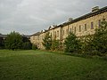
 Canwick Hall - geograph.org.uk - 1074249.jpg 640 × 427; 70 KB
-
 Canwick Hall - geograph.org.uk - 1074255.jpg 640 × 427; 73 KB
-
 Canwick Hall - geograph.org.uk - 3532557.jpg 5,552 × 1,944; 2.56 MB
-
 Canwick Hall - geograph.org.uk - 50201.jpg 640 × 480; 115 KB
-
 Canwick Hall Mews - geograph.org.uk - 2935342.jpg 640 × 427; 140 KB
-
 Canwick Hall Mews Cottages, Grange Lane. - geograph.org.uk - 84399.jpg 640 × 480; 108 KB
-
 Canwick Heath - geograph.org.uk - 2110340.jpg 640 × 427; 88 KB
-
 Canwick Heath - geograph.org.uk - 2110343.jpg 640 × 427; 93 KB
-
 Canwick Heath - geograph.org.uk - 2830194.jpg 640 × 427; 45 KB
-
 Canwick Heath - geograph.org.uk - 5039527.jpg 6,000 × 4,000; 5.27 MB
-
 Canwick Heath Farm - geograph.org.uk - 2830165.jpg 640 × 427; 77 KB
-
 Canwick Park, Lincoln, aerial 2018 - geograph.org.uk - 5811413.jpg 800 × 533; 92 KB
-
 Canwick Road - geograph.org.uk - 2110262.jpg 640 × 427; 89 KB
-
 Canwick Village Hall - geograph.org.uk - 3563725.jpg 640 × 480; 68 KB
-
 Canwick, Heighington Road - geograph.org.uk - 2435881.jpg 640 × 480; 134 KB
-

-
 Car park at the International Bomber Command Memorial - geograph.org.uk - 5847320.jpg 1,600 × 1,065; 534 KB
-
 Change In The Air^ - geograph.org.uk - 95154.jpg 640 × 480; 210 KB
-
 Church on the Hill - geograph.org.uk - 90222.jpg 640 × 480; 80 KB
-
 Church Walk - geograph.org.uk - 1074275.jpg 640 × 427; 105 KB
-
 City of Lincoln - geograph.org.uk - 3531040.jpg 6,804 × 1,459; 1.22 MB
-

-
 Club House - geograph.org.uk - 90216.jpg 640 × 480; 148 KB
-
 Collinge Hinges on a shed in Canwick - geograph.org.uk - 4660773.jpg 640 × 427; 55 KB
-
 Construction barriers - geograph.org.uk - 5039520.jpg 5,600 × 3,733; 7.75 MB
-
 Crop field , Canwick Heath Farm - geograph.org.uk - 3563837.jpg 640 × 480; 74 KB
-
 Crop field near The Pits woodland - geograph.org.uk - 3563726.jpg 640 × 480; 56 KB
-
 Crop field south of Heighington Road - geograph.org.uk - 3563730.jpg 640 × 480; 75 KB
-

-
 Entrance drive to Highfield House - geograph.org.uk - 3218710.jpg 3,088 × 2,056; 1.64 MB
-
 Field of oilseed rape near Bracebridge Heath - geograph.org.uk - 6197258.jpg 1,024 × 768; 215 KB
-
 Footpath towards Branston - geograph.org.uk - 4660797.jpg 640 × 354; 57 KB
-
 Freightliner - geograph.org.uk - 4382205.jpg 1,024 × 695; 251 KB
-
 From Canwick to Lincoln Centre, aerial 2015 - geograph.org.uk - 4750819.jpg 1,024 × 683; 119 KB
-
 Gas lamp - geograph.org.uk - 1074303.jpg 427 × 640; 135 KB
-
 Heighington Road - geograph.org.uk - 3563727.jpg 640 × 480; 73 KB
-
 Heighington Road - geograph.org.uk - 3563731.jpg 640 × 480; 52 KB
-
 Heighington Road - geograph.org.uk - 5989171.jpg 1,024 × 768; 132 KB
-
 Highfield House - geograph.org.uk - 2830163.jpg 640 × 427; 102 KB
-
 House on B1188 Canwick to Branston Road - geograph.org.uk - 2456058.jpg 1,280 × 960; 293 KB
-
 International Bomber Command Centre - geograph.org.uk - 5855788.jpg 640 × 480; 54 KB
-
 International Bomber Command Centre Memorial Spire - Lincoln - geograph.org.uk - 5755634.jpg 1,934 × 2,880; 1.41 MB
-
 International Bomber Command Centre spire - geograph.org.uk - 5038376.jpg 6,184 × 3,968; 5.01 MB
-
 International Bomber Command Centre spire - geograph.org.uk - 5319716.jpg 1,024 × 683; 133 KB
-
 International Bomber Command Centre spire - geograph.org.uk - 5321800.jpg 683 × 1,024; 113 KB
-
 International Bomber Command Centre, Lincoln - geograph.org.uk - 5670695.jpg 1,600 × 1,067; 493 KB
-
 International Bomber Command Centre, Lincoln - geograph.org.uk - 5670697.jpg 1,067 × 1,600; 268 KB
-
 International Bomber Command Centre, Lincoln - geograph.org.uk - 5847322.jpg 1,600 × 1,065; 455 KB
-
 International Bomber Command Centre, Lincoln - geograph.org.uk - 6054073.jpg 3,648 × 2,736; 1.93 MB
-
 Just parts of the Wall of Names - geograph.org.uk - 5990687.jpg 1,600 × 900; 163 KB
-
 Lamppost detail - geograph.org.uk - 1074308.jpg 427 × 640; 116 KB
-
 Lamppost, Canwick - geograph.org.uk - 3532571.jpg 2,134 × 2,848; 915 KB
-
 Lamppost, Canwick - geograph.org.uk - 3532575.jpg 2,134 × 2,848; 1.09 MB
-

-
 Lay-by on Lincoln Road - geograph.org.uk - 3102248.jpg 3,648 × 2,736; 2.61 MB
-
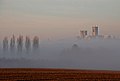
 Lincoln Cathedral - geograph.org.uk - 3531030.jpg 2,270 × 914; 282 KB
-
 Lincoln Cathedral - geograph.org.uk - 3532578.jpg 1,358 × 758; 241 KB
-
 Lincoln Cathedral - geograph.org.uk - 3532582.jpg 1,675 × 1,208; 380 KB
-
-

-
 Lincoln from the IBCC memorial - geograph.org.uk - 5990695.jpg 1,600 × 900; 213 KB
-
 Lincoln Road (B1188) - geograph.org.uk - 3563844.jpg 640 × 480; 59 KB
-
 Lincoln Road - geograph.org.uk - 2829789.jpg 640 × 427; 91 KB
-
 Lincoln Road - geograph.org.uk - 2829897.jpg 640 × 427; 85 KB
-
 Lincoln Road - geograph.org.uk - 2830168.jpg 640 × 427; 83 KB
-
 Lincoln Road - geograph.org.uk - 2830191.jpg 640 × 427; 103 KB
-

-

-

-

-
 Materials store - geograph.org.uk - 5989168.jpg 1,024 × 768; 160 KB
-
 Memorial to Bomber Command - geograph.org.uk - 5856192.jpg 640 × 480; 68 KB
-
 Memorial to Bomber Command - geograph.org.uk - 5856193.jpg 640 × 480; 147 KB
-
 Memorial to Bomber Command - geograph.org.uk - 5856195.jpg 640 × 480; 51 KB
-
 Misty Dogwalkers - geograph.org.uk - 639083.jpg 640 × 402; 27 KB
-
 Oilseed rape crop - geograph.org.uk - 3563851.jpg 640 × 480; 72 KB
-
 Park Lodges, Washingborough Road, Lincoln - geograph.org.uk - 6355776.jpg 3,623 × 2,415; 5.23 MB
-
 Potato field off Lincoln Road - geograph.org.uk - 3563829.jpg 640 × 480; 68 KB
-
 Premier Inn - geograph.org.uk - 3508046.jpg 1,600 × 1,112; 215 KB
-
 Premier Inn, Canwick - geograph.org.uk - 3563848.jpg 640 × 480; 59 KB
-
 Private road off B1188 - geograph.org.uk - 2456072.jpg 1,280 × 960; 398 KB
-
 Railway bridge - geograph.org.uk - 4382201.jpg 1,024 × 692; 217 KB
-

-
 Recreation Ground footpath - geograph.org.uk - 2829782.jpg 640 × 427; 112 KB
-
 Restricted byway to Washingborough Road - geograph.org.uk - 5989387.jpg 1,024 × 768; 283 KB
-
 Road to Canwick - geograph.org.uk - 5039531.jpg 6,000 × 4,000; 6.2 MB
-
 Rust patterns - geograph.org.uk - 5548955.jpg 4,176 × 2,784; 4.06 MB
-
 School Lane from Canwick Hill - geograph.org.uk - 5847317.jpg 1,600 × 1,065; 637 KB
-
 Service station on Canwick Road - geograph.org.uk - 3563723.jpg 640 × 480; 109 KB
-

-
 Sheepwash Grange Farm - geograph.org.uk - 2942507.jpg 640 × 427; 61 KB
-
 Sheepwash Grange farmhouse - geograph.org.uk - 2942539.jpg 640 × 427; 105 KB
-
 South Common - geograph.org.uk - 5321825.jpg 1,024 × 683; 251 KB
-
 South Common - geograph.org.uk - 54273.jpg 640 × 480; 116 KB
-
 Spire, International Bomber Command Centre - geograph.org.uk - 5827070.jpg 4,608 × 3,456; 3.94 MB
-
 St.John's Hospital - geograph.org.uk - 64866.jpg 640 × 480; 118 KB
-
 Stamp End Bridge - geograph.org.uk - 131096.jpg 640 × 427; 122 KB
-
 Stubble fields at Canwick - geograph.org.uk - 3389521.jpg 1,024 × 681; 182 KB
-
 Sunset on Heighington road - geograph.org.uk - 1597500.jpg 2,048 × 1,360; 1.21 MB
-
 The cathedral over the pea field - geograph.org.uk - 5039516.jpg 6,000 × 4,000; 4.13 MB
-
 The entrance to Manor Farm - geograph.org.uk - 5989177.jpg 1,024 × 750; 232 KB
-
 The Lodge - geograph.org.uk - 3508042.jpg 1,600 × 1,200; 469 KB
-
 The path from the church, Canwick - geograph.org.uk - 5989202.jpg 1,024 × 768; 179 KB
-
 The Pits - geograph.org.uk - 2829892.jpg 640 × 427; 152 KB
-
 The spire from across the peafield - geograph.org.uk - 5039511.jpg 6,480 × 4,320; 7.43 MB
-
 The spire seen from the allotments - geograph.org.uk - 5038380.jpg 4,320 × 6,480; 1,015 KB
-
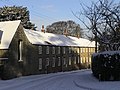
 The west wing, Canwick Hall - geograph.org.uk - 5989208.jpg 1,024 × 768; 240 KB
-
 Toward Bracebridge Heath - geograph.org.uk - 5039532.jpg 6,000 × 4,000; 7.61 MB
-
 Track off Heighington Road - geograph.org.uk - 3008261.jpg 2,256 × 1,504; 1.18 MB
-
 Track to Glebe Farm - geograph.org.uk - 2830188.jpg 640 × 427; 66 KB
-
 Track to Glebe Farm - geograph.org.uk - 3563831.jpg 640 × 480; 60 KB
-
 Track to Glebe Farm - geograph.org.uk - 5989180.jpg 1,024 × 768; 179 KB
-
 Track to Highfield House - geograph.org.uk - 3563839.jpg 640 × 480; 58 KB
-
 Track to Sheepwash Grange - geograph.org.uk - 4660816.jpg 1,024 × 513; 115 KB
-
 Track to Whitehall - geograph.org.uk - 3563852.jpg 640 × 480; 58 KB
-
 Trees by the entrance to Hall Gardens - geograph.org.uk - 5989204.jpg 1,024 × 768; 247 KB
-

-
 View from IBCC - geograph.org.uk - 5856196.jpg 640 × 480; 63 KB
-
 View over South Common to the cathedral, Lincoln - geograph.org.uk - 3635382.jpg 3,776 × 2,520; 4 MB
-
 View to Lincoln - geograph.org.uk - 2943145.jpg 640 × 427; 86 KB
-
 Viking Way towards Bracebridge Heath - geograph.org.uk - 5847343.jpg 1,600 × 1,065; 1,018 KB
-
 Viking Way towards Canwick Road, Lincoln - geograph.org.uk - 5847301.jpg 1,600 × 1,065; 935 KB
-
 Villa Canwick.png 598 × 725; 409 KB
-
 Waiting for the by-pass - geograph.org.uk - 6059542.jpg 4,032 × 3,024; 1.75 MB
-
 War Memorial, Canwick - geograph.org.uk - 5989196.jpg 768 × 1,024; 185 KB
-
 Washingborough Road Railway Bridge - geograph.org.uk - 3008272.jpg 2,256 × 1,504; 1.2 MB
-
 Washingborough Road railway bridge - geograph.org.uk - 5989397.jpg 1,024 × 768; 181 KB
-
 Canwick - geograph.org.uk - 89540.jpg 640 × 480; 118 KB
-
 Canwick - geograph.org.uk - 91445.jpg 640 × 480; 110 KB
-
 Canwick - geograph.org.uk - 91446.jpg 640 × 480; 139 KB
-
 Canwick Cemetery - Lincoln - geograph.org.uk - 50198.jpg 640 × 480; 106 KB
-
 Canwick Golf Course - geograph.org.uk - 50200.jpg 640 × 480; 130 KB
-
 Canwick Manor Farm - geograph.org.uk - 1441209.jpg 640 × 426; 80 KB
-
 Canwick Manor Farm - geograph.org.uk - 427982.jpg 640 × 480; 48 KB
-
 Clayton Road - geograph.org.uk - 712798.jpg 640 × 427; 58 KB
-

-
 Field - geograph.org.uk - 90209.jpg 640 × 480; 79 KB
-
 Misty Sunset - geograph.org.uk - 639088.jpg 640 × 223; 21 KB
-
 No Step - geograph.org.uk - 91443.jpg 640 × 480; 114 KB
-
 Pond on Lincoln South Common - geograph.org.uk - 622268.jpg 426 × 640; 158 KB
-
 Site of the Eleanor Cross - geograph.org.uk - 567595.jpg 640 × 427; 66 KB
-
 St.Catherines - geograph.org.uk - 568993.jpg 640 × 427; 63 KB
-
 The Pits - geograph.org.uk - 89538.jpg 640 × 480; 105 KB


_-_geograph.org.uk_-_3563856.jpg)


_Heighington_Road_intersection,_aerial_2018_-_geograph.org.uk_-_5979428.jpg)

_-_geograph.org.uk_-_3563844.jpg)


_-_geograph.org.uk_-_6339100.jpg)
_-_geograph.org.uk_-_6339101.jpg)


