Category:Callington, Cornwall
Jump to navigation
Jump to search
town and civil parish in south-east Cornwall  | |||||
| Upload media | |||||
| Instance of | |||||
|---|---|---|---|---|---|
| Location | Cornwall, South West England, England | ||||
| Population |
| ||||
| Different from | |||||
| Said to be the same as | Callington (Wikimedia duplicated page, civil parish) | ||||
 | |||||
Brezhoneg: Rummad:Kêrioù Kernev-Veur
English: Callington is a small town and civil parish in southeast Cornwall, UK. The civil parish had a population of 4,783 in 2001, according to the 2001 census, although recent figures show that the population has risen to around 6000.
Kernowek: Kelliwik ( Sowsnek Callington) yw tre yn soth-est Kernow, Breten Veur, yn Ranndir Karadon. Desedhans an wig yw yntra Goen Brenn ha Bronn Kit. Kowethyans pastiow Ginsters a's peus y hweythva omma. Poblans Kelliwik o 4,048 yn 2001 ha 3,511 yn 1996.
Norsk bokmål: Callington ( kornisk Kelliwik) er en by i Cornwall, England. Den ligger mellom Kit Hill og Bodmin Moor i distriktet Caradon.
Polski: Callington ( korn. Kelliwik) - miasto w Wielkiej Brytanii, w Anglii w Kornwalii usytuowane między Kit Hill i Bodmin Moor.
Subcategories
This category has the following 9 subcategories, out of 9 total.
C
- Cadson Bury Hill Fort (8 F)
- Callington War Memorial (2 F)
D
- Dupath Well (4 F)
F
- Frogwell (2 F)
G
K
N
- Newbridge bridge, Cornwall (6 F)
T
Media in category "Callington, Cornwall"
The following 200 files are in this category, out of 217 total.
(previous page) (next page)-
 A Book of the West - Callington Cross.png 2,330 × 1,873; 1.07 MB
-
 A Book of the West - Callington.png 2,715 × 1,589; 2.84 MB
-
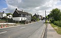
 A390 - geograph.org.uk - 5773243.jpg 640 × 426; 74 KB
-
 Animal services, Callington - geograph.org.uk - 4239068.jpg 1,918 × 1,102; 477 KB
-
 Approaching Frogwell Mill - geograph.org.uk - 3983721.jpg 1,920 × 2,560; 837 KB
-
 Ashton Methodist church.png 640 × 960; 956 KB
-
 Bend, Florence Rd - geograph.org.uk - 5778527.jpg 640 × 426; 76 KB
-
 Bluebells by the Lynher - geograph.org.uk - 3983701.jpg 1,920 × 1,440; 978 KB
-
 Borough Stone, Tavistock Rd - geograph.org.uk - 5773191.jpg 640 × 426; 96 KB
-
 Bridge over Haye Valley Stream - geograph.org.uk - 4126379.jpg 1,920 × 2,560; 1.88 MB
-
 Buildings at Wheal St Vincent (geograph 4237334).jpg 1,845 × 1,317; 1.08 MB
-
 Bungalows off the A388, near Callington - geograph.org.uk - 178791.jpg 640 × 427; 249 KB
-
 Bus stop, Kelly Bray - geograph.org.uk - 4129971.jpg 1,920 × 1,441; 867 KB
-
 Callington , Tesco - geograph.org.uk - 5756167.jpg 5,312 × 2,988; 3.48 MB
-
 Callington , Tesco - geograph.org.uk - 5756169.jpg 3,264 × 2,448; 5.69 MB
-
 Callington , Tesco - geograph.org.uk - 5756170.jpg 3,264 × 2,448; 5.1 MB
-
 Callington Campsite - geograph.org.uk - 3127184.jpg 640 × 424; 227 KB
-
 Callington Cricket Field - geograph.org.uk - 691586.jpg 640 × 486; 55 KB
-
 Callington Methodist Church - geograph.org.uk - 4470842.jpg 3,812 × 2,792; 1.48 MB
-
 Callington PL17, UK - panoramio.jpg 2,048 × 1,150; 540 KB
-
 Callington Primary School - geograph.org.uk - 5771837.jpg 459 × 640; 73 KB
-
 Callington Sewage Treatment Works - geograph.org.uk - 4126350.jpg 1,920 × 1,440; 1.01 MB
-
 Callington, church tower and wind turbine - geograph.org.uk - 4239012.jpg 2,350 × 2,976; 442 KB
-
 Calweton Veterinary Group - geograph.org.uk - 5773205.jpg 640 × 426; 60 KB
-
 Car park off New Rd - geograph.org.uk - 5771836.jpg 640 × 571; 99 KB
-
 Car sales, Kelly Bray - geograph.org.uk - 3987025.jpg 1,920 × 1,121; 334 KB
-
 Cattle pasture, Dupath Farm - geograph.org.uk - 4234374.jpg 1,920 × 1,347; 732 KB
-
 CBM at Callington Church - geograph.org.uk - 4890517.jpg 360 × 640; 99 KB
-
 Corner of Moonsfield - geograph.org.uk - 5773187.jpg 640 × 426; 53 KB
-
 Cottage on Tavistock Rd - geograph.org.uk - 5773189.jpg 640 × 426; 56 KB
-
 Cross roads, end of Fore St - geograph.org.uk - 5773143.jpg 640 × 426; 54 KB
-

-
 Drive to Bearland Bridge Cottage - geograph.org.uk - 4127376.jpg 1,920 × 2,560; 1.64 MB
-
 Dupath Farm - geograph.org.uk - 4238172.jpg 1,913 × 2,137; 1.07 MB
-
 Dupath Farm - geograph.org.uk - 4238184.jpg 1,873 × 1,329; 478 KB
-
 Dupath Well - geograph.org.uk - 4238119.jpg 1,762 × 1,368; 660 KB
-
 Dupath Well - geograph.org.uk - 4238146.jpg 1,920 × 2,200; 1,005 KB
-
 Dupath Well - geograph.org.uk - 4577350.jpg 1,600 × 1,257; 588 KB
-
-
 Entering Callington, A390 - geograph.org.uk - 5773248.jpg 640 × 426; 85 KB
-
 Entrance to Ginsters - geograph.org.uk - 5773238.jpg 640 × 426; 100 KB
-
 Farmland east of Callington - geograph.org.uk - 4130167.jpg 1,920 × 1,188; 592 KB
-
 Farmland near Callington - geograph.org.uk - 4238300.jpg 1,920 × 1,440; 640 KB
-
 Farmland near Callington - geograph.org.uk - 4238347.jpg 1,920 × 1,427; 543 KB
-
 Farmland, Dupath - geograph.org.uk - 4238306.jpg 1,920 × 1,327; 701 KB
-
 Field above the Lynher valley - geograph.org.uk - 3986952.jpg 1,920 × 1,440; 789 KB
-
 Field and hedge by A388 - geograph.org.uk - 5771828.jpg 640 × 311; 40 KB
-
 Field beside the A390 - geograph.org.uk - 4130158.jpg 1,920 × 1,314; 675 KB
-
 Field near Callington - geograph.org.uk - 3737766.jpg 1,920 × 1,382; 503 KB
-
 Field near Dupath - geograph.org.uk - 4238033.jpg 1,920 × 1,373; 713 KB
-
 Field near Dupath - geograph.org.uk - 4238051.jpg 1,920 × 2,350; 1.41 MB
-
 Field near Haye - geograph.org.uk - 4127559.jpg 1,920 × 1,084; 573 KB
-
 Field near Rill Farm - geograph.org.uk - 3737746.jpg 1,920 × 1,420; 677 KB
-
 Fields Near Kithill Castle - geograph.org.uk - 5603168.jpg 640 × 427; 264 KB
-
 Fire Station behind the Allotments - geograph.org.uk - 1882269.jpg 640 × 413; 69 KB
-
 Florence Rd - geograph.org.uk - 5773252.jpg 640 × 426; 96 KB
-
 Florence Rd - geograph.org.uk - 5773256.jpg 640 × 426; 103 KB
-
 Florence Rd - geograph.org.uk - 5773261.jpg 640 × 426; 98 KB
-
 Florence Rd - geograph.org.uk - 5773265.jpg 640 × 426; 81 KB
-
 Florence Road Industrial Estate, Kelly Bray - geograph.org.uk - 3979203.jpg 1,920 × 1,427; 306 KB
-
 Florence Tomkin Plantation - geograph.org.uk - 5778543.jpg 426 × 640; 145 KB
-
 Footpath and track - geograph.org.uk - 1759943.jpg 640 × 480; 255 KB
-
 Footpath off Florence Rd - geograph.org.uk - 5778528.jpg 640 × 426; 84 KB
-
 Footpath to Kit Hill - geograph.org.uk - 5778544.jpg 640 × 426; 64 KB
-
 Fore St - geograph.org.uk - 5771839.jpg 640 × 426; 64 KB
-
 Fore St - geograph.org.uk - 5773142.jpg 640 × 426; 72 KB
-
 Fore St - geograph.org.uk - 5773152.jpg 640 × 426; 63 KB
-
 Former Mine Shaft - geograph.org.uk - 3127181.jpg 640 × 424; 306 KB
-
 Former Mine Site - geograph.org.uk - 3127179.jpg 640 × 424; 304 KB
-
 Freemasons Hall, Callington - geograph.org.uk - 2679338.jpg 556 × 640; 72 KB
-
 Fullaford Rd - geograph.org.uk - 5773250.jpg 640 × 426; 68 KB
-
 Gate on footpath to Kit Hill - geograph.org.uk - 5778541.jpg 640 × 426; 92 KB
-
 Gate Piers, Tors View - geograph.org.uk - 5773197.jpg 640 × 426; 110 KB
-
 Gate to open moorland - geograph.org.uk - 5778551.jpg 640 × 426; 66 KB
-
 Ginsters - geograph.org.uk - 5773206.jpg 640 × 426; 52 KB
-
 Ginsters - geograph.org.uk - 5773209.jpg 640 × 426; 51 KB
-
 Ginsters - geograph.org.uk - 5773210.jpg 640 × 426; 59 KB
-
 Ginsters - geograph.org.uk - 5773211.jpg 640 × 426; 85 KB
-
 Granite Road, Callington - geograph.org.uk - 4238921.jpg 1,920 × 1,123; 602 KB
-
 Guipavas Rd - geograph.org.uk - 5773240.jpg 640 × 426; 88 KB
-
 Haye Valley Stream - geograph.org.uk - 4126370.jpg 1,920 × 1,440; 1.14 MB
-
 Hazelwood Rd - geograph.org.uk - 5773195.jpg 640 × 426; 55 KB
-
 Hedgeline - geograph.org.uk - 5778549.jpg 640 × 426; 45 KB
-
 Hillside, Newbridge - geograph.org.uk - 3983695.jpg 1,920 × 1,440; 644 KB
-
 Hingston Down from Kit Hill - geograph.org.uk - 68257.jpg 640 × 363; 118 KB
-
 House on Florence Rd - geograph.org.uk - 5773255.jpg 640 × 426; 69 KB
-
 Isambard's Pasty Chefs - geograph.org.uk - 4457730.jpg 681 × 547; 199 KB
-
 Junction, Kelly Bray - geograph.org.uk - 4130074.jpg 1,920 × 1,373; 643 KB
-
 Kelly Bray and Kit Hill from Caradon Hill - geograph.org.uk - 4286367.jpg 1,920 × 1,097; 347 KB
-
 Kit Hill mine stacks - geograph.org.uk - 357295.jpg 480 × 640; 91 KB
-
 Kit Hill road, near Callington - geograph.org.uk - 178800.jpg 640 × 427; 248 KB
-
 Kit Hill viewpoint - geograph.org.uk - 68260.jpg 640 × 378; 79 KB
-
 Land near Dupath Well - geograph.org.uk - 4582472.jpg 3,357 × 2,172; 1.78 MB
-
 Lane at Lendra - geograph.org.uk - 4126318.jpg 1,920 × 2,429; 1.6 MB
-
 Lane near Dupath - geograph.org.uk - 4238105.jpg 1,920 × 1,440; 784 KB
-
 Lane past Callington Sewage Treatment Works - geograph.org.uk - 4126331.jpg 1,920 × 1,440; 1.2 MB
-
 Lane to Corneal - geograph.org.uk - 4237346.jpg 1,920 × 1,440; 1.05 MB
-
 Lane to Frogwell - geograph.org.uk - 3983684.jpg 1,920 × 2,560; 1.13 MB
-
 Lane to Lendra - geograph.org.uk - 4126298.jpg 1,920 × 2,560; 1.89 MB
-
 Lane to Welltown - geograph.org.uk - 4238071.jpg 1,920 × 1,399; 800 KB
-
 Large potato field near the Dupath Road - geograph.org.uk - 690990.jpg 640 × 579; 124 KB
-
 Longfield Close - geograph.org.uk - 5773201.jpg 640 × 426; 88 KB
-
 Looking towards Kelly Bray - geograph.org.uk - 1882278.jpg 640 × 425; 62 KB
-
 Lynher flood plain - geograph.org.uk - 3983865.jpg 1,920 × 1,333; 530 KB
-
 Lynher valley from Frogwell - geograph.org.uk - 4126283.jpg 1,920 × 1,257; 924 KB
-
 Martin Hill Motors - geograph.org.uk - 5778524.jpg 640 × 426; 47 KB
-
 Meadow by the Lynher - geograph.org.uk - 3983871.jpg 1,920 × 1,440; 618 KB
-
 Methodist church, Callington - geograph.org.uk - 2679481.jpg 640 × 422; 59 KB
-
 Mill Leat Valley - geograph.org.uk - 4237834.jpg 1,920 × 1,238; 453 KB
-
 Mill Leat Valley - geograph.org.uk - 4237942.jpg 1,909 × 1,143; 677 KB
-
 Mobile Farm Shop - geograph.org.uk - 3179121.jpg 640 × 480; 94 KB
-
 New building by Dupath Lane - geograph.org.uk - 4238766.jpg 1,920 × 1,440; 874 KB
-
 New Rd - geograph.org.uk - 5773141.jpg 640 × 425; 33 KB
-
 New St, Fore St junction - geograph.org.uk - 5773048.jpg 640 × 426; 56 KB
-
 Newbridge - geograph.org.uk - 3983674.jpg 1,920 × 2,560; 1.11 MB
-
 Newbridge - geograph.org.uk - 410793.jpg 640 × 427; 99 KB
-
 Newbridge and smithy - geograph.org.uk - 3983884.jpg 1,920 × 2,560; 1.3 MB
-
 Off Tavistock Rd - geograph.org.uk - 5773199.jpg 640 × 426; 59 KB
-
 Old Boundary Marker on Saltash Road (geograph 6678243).jpg 812 × 540; 113 KB
-

-

-
 Old Farm Machine - geograph.org.uk - 4486851.jpg 4,000 × 3,000; 4.62 MB
-
 Old Milestone by Bearland Bridge - geograph.org.uk - 5623231.jpg 537 × 800; 142 KB
-

-
-
 Old Milestone by the A390 at Newbridge - geograph.org.uk - 5623251.jpg 600 × 800; 203 KB
-
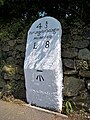
 Old Milestone by the A390 in Callington - geograph.org.uk - 5623265.jpg 600 × 800; 184 KB
-
 Old Milestone in Callington - geograph.org.uk - 5623250.jpg 600 × 800; 213 KB
-
 Old Milestone south of Callington - geograph.org.uk - 5623255.jpg 600 × 800; 274 KB
-
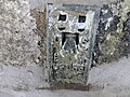
 Ordnance Survey Flush Bracket 1921 - geograph.org.uk - 4714324.jpg 4,000 × 3,000; 2.71 MB
-
 Ordnance Survey Flush Bracket 1922 - geograph.org.uk - 4714497.jpg 4,000 × 3,000; 2.78 MB
-
 Ordnance Survey Flush Bracket G2055 - geograph.org.uk - 4714513.jpg 4,000 × 3,000; 3.02 MB
-
 Ordnance Survey Flush Bracket G2055 - geograph.org.uk - 4714515.jpg 4,000 × 3,000; 3.52 MB
-
 Ordnance Survey Flush Bracket S5217 - geograph.org.uk - 4714335.jpg 4,000 × 3,000; 3.9 MB
-
 Outskirts of Callington - geograph.org.uk - 1882285.jpg 640 × 407; 58 KB
-
 Pasture on the slopes of Kit Hill - geograph.org.uk - 5773253.jpg 640 × 426; 59 KB
-
 Pasture, Southern slopes of Kit Hill - geograph.org.uk - 5773262.jpg 640 × 426; 74 KB
-
 Path and verge, Callington - geograph.org.uk - 4238789.jpg 1,920 × 2,573; 1.66 MB
-
 Pridham's Steam Train - geograph.org.uk - 4457735.jpg 1,979 × 1,641; 696 KB
-
 Rainbow over Farmland - geograph.org.uk - 291702.jpg 640 × 514; 80 KB
-
 Road Junction at Amy Tree - geograph.org.uk - 291745.jpg 640 × 441; 96 KB
-
 Road Junction on Minor Roads - geograph.org.uk - 260566.jpg 640 × 427; 111 KB
-
 Road to Tesco Superstore - geograph.org.uk - 5773200.jpg 640 × 426; 63 KB
-
 Robert Willoughby 1st Baron Willoughby de Broke CallingtonChurch Cornwall.jpg 733 × 2,129; 764 KB
-
 Roundabout, Callington - geograph.org.uk - 4238806.jpg 1,920 × 1,440; 521 KB
-
 Row of Houses, A390 - geograph.org.uk - 5773244.jpg 640 × 426; 65 KB
-
 Saltash Rd - geograph.org.uk - 5773147.jpg 640 × 426; 62 KB
-
 Sheep near Haye - geograph.org.uk - 4127725.jpg 1,920 × 1,195; 829 KB
-
 Site of Redmoor mine - geograph.org.uk - 4486888.jpg 4,000 × 3,000; 2.81 MB
-
 Slopes of Kit Hill - geograph.org.uk - 5778546.jpg 640 × 426; 68 KB
-
 South Mill Road - geograph.org.uk - 2680091.jpg 640 × 430; 73 KB
-
 Southern slopes of Kit Hill - geograph.org.uk - 5773257.jpg 640 × 426; 120 KB
-
 Spider Web in the Grass - geograph.org.uk - 411758.jpg 640 × 640; 206 KB
-
 St Mary's Church, Callington - geograph.org.uk - 3175750.jpg 640 × 480; 113 KB
-

-
 Steps by the church, Callington - geograph.org.uk - 4239458.jpg 1,920 × 2,560; 1.2 MB
-
 Stone Water Trough - geograph.org.uk - 262160.jpg 640 × 427; 153 KB
-
 Tamar Foods Head Office, Callington - geograph.org.uk - 1759976.jpg 640 × 480; 255 KB
-
 Tavistock Rd - geograph.org.uk - 5773148.jpg 640 × 426; 50 KB
-
 Tavistock Rd - geograph.org.uk - 5773192.jpg 640 × 426; 73 KB
-
 Terrace, Tavistock Rd - geograph.org.uk - 5773186.jpg 640 × 426; 67 KB
-
 The A390 at Newbridge - geograph.org.uk - 3488285.jpg 800 × 600; 162 KB
-
 The approach to Newbridge - geograph.org.uk - 2589975.jpg 640 × 389; 129 KB
-
 The Lynher River - geograph.org.uk - 411619.jpg 640 × 427; 141 KB
-
 The Lynher Valley from Frogwell - geograph.org.uk - 410771.jpg 640 × 427; 113 KB
-
 The River Lynher at Bicton Mill - geograph.org.uk - 465227.jpg 640 × 427; 104 KB
-
 The River Lynher below Cadson Bury Fort - geograph.org.uk - 407984.jpg 427 × 640; 154 KB
-
 The Road to Kit Hill - geograph.org.uk - 1889796.jpg 640 × 421; 75 KB
-
 The Secret Pasty Factory of Isambard Kingdom Brunel - geograph.org.uk - 4457724.jpg 3,516 × 2,500; 1.89 MB
-
 The View from Florence Road - geograph.org.uk - 1262842.jpg 640 × 427; 80 KB
-
-
 Tors View Close - geograph.org.uk - 5773193.jpg 640 × 425; 99 KB
-
 Towards Dupath Farm - geograph.org.uk - 4238754.jpg 3,376 × 2,381; 765 KB
-
 Towards Kit Hill - geograph.org.uk - 4237922.jpg 1,920 × 962; 460 KB
-
 Towards Kit Hill - geograph.org.uk - 4238293.jpg 1,920 × 1,231; 599 KB
-
 Track by the A390 - geograph.org.uk - 4130140.jpg 3,638 × 2,563; 1.28 MB
-
 Track to Claremont - geograph.org.uk - 5778529.jpg 640 × 426; 120 KB
-
 Track to Pengover - geograph.org.uk - 4130113.jpg 1,920 × 2,621; 2.16 MB
-
 Track, Dupath - geograph.org.uk - 4238152.jpg 1,920 × 1,365; 679 KB
-
 Tractor with Hay Turner -Tedder - geograph.org.uk - 5600761.jpg 640 × 427; 224 KB
-
 Traffic lights, Callington - geograph.org.uk - 2680039.jpg 640 × 411; 50 KB
-
 Trees along field boundary by Haye Lane - geograph.org.uk - 4127699.jpg 1,920 × 1,440; 915 KB
-
 Tributary of the Lynher - geograph.org.uk - 1759931.jpg 640 × 480; 234 KB
-
 Urban Terrace, Callington - geograph.org.uk - 4457793.jpg 4,000 × 3,000; 2.56 MB
-
 View from A388 - geograph.org.uk - 5771832.jpg 640 × 294; 48 KB
-
 Wall Painting in Callington - geograph.org.uk - 4457741.jpg 3,600 × 3,000; 3.25 MB
-
 Windpump at Woodcock's Well - geograph.org.uk - 260749.jpg 480 × 640; 84 KB
-
 Across the Rainy Valley - geograph.org.uk - 291718.jpg 640 × 427; 91 KB
-
 Alley off Fore Street - geograph.org.uk - 260138.jpg 640 × 427; 91 KB
-
 Bearland Bridge - geograph.org.uk - 444906.jpg 640 × 480; 124 KB
-
 Bearland Bridge Cottage from the footpath - geograph.org.uk - 444911.jpg 640 × 480; 125 KB
-
 Below the Ramparts at Cadson Fort - geograph.org.uk - 411766.jpg 640 × 427; 114 KB
-
 Bend in the Road at Pigeon Wood - geograph.org.uk - 260528.jpg 640 × 427; 121 KB
-
 Cadson from Cadson Bury Fort - geograph.org.uk - 411734.jpg 640 × 426; 78 KB
-
 Callington - geograph.org.uk - 703559.jpg 640 × 499; 86 KB
-
 Callington Water Treatment Works - geograph.org.uk - 260535.jpg 640 × 427; 119 KB
-
 Castlewich Farm, Callington - geograph.org.uk - 178785.jpg 640 × 427; 321 KB
-
 Converted building near Lendra Wood - geograph.org.uk - 260549.jpg 640 × 427; 130 KB
-
 Disused Mine in the Valley Bottom - geograph.org.uk - 292295.jpg 640 × 427; 96 KB
-
 Dupath Farm - geograph.org.uk - 292298.jpg 640 × 427; 84 KB


.jpg)


.jpg)


.jpg)


