Category:Caldwell, North Yorkshire
Jump to navigation
Jump to search
village and civil parish in the Richmondshire district of North Yorkshire, England  | |||||
| Upload media | |||||
| Instance of | |||||
|---|---|---|---|---|---|
| Location | Richmondshire, North Yorkshire, Yorkshire and the Humber, England | ||||
 | |||||
English: Caldwell is a village and civil parish in the Richmondshire district of North Yorkshire, England, close to the border with County Durham and a few miles west of Darlington. According to the 2001 UK census the parish had a population of 115.cite web
Media in category "Caldwell, North Yorkshire"
The following 66 files are in this category, out of 66 total.
-

-
 B6274 at the east end of Caldwell - geograph.org.uk - 5311116.jpg 1,024 × 768; 140 KB
-
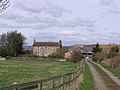 Barforth Grange. - geograph.org.uk - 147273.jpg 640 × 479; 83 KB
-
 Bridleway , Greystone - geograph.org.uk - 352221.jpg 640 × 374; 85 KB
-
 Bridleway just south of Greystone Farm - geograph.org.uk - 2857782.jpg 3,648 × 2,736; 2.34 MB
-
 Bridleway to Ovington - geograph.org.uk - 5311111.jpg 1,024 × 768; 251 KB
-
 Caldwell's northern houses - geograph.org.uk - 1627252.jpg 640 × 400; 106 KB
-
 Communications in Caldwell - geograph.org.uk - 5311117.jpg 1,024 × 768; 183 KB
-
 County Border - geograph.org.uk - 459520.jpg 640 × 480; 110 KB
-
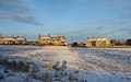
 County Durham south of the River Tees - geograph.org.uk - 2389670.jpg 1,436 × 1,120; 527 KB
-
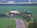 Crop spraying at Greystone Farm - geograph.org.uk - 3956033.jpg 640 × 480; 130 KB
-
 Cut Benchmark - geograph.org.uk - 5390849.jpg 3,000 × 4,000; 2.7 MB
-
 Dovecote in Caldwell Village.jpg 640 × 479; 113 KB
-
 Drive to Foxberry Farm from West Lane - geograph.org.uk - 2857755.jpg 3,648 × 2,736; 1.75 MB
-
 Drive to Greystone Farm off the B6274 - geograph.org.uk - 2860668.jpg 3,648 × 2,736; 2.89 MB
-
 Farm road to Greystone Farm - geograph.org.uk - 3956031.jpg 640 × 480; 112 KB
-
 Farmhouse at East Middleton Farm - geograph.org.uk - 2856602.jpg 3,648 × 2,736; 2.65 MB
-
 Farmhouse at Foxberry Farm - geograph.org.uk - 2856621.jpg 3,648 × 2,736; 2.71 MB
-
 Farmhouse at Greystone Farm - geograph.org.uk - 2857763.jpg 3,648 × 2,736; 2.31 MB
-
 Farmland north of West Lane - geograph.org.uk - 5311107.jpg 1,024 × 768; 145 KB
-
 Farmland north-west of Foxberry - geograph.org.uk - 5311113.jpg 1,024 × 768; 110 KB
-
 Farmland, Caldwell - geograph.org.uk - 2675364.jpg 640 × 480; 158 KB
-
 Farmland, Caldwell - geograph.org.uk - 2675424.jpg 640 × 480; 135 KB
-
 Farmland, Caldwell - geograph.org.uk - 2758880.jpg 640 × 480; 145 KB
-
 Farmland, Caldwell - geograph.org.uk - 6137554.jpg 1,024 × 768; 236 KB
-
 Field of oilseed rape off West Lane - geograph.org.uk - 3956036.jpg 640 × 480; 163 KB
-
 Greystone West - geograph.org.uk - 2857790.jpg 3,648 × 2,736; 2.29 MB
-
 Hedge and Field at Cote Hill Triangulation Pillar - geograph.org.uk - 4571513.jpg 4,000 × 3,000; 2.78 MB
-
 House at West Lane junction, Caldwell - geograph.org.uk - 2389438.jpg 1,824 × 1,368; 878 KB
-
 Houses and telephone box at Caldwell - geograph.org.uk - 3956088.jpg 640 × 480; 150 KB
-
 Houses at the east end of High Row, Caldwell - geograph.org.uk - 5311121.jpg 1,024 × 768; 200 KB
-
 Hutton Grove - geograph.org.uk - 3956014.jpg 640 × 480; 108 KB
-
 Lane to Caldwell Farm carrying a public footpath - geograph.org.uk - 2854661.jpg 3,648 × 2,736; 2.67 MB
-
 Leaholme just west of Caldwell with West Ridge at rear - geograph.org.uk - 2857738.jpg 3,648 × 2,736; 1.82 MB
-
 New house, High Row, Caldwell - geograph.org.uk - 3289933.jpg 640 × 480; 91 KB
-
 Ordnance Survey flush bracket - old school house - geograph.org.uk - 5390844.jpg 4,000 × 3,000; 2.47 MB
-
 Road from Caldwell to Hutton Magna - geograph.org.uk - 2389450.jpg 1,368 × 1,824; 726 KB
-
 St Hildas Church and churchyard, Caldwell (geograph 5311119).jpg 1,024 × 768; 418 KB
-
 Village pub, Caldwell - geograph.org.uk - 5311122.jpg 1,024 × 768; 137 KB
-
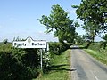
 Welcome to Richmondshire - geograph.org.uk - 2389424.jpg 1,775 × 1,255; 681 KB
-
 West Lane heading east to Caldwell - geograph.org.uk - 5311106.jpg 1,024 × 768; 135 KB
-
 West Lane junction, off B6274 at Caldwell - geograph.org.uk - 2018466.jpg 1,191 × 747; 343 KB
-
 A flower tub - geograph.org.uk - 459433.jpg 640 × 480; 138 KB
-
 Access to Barforth Grange - geograph.org.uk - 459438.jpg 640 × 480; 92 KB
-
 Access to Pond Cottage - geograph.org.uk - 459425.jpg 640 × 480; 60 KB
-
 Access to Pudding Hill reservoir - geograph.org.uk - 459397.jpg 640 × 480; 80 KB
-
 Brownlow Arms , Caldwell. - geograph.org.uk - 147232.jpg 640 × 479; 112 KB
-
 Cote Hill - geograph.org.uk - 152129.jpg 640 × 479; 90 KB
-
 Cote Hill farm - geograph.org.uk - 459414.jpg 640 × 480; 75 KB
-
 Eppleby junction - geograph.org.uk - 459382.jpg 640 × 480; 98 KB
-
 Exit from Boat Lane - geograph.org.uk - 459507.jpg 640 × 637; 129 KB
-
 Greystone Farm. - geograph.org.uk - 147230.jpg 640 × 479; 80 KB
-
 High Close barn - geograph.org.uk - 459509.jpg 640 × 480; 91 KB
-
 High Close Cottage - geograph.org.uk - 459452.jpg 640 × 480; 81 KB
-
 Honeysuckle Hedge - geograph.org.uk - 459445.jpg 640 × 480; 190 KB
-
 Junction for Low Fields-Low Close - geograph.org.uk - 459460.jpg 640 × 387; 49 KB
-
 Lane to East Middleton - geograph.org.uk - 352194.jpg 640 × 379; 82 KB
-
 Layton Fields. - geograph.org.uk - 143530.jpg 640 × 479; 71 KB
-
 Mill Bridge , Caldwell. - geograph.org.uk - 140242.jpg 640 × 479; 138 KB
-
 New House Farm - geograph.org.uk - 140180.jpg 640 × 479; 65 KB
-
 Pond Cottage - geograph.org.uk - 459406.jpg 640 × 480; 107 KB
-
 Public footpath to Cote Hill - geograph.org.uk - 459420.jpg 640 × 480; 70 KB
-
 Pudding Hill , Reservoir. - geograph.org.uk - 147267.jpg 640 × 479; 86 KB
-
 Pudding Hill , Reservoir. - geograph.org.uk - 152130.jpg 640 × 479; 65 KB
-
 Pudding Hill reservoir - geograph.org.uk - 459392.jpg 640 × 480; 95 KB
-
 Sough Hill. - geograph.org.uk - 190495.jpg 640 × 339; 49 KB


.jpg)


