Category:Caldbergh, North Yorkshire
Jump to navigation
Jump to search
village in United Kingdom  | |||||
| Upload media | |||||
| Instance of | |||||
|---|---|---|---|---|---|
| Location | Richmondshire, North Yorkshire, Yorkshire and the Humber, England | ||||
 | |||||
English: Caldbergh (Caldeber in the Domesday Book) is a hamlet within the Yorkshire Dales, North Yorkshire, England. It lies about four miles south of Leyburn. East Scrafton and Coverham are nearby.
Media in category "Caldbergh, North Yorkshire"
The following 43 files are in this category, out of 43 total.
-
 A 'Boulder' Sheep - geograph.org.uk - 439722.jpg 480 × 640; 135 KB
-
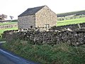 A Barn In Good Repair - geograph.org.uk - 288399.jpg 640 × 480; 83 KB
-
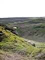
 Approaching Caldbergh. - geograph.org.uk - 439754.jpg 640 × 480; 109 KB
-
 Remains of St. Simons Chapel - geograph.org.uk - 126771.jpg 640 × 480; 169 KB
-
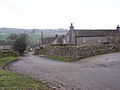
 Caldbergh - geograph.org.uk - 494974.jpg 640 × 427; 172 KB
-
 Caldbergh, North Yorkshire.jpg 640 × 480; 81 KB
-
 Cats' burial ground, Caldbergh - geograph.org.uk - 1579415.jpg 640 × 480; 102 KB
-
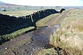 Ford at Caldbergh - geograph.org.uk - 4341731.jpg 3,872 × 2,592; 4.84 MB
-
 Hollow Way on Moorland Track - geograph.org.uk - 439721.jpg 480 × 640; 145 KB
-

-
 In Caldbergh - geograph.org.uk - 3534554.jpg 4,320 × 3,240; 3.5 MB
-
 Looking down to Caldbergh - geograph.org.uk - 1579425.jpg 640 × 480; 59 KB
-
 Narrow Lane leading away from Caldbergh - geograph.org.uk - 3534564.jpg 4,320 × 3,240; 4.68 MB
-
 New plantation at Ulfers Gill - geograph.org.uk - 439724.jpg 480 × 640; 142 KB
-
 Photographer's dilemma. - geograph.org.uk - 439760.jpg 640 × 480; 65 KB
-
 Red Way - geograph.org.uk - 494971.jpg 427 × 640; 161 KB
-
 Red Way - geograph.org.uk - 497596.jpg 640 × 427; 171 KB
-
 Riders Approaching - geograph.org.uk - 439751.jpg 480 × 640; 85 KB
-
 Telephone Kiosk, Caldbergh.jpg 1,024 × 683; 185 KB
-
 The bridges of Caldbergh Gill - geograph.org.uk - 1801971.jpg 480 × 640; 140 KB
-
 Track and cattle grid at Carldbergh - geograph.org.uk - 4136710.jpg 4,000 × 3,000; 4.14 MB
-
 Track to St Simon's footbridge - geograph.org.uk - 688546.jpg 600 × 450; 70 KB
-
 Ulfers Gill - geograph.org.uk - 439727.jpg 640 × 480; 108 KB
-
 A Gated Track - geograph.org.uk - 283620.jpg 640 × 480; 100 KB
-
 A View To Melmerby Moor - geograph.org.uk - 288405.jpg 640 × 480; 81 KB
-
 Beck below Town Spring - geograph.org.uk - 439740.jpg 480 × 640; 124 KB
-
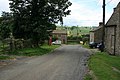
 Caldbergh cottages - geograph.org.uk - 347805.jpg 600 × 450; 46 KB
-
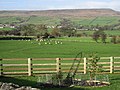
 Dales sheep - geograph.org.uk - 158631.jpg 640 × 480; 114 KB
-
 Fellside at Honey Pots - geograph.org.uk - 439736.jpg 640 × 480; 70 KB
-
 Lady Hill - geograph.org.uk - 127155.jpg 640 × 480; 69 KB
-
 Otter's Hole - geograph.org.uk - 347087.jpg 600 × 450; 89 KB
-
 Scale Gill - geograph.org.uk - 439728.jpg 640 × 480; 91 KB
-
 Shooting Butt, Barnley - geograph.org.uk - 496682.jpg 640 × 427; 62 KB
-
 Shooting House, Caldbergh Moor - geograph.org.uk - 439731.jpg 640 × 480; 91 KB
-
 Slip Wath - geograph.org.uk - 494980.jpg 640 × 427; 188 KB
-
 Small Rock, Colsterdale Moor - geograph.org.uk - 497620.jpg 640 × 427; 173 KB
-
 St Simon's footbridge - geograph.org.uk - 347604.jpg 600 × 450; 87 KB
-
 Substantial Wall at Agglethorpe - geograph.org.uk - 127194.jpg 640 × 480; 99 KB
-
 Towards Melmerby - geograph.org.uk - 288402.jpg 640 × 480; 105 KB
-
 View from Forbidden Corner - geograph.org.uk - 54963.jpg 640 × 480; 104 KB
-
 Water worn Limestone - geograph.org.uk - 439761.jpg 480 × 640; 167 KB
-
 Woodland near Caldbergh - geograph.org.uk - 347807.jpg 600 × 450; 66 KB
-


