Category:CIA maps of the Socialist Federal Republic of Yugoslavia
Jump to navigation
Jump to search
Media in category "CIA maps of the Socialist Federal Republic of Yugoslavia"
The following 11 files are in this category, out of 11 total.
-
 1981 Yugoslavia (30849054506).jpg 972 × 963; 901 KB
-
 Western former Yugoslav republics. LOC 2001621253.jpg 2,496 × 2,861; 621 KB
-
 Yugoslav Claims against Austria - DPLA - 0cc865051917244e506ca766ea392359.jpg 7,184 × 4,208; 3.14 MB
-
 Yugoslavia - DPLA - e03ed011829c1eeeaa8cec7926bcfc23 (page 1).jpg 3,983 × 4,670; 1.64 MB
-
 Yugoslavia - DPLA - fcc5b76efdaa3ca097e4070a5885f644.jpg 3,984 × 4,658; 1.85 MB
-
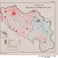 Yugoslavia - Religious Distribution - 1931 - DPLA - de987fd6196335797b1270e280467783.jpg 3,258 × 3,254; 1.45 MB
-
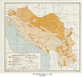 Yugoslavia Agricultural Land Use - DPLA - 4a3f31778d1ef95afe91d843e3e07211.jpg 5,351 × 5,002; 4.05 MB
-
 Yugoslavia Railroads - DPLA - d05b596972175aa133404ddda3c281da.jpg 7,152 × 6,885; 6.64 MB
-
 Yugoslavia's Ethnic Composition - DPLA - 52c4a6a82e6fe5a76fb070c462114598.jpg 2,550 × 3,280; 2.06 MB
-
 Yugoslavia. LOC 2011587053.jpg 3,323 × 4,342; 1.61 MB
-
 Yugoslavia. LOC 2011587054.jpg 3,322 × 4,317; 1.92 MB
.jpg)


.jpg)


