Category:CIA World Factbook maps of Hungary
Jump to navigation
Jump to search
Countries of Europe: Albania · Andorra · Armenia‡ · Austria · Azerbaijan‡ · Belarus · Belgium · Bosnia and Herzegovina · Bulgaria · Croatia · Cyprus‡ · Czech Republic · Denmark · Estonia · Finland · France‡ · Georgia‡ · Germany · Greece · Hungary · Iceland · Republic of Ireland · Italy · Kazakhstan‡ · Latvia · Liechtenstein · Lithuania · Luxembourg · Malta · Moldova · Monaco · Montenegro · Netherlands‡ · North Macedonia · Norway · Poland · Portugal‡ · Romania · Russia‡ · San Marino · Serbia · Slovakia · Slovenia · Spain‡ · Sweden · Switzerland · Turkey‡ · Ukraine · United Kingdom · Vatican City
Specific status: Akrotiri and Dhekelia‡ · Faroe Islands · Gibraltar · Bailiwick of Guernsey · Isle of Man · Jersey – Limited recognition: Kosovo
‡: partly located in Europe
Specific status: Akrotiri and Dhekelia‡ · Faroe Islands · Gibraltar · Bailiwick of Guernsey · Isle of Man · Jersey – Limited recognition: Kosovo
‡: partly located in Europe
Media in category "CIA World Factbook maps of Hungary"
The following 23 files are in this category, out of 23 total.
-
 Carte de Hongrie.png 635 × 324; 48 KB
-
 Hu-map de.png 635 × 324; 28 KB
-
 Hu-map-ja.png 635 × 325; 18 KB
-
 Hu-map-sl.png 635 × 324; 14 KB
-
 Hu-map.png 635 × 325; 17 KB
-
 HU-mapa.png 635 × 324; 14 KB
-
 Hu-mapo1.gif 635 × 324; 15 KB
-
 Hu-terkepSzerbiaval.png 635 × 324; 19 KB
-
 Hungaria harta.png 635 × 324; 27 KB
-
 Hungary CIA map PL.png 635 × 325; 17 KB
-
 Hungary – U.S. area comparison.jpg 701 × 851; 392 KB
-
 Hungary-CIA WFB Map (2004).png 635 × 324; 14 KB
-
 Hungary-CIA WFB Map.png 635 × 325; 16 KB
-
 Hungary-map-uk.png 633 × 324; 13 KB
-
 Kaart Hongarije.png 635 × 324; 19 KB
-
 Karte Weinbau Ungarn.png 635 × 324; 59 KB
-
 Mapa Maďarska.PNG 635 × 324; 70 KB
-
 Ungari-kaart.png 632 × 322; 62 KB
-
 Ungheriait.png 631 × 321; 56 KB
-
 Venhryja be.png 635 × 324; 41 KB
-
 Wegry-map.JPG 635 × 324; 29 KB
-
 World Factbook (1982) Hungary.jpg 586 × 589; 89 KB
-
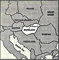
 World Factbook (1990) Hungary.jpg 561 × 455; 72 KB


.png)


_Hungary.jpg)
_Hungary.jpg)