Category:CCC Kei Wa Primary School (Kowloon Tong)
Jump to navigation
Jump to search
| Object location | | View all coordinates using: OpenStreetMap |
|---|
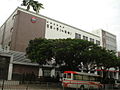
primary school in Hong Kong _CCC_Kei_Wa_Primary_School_(Kowloon_Tong)_front_full_view,_2021.jpg) | |||||
| Upload media | |||||
| Instance of | |||||
|---|---|---|---|---|---|
| Location | Hong Kong, PRC | ||||
| Street address |
| ||||
| official website | |||||
 | |||||
中文:中華基督教會基華小學(九龍塘)
Media in category "CCC Kei Wa Primary School (Kowloon Tong)"
The following 4 files are in this category, out of 4 total.
-
 Derby Road.JPG 3,648 × 2,736; 2.04 MB
-
 Kwps kt.JPG 1,600 × 1,200; 634 KB
-
 中華基督教會基華小學 (九龍塘) CCC Kei Wa Primary School (Kowloon Tong) front full view, 2021.jpg 2,750 × 2,062; 1.76 MB
-
 中華基督教會基華小學 (九龍塘) CCC Kei Wa Primary School (Kowloon Tong) front side view, 2021.jpg 3,061 × 2,449; 1.82 MB


_CCC_Kei_Wa_Primary_School_(Kowloon_Tong)_front_side_view,_2021.jpg)