Category:Burton Constable
Jump to navigation
Jump to search
English: Burton Constable is a village and civil parish in the East Riding of Yorkshire, England. It is located approximately 9 miles (14 km) north east of Hull city centre and 3 miles (5 km) south east of the village of Skirlaugh.
village in the East Riding of Yorkshire, England, UK  | |||||
| Upload media | |||||
| Instance of | |||||
|---|---|---|---|---|---|
| Location | East Riding of Yorkshire, Yorkshire and the Humber, England | ||||
 | |||||
Subcategories
This category has the following 6 subcategories, out of 6 total.
Media in category "Burton Constable"
The following 168 files are in this category, out of 168 total.
-
 A farm track leading to West Newton Road - geograph.org.uk - 2100508.jpg 800 × 600; 245 KB
-
 A footpath to High Fosham Farm - geograph.org.uk - 2281110.jpg 800 × 600; 252 KB
-
 A minor road in the woods - geograph.org.uk - 2100442.jpg 800 × 600; 371 KB
-
 A road through the Moors (woods) - geograph.org.uk - 2100491.jpg 800 × 600; 315 KB
-
 Alpacas at Burton Constable - geograph.org.uk - 1253789.jpg 640 × 428; 88 KB
-

-
 Autumn sown crop and West Newton Grange - geograph.org.uk - 5669288.jpg 1,024 × 768; 155 KB
-
 Avenue of trees, Burton Constable Hall - geograph.org.uk - 2005336.jpg 640 × 480; 116 KB
-
 Bay Window at Burton Constable Hall - geograph.org.uk - 4944890.jpg 2,963 × 2,135; 2.35 MB
-
 Behind the crowd areas - geograph.org.uk - 5413556.jpg 640 × 427; 240 KB
-
 Bigland's Belt - geograph.org.uk - 383773.jpg 640 × 480; 96 KB
-
 Boating lake, Burton Constable Hall - geograph.org.uk - 2005353.jpg 640 × 480; 114 KB
-
 Brickyard House, Burton Constable - geograph.org.uk - 600244.jpg 464 × 640; 98 KB
-
 Burton Constable Bridge Balustrading - geograph.org.uk - 4861563.jpg 4,608 × 3,456; 7.38 MB
-
 Burton Constable Cows - geograph.org.uk - 4439323.jpg 640 × 428; 229 KB
-
 Burton Constable dressage competition, 2000 - geograph.org.uk - 3102412.jpg 1,600 × 1,137; 309 KB
-
 Burton Constable Estate Trees - geograph.org.uk - 2238590.jpg 3,648 × 2,736; 4.43 MB
-

-
 Burton Constable Hall - geograph.org.uk - 5058232.jpg 1,024 × 683; 195 KB
-
 Burton Constable Hall - geograph.org.uk - 5058273.jpg 1,024 × 683; 245 KB
-
 Burton Constable Hall - geograph.org.uk - 5058529.jpg 1,024 × 683; 315 KB
-
 Burton Constable Hall - geograph.org.uk - 5058726.jpg 1,024 × 683; 176 KB
-
 Burton Constable Hall - geograph.org.uk - 5351025.jpg 4,608 × 3,456; 3.16 MB
-
 Burton Constable Hall - geograph.org.uk - 5351034.jpg 4,608 × 3,456; 3.09 MB
-
 Burton Constable Hall - South Façade - geograph.org.uk - 5890119.jpg 1,024 × 768; 238 KB
-
 Burton Constable Hall - West Façade - geograph.org.uk - 5890132.jpg 1,024 × 768; 183 KB
-
 Burton Constable Hall from the North West - geograph.org.uk - 5668676.jpg 1,024 × 768; 175 KB
-
 Burton Constable Lake (northern section) - geograph.org.uk - 4861571.jpg 4,608 × 3,456; 7.23 MB
-
 Burton Constable Park in winter - geograph.org.uk - 5672561.jpg 1,024 × 768; 191 KB
-
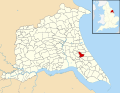 Burton Constable UK parish locator map.svg 1,425 × 1,107; 1.68 MB
-
 Burton Constable Woodland - geograph.org.uk - 383768.jpg 640 × 480; 160 KB
-
 Burton Constable's Western Grounds Frontage - geograph.org.uk - 4944382.jpg 3,456 × 2,592; 2.66 MB
-
 Burton Constable, Yorkshire (geograph 7391486).jpg 3,817 × 2,498; 2.24 MB
-
 By a drain leading to L Dike - geograph.org.uk - 5672577.jpg 1,024 × 742; 198 KB
-

-
 Caravans at a Stately Home - geograph.org.uk - 2518642.jpg 2,560 × 1,920; 1.99 MB
-
 Catholic Church Marton - geograph.org.uk - 1807289.jpg 4,000 × 3,000; 5.26 MB
-
 Cattle at Burton Constable - geograph.org.uk - 4439322.jpg 640 × 427; 214 KB
-
 Check Mate - geograph.org.uk - 4944750.jpg 2,897 × 1,939; 1.74 MB
-
 Church of the Most Holy Sacrament - geograph.org.uk - 6121667.jpg 3,749 × 3,648; 2.94 MB
-

-
 Church of the Most Holy Sacrament, Marton - geograph.org.uk - 5917678.jpg 1,600 × 1,064; 1.05 MB
-
 Church of the Most Holy Sacrament, Marton - geograph.org.uk - 5917681.jpg 1,600 × 1,064; 934 KB
-
 Church of the Most Holy Sacrament, Marton - geograph.org.uk - 5917685.jpg 1,600 × 1,064; 842 KB
-
 Church of the Most Holy Sacrament, Marton - geograph.org.uk - 5917689.jpg 1,600 × 1,064; 970 KB
-

-
 Crook Lane, near West Newton - geograph.org.uk - 4908205.jpg 532 × 640; 375 KB
-
 Crook Lane, Smithy Briggs - geograph.org.uk - 600208.jpg 640 × 460; 111 KB
-
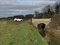
 Drain and bridge near Crofton Hill - geograph.org.uk - 5603000.jpg 1,024 × 768; 157 KB
-
 Drain by the lane, near Fosham - geograph.org.uk - 4908810.jpg 530 × 640; 466 KB
-
 Drain Cleaning - geograph.org.uk - 2240893.jpg 3,264 × 2,448; 1.68 MB
-

-
 Elizabeth II postbox on West Newton Road, West Newton - geograph.org.uk - 6362398.jpg 4,552 × 3,218; 2.93 MB
-
 Entering Marton - geograph.org.uk - 5048444.jpg 640 × 480; 489 KB
-
 Entering West Newton, East Yorks - geograph.org.uk - 4439278.jpg 640 × 471; 201 KB
-
 Ewe and lambs, Burton Constable - geograph.org.uk - 4439311.jpg 640 × 451; 184 KB
-
 Farm Road Junction to Lane - geograph.org.uk - 2240906.jpg 3,264 × 2,448; 1.7 MB
-
 Farm Road through Fields - geograph.org.uk - 2240917.jpg 3,264 × 2,448; 1.77 MB
-
 Farm Track - geograph.org.uk - 383763.jpg 640 × 480; 75 KB
-
 Farm track and Icehouse Plantation - geograph.org.uk - 5668640.jpg 1,024 × 768; 169 KB
-
 Farm track near West Newton - geograph.org.uk - 5669287.jpg 1,024 × 768; 160 KB
-
 Farm track off Jackey Lane - geograph.org.uk - 2005184.jpg 640 × 480; 83 KB
-
 Farmhouse, Marton Farm - geograph.org.uk - 6364094.jpg 800 × 552; 119 KB
-
 Farmland and Hornsea Rail Trail - geograph.org.uk - 6256667.jpg 1,024 × 768; 219 KB
-
 Farmland from the Hornsea Rail Trail - geograph.org.uk - 5024180.jpg 640 × 480; 124 KB
-
 Farmland off Jackey Lane - geograph.org.uk - 2005189.jpg 640 × 480; 82 KB
-
 Ferris Wheel - geograph.org.uk - 5413558.jpg 640 × 427; 213 KB
-
 Ferris Wheel and Fireworks - geograph.org.uk - 5413562.jpg 640 × 480; 279 KB
-
 Field boundary near Low Fosham - geograph.org.uk - 5602976.jpg 1,024 × 768; 192 KB
-
 Fields behind the Church - geograph.org.uk - 6121678.jpg 5,472 × 3,648; 7.07 MB
-
 Fields near New Ellerby - geograph.org.uk - 2700608.jpg 500 × 640; 193 KB
-
 Fireworks over Burton Constable - geograph.org.uk - 5413560.jpg 622 × 640; 78 KB
-
 Flinton Road - geograph.org.uk - 5605225.jpg 1,024 × 768; 136 KB
-
 Footpath from High Fosham at West Newton - geograph.org.uk - 5668986.jpg 1,024 × 768; 143 KB
-
 Free Range Eggs......Duck - geograph.org.uk - 6121658.jpg 3,685 × 2,585; 1.71 MB
-
 Graveyard, Marton - geograph.org.uk - 5048442.jpg 508 × 640; 567 KB
-
 Grazing Cows in the Evening Sun at Burton Constable - geograph.org.uk - 4944377.jpg 3,038 × 2,180; 1.59 MB
-
 Ha-ha, Burton Constable Hall - geograph.org.uk - 2005312.jpg 640 × 480; 84 KB
-
 Hornsea Rail Trail near New Ellerby - geograph.org.uk - 2099272.jpg 800 × 600; 225 KB
-
 Hornsea Rail Trail ^15 - geograph.org.uk - 5024179.jpg 640 × 480; 161 KB
-
 House and lane, West Newton - geograph.org.uk - 4439271.jpg 640 × 460; 166 KB
-
 House with post box, Marton - geograph.org.uk - 5048318.jpg 640 × 480; 308 KB
-
 House, Wood End - geograph.org.uk - 6362810.jpg 4,791 × 3,200; 3.27 MB
-
 House, Wood End - geograph.org.uk - 6362811.jpg 640 × 443; 73 KB
-
 Knotty Tree - geograph.org.uk - 383771.jpg 480 × 640; 177 KB
-
 L Dike at Smithy Briggs - geograph.org.uk - 5669004.jpg 1,024 × 820; 251 KB
-
 L Dike Bridge, Smithy Briggs - geograph.org.uk - 600223.jpg 640 × 454; 146 KB
-
 Lake, Burton Constable Hall - geograph.org.uk - 2005339.jpg 640 × 480; 104 KB
-

-
 Lamb at Burton Constable - geograph.org.uk - 4439314.jpg 640 × 452; 177 KB
-
 Lambwath Bridge, near New Ellerby (geograph 4869560).jpg 640 × 480; 412 KB
-
 Lambwath Lane towards New Ellerby (geograph 2230579).jpg 800 × 600; 209 KB
-
 Lambwath Stream (geograph 4693145).jpg 1,024 × 768; 209 KB
-
 Landscape near Low Fosham - geograph.org.uk - 5605221.jpg 1,024 × 768; 130 KB
-
 Lane near Burton Constable - geograph.org.uk - 4439262.jpg 480 × 640; 188 KB
-
 Lane to the turbines, near Fosham - geograph.org.uk - 4908802.jpg 469 × 640; 308 KB
-
 Leaving Marton on the Road to Sproatley - geograph.org.uk - 2199297.jpg 800 × 600; 300 KB
-

-
 Looking towards the Moors (woods) - geograph.org.uk - 2100429.jpg 800 × 600; 264 KB
-
 Main drive to Burton Constable Estate - geograph.org.uk - 6256429.jpg 1,024 × 769; 175 KB
-

-
 Major repairs to drainage ditch - geograph.org.uk - 1807279.jpg 4,000 × 3,000; 3.84 MB
-
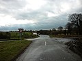
 Minor road junction, West Newton - geograph.org.uk - 6364085.jpg 800 × 600; 168 KB
-
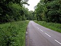
 Minor road just NW of Burton Constable - geograph.org.uk - 18698.jpg 640 × 480; 123 KB
-
 Minor road, Wood End - geograph.org.uk - 6362812.jpg 4,797 × 3,593; 4.31 MB
-
 Moat at Marton - geograph.org.uk - 5672542.jpg 1,024 × 768; 299 KB
-
 Model Farm, West Newton - geograph.org.uk - 5668996.jpg 1,024 × 768; 220 KB
-

-
 New Ellerby farmland - geograph.org.uk - 2700671.jpg 640 × 450; 174 KB
-
 New Ellerby, Byway - geograph.org.uk - 37838.jpg 640 × 480; 126 KB
-
 New Trees - geograph.org.uk - 2900355.jpg 4,592 × 3,448; 5.95 MB
-
 Old Farm, West Newton - geograph.org.uk - 4908219.jpg 498 × 640; 448 KB
-
 Old Lodge, Burton Constable - geograph.org.uk - 1562643.jpg 640 × 400; 213 KB
-
 Old moat, Burton Constable Hall - geograph.org.uk - 2005324.jpg 640 × 480; 72 KB
-
 Old Wood - geograph.org.uk - 426899.jpg 640 × 480; 152 KB
-
-
 Private road, Burton Constable Estate - geograph.org.uk - 5672558.jpg 1,024 × 768; 193 KB
-
 Rear View at Burton Constable Hall - geograph.org.uk - 4944386.jpg 3,456 × 2,592; 2.44 MB
-
 Roadside drain near Crofton Hill - geograph.org.uk - 5669001.jpg 1,024 × 768; 167 KB
-
 Roadside Lightning Tree - geograph.org.uk - 4304671.jpg 2,958 × 3,870; 1.41 MB
-
 Roadside stall, Marton - geograph.org.uk - 5048441.jpg 480 × 640; 359 KB
-
 Roadway to Smithy Briggs Cottage - geograph.org.uk - 5669007.jpg 1,024 × 768; 133 KB
-

-
 Service road for Big Weekend - geograph.org.uk - 5413554.jpg 640 × 427; 199 KB
-
 Smithy Briggs - geograph.org.uk - 600218.jpg 640 × 451; 119 KB
-
 Smithy Briggs Farm - geograph.org.uk - 2100496.jpg 800 × 600; 233 KB
-

-
 South Avenue, Burton Constable Estate - geograph.org.uk - 6256449.jpg 1,024 × 769; 311 KB
-
 Stag vista at Burton Constable, 2000 - geograph.org.uk - 3191166.jpg 640 × 434; 59 KB
-
 Statue Atop the Burton Constable Summer House - geograph.org.uk - 4944765.jpg 2,565 × 3,682; 4.54 MB
-
 Statue of a discus thrower at Burton Constable - geograph.org.uk - 4993362.jpg 4,569 × 3,759; 3.34 MB
-
 Statue of a goddess at Burton Constable - geograph.org.uk - 4993360.jpg 5,040 × 3,790; 4.8 MB
-
 Statue, Burton Constable Hall - geograph.org.uk - 2005330.jpg 640 × 480; 54 KB
-
 Statues at Burton Constable - geograph.org.uk - 4944384.jpg 2,553 × 3,566; 4.95 MB
-
 Sunday afternoon by The Lake at Burton Constable - geograph.org.uk - 4982582.jpg 4,663 × 3,452; 3.38 MB
-
 Sunset over Burton Constable - geograph.org.uk - 1868453.jpg 2,631 × 2,112; 942 KB
-

-

-
 The church of the Most Holy Sacrament, Marton - geograph.org.uk - 5668610.jpg 1,024 × 768; 163 KB
-
 The Constable Arboretum - geograph.org.uk - 600379.jpg 640 × 419; 73 KB
-
 The Hornsea Rail Trail - geograph.org.uk - 4693127.jpg 1,024 × 768; 244 KB
-
 The Long and Winding Fence - geograph.org.uk - 551352.jpg 640 × 432; 98 KB
-
 The minor road to Old Ellerby - geograph.org.uk - 1870011.jpg 2,916 × 1,968; 2.23 MB
-

-
 The Old Hull to Hornsea Railway Track at New Ellerby - geograph.org.uk - 2169569.jpg 3,648 × 2,736; 3.46 MB
-
 The Road to Burton Constable - geograph.org.uk - 2900350.jpg 4,200 × 2,552; 4.98 MB
-
 The road to Fosham and Carlton - geograph.org.uk - 2101186.jpg 800 × 600; 370 KB
-
 The Road to New Ellerby - geograph.org.uk - 2238591.jpg 3,648 × 2,736; 4.68 MB
-
 The sign for Smithy Briggs Farm - geograph.org.uk - 2100502.jpg 800 × 600; 320 KB
-
 The track to Burton Constable Hall - geograph.org.uk - 4982572.jpg 5,033 × 3,775; 3.74 MB
-
 The way to Brickyard House - geograph.org.uk - 2101190.jpg 800 × 600; 308 KB
-

-
 Tower House, Burton Constable - geograph.org.uk - 4908135.jpg 640 × 474; 461 KB
-
 Tower House, Burton Constable - geograph.org.uk - 600234.jpg 640 × 480; 76 KB
-
 Track to Wood Hall - geograph.org.uk - 2005195.jpg 640 × 480; 83 KB
-
 Tractors working in tandem - geograph.org.uk - 2101188.jpg 800 × 600; 245 KB
-
 Tree Avenue - geograph.org.uk - 4944787.jpg 3,456 × 2,323; 3.3 MB
-
 Under the Moonlight - geograph.org.uk - 4839543.jpg 4,608 × 3,456; 4.83 MB
-
 Victorian postbox, Wood End - geograph.org.uk - 6362808.jpg 2,267 × 3,712; 1.8 MB
-
 View towards Marton Old School - geograph.org.uk - 5668992.jpg 1,024 × 768; 189 KB
-
 Village street, West Newton - geograph.org.uk - 5672564.jpg 1,024 × 768; 126 KB
-
 West Newton Road and Mount Pleasant Farm - geograph.org.uk - 5669285.jpg 1,024 × 768; 187 KB
-
 West Newton Road, West Newton - geograph.org.uk - 6362402.jpg 4,466 × 2,887; 2.38 MB
-
 West Newton Road, West Newton - geograph.org.uk - 6362403.jpg 4,663 × 3,360; 3.3 MB
-
 Wickerwork deer at Burton Constable - geograph.org.uk - 4982579.jpg 4,959 × 3,434; 4.33 MB
-
 Wickerwork deer figure at Burton Constable Hall - geograph.org.uk - 4982575.jpg 4,790 × 3,627; 3.81 MB
-
 Wild Garlic Carpet in Bigland's Belt - geograph.org.uk - 1869999.jpg 3,200 × 2,400; 4.97 MB
-
 Woodland Brook - geograph.org.uk - 383777.jpg 640 × 480; 178 KB


_-_geograph.org.uk_-_2100491.jpg)


_-_geograph.org.uk_-_4861571.jpg)


.jpg)


.jpg)
.jpg)
.jpg)


_-_geograph.org.uk_-_2100429.jpg)


