Category:Burnhope
Jump to navigation
Jump to search
English: Burnhope is a village and civil parish in County Durham, England. It is located in the Craghead valley on the opposite side to Stanley.
village in County Durham, England, UK  | |||||
| Upload media | |||||
| Instance of | |||||
|---|---|---|---|---|---|
| Location | County Durham, North East England, England | ||||
 | |||||
Subcategories
This category has the following 4 subcategories, out of 4 total.
B
- Burnhope Memorial Garden (3 F)
H
- Holmside (1 F)
- Holmside Hall (1 F)
- Holmside Hall Wind Farm (4 F)
Media in category "Burnhope"
The following 200 files are in this category, out of 203 total.
(previous page) (next page)-
 A691 towards Durham - geograph.org.uk - 4896100.jpg 640 × 480; 88 KB
-
 A691 towards Durham - geograph.org.uk - 4896117.jpg 640 × 480; 73 KB
-
 Access road for West Hall Cottage - geograph.org.uk - 3767385.jpg 1,500 × 1,125; 2.04 MB
-
 An Old Quarry - geograph.org.uk - 963248.jpg 640 × 480; 132 KB
-

-
 Beech wood near Wheatley Hill - geograph.org.uk - 4228486.jpg 640 × 480; 231 KB
-
 Berries - geograph.org.uk - 963243.jpg 640 × 480; 81 KB
-
 Blackberries - geograph.org.uk - 963233.jpg 640 × 470; 67 KB
-
 Bleachgreen Plantation - geograph.org.uk - 4237674.jpg 4,608 × 3,456; 7.29 MB
-
 Bridlepath from Morrow Edge Farm - geograph.org.uk - 963128.jpg 640 × 480; 81 KB
-
 Bridlepath Towards Wheatley Hill - geograph.org.uk - 963221.jpg 640 × 412; 91 KB
-
 Bridleway sign on footpath, by Holmside Lane - geograph.org.uk - 2907133.jpg 1,024 × 768; 221 KB
-
 Bridleway sign, Green Lane - geograph.org.uk - 2907065.jpg 1,024 × 768; 182 KB
-
 Bridleway towards Wheatley Hill - geograph.org.uk - 4894816.jpg 640 × 480; 72 KB
-
 Bridleway, Wheatley Hill - geograph.org.uk - 4887086.jpg 640 × 480; 113 KB
-
 Burnhope Hall - geograph.org.uk - 3252119.jpg 4,608 × 3,456; 4.94 MB
-
 Burnhope Mast - geograph.org.uk - 3252239.jpg 4,608 × 3,456; 3.88 MB
-
 Burnhope Pond - geograph.org.uk - 5683274.jpg 4,608 × 3,456; 6.25 MB
-
 Burnhope Pond and Nature Reserve - geograph.org.uk - 3225285.jpg 640 × 480; 100 KB
-
 Burnhope Pond interpreted - geograph.org.uk - 2907451.jpg 1,024 × 768; 156 KB
-
 Burnhope to Lanchester road - geograph.org.uk - 397306.jpg 640 × 426; 178 KB
-
 Burnhope Village asserts its mining heritage - geograph.org.uk - 2907430.jpg 1,024 × 768; 145 KB
-
 Burnhope Village Pit wheel - geograph.org.uk - 3225274.jpg 640 × 480; 72 KB
-
 Bus on the A691, Newlands - geograph.org.uk - 4896110.jpg 640 × 480; 45 KB
-
 Bus stop and shelter on the A691 - geograph.org.uk - 4896107.jpg 640 × 480; 79 KB
-
 Cattle in Field - geograph.org.uk - 963105.jpg 640 × 480; 75 KB
-
 Cattle next to Newacres Road - geograph.org.uk - 3065703.jpg 4,608 × 3,456; 4.85 MB
-
 Clear felled area - geograph.org.uk - 5683281.jpg 3,985 × 3,213; 5 MB
-
 Cleared site, Holmside Lane, Burnhope - geograph.org.uk - 2907383.jpg 1,024 × 768; 137 KB
-
 Coal Chauldrons and pit wheel sculpture at Burnhope.jpg 640 × 480; 67 KB
-
 Cottage in Burnhope - geograph.org.uk - 3252200.jpg 4,608 × 3,456; 5.24 MB
-
 Cottages in Holmside - geograph.org.uk - 6269440.jpg 1,600 × 952; 537 KB
-
 Crop field off Langley Lane - geograph.org.uk - 4895366.jpg 640 × 480; 56 KB
-
 Drift Plantation - geograph.org.uk - 4895402.jpg 640 × 480; 46 KB
-
 Drystone wall field boundary - geograph.org.uk - 2907461.jpg 1,024 × 768; 151 KB
-
 Edge Lane - geograph.org.uk - 2907486.jpg 1,024 × 768; 141 KB
-
 Edge Lane - geograph.org.uk - 4895346.jpg 640 × 480; 67 KB
-
 Edge Lane - geograph.org.uk - 4895360.jpg 640 × 480; 51 KB
-
 Entrance to Burnhope - geograph.org.uk - 2907138.jpg 1,024 × 768; 162 KB
-
 Farm road near to West Hall Cottage - geograph.org.uk - 3767378.jpg 1,500 × 1,125; 1.33 MB
-
 Farm track (footpath) off Langley Lane - geograph.org.uk - 4895408.jpg 640 × 480; 125 KB
-
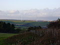
 Farm track and wind turbine - geograph.org.uk - 4895376.jpg 640 × 480; 61 KB
-
 Farm track off Langley Lane - geograph.org.uk - 4896088.jpg 640 × 480; 67 KB
-
 Farm track, Langley - geograph.org.uk - 4895390.jpg 640 × 480; 51 KB
-
 Farmhouse at Holmside Hall - geograph.org.uk - 4219641.jpg 4,608 × 3,456; 4.43 MB
-
 Farmland east of Whiteside Farm - geograph.org.uk - 2907100.jpg 1,024 × 768; 115 KB
-
 Farmland near Hag Wood - geograph.org.uk - 2876076.jpg 640 × 480; 64 KB
-
 Farmland west of Witton Gilbert - geograph.org.uk - 3496357.jpg 1,024 × 628; 281 KB
-
 Fellside Plantation - geograph.org.uk - 4228485.jpg 640 × 480; 87 KB
-
 Fence Charlaw Moor - geograph.org.uk - 277551.jpg 640 × 480; 66 KB
-
 Field entrance between Green and Holmside Lanes - geograph.org.uk - 2907094.jpg 1,024 × 768; 174 KB
-
 Field entrance off Langley Lane - geograph.org.uk - 4895397.jpg 640 × 480; 52 KB
-
 Field entrance off Langley Lane - geograph.org.uk - 4895406.jpg 640 × 480; 92 KB
-
 Field on west side of Holmside Road - geograph.org.uk - 6259510.jpg 1,600 × 928; 706 KB
-
 Field on west side of Standagainstall Plantation - geograph.org.uk - 4749240.jpg 1,500 × 1,000; 1.38 MB
-
 Field path south of Langley Lane, Burnhope - geograph.org.uk - 4245044.jpg 4,608 × 3,456; 6.32 MB
-
 Field with cow and trees - geograph.org.uk - 3438453.jpg 1,500 × 996; 1.84 MB
-
 Fields and Mast - geograph.org.uk - 963176.jpg 640 × 480; 71 KB
-
 Fine view from Edge Lane - geograph.org.uk - 5864802.jpg 4,608 × 3,456; 4.65 MB
-
 Fly tipped rubbish beside Langley Lane - geograph.org.uk - 4896071.jpg 640 × 480; 101 KB
-
 Footpath gate on the way to Green Lane - geograph.org.uk - 2907146.jpg 1,024 × 768; 192 KB
-
 Footpath off Edge Lane - geograph.org.uk - 4895355.jpg 640 × 480; 65 KB
-
 Footpath to Fellside Plantation - geograph.org.uk - 2907136.jpg 1,024 × 768; 183 KB
-
 Footpath to Green Lane - geograph.org.uk - 2907142.jpg 1,024 × 768; 223 KB
-
 Ford over Old Hall Burn - geograph.org.uk - 426494.jpg 640 × 480; 97 KB
-
 Front view of Beechgrove Terrace - geograph.org.uk - 6276853.jpg 4,608 × 3,456; 2.53 MB
-
 Gate into pasture field - geograph.org.uk - 2907119.jpg 1,024 × 768; 154 KB
-
 Grassed slope with tree shadows - geograph.org.uk - 5237771.jpg 1,500 × 877; 1.25 MB
-
 Grazing cattle - geograph.org.uk - 4242741.jpg 4,608 × 3,456; 6.7 MB
-
 Grazing cattle beside Edge Lane - geograph.org.uk - 5682283.jpg 4,608 × 3,456; 6.58 MB
-
 Grazing north of the A691 - geograph.org.uk - 4896103.jpg 640 × 480; 76 KB
-
 Grazing off Langley Lane - geograph.org.uk - 4896092.jpg 640 × 480; 111 KB
-
 Grazing towards Waterfall Wood - geograph.org.uk - 4896086.jpg 640 × 480; 62 KB
-
 Grazing towards woodland - geograph.org.uk - 4895352.jpg 640 × 451; 60 KB
-
 Grazing west of Edge Lane - geograph.org.uk - 4894817.jpg 640 × 480; 43 KB
-
 Grazing, Langley - geograph.org.uk - 4895394.jpg 640 × 480; 67 KB
-
 Green pasture, east of Green Lane - geograph.org.uk - 2907072.jpg 1,024 × 768; 143 KB
-
 Grey Squirrel - geograph.org.uk - 4086559.jpg 640 × 480; 69 KB
-
 Hag Wood - geograph.org.uk - 5313057.jpg 640 × 480; 105 KB
-
 Heading south east on Langley Lane - geograph.org.uk - 4895377.jpg 640 × 480; 57 KB
-
 Hillside grazing off Edge Lane - geograph.org.uk - 4895350.jpg 640 × 480; 46 KB
-
 Holmside Hall Road - geograph.org.uk - 4228494.jpg 640 × 480; 129 KB
-
 Holmside Lane entering Holmside - geograph.org.uk - 4745928.jpg 1,500 × 789; 1.17 MB
-
 Holmside Lane near Whiteside Farm - geograph.org.uk - 2907103.jpg 1,024 × 768; 194 KB
-
 Holmside Lane towards Warland - geograph.org.uk - 2876075.jpg 640 × 480; 46 KB
-
 Holmside Lane, Burnhope - geograph.org.uk - 2907386.jpg 1,024 × 768; 169 KB
-
 Horse paddock, Burnhope - geograph.org.uk - 2907156.jpg 1,024 × 768; 197 KB
-
 Kaysburn House - geograph.org.uk - 3605159.jpg 3,648 × 2,736; 3.21 MB
-
 Langley Hall Ford - geograph.org.uk - 5717654.jpg 2,826 × 2,902; 5.06 MB
-
 Langley Lane - geograph.org.uk - 4895370.jpg 640 × 480; 54 KB
-
 Langley Lane - geograph.org.uk - 4895380.jpg 640 × 480; 50 KB
-
 Langley Lane - geograph.org.uk - 4895387.jpg 640 × 480; 76 KB
-
 Langley Lane - geograph.org.uk - 4895404.jpg 640 × 480; 65 KB
-
 Langley Lane - geograph.org.uk - 4896089.jpg 640 × 480; 79 KB
-

-
 Langley Lane, east of Burnhope - geograph.org.uk - 5613792.jpg 4,282 × 3,211; 2.68 MB
-
 Langley West House farm - geograph.org.uk - 5614534.jpg 4,439 × 3,329; 3.56 MB
-
 Left for Durham, right for Maiden Law - geograph.org.uk - 2907419.jpg 1,024 × 768; 104 KB
-
 Local bus at Burnhope - geograph.org.uk - 5613574.jpg 3,080 × 2,550; 4.09 MB
-
 Lone tree on hedge line - geograph.org.uk - 5237840.jpg 1,499 × 1,007; 1.45 MB
-
 Looking across to Blackhouse - geograph.org.uk - 6276892.jpg 4,608 × 3,456; 2.83 MB
-
 Looking along Lowery Lane - geograph.org.uk - 6276868.jpg 4,455 × 3,341; 2.2 MB
-
 Looking along the Lanchester road - geograph.org.uk - 5616514.jpg 4,608 × 3,456; 4.86 MB
-
 Looking east towards Langley Lane - geograph.org.uk - 4245093.jpg 4,608 × 3,456; 6.18 MB
-
 Looking north from Long Edge - geograph.org.uk - 4242883.jpg 4,608 × 3,456; 6.06 MB
-
 Looking north to Langley West House farm - geograph.org.uk - 5614496.jpg 4,608 × 3,456; 4.66 MB
-
 Looking south along Edge Lane - geograph.org.uk - 3066705.jpg 4,608 × 3,456; 5.46 MB
-
 Looking south down Holmside Hall Road - geograph.org.uk - 4219466.jpg 4,466 × 3,258; 4.11 MB
-
 Looking South Towards Burnhope - geograph.org.uk - 963238.jpg 640 × 449; 51 KB
-
 Looking towards Morrow Edge - geograph.org.uk - 3065179.jpg 4,608 × 3,456; 5.24 MB
-
 Looking up Holmside Lane - geograph.org.uk - 3252100.jpg 4,608 × 3,456; 4.53 MB
-
 Looking west along Long Edge - geograph.org.uk - 4242822.jpg 4,608 × 3,456; 5.64 MB
-
 Looking west up Langley Lane - geograph.org.uk - 4237693.jpg 4,608 × 3,456; 6.79 MB
-
 Morrow Edge Farm - geograph.org.uk - 3065201.jpg 4,608 × 3,456; 4.99 MB
-
 Morrow Edge Farm from the south - geograph.org.uk - 3065214.jpg 4,608 × 3,456; 5.42 MB
-
 Muddy bridleway, south of Holmside Lane - geograph.org.uk - 2907135.jpg 1,024 × 768; 213 KB
-
 Nature reserve at Burnhope Pond - geograph.org.uk - 4746478.jpg 1,500 × 866; 1.13 MB
-
 No parking here - geograph.org.uk - 2907402.jpg 1,024 × 768; 122 KB
-

-
 Ordnance Survey Cut Mark - geograph.org.uk - 5907889.jpg 1,024 × 717; 281 KB
-
 Ordnance Survey Flush Bracket 10938 - geograph.org.uk - 2953707.jpg 3,264 × 2,448; 2.52 MB
-
 Path into Standagainstall Plantation - geograph.org.uk - 4243233.jpg 4,608 × 3,456; 7.19 MB
-
 Path leading off Langley Lane - geograph.org.uk - 5614403.jpg 4,608 × 3,456; 4.45 MB
-
 Path off Long Edge - geograph.org.uk - 4242830.jpg 4,410 × 3,174; 4.93 MB
-
 Pavilion Terrace, Burnhope - geograph.org.uk - 3252210.jpg 4,608 × 3,456; 4.54 MB
-
 Peartree Terrace - geograph.org.uk - 3252079.jpg 4,608 × 3,456; 5.17 MB
-
 Peartree Terrace - geograph.org.uk - 4228493.jpg 640 × 480; 93 KB
-
 Peartree Terrace from the west - geograph.org.uk - 3252086.jpg 4,608 × 3,456; 4.8 MB
-
 Pretty Track - geograph.org.uk - 963231.jpg 640 × 480; 118 KB
-
 Public footpath to Burnhope Pond - geograph.org.uk - 2907447.jpg 1,024 × 768; 161 KB
-
 Road in Chapman's Well Nature Reserve - geograph.org.uk - 4755079.jpg 1,500 × 1,000; 1.65 MB
-
 Road junction at Lane Ends - geograph.org.uk - 4236528.jpg 4,608 × 3,456; 5.69 MB
-
 Road junction near Craghead - geograph.org.uk - 4777975.jpg 4,608 × 3,456; 4.62 MB
-
 Road Near Holmside Hall - geograph.org.uk - 963255.jpg 640 × 460; 98 KB
-
 Ruins of Langley Hall - geograph.org.uk - 4237819.jpg 3,592 × 2,718; 5.6 MB
-
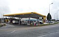 Service station on the A691 - geograph.org.uk - 4896114.jpg 640 × 408; 49 KB
-
 Sheep and lambs - geograph.org.uk - 2907078.jpg 1,024 × 768; 122 KB
-
 Sheep feeding on field - geograph.org.uk - 3767235.jpg 1,500 × 1,062; 1.57 MB
-
 Somewhere to enjoy the view - geograph.org.uk - 2907410.jpg 1,024 × 768; 147 KB
-
 St John's Church, Burnhope - geograph.org.uk - 2907130.jpg 1,024 × 768; 166 KB
-
 St John's Church, Burnhope - geograph.org.uk - 3252155.jpg 4,608 × 3,456; 5.28 MB
-
 St John's Church, Burnhope - geograph.org.uk - 6259430.jpg 1,600 × 1,039; 607 KB
-
 Start of bridleway off Edge Lane - geograph.org.uk - 3226578.jpg 640 × 480; 101 KB
-
 Start of field path - geograph.org.uk - 5614411.jpg 4,608 × 3,456; 6.28 MB
-
 Tait's House on the Burnhope road - geograph.org.uk - 3066700.jpg 4,608 × 3,456; 5.35 MB
-
 Taylorshill Plantation - geograph.org.uk - 4749239.jpg 1,500 × 1,000; 1.32 MB
-
 The Approach to Chapmans Well - geograph.org.uk - 963149.jpg 640 × 480; 92 KB
-
 The first and last house in Burnhope - geograph.org.uk - 2907150.jpg 1,024 × 768; 152 KB
-
 The first and last house in Burnhope - geograph.org.uk - 2907436.jpg 1,024 × 768; 136 KB
-
 The hamlet of Holmside - geograph.org.uk - 3252009.jpg 4,608 × 3,456; 5.72 MB
-
 The hamlet of Holmside - geograph.org.uk - 4228497.jpg 640 × 480; 173 KB
-
 The main road through Burnhope - geograph.org.uk - 3252218.jpg 4,608 × 3,456; 5.63 MB
-
 This way for Maiden Law - geograph.org.uk - 2907396.jpg 1,024 × 768; 143 KB
-
 Top of the path from Langley Lane - geograph.org.uk - 4242764.jpg 4,608 × 3,456; 6.41 MB
-

-
 Trees along a small stream - geograph.org.uk - 2907115.jpg 1,024 × 768; 128 KB
-
 Trees beside the track to Langley Hall - geograph.org.uk - 4237789.jpg 4,608 × 3,456; 6.95 MB
-
 Turn left for Burnope - geograph.org.uk - 2907109.jpg 1,024 × 768; 137 KB
-
 Unusual Stile - geograph.org.uk - 963244.jpg 480 × 640; 128 KB
-
 View along Holmside Hall Road - geograph.org.uk - 4219621.jpg 4,608 × 3,456; 6.4 MB
-
 View along Langley Lane - geograph.org.uk - 4237726.jpg 4,608 × 3,456; 5.99 MB
-
 View back down the track at Morrow Edge - geograph.org.uk - 3065190.jpg 4,608 × 3,456; 4.8 MB
-
 View east from Newacres Road - geograph.org.uk - 3065322.jpg 4,608 × 3,456; 4.66 MB
-
 View from beside the stile - geograph.org.uk - 5614429.jpg 4,608 × 3,456; 3.54 MB
-
 View from Newacres Road - geograph.org.uk - 3065709.jpg 4,608 × 3,456; 5.06 MB
-
 View of Drift Plantation - geograph.org.uk - 4237735.jpg 4,608 × 3,456; 6.55 MB
-
 View of Moor Leazes Farm - geograph.org.uk - 5682263.jpg 4,608 × 3,456; 5.38 MB
-
 View of the Valley Over Tait's House - geograph.org.uk - 963200.jpg 640 × 452; 53 KB
-
 View Over the Fields - geograph.org.uk - 963141.jpg 640 × 480; 99 KB
-
 View over the valley - geograph.org.uk - 5616503.jpg 4,608 × 3,456; 4.07 MB
-
 View SE from Burnhope - geograph.org.uk - 3252259.jpg 4,608 × 3,456; 4.25 MB
-
 View south from below Langley Lane - geograph.org.uk - 4245087.jpg 4,608 × 3,456; 5.12 MB
-
 View south from the path north of Langley Hall - geograph.org.uk - 4242675.jpg 4,608 × 3,456; 4.56 MB
-
 View towards Burnhope - geograph.org.uk - 1316771.jpg 640 × 199; 37 KB
-
 View west from path north of Langley Hall - geograph.org.uk - 4242662.jpg 4,608 × 3,456; 4.58 MB
-
 View west from the bottom of Long Edge lane, Burnhope - geograph.org.uk - 4243246.jpg 4,608 × 3,456; 5.35 MB
-
 Wardle's Bridge Inn - geograph.org.uk - 3251990.jpg 4,608 × 3,456; 4.87 MB
-
 Wardle's Bridge Inn - geograph.org.uk - 4228496.jpg 640 × 480; 126 KB
-
 Well-trodden pasture near Whiteside Farm - geograph.org.uk - 2907113.jpg 1,024 × 768; 147 KB
-
 Wheatley Green Lane heading north - geograph.org.uk - 2876078.jpg 640 × 480; 75 KB
-
 Whiteside Burn - geograph.org.uk - 3252007.jpg 4,608 × 3,456; 5.49 MB
-
 Whiteside Farm - geograph.org.uk - 3252094.jpg 4,608 × 3,456; 4.7 MB
-
 Wind turbine at Long Edge, Burnhope - geograph.org.uk - 4242901.jpg 4,442 × 3,224; 5.17 MB
-
 Wind turbine of Langley Wind Farm - geograph.org.uk - 4752686.jpg 1,203 × 1,600; 324 KB
-
 Wind turbines on Wagtail Lane, Craghead - geograph.org.uk - 4219448.jpg 4,608 × 3,456; 3.99 MB
-
 Young crop field off Langley Lane - geograph.org.uk - 4895374.jpg 640 × 480; 60 KB
-
 Young crop field off Langley Lane - geograph.org.uk - 4895385.jpg 640 × 480; 80 KB
-
 Burnhope Burn - geograph.org.uk - 272480.jpg 640 × 480; 162 KB
-
 Burnhope Burn - geograph.org.uk - 273424.jpg 640 × 480; 137 KB
-
 Burnhope Burn - geograph.org.uk - 273426.jpg 640 × 480; 129 KB
-
 Burnhope Moor - geograph.org.uk - 273431.jpg 640 × 480; 101 KB
-
 Burnhope Pond - geograph.org.uk - 319582.jpg 640 × 480; 85 KB
-
 Burnhope Pond Plantation - geograph.org.uk - 318795.jpg 640 × 480; 129 KB
-
 Burnhope Radio Mast - geograph.org.uk - 30866.jpg 393 × 640; 230 KB
-
 Chapmans Well Nature Reserve - geograph.org.uk - 318793.jpg 640 × 480; 108 KB
-
 Charlaw plantation - geograph.org.uk - 324539.jpg 640 × 480; 160 KB
-

-

-
 Public footpath approaching Long Edge - geograph.org.uk - 324547.jpg 640 × 480; 134 KB
-
 Ruins of Langley Hall - geograph.org.uk - 426493.jpg 480 × 640; 113 KB


_off_Langley_Lane_-_geograph.org.uk_-_4895408.jpg)


