Category:Burland
Jump to navigation
Jump to search
village and former civil parish in Cheshire East, England, UK  | |||||
| Upload media | |||||
| Instance of |
| ||||
|---|---|---|---|---|---|
| Location | Burland and Acton, Cheshire East, Cheshire, North West England, England | ||||
 | |||||
Subcategories
This category has the following 2 subcategories, out of 2 total.
R
- Ravensmoor (41 F)
S
- Swanley, Cheshire (39 F)
Media in category "Burland"
The following 90 files are in this category, out of 90 total.
-
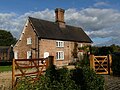 3 & 4 Tollemache Cottages.jpg 4,000 × 3,000; 1.52 MB
-
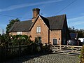 5 & 6 Tollemache Cottages.jpg 4,000 × 3,000; 1.51 MB
-
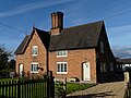 7 & 8 Tollemache Cottages.jpg 4,000 × 3,000; 1.41 MB
-
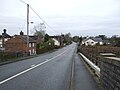 A534, Burland - geograph.org.uk - 5225246.jpg 640 × 480; 62 KB
-
 Autumn trees near Burland, Cheshire - geograph.org.uk - 3216359.jpg 1,024 × 768; 540 KB
-
 Bachehouse Bridge north of Burland in Cheshire - geograph.org.uk - 5501584.jpg 1,280 × 822; 1.22 MB
-
 Baddiley Lane, Ravensmoor - geograph.org.uk - 2060119.jpg 640 × 480; 160 KB
-
 Bank Farm, Burland - geograph.org.uk - 1198890.jpg 640 × 433; 162 KB
-
 Bank Farm, Burland - geograph.org.uk - 5212003.jpg 1,024 × 768; 128 KB
-
 Bank Farm, near Burland - geograph.org.uk - 2897276.jpg 640 × 480; 116 KB
-
 Bank Lane, Burland - geograph.org.uk - 1198475.jpg 640 × 432; 148 KB
-
 Bridge Cottage, Burland - geograph.org.uk - 1199137.jpg 640 × 491; 176 KB
-
 Bridge with a path crossing it - geograph.org.uk - 3179608.jpg 640 × 480; 153 KB
-
 Burland Bridge - geograph.org.uk - 3179618.jpg 640 × 480; 127 KB
-
 Burland cottage Cheshire.jpg 640 × 479; 102 KB
-
 Burland Upper Green - geograph.org.uk - 220623.jpg 533 × 347; 121 KB
-

-
 Canal lock overflow south of Burland, Cheshire - geograph.org.uk - 3215397.jpg 1,024 × 768; 541 KB
-
 Canalside gardens near Burland, Cheshire - geograph.org.uk - 3215388.jpg 1,024 × 756; 496 KB
-
 Canalside pasture near Burland, Cheshire - geograph.org.uk - 3216262.jpg 1,024 × 756; 455 KB
-

-

-
 Cottage at Burland, Cheshire - geograph.org.uk - 1323099.jpg 640 × 505; 138 KB
-
 Cottage Plantation, Burland - geograph.org.uk - 1198470.jpg 640 × 427; 203 KB
-

-
 Decorative chimney, Burland, Cheshire - geograph.org.uk - 1323103.jpg 477 × 640; 129 KB
-
 Decorative chimney, Burland, Cheshire - geograph.org.uk - 1323107.jpg 483 × 640; 119 KB
-

-
-
 Farm buildings, Burland Green - geograph.org.uk - 5225252.jpg 640 × 480; 54 KB
-
 Farm track near Stoneley Green, Cheshire - geograph.org.uk - 1706101.jpg 640 × 420; 143 KB
-
 Farmland by the canal, Hurleston - geograph.org.uk - 1199223.jpg 640 × 427; 136 KB
-
 Farmland near Bank Farm, Burland - geograph.org.uk - 1198918.jpg 640 × 427; 123 KB
-
 Farmland north of Brook Farm, Burland - geograph.org.uk - 5211999.jpg 1,024 × 614; 96 KB
-
 Farmland south of Bachehouse Pool - geograph.org.uk - 5211959.jpg 1,024 × 614; 130 KB
-
 Farmland with two small streams, Burland - geograph.org.uk - 5211995.jpg 1,024 × 615; 119 KB
-
 Grazing near Burland, Cheshire - geograph.org.uk - 3216333.jpg 1,024 × 694; 450 KB
-
 Late afternoon sun on the canal, Burland - geograph.org.uk - 1199063.jpg 640 × 473; 143 KB
-

-
 Lee's Bridge north of Burland in Cheshire - geograph.org.uk - 5498057.jpg 1,280 × 894; 1.26 MB
-
 Lee's Bridge, Llangollen Canal - geograph.org.uk - 6013005.jpg 5,184 × 3,888; 3.58 MB
-
 Little Foxes, Hollin Green - geograph.org.uk - 823028.jpg 640 × 427; 161 KB
-

-

-
 Llangollen Canal - geograph.org.uk - 423496.jpg 640 × 480; 81 KB
-
 Llangollen Canal near Burland in Cheshire - geograph.org.uk - 5497997.jpg 1,280 × 825; 982 KB
-
 Llangollen Canal near Burland in Cheshire - geograph.org.uk - 5498027.jpg 1,280 × 960; 1,015 KB
-

-

-
 Llangollen Canal north of Burland in Cheshire - geograph.org.uk - 5498034.jpg 1,280 × 907; 1,009 KB
-
 Llangollen Canal north of Burland in Cheshire - geograph.org.uk - 5498063.jpg 1,280 × 960; 915 KB
-
 Llangollen Canal north of Burland in Cheshire - geograph.org.uk - 5501211.jpg 1,280 × 960; 931 KB
-
 Llangollen Canal north of Burland in Cheshire - geograph.org.uk - 5501305.jpg 1,280 × 960; 1.08 MB
-
 Llangollen Canal north of Burland in Cheshire - geograph.org.uk - 5501309.jpg 960 × 1,280; 1.09 MB
-
-
 Llangollen Canal north of Burland in Cheshire - geograph.org.uk - 5501667.jpg 1,280 × 847; 1.1 MB
-

-
 Martin's Bridge north of Burland in Cheshire - geograph.org.uk - 5501207.jpg 1,280 × 960; 903 KB
-
 Monks Lane - Cuckoo lane junction - geograph.org.uk - 2664838.jpg 640 × 480; 85 KB
-

-
 Moored narrowboat near Burland in Cheshire - geograph.org.uk - 5498046.jpg 1,280 × 864; 1.15 MB
-

-
 Once a windmill, now a home - geograph.org.uk - 3179634.jpg 640 × 480; 113 KB
-
 Pasture near Burland, Cheshire - geograph.org.uk - 3216270.jpg 1,024 × 687; 443 KB
-

-
 Platt's Bridge - geograph.org.uk - 1198472.jpg 640 × 435; 154 KB
-
 Platt's Bridge near Burland in Cheshire - geograph.org.uk - 5498007.jpg 1,280 × 960; 1.1 MB
-
 Platt's Bridge near Burland in Cheshire - geograph.org.uk - 5498014.jpg 1,280 × 960; 939 KB
-
 Platt's Bridge near Burland in Cheshire - geograph.org.uk - 5498021.jpg 1,280 × 960; 1,001 KB
-
 Platt's Bridge near Burland, Cheshire - geograph.org.uk - 3216351.jpg 800 × 558; 335 KB
-
 Platt's Bridge, Llangollen Canal - geograph.org.uk - 5947215.jpg 1,280 × 851; 532 KB
-
 Platt's Bridge, rebuilding detail - geograph.org.uk - 1198473.jpg 640 × 427; 175 KB
-
 Platts Bridge Burland Cheshire.jpg 640 × 429; 133 KB
-
 Pumps by the canal south of Burland, Cheshire - geograph.org.uk - 3215427.jpg 1,024 × 756; 320 KB
-
 Rose+End Cottages Stoneley Green.jpg 640 × 417; 109 KB
-
-
-
 Stoneley Green Bridge near Ravensmoor, Cheshire - geograph.org.uk - 3200568.jpg 1,024 × 768; 512 KB
-
 Swanley Bridge Marina.jpg 1,024 × 751; 438 KB
-
 Swanley Lane, Burland - geograph.org.uk - 1198468.jpg 640 × 427; 142 KB
-
 Telephone box on Brook Lane, Burland - geograph.org.uk - 5225247.jpg 640 × 480; 67 KB
-
 Track to Stoneley Green, Cheshire - geograph.org.uk - 1706137.jpg 640 × 453; 138 KB
-
 Trees along Bank Lane, Burland - geograph.org.uk - 5212007.jpg 1,024 × 768; 155 KB
-
 View across Cheshire fields to Acton Grange, near Burland - geograph.org.uk - 4426754.jpg 3,264 × 2,448; 1.09 MB
-
 Wrexham Bridge - geograph.org.uk - 1199171.jpg 640 × 423; 141 KB
-
 Wrexham Road (A534), Burland Green - geograph.org.uk - 5225255.jpg 640 × 480; 64 KB
-
 A534 at Brindley - geograph.org.uk - 823371.jpg 640 × 387; 117 KB
-
 Arable field adjacent to canal - geograph.org.uk - 1199442.jpg 640 × 436; 150 KB
-
 Long Lane ,Burland - geograph.org.uk - 263674.jpg 427 × 640; 75 KB
-


,_Burland_-_geograph.org.uk_-_5225250.jpg)


.jpg)


_near_Burland,_Cheshire_-_geograph.org.uk_-_1706142.jpg)


,_Burland_Green_-_geograph.org.uk_-_5225255.jpg)


