Category:Burgstraße 31, Hann. Münden
Jump to navigation
Jump to search
| Object location | | View all coordinates using: OpenStreetMap |
|---|
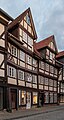
This is the category of the Baudenkmal (cultural heritage monument) according to the Cultural Heritage Protection Law of Lower Saxony with the ID 36477536 (Wikidata (P7900)).
|
| Upload media | |||||
| Instance of | |||||
|---|---|---|---|---|---|
| Location | Hann. Münden, Göttingen district, Lower Saxony, Germany | ||||
| Located on street |
| ||||
| Heritage designation | |||||
 | |||||
Media in category "Burgstraße 31, Hann. Münden"
The following 3 files are in this category, out of 3 total.
-
 Burgstraße 31 Hann. Münden 001 20171027.jpg 3,435 × 5,146; 11.03 MB
-
 Burgstrasse 31 in Hann. Muenden (1).jpg 2,588 × 4,848; 7.18 MB
-
 Burgstrasse 31 in Hann. Muenden (2).jpg 2,950 × 5,287; 9.84 MB

.jpg)
.jpg)