Category:Burg Lichtenberg (Salzgitter)
Jump to navigation
Jump to search
| Object location | | View all coordinates using: OpenStreetMap |
|---|
castle ruin  | |||||
| Upload media | |||||
| Instance of | |||||
|---|---|---|---|---|---|
| Location | Salzgitter, Lower Saxony, Germany | ||||
| Heritage designation | |||||
 | |||||
Media in category "Burg Lichtenberg (Salzgitter)"
The following 20 files are in this category, out of 20 total.
-
 Burg Lichtenberg (Salzgitter).jpg 1,905 × 2,543; 1.24 MB
-
 Burg Lichtenberg Merian Ausschnitt.jpg 720 × 532; 280 KB
-
 Burg Lichtenberg Salzgitter 2022CF 01.jpg 6,192 × 4,128; 16.35 MB
-
 Burg Lichtenberg Salzgitter 2022CF 02.jpg 6,192 × 4,128; 20.09 MB
-
 Burg Lichtenberg Salzgitter 2022CF 03.jpg 6,192 × 4,128; 20.24 MB
-
 Burg Lichtenberg Salzgitter 2022CF 04.jpg 6,192 × 4,128; 14.88 MB
-
 Burg Lichtenberg Salzgitter 2022CF 05.jpg 6,192 × 4,128; 18.1 MB
-
 Burg Lichtenberg Salzgitter 2022CF 06.jpg 6,192 × 4,128; 19.59 MB
-
 Burg Lichtenberg Salzgitter 2022CF 07.jpg 6,192 × 4,128; 17.08 MB
-
 Burg Lichtenberg Salzgitter 2022CF 08.jpg 6,192 × 4,128; 19.29 MB
-
 Burg Lichtenberg Salzgitter 2022CF 09.jpg 6,192 × 4,128; 19.64 MB
-
 Burg Lichtenberg Salzgitter 2022CF 10.jpg 6,192 × 4,128; 19.69 MB
-
 Burg lichtenberg.jpg 420 × 560; 99 KB
-

-
 Lichtenberg Burg Fundamente.jpg 691 × 518; 156 KB
-
 Lichtenberg Burg Gesamt.jpg 723 × 565; 193 KB
-
 Lichtenberg Grundriss Burg.png 817 × 1,415; 234 KB
-
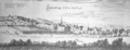 Merian Lichtenberg.png 1,560 × 597; 351 KB
-
 Salzgitter-Lichtenberg Turm.jpg 3,672 × 4,896; 2.14 MB
-
 Salzgitter-Lichtenberg Turmu.jpg 3,672 × 4,896; 2.44 MB
.jpg)


