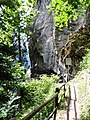
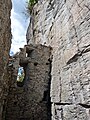
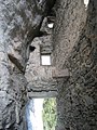
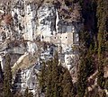
Category:Burg Kropfenstein
Jump to navigation
Jump to search
| Object location | | View all coordinates using: OpenStreetMap |
|---|
 | |||||
| Upload media | |||||
| Instance of | |||||
|---|---|---|---|---|---|
| Location | |||||
| Heritage designation | |||||
| Inception |
| ||||
 | |||||
|
This is a category about a cultural property of national significance in Switzerland with KGS number 3419
|
Note that the image indicated as the "Kropfenstein Wappen" is the coat of arms of the family Mötteli von Rappenstein, which owned/married into families that owned nearby castles, Neuenberg and Rappenstein near Landquart in the Canton of Graubunden, Switzerland. This family also owned/married into families owning Schloss Arbon, Sulzberg (Möttelischloss), Altstetten (Prestegg), Güttingen (Moosberg), Hüttingen, Pfyn, Alt-Regensburg, Memmingen, Wellenberg, Weinfelden, Roggwil, and Bürglen, as well as castles in Germany, Italy, in Spain and France, from about 1320 to about 1600.
Media in category "Burg Kropfenstein"
The following 57 files are in this category, out of 57 total.
-
 GB19BurgKropfenstein01.jpg 3,000 × 4,000; 4.34 MB
-
 GB19BurgKropfenstein02.jpg 3,000 × 4,000; 3.83 MB
-
 GB19BurgKropfenstein03.jpg 3,000 × 4,000; 3.94 MB
-
 GB19BurgKropfenstein04.jpg 3,000 × 4,000; 3.57 MB
-
 GB19BurgKropfenstein05.jpg 3,000 × 4,000; 3.86 MB
-
 GB19BurgKropfenstein06.jpg 3,000 × 4,000; 4.9 MB
-
 GB19BurgKropfenstein07.jpg 3,000 × 4,000; 4.98 MB
-
 GB19BurgKropfenstein08.jpg 3,000 × 4,000; 4.18 MB
-
 Kropfenstein Balkenrest.jpg 2,592 × 1,944; 1.4 MB
-
 Kropfenstein DJIa.JPG 5,472 × 3,078; 6.86 MB
-
 Kropfenstein DJIb.JPG 5,472 × 3,078; 6.82 MB
-
 Kropfenstein DJIc.JPG 5,472 × 3,078; 6.79 MB
-
 Kropfenstein DJId.JPG 5,472 × 3,078; 6.85 MB
-
 Kropfenstein Eingang.jpg 1,200 × 1,600; 846 KB
-
 Kropfenstein innen.jpg 1,600 × 1,200; 749 KB
-
 Kropfenstein Lage.jpg 1,272 × 1,144; 285 KB
-
 Kropfenstein Ost.jpg 916 × 1,222; 228 KB
-
 Kropfenstein Plan.jpg 893 × 336; 47 KB
-
 Kropfenstein Wappen.jpg 406 × 389; 50 KB
-
 Kropfenstein Zeichnung.jpg 341 × 500; 67 KB
-
 Kropfenstein Zugang.jpg 916 × 1,222; 265 KB
-
 Ruïne Burg Kropfenstein (Casti Grotta) 23-09-2022. (actm.) 01.jpg 3,456 × 5,184; 11.61 MB
-
 Ruïne Burg Kropfenstein (Casti Grotta) 23-09-2022. (actm.) 02.jpg 4,607 × 3,028; 15.64 MB
-
 Ruïne Burg Kropfenstein (Casti Grotta) 23-09-2022. (actm.) 03.jpg 4,257 × 3,304; 15.56 MB
-
 Ruïne Burg Kropfenstein (Casti Grotta) 23-09-2022. (actm.) 04.jpg 4,216 × 3,162; 13.86 MB
-
 Ruïne Burg Kropfenstein (Casti Grotta) 23-09-2022. (actm.) 05.jpg 4,837 × 3,225; 15.05 MB
-
 Ruïne Burg Kropfenstein (Casti Grotta) 23-09-2022. (actm.) 06.jpg 3,163 × 4,744; 16.24 MB
-
 Ruïne Burg Kropfenstein (Casti Grotta) 23-09-2022. (actm.) 07.jpg 3,456 × 5,184; 17.41 MB
-
 Ruïne Burg Kropfenstein (Casti Grotta) 23-09-2022. (actm.) 08.jpg 3,456 × 5,184; 19.49 MB
-
 Ruïne Burg Kropfenstein (Casti Grotta) 23-09-2022. (actm.) 09.jpg 3,456 × 3,456; 13.67 MB
-
 Ruïne Burg Kropfenstein (Casti Grotta) 23-09-2022. (actm.) 10.jpg 3,309 × 4,964; 11.21 MB
-
 Ruïne Burg Kropfenstein (Casti Grotta) 23-09-2022. (actm.) 11.jpg 3,373 × 4,497; 19.26 MB
-
 Ruïne Burg Kropfenstein (Casti Grotta) 23-09-2022. (actm.) 12.jpg 3,180 × 4,240; 15.91 MB
-
 Ruïne Burg Kropfenstein (Casti Grotta) 23-09-2022. (actm.) 13.jpg 4,598 × 2,583; 15.07 MB
-
 Ruïne Burg Kropfenstein (Casti Grotta) 23-09-2022. (actm.) 14.jpg 4,255 × 3,349; 17.35 MB
-
 Ruïne Burg Kropfenstein (Casti Grotta) 23-09-2022. (actm.) 15.jpg 3,828 × 3,429; 14.7 MB
-
 Ruïne Burg Kropfenstein (Casti Grotta) 23-09-2022. (actm.) 16.jpg 4,608 × 3,456; 17.59 MB
-
 Ruïne Burg Kropfenstein (Casti Grotta) 23-09-2022. (d.j.b). 01.jpg 4,001 × 3,201; 12.48 MB
-
 Ruïne Burg Kropfenstein (Casti Grotta) 23-09-2022. (d.j.b). 02.jpg 5,184 × 3,456; 18.1 MB
-
 Ruïne Burg Kropfenstein (Casti Grotta) 23-09-2022. (d.j.b). 03.jpg 3,456 × 5,184; 16.08 MB
-
 Ruïne Burg Kropfenstein (Casti Grotta) 23-09-2022. (d.j.b). 04.jpg 3,456 × 5,184; 15.59 MB
-
 Ruïne Burg Kropfenstein (Casti Grotta) 23-09-2022. (d.j.b). 05.jpg 3,456 × 5,184; 16.14 MB
-
 Ruïne Burg Kropfenstein (Casti Grotta)-.jpg 3,456 × 5,184; 22.36 MB
-
 Waltensburg-Vuorz railway station. 22-09-2022. (actm.) 01.jpg 2,132 × 1,706; 4.52 MB
-
 Waltensburg-Vuorz railway station. 22-09-2022. (actm.) 02.jpg 5,184 × 2,524; 14.62 MB
-
 Waltensburg-Vuorz. Ruïne Burg Kropfenstein (Casti Grotta) (actm) 01.jpg 4,889 × 2,929; 12.98 MB
-
 Waltensburg-Vuorz. Ruïne Burg Kropfenstein (Casti Grotta) (actm) 02.jpg 3,456 × 4,854; 13.99 MB
-
 Waltensburg-Vuorz. Ruïne Burg Kropfenstein (Casti Grotta) (actm) 03.jpg 3,200 × 5,024; 12.42 MB
-
 Waltensburg-Vuorz. Ruïne Burg Kropfenstein (Casti Grotta) (actm) 04.jpg 3,141 × 5,062; 15.89 MB
-
 Waltensburg-Vuorz. Ruïne Burg Kropfenstein (Casti Grotta) (actm) 05.jpg 3,341 × 5,118; 14.68 MB
-
 Waltensburg-Vuorz. Ruïne Burg Kropfenstein (Casti Grotta) (actm) 06.jpg 4,829 × 3,271; 14.82 MB
-
 Waltensburg-Vuorz. Ruïne Burg Kropfenstein (Casti Grotta) (actm) 07.jpg 3,269 × 4,903; 13.33 MB
-
 Waltensburg-Vuorz. Ruïne Burg Kropfenstein (Casti Grotta) (d.j.b.) 01.jpg 4,798 × 3,323; 12.48 MB
-
 Waltensburg-Vuorz. Ruïne Burg Kropfenstein (Casti Grotta) (d.j.b.) 02.jpg 4,933 × 3,036; 8.62 MB
-
 Waltensburg-Vuorz. Ruïne Burg Kropfenstein (Casti Grotta) (d.j.b.) 03.jpg 4,633 × 3,283; 13.41 MB
-
 Waltensburg-Vuorz. Ruïne Burg Kropfenstein (Casti Grotta) (d.j.b.) 04.jpg 3,456 × 5,184; 16.06 MB
-
 Waltensburg-Vuorz. Ruïne Burg Kropfenstein (Casti Grotta) (d.j.b.) 05.jpg 3,395 × 5,093; 9.65 MB


_23-09-2022._(actm.)_01.jpg)
_23-09-2022._(actm.)_02.jpg)
_23-09-2022._(actm.)_03.jpg)
_23-09-2022._(actm.)_04.jpg)
_23-09-2022._(actm.)_05.jpg)
_23-09-2022._(actm.)_06.jpg)
_23-09-2022._(actm.)_07.jpg)
_23-09-2022._(actm.)_08.jpg)
_23-09-2022._(actm.)_09.jpg)
_23-09-2022._(actm.)_10.jpg)
_23-09-2022._(actm.)_11.jpg)
_23-09-2022._(actm.)_12.jpg)
_23-09-2022._(actm.)_13.jpg)
_23-09-2022._(actm.)_14.jpg)
_23-09-2022._(actm.)_15.jpg)
_23-09-2022._(actm.)_16.jpg)
_23-09-2022._(d.j.b)._01.jpg)
_23-09-2022._(d.j.b)._02.jpg)
_23-09-2022._(d.j.b)._03.jpg)
_23-09-2022._(d.j.b)._04.jpg)
_23-09-2022._(d.j.b)._05.jpg)
-.jpg)
_01.jpg)
_02.jpg)
_(actm)_01.jpg)
_(actm)_02.jpg)
_(actm)_03.jpg)
_(actm)_04.jpg)
_(actm)_05.jpg)
_(actm)_06.jpg)
_(actm)_07.jpg)
_(d.j.b.)_01.jpg)
_(d.j.b.)_02.jpg)
_(d.j.b.)_03.jpg)
_(d.j.b.)_04.jpg)
_(d.j.b.)_05.jpg)