Category:Bunny, Nottinghamshire
Jump to navigation
Jump to search
English: Bunny is a village and civil parish in the Rushcliffe borough of Nottinghamshire, England. The parish has a population of around 600. It is on the A60 seven miles south of Nottingham, south of Bradmore and north of Costock.
village and civil parish in Rushcliffe, Nottinghamshire, England | |||||
| Upload media | |||||
| Instance of | |||||
|---|---|---|---|---|---|
| Location | Rushcliffe, Nottinghamshire, East Midlands, England | ||||
 | |||||
Subcategories
This category has the following 7 subcategories, out of 7 total.
B
- Bunny Hall (2 F)
I
- Ivy Cottage, Bunny (2 F)
K
- K & M Gagg (bus company) (11 F)
M
- St Mary's, Bunny (17 F)
O
- Old School, Bunny (9 F)
R
- The Rancliffe Arms (8 F)
W
- White House, Bunny (3 F)
Media in category "Bunny, Nottinghamshire"
The following 200 files are in this category, out of 258 total.
(previous page) (next page)-
 15 Church Street, Bunny.jpg 1,280 × 926; 436 KB
-
 15 Main Street, Bunny.jpg 1,280 × 960; 370 KB
-
 5 Main Street, Bunny.jpg 1,280 × 954; 393 KB
-
 A bend in Gotham Lane - geograph.org.uk - 3938208.jpg 640 × 427; 358 KB
-

-

-
 A60 at Bunny, and Jet station - geograph.org.uk - 3775279.jpg 640 × 427; 69 KB
-
 Albert Road - geograph.org.uk - 1928573.jpg 1,280 × 854; 264 KB
-
 Almshouses, Bunny - geograph.org.uk - 2115756.jpg 3,072 × 2,304; 2.73 MB
-
 Ash tree in a field of rape - geograph.org.uk - 3951321.jpg 640 × 640; 486 KB
-
 Bell tower on Bunny Village Hall - geograph.org.uk - 3739552.jpg 427 × 640; 93 KB
-

-

-
 Bench mark, St Mary's Church, Bunny - geograph.org.uk - 5290354.jpg 1,280 × 960; 477 KB
-
 Birdscarer (1) - geograph.org.uk - 1771704.jpg 1,280 × 959; 383 KB
-
 Birdscarer (2) - geograph.org.uk - 1771707.jpg 1,280 × 959; 282 KB
-
 Bluebells in Bunny Hill Wood - geograph.org.uk - 6486.jpg 640 × 480; 227 KB
-
 Bradmore Lane cuts through Old Wood - geograph.org.uk - 4062258.jpg 1,280 × 1,280; 2.07 MB
-
 Bradmore Moor - geograph.org.uk - 1745576.jpg 1,280 × 959; 394 KB
-
 Bridge over Fairham Brook west of Bunny - geograph.org.uk - 4581661.jpg 1,024 × 768; 187 KB
-
 Bridge over the Fairham Brook - geograph.org.uk - 1771574.jpg 1,280 × 959; 412 KB
-
 Bridleway across Bunny Moor (1) - geograph.org.uk - 4595854.jpg 1,024 × 768; 196 KB
-
 Bridleway across Bunny Moor (2) - geograph.org.uk - 4595862.jpg 1,024 × 768; 160 KB
-
 Bridleway near Welldale Farm (1) - geograph.org.uk - 4581604.jpg 1,024 × 768; 206 KB
-
 Bridleway near Welldale Farm - geograph.org.uk - 748134.jpg 640 × 480; 248 KB
-
 Bridleway on Bunny Moor - geograph.org.uk - 1745566.jpg 1,280 × 940; 198 KB
-
 Bridleway sign - geograph.org.uk - 1771527.jpg 1,280 × 959; 242 KB
-
 Bridleway to Bunny - geograph.org.uk - 1771565.jpg 1,280 × 959; 520 KB
-
 Bunny Decoy - geograph.org.uk - 1745568.jpg 1,280 × 959; 335 KB
-
 Bunny first school - geograph.org.uk - 1870737.jpg 640 × 426; 95 KB
-
 Bunny from the air (geograph 2723123).jpg 640 × 480; 98 KB
-
 Bunny Hall and Tower - geograph.org.uk - 3845962.jpg 1,024 × 683; 122 KB
-
 Bunny Hill (A60) - geograph.org.uk - 4037461.jpg 640 × 480; 77 KB
-
 Bunny Industrial Estate - geograph.org.uk - 4037455.jpg 640 × 405; 43 KB
-
 Bunny Lane - geograph.org.uk - 1928603.jpg 1,280 × 854; 284 KB
-
 Bunny Lane sign - geograph.org.uk - 6311225.jpg 640 × 590; 89 KB
-
 Bunny Old Wood gates - geograph.org.uk - 3132871.jpg 1,024 × 768; 349 KB
-
 Bunny Trading Estate - geograph.org.uk - 3938201.jpg 640 × 427; 305 KB
-
 Bunny Village - geograph.org.uk - 1335514.jpg 480 × 640; 66 KB
-
 Bunny Village - geograph.org.uk - 1335563.jpg 640 × 480; 69 KB
-
 Bunny Village - geograph.org.uk - 1335578.jpg 640 × 480; 59 KB
-
 Bunny Village - geograph.org.uk - 1335625.jpg 640 × 480; 53 KB
-
 Bunny Village - geograph.org.uk - 1335626.jpg 640 × 480; 56 KB
-
 Bunny village green - geograph.org.uk - 5290366.jpg 1,280 × 960; 471 KB
-
 Bunny, Notts. - geograph.org.uk - 5745036.jpg 3,353 × 2,341; 1.91 MB
-
 Bunny, Notts. - geograph.org.uk - 5745074.jpg 3,502 × 2,471; 2.13 MB
-
 Bunny, Notts. - geograph.org.uk - 5745089.jpg 3,254 × 2,413; 1.6 MB
-
 Bunny, Notts. - geograph.org.uk - 5745106.jpg 3,613 × 2,287; 3.98 MB
-
 Bunny, Notts. - geograph.org.uk - 5745127.jpg 3,662 × 2,663; 3.1 MB
-
 Bunny, Notts. - geograph.org.uk - 5745149.jpg 3,643 × 2,939; 3.29 MB
-
 Bunny, Notts. - geograph.org.uk - 5745177.jpg 2,308 × 2,692; 1.31 MB
-
 Bunny, Notts. - geograph.org.uk - 5745199.jpg 3,763 × 2,822; 2.38 MB
-
 Bunny, Notts. - geograph.org.uk - 5746662.jpg 2,919 × 2,918; 1.88 MB
-
 Bunny, Notts. - geograph.org.uk - 5746668.jpg 2,342 × 1,852; 1.35 MB
-
 Bunny, Notts. - geograph.org.uk - 5746689.jpg 2,955 × 3,940; 3.23 MB
-
 Bunny, Notts. - geograph.org.uk - 5746704.jpg 3,969 × 2,977; 2.68 MB
-
 Bunny, Notts. - geograph.org.uk - 5746746.jpg 3,929 × 2,947; 2.72 MB
-
 Bunny, Notts. - geograph.org.uk - 5746793.jpg 3,517 × 2,459; 1.84 MB
-
 Bunny, Notts. - geograph.org.uk - 5746841.jpg 3,965 × 2,974; 2.86 MB
-
 Bunny, Notts. - geograph.org.uk - 5746846.jpg 3,606 × 2,421; 3.06 MB
-
 Bunny, School and Almshouses - geograph.org.uk - 3340466.jpg 1,200 × 864; 1.02 MB
-
 Bunny, School and Almshouses from the south - geograph.org.uk - 3340474.jpg 1,200 × 1,200; 1.62 MB
-
 Bunny, St Mary - geograph.org.uk - 3340487.jpg 1,200 × 862; 1.01 MB
-
 Bunny, St Mary's Church and the School and Almshouses - geograph.org.uk - 3340454.jpg 1,200 × 1,200; 1.51 MB
-
 Cereals and Dung - geograph.org.uk - 25139.jpg 640 × 480; 151 KB
-
 Church of St Mary, Bunny - geograph.org.uk - 4581726.jpg 1,024 × 768; 166 KB
-
 Church of St Mary, Bunny - geograph.org.uk - 5290355.jpg 1,280 × 951; 250 KB
-
 Church Street Bunny - geograph.org.uk - 1335600.jpg 640 × 480; 72 KB
-
 Church Street, Bunny - geograph.org.uk - 1319741.jpg 640 × 427; 71 KB
-
 Coach house, 17 Main Street, Bunny - geograph.org.uk - 5290349.jpg 1,280 × 960; 474 KB
-
 Coppicing in Old Wood, near Bunny - geograph.org.uk - 1750835.jpg 640 × 480; 139 KB
-
 Cottage at Bunny - geograph.org.uk - 1335717.jpg 640 × 480; 80 KB
-
 Cottages on Main Street, Bunny - geograph.org.uk - 4581689.jpg 1,024 × 768; 271 KB
-
 Cottages, Bunny (geograph 6717184).jpg 1,024 × 768; 189 KB
-
 Country crossroads - geograph.org.uk - 1928592.jpg 1,280 × 854; 300 KB
-
 Country lane heading east - geograph.org.uk - 4037464.jpg 640 × 480; 103 KB
-
 Country lane heading east - geograph.org.uk - 4037474.jpg 640 × 480; 103 KB
-
 Credit Crunch Scarecrow - geograph.org.uk - 1335681.jpg 640 × 480; 69 KB
-
 Crop field east of Bunny - geograph.org.uk - 4037470.jpg 640 × 480; 71 KB
-
 Crop field north of Gotham Lane - geograph.org.uk - 4037446.jpg 640 × 480; 57 KB
-
 Cultivation (1) - geograph.org.uk - 1771550.jpg 1,280 × 829; 366 KB
-
 Cultivation (2) - geograph.org.uk - 1771552.jpg 1,280 × 942; 323 KB
-
 Cutting across the grain - geograph.org.uk - 1771577.jpg 1,280 × 959; 401 KB
-
 Donkey jacket - geograph.org.uk - 3845982.jpg 800 × 533; 94 KB
-
 Down Bunny Hill - geograph.org.uk - 3132879.jpg 1,024 × 768; 181 KB
-
 Drab but not derelict - geograph.org.uk - 1771558.jpg 1,280 × 959; 429 KB
-
 East end of field south of Rancliffe Wood - geograph.org.uk - 4620552.jpg 1,024 × 768; 174 KB
-
 Edge of rapeseed field on Bunny Moor - geograph.org.uk - 4595847.jpg 1,024 × 768; 255 KB
-
 Entering Bunny - geograph.org.uk - 4037456.jpg 640 × 480; 55 KB
-
 Entrance to Bunny Hill Riding Centre - geograph.org.uk - 3845968.jpg 640 × 427; 79 KB
-

-

-
 Entrance to Wysall Road Farm - geograph.org.uk - 6311212.jpg 640 × 415; 51 KB
-
 Fairham Brook - geograph.org.uk - 1771568.jpg 959 × 1,280; 376 KB
-
 Fairham Brook - geograph.org.uk - 1771569.jpg 1,280 × 959; 348 KB
-
 Fairham Brook - geograph.org.uk - 3322536.jpg 2,256 × 1,504; 1.5 MB
-
 Fairham Brook - geograph.org.uk - 3845965.jpg 640 × 427; 75 KB
-
 Fairham Brook Bunny - geograph.org.uk - 1335634.jpg 640 × 480; 91 KB
-
 Fairham Brook Bunny - geograph.org.uk - 1335641.jpg 640 × 480; 73 KB
-
 Fairham Brook Bunny - geograph.org.uk - 1335678.jpg 640 × 480; 75 KB
-
 Fairham Brook Bunny - geograph.org.uk - 1335685.jpg 640 × 480; 70 KB
-
 Fairham Brook Bunny - geograph.org.uk - 1335690.jpg 640 × 480; 72 KB
-
 Fairham Brook west of Bunny - geograph.org.uk - 4581631.jpg 1,024 × 768; 198 KB
-
 Farm on Bunny Moor - geograph.org.uk - 1771535.jpg 1,280 × 959; 321 KB
-
 Farm on Bunny Moor - geograph.org.uk - 1771536.jpg 1,280 × 949; 282 KB
-
 Farm track across Bunny Moor - geograph.org.uk - 1771524.jpg 1,280 × 959; 283 KB
-
 Farm track and footpath - geograph.org.uk - 1771519.jpg 1,280 × 959; 405 KB
-

-
 Farm track heading south - geograph.org.uk - 4037469.jpg 640 × 480; 87 KB
-
 Farmland near Bradmore - geograph.org.uk - 5921117.jpg 5,376 × 3,024; 5.16 MB
-
 Farmland near Bunny - geograph.org.uk - 4037465.jpg 640 × 480; 67 KB
-
 Farmland south of Gotham Lane - geograph.org.uk - 4037453.jpg 640 × 480; 74 KB
-
 February Fill-Dyke - geograph.org.uk - 3845974.jpg 640 × 427; 83 KB
-
 Field edge footpath near Welldale Farm - geograph.org.uk - 4581606.jpg 1,024 × 768; 226 KB
-
 Field entrance from Bunny Lane - geograph.org.uk - 5912931.jpg 1,024 × 683; 359 KB
-
 Field of beans - geograph.org.uk - 4037468.jpg 640 × 480; 89 KB
-
 Field south of Bunny Old Wood - geograph.org.uk - 3132856.jpg 1,024 × 768; 144 KB
-
 Field west of Wysall Road - geograph.org.uk - 6311213.jpg 640 × 486; 81 KB
-
 Field west of Wysall Road - geograph.org.uk - 6311227.jpg 640 × 456; 53 KB
-
 Flood warning on Wysall Road - geograph.org.uk - 3845954.jpg 640 × 427; 51 KB
-
 Footbridge over drain, Bunny Moor - geograph.org.uk - 4595876.jpg 1,024 × 768; 305 KB
-
 Footpath along field south of Rancliffe Wood - geograph.org.uk - 4620547.jpg 1,024 × 768; 157 KB
-
 Footpath alongside Fairham Brook west of Bunny - geograph.org.uk - 4581653.jpg 1,024 × 768; 279 KB
-

-
 Footpath signs in a rape field - geograph.org.uk - 3963583.jpg 640 × 427; 525 KB
-
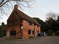 Former Barn, Bunny.jpg 1,024 × 768; 206 KB
-
 Former school and almshouses, Bunny.jpg 1,024 × 761; 150 KB
-
 Gap in the Hedge near Bunny - geograph.org.uk - 1337315.jpg 640 × 480; 93 KB
-
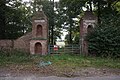 Gate Piers, Bunny Park.jpg 1,600 × 1,065; 784 KB
-
 Gateway to the Silver Seal Mine - geograph.org.uk - 1750790.jpg 640 × 480; 61 KB
-
 Gotham Lane - geograph.org.uk - 3938195.jpg 640 × 427; 392 KB
-
 Gotham Lane - geograph.org.uk - 4037449.jpg 640 × 480; 61 KB
-
 Gotham Lane - geograph.org.uk - 4037451.jpg 640 × 480; 76 KB
-
 Gotham Lane - geograph.org.uk - 4037459.jpg 640 × 480; 72 KB
-
 Haymaking near Bunny - geograph.org.uk - 1928600.jpg 1,280 × 854; 331 KB
-
 House in Main Street, Bunny (geograph 6717219).jpg 1,024 × 768; 164 KB
-

-
 Junction of well marked paths near Welldale Farm - geograph.org.uk - 4581613.jpg 1,024 × 768; 227 KB
-
 Keyworth Lane - geograph.org.uk - 1928591.jpg 1,280 × 854; 243 KB
-
 Keyworth Lane junction - geograph.org.uk - 1928580.jpg 1,280 × 854; 292 KB
-
 Keyworth Lane Lodge - geograph.org.uk - 1928583.jpg 1,280 × 854; 306 KB
-

-
 Lane on Bunny Moor - geograph.org.uk - 1771540.jpg 1,280 × 959; 425 KB
-
 Leaving Bunny Old Wood - geograph.org.uk - 1335539.jpg 640 × 480; 77 KB
-
 Limited View - geograph.org.uk - 1335574.jpg 640 × 480; 85 KB
-
 Looking to New Wood - geograph.org.uk - 1335671.jpg 640 × 480; 71 KB
-
 Main Street Bunny - geograph.org.uk - 1335597.jpg 640 × 480; 52 KB
-
 Main Street Bunny - geograph.org.uk - 1335720.jpg 640 × 480; 53 KB
-
 Main Street Bunny - geograph.org.uk - 1335723.jpg 640 × 480; 88 KB
-
 Mining tunnel under Bunny Old Wood - geograph.org.uk - 1335548.jpg 640 × 480; 103 KB
-
 Minor Road to Bunny from Wysall Road - geograph.org.uk - 3775299.jpg 640 × 427; 40 KB
-
 Moor Lane, Bradmore - geograph.org.uk - 1771514.jpg 1,280 × 959; 425 KB
-
 Moor Lane, Bunny - geograph.org.uk - 1771528.jpg 1,280 × 959; 275 KB
-
 Moor Lane, Bunny - geograph.org.uk - 1771534.jpg 1,280 × 958; 278 KB
-
 Moor Lane, Bunny - geograph.org.uk - 4581732.jpg 1,024 × 768; 165 KB
-
 More Moors - geograph.org.uk - 1745572.jpg 1,280 × 959; 338 KB
-
 New Farmhouse - geograph.org.uk - 1335652.jpg 640 × 480; 45 KB
-

-
 Old shed near Bunny - geograph.org.uk - 3775283.jpg 640 × 427; 57 KB
-
 Old Wood - geograph.org.uk - 4037477.jpg 640 × 480; 96 KB
-
 On Bradmore Moor - geograph.org.uk - 5921107.jpg 5,376 × 3,024; 7.33 MB
-
 On Bradmore Moor - geograph.org.uk - 5921112.jpg 5,376 × 3,024; 4.89 MB
-
 Path across field to Bunny - geograph.org.uk - 4581685.jpg 1,024 × 768; 158 KB
-
 Path at Bunny - geograph.org.uk - 1335707.jpg 640 × 480; 75 KB
-
 Path at Bunny to Bunny Moor - geograph.org.uk - 1335612.jpg 640 × 480; 74 KB
-
 Path at Bunny to Gotham - geograph.org.uk - 1335610.jpg 640 × 480; 73 KB
-
 Path by Fairham Brook Bunny - geograph.org.uk - 1335654.jpg 640 × 480; 59 KB
-
 Path by Fairham Brook Bunny - geograph.org.uk - 1335655.jpg 640 × 480; 64 KB
-
 Path by Fairham Brook Bunny - geograph.org.uk - 1335666.jpg 640 × 480; 83 KB
-
 Path inside Bunny Old Wood - geograph.org.uk - 1335517.jpg 640 × 480; 83 KB
-
 Path inside Bunny Old Wood - geograph.org.uk - 1335523.jpg 640 × 480; 92 KB
-
 Path inside Bunny Old Wood - geograph.org.uk - 1335530.jpg 640 × 480; 98 KB
-
 Path inside Bunny Old Wood - geograph.org.uk - 1335533.jpg 640 × 480; 88 KB
-
 Path inside Bunny Old Wood - geograph.org.uk - 1335534.jpg 640 × 480; 109 KB
-
 Path Near Bunny - geograph.org.uk - 1335742.jpg 640 × 480; 72 KB
-
 Path near Bunny - geograph.org.uk - 1335919.jpg 640 × 480; 97 KB
-
 Path to Bunny from the Old Wood - geograph.org.uk - 1335543.jpg 640 × 480; 100 KB
-
 Path to Bunny from the Old Wood - geograph.org.uk - 1335546.jpg 640 × 480; 80 KB
-
 Path To Gotham Road Near Bunny - geograph.org.uk - 1335735.jpg 640 × 480; 66 KB
-
 Path to road near Bunny - geograph.org.uk - 1335663.jpg 640 × 480; 76 KB
-
 Postbox Ref, HG11 172 - geograph.org.uk - 1928577.jpg 1,280 × 854; 379 KB
-
 Ratcliffe Power Station - geograph.org.uk - 3963589.jpg 640 × 427; 247 KB
-

-
 Road in Bunny - geograph.org.uk - 1335566.jpg 640 × 480; 59 KB
-
 Road in Bunny - geograph.org.uk - 1335569.jpg 640 × 480; 59 KB
-
 Road junction by Wysall Road Farm - geograph.org.uk - 6311215.jpg 640 × 405; 35 KB
-
 Road junction by Wysall Road Farm - geograph.org.uk - 6311216.jpg 640 × 444; 46 KB
-
 Road Junction near Bunny - geograph.org.uk - 3320374.jpg 2,256 × 1,504; 782 KB
-

-
 Rose Cottage, Bunny.jpg 1,280 × 883; 405 KB
-
 Seed drill - geograph.org.uk - 1771557.jpg 1,280 × 959; 283 KB
-
 Sharp bend in Gotham Lane - geograph.org.uk - 4037445.jpg 640 × 480; 55 KB
-

-
 Signpost by Wysall Road Farm - geograph.org.uk - 6311217.jpg 640 × 499; 31 KB
-
 Signpost by Wysall Road Farm - geograph.org.uk - 6311218.jpg 640 × 483; 70 KB
-
 Signpost on the Moor - geograph.org.uk - 1771564.jpg 959 × 1,280; 586 KB
-
 Solitary cloud - geograph.org.uk - 1928607.jpg 854 × 1,280; 169 KB
-
 Solitary oak - geograph.org.uk - 1771698.jpg 1,280 × 898; 237 KB
-
 St Mary's church - geograph.org.uk - 4430959.jpg 640 × 480; 37 KB
-
 Stile at Bunny - geograph.org.uk - 1335606.jpg 640 × 480; 72 KB


_-_geograph.org.uk_-_1771704.jpg)
_-_geograph.org.uk_-_1771707.jpg)


_-_geograph.org.uk_-_4595854.jpg)
_-_geograph.org.uk_-_4595862.jpg)
_-_geograph.org.uk_-_4581604.jpg)


.jpg)

_-_geograph.org.uk_-_4037461.jpg)


.jpg)


_-_geograph.org.uk_-_1771550.jpg)
_-_geograph.org.uk_-_1771552.jpg)


.jpg)


