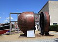
Category:Bulbous bow of Godewind (ship, 1983)
Jump to navigation
Jump to search
| Object location | | View all coordinates using: OpenStreetMap |
|---|
Media in category "Bulbous bow of Godewind (ship, 1983)"
The following 6 files are in this category, out of 6 total.
-
 Husum - Am Binnenhafen - Wulstbug MV Godewind 01 ies.jpg 5,616 × 3,744; 7.38 MB
-
 Husum - Am Binnenhafen - Wulstbug MV Godewind 02 ies.jpg 5,616 × 3,744; 13.37 MB
-
 Husum - Am Binnenhafen - Wulstbug MV Godewind 03 ies.jpg 5,616 × 3,744; 13.42 MB
-
 Husum - Am Binnenhafen - Wulstbug MV Godewind 04 ies.jpg 5,135 × 3,680; 3.19 MB
-
 Husum - Am Binnenhafen - Wulstbug MV Godewind 05 ies.jpg 3,744 × 5,616; 10.23 MB
-
 Wulstbug vom Ro-Ro-Schiff MV Godewind in Husum.jpg 2,672 × 4,000; 3.56 MB


