Category:Buildings in the London Borough of Havering
Jump to navigation
Jump to search
Boroughs of London: City of London · City of Westminster · Barking and Dagenham · Barnet · Bexley · Brent · Bromley · Camden · Croydon · Ealing · Enfield · Greenwich · Hackney · Hammersmith and Fulham · Haringey · Harrow · Havering · Hillingdon · Hounslow · Islington · Kensington and Chelsea · Kingston · Lambeth · Lewisham · Merton · Newham · Redbridge · Richmond · Southwark · Sutton · Tower Hamlets · Waltham Forest · Wandsworth
Wikimedia category | |||||
| Upload media | |||||
| Instance of | |||||
|---|---|---|---|---|---|
| Category combines topics | |||||
| London | |||||
capital and largest city of England and the United Kingdom     .svg)   | |||||
| Pronunciation audio | |||||
| Instance of |
| ||||
| Location |
| ||||
| Located in or next to body of water | |||||
| Official language | |||||
| Head of government |
| ||||
| Inception |
| ||||
| Significant event |
| ||||
| Highest point |
| ||||
| Population |
| ||||
| Area |
| ||||
| Elevation above sea level |
| ||||
| Replaces | |||||
| IATA airport code |
| ||||
| Different from | |||||
| official website | |||||
 | |||||
Subcategories
This category has the following 33 subcategories, out of 33 total.
B
D
H
I
L
O
P
R
S
T
~
Media in category "Buildings in the London Borough of Havering"
The following 30 files are in this category, out of 30 total.
-
 Arcade place Romford - geograph.org.uk - 1205414.jpg 640 × 428; 76 KB
-
 Hornchurch Country Park, (Astra House).JPG 3,888 × 2,592; 3.12 MB
-

-
 Bury Farm - geograph.org.uk - 60044.jpg 640 × 482; 93 KB
-
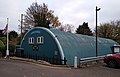
 Coldharbour Depot - geograph.org.uk - 49372.jpg 640 × 482; 60 KB
-
 Collier Row, Prospect Place - geograph.org.uk - 906122.jpg 640 × 480; 67 KB
-
 Cosmo at Romford - geograph.org.uk - 1778186.jpg 3,296 × 2,472; 1.91 MB
-
 Cranham Farm, Cranham - geograph.org.uk - 147592.jpg 640 × 480; 83 KB
-
 Entrance to Westbury Farm, Cranham - geograph.org.uk - 1101282.jpg 640 × 425; 61 KB
-
 Forest Freight - geograph.org.uk - 57170.jpg 640 × 482; 47 KB
-
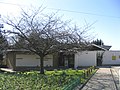
 Harold Hill, My Place - geograph.org.uk - 3626594.jpg 640 × 480; 108 KB
-
 Hill Farm, Noak Hill, Essex - geograph.org.uk - 18215.jpg 640 × 480; 100 KB
-
 Hornchurch Country Park (Astra Court East).JPG 3,888 × 2,592; 5.79 MB
-
 Hornchurch Mental Health Team, Rainham - geograph.org.uk - 1602344.jpg 640 × 430; 116 KB
-
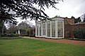 Langtons Orangey - geograph.org.uk - 1763560.jpg 640 × 428; 89 KB
-
 New development - Romford Market - geograph.org.uk - 271987.jpg 640 × 480; 100 KB
-
 New Windmill Hall, Upminster - geograph.org.uk - 147570.jpg 640 × 480; 123 KB
-
 Pavilion, Raphael Park - geograph.org.uk - 5525721.jpg 640 × 480; 120 KB
-
 Queens Court, Romford.jpg 2,246 × 2,727; 2.07 MB
-
 Rainham Tyres - geograph.org.uk - 49321.jpg 640 × 482; 98 KB
-
 Richardson's Hall 1.jpg 4,096 × 2,638; 3.78 MB
-
 Richardson's Hall 2.jpg 4,096 × 2,893; 3.8 MB
-
 Romford market building london.jpg 1,024 × 768; 121 KB
-
 Romford town hall snow.jpg 2,304 × 3,072; 1.48 MB
-
 Thames Chase Forest Centre - geograph.org.uk - 686671.jpg 640 × 363; 52 KB
-

-
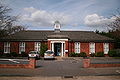
 The Officers Mess, RAF Hornchurch - geograph.org.uk - 1130866.jpg 640 × 428; 76 KB
-
 Upminster Court Front.jpg 4,928 × 3,264; 4.81 MB
-

-
 Wincantons, Coldharbour Lane - geograph.org.uk - 1601768.jpg 640 × 430; 105 KB

.JPG)


.JPG)


