Category:Buildings in Wakefield, West Yorkshire
Jump to navigation
Jump to search
Wikimedia category | |||||
| Upload media | |||||
| Instance of | |||||
|---|---|---|---|---|---|
| Category combines topics |
| ||||
| |||||
Subcategories
This category has the following 68 subcategories, out of 68 total.
A
B
C
- County Hall, Wakefield (50 F)
E
F
G
H
- HM Prison Wakefield (24 F)
M
T
W
- Wakefield Old Crown Court (12 F)
- Wakefield Power Station (1 F)
Media in category "Buildings in Wakefield, West Yorkshire"
The following 82 files are in this category, out of 82 total.
-

-

-

-
 2-10, Northgate - geograph.org.uk - 1095478.jpg 640 × 510; 359 KB
-
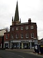
 20 King Street - geograph.org.uk - 1034540.jpg 480 × 640; 113 KB
-
 2a Westmorland Street - geograph.org.uk - 1095493.jpg 480 × 640; 224 KB
-
 Army Careers (now closed), Northgate Street (10th March 2013).JPG 3,872 × 2,176; 2.53 MB
-
 Art House - geograph.org.uk - 5950989.jpg 640 × 427; 298 KB
-
 Bank House - geograph.org.uk - 1025931.jpg 640 × 480; 98 KB
-
 Barstow Square - geograph.org.uk - 654133.jpg 640 × 567; 39 KB
-
 Barstow Square - Westgate - geograph.org.uk - 747539.jpg 640 × 558; 76 KB
-
 Bayheath House, Wakefield - geograph.org.uk - 2745065.jpg 3,798 × 3,032; 3.25 MB
-
 Bean for Coffee - Westgate End - geograph.org.uk - 1712640.jpg 480 × 640; 63 KB
-

-
 Calder and Hebble Navigation Warehouse (1790) Wakefield (8125678474).jpg 3,000 × 2,080; 4.17 MB
-
 Caldervets - Westgate End - geograph.org.uk - 1712618.jpg 640 × 631; 88 KB
-

-
 Fell House, Wakefield - geograph.org.uk - 2745070.jpg 4,320 × 3,240; 4.05 MB
-

-
 Former Police Station - Dewsbury Road - geograph.org.uk - 1400285.jpg 640 × 480; 322 KB
-
 Former Public Library - Balne Lane - geograph.org.uk - 3738913.jpg 640 × 480; 92 KB
-
 Former Wakefield City Police Station, Cliff Parade, Wakefield.jpg 3,264 × 1,836; 1.63 MB
-
 George and Crown Yard - Westgate - geograph.org.uk - 747542.jpg 509 × 640; 68 KB
-
 Hatfield Villa, No.1 Hatfield Street - geograph.org.uk - 1337376.jpg 640 × 481; 301 KB
-
 Hepworth Gallery (8912340279).jpg 3,456 × 5,184; 7.44 MB
-
 Housing Federation - geograph.org.uk - 1006092.jpg 640 × 480; 86 KB
-
 King Street - geograph.org.uk - 1005977.jpg 480 × 640; 89 KB
-
 King Street - geograph.org.uk - 1026946.jpg 480 × 640; 113 KB
-
 Lawefield Lodge - geograph.org.uk - 1431779.jpg 640 × 480; 120 KB
-
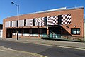
 Merchant Gate development (1) - geograph.org.uk - 1754310.jpg 640 × 480; 251 KB
-
 Merchant Gate development (2) - geograph.org.uk - 1754315.jpg 640 × 480; 291 KB
-
 Merchant Gate development (3) - geograph.org.uk - 1754331.jpg 640 × 480; 241 KB
-
 Merchant Gate development (4) - geograph.org.uk - 1754338.jpg 640 × 480; 255 KB
-
 Merchant Gate development (5) - geograph.org.uk - 1754346.jpg 640 × 480; 250 KB
-
 Merchant Gate development (6) - geograph.org.uk - 1754359.jpg 640 × 480; 330 KB
-
 Merchant Gate development (7) - geograph.org.uk - 1754365.jpg 640 × 480; 319 KB
-
 Merchant Gate development - geograph.org.uk - 1492789.jpg 640 × 480; 79 KB
-
 Merchant Gate development - geograph.org.uk - 1492790.jpg 640 × 480; 109 KB
-
 No. 24 St John's North - geograph.org.uk - 1120669.jpg 640 × 462; 286 KB
-
 No.8 Bond Street, Wakefield (geograph 5857239).jpg 768 × 1,024; 1.06 MB
-
 North Road Terrace - geograph.org.uk - 946028.jpg 640 × 480; 89 KB
-
 Number 1 Tammy Hall Street (geograph 5872044).jpg 4,154 × 3,115; 2.2 MB
-
 Old Fire Station Buildings - geograph.org.uk - 1854873.jpg 1,024 × 835; 197 KB
-
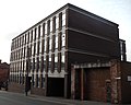
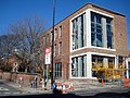
 Phoenix Court, Wakefield - geograph.org.uk - 5827415.jpg 4,608 × 3,072; 1.72 MB
-
 Ploughland House - geograph.org.uk - 1044591.jpg 640 × 480; 114 KB
-
 Red Hall on Red Hall Lane, Wakefield - geograph.org.uk - 5746344.jpg 1,600 × 1,065; 802 KB
-
 Registry of Deeds, Newstead Road - geograph.org.uk - 944614.jpg 640 × 480; 77 KB
-
 Shutting off the view - geograph.org.uk - 1579642.jpg 640 × 480; 68 KB
-
 Southgate House, George Street, Wakefield (geograph 5747564).jpg 1,600 × 1,065; 507 KB
-

-

-

-
 Stork cafe - geograph.org.uk - 969107.jpg 640 × 480; 100 KB
-
 Tammy Hall - geograph.org.uk - 1025955.jpg 640 × 480; 97 KB
-
 Telephone Kiosk - geograph.org.uk - 1025975.jpg 480 × 640; 120 KB
-
 The Art House - geograph.org.uk - 843959.jpg 640 × 470; 71 KB
-
 The Art House - geograph.org.uk - 975029.jpg 640 × 480; 76 KB
-
 The Gatehouse Newmillerdam. - geograph.org.uk - 483534.jpg 640 × 480; 114 KB
-
 The New Life Christian Centre, Wakefield - geograph.org.uk - 2750720.jpg 4,320 × 3,240; 5.05 MB
-
 The Old Courtyard - geograph.org.uk - 974828.jpg 640 × 480; 77 KB
-
 The Refurbishment - geograph.org.uk - 5289417.jpg 4,608 × 3,456; 5.61 MB
-

-
 Thornes Cricket Club Pavilion - geograph.org.uk - 524295.jpg 640 × 480; 85 KB
-
 Through the boiler house - geograph.org.uk - 5828148.jpg 772 × 1,024; 116 KB
-
 Town Hall Chambers (2) - geograph.org.uk - 2873315.jpg 1,024 × 768; 700 KB
-

-
 Vacant Building at 7-9 Bank Street - geograph.org.uk - 1098695.jpg 640 × 480; 95 KB
-
 Victoria Chambers, Wood Street - geograph.org.uk - 1111124.jpg 480 × 640; 290 KB
-
 Viva Nightclub - geograph.org.uk - 1098679.jpg 640 × 466; 99 KB
-
 Wakefield Art Gallery - geograph.org.uk - 1191552.jpg 640 × 512; 432 KB
-
 Wakefield Art Gallery, Wentworth Street - geograph.org.uk - 945650.jpg 640 × 480; 136 KB
-
 Wakefield City Club - geograph.org.uk - 2761552.jpg 4,320 × 3,240; 4.55 MB
-
 Wakefield Magistrates Court - geograph.org.uk - 1854861.jpg 640 × 493; 89 KB
-
 Wakefield Telephone Exchange (1) - geograph.org.uk - 5868248.jpg 2,592 × 1,944; 1.38 MB
-
 Wakefield Telephone Exchange (2) - geograph.org.uk - 5868289.jpg 2,592 × 1,944; 1.41 MB
-
 Waterfront Mural, Bridge Street - geograph.org.uk - 1531513.jpg 640 × 480; 74 KB
-
 Wentworth Lodge, Wentworth Terrace - geograph.org.uk - 945647.jpg 640 × 480; 112 KB
-
 Wentworth Terrace - geograph.org.uk - 1289531.jpg 640 × 470; 348 KB
-
-
 Wood Street Wakefield - geograph.org.uk - 344715.jpg 640 × 480; 90 KB
-

-
 ^26 King Street (former police station^) - geograph.org.uk - 3166959.jpg 683 × 1,024; 132 KB


,_Northgate_Street_(10th_March_2013).JPG)


_Wakefield_(8125678474).jpg)

.jpg)


.jpg)


_-_geograph.org.uk_-_1754310.jpg)
_-_geograph.org.uk_-_1754315.jpg)
_-_geograph.org.uk_-_1754331.jpg)
_-_geograph.org.uk_-_1754338.jpg)
_-_geograph.org.uk_-_1754346.jpg)
_-_geograph.org.uk_-_1754359.jpg)
_-_geograph.org.uk_-_1754365.jpg)


.jpg)

.jpg)


.jpg)


_-_geograph.org.uk_-_2873315.jpg)


_-_geograph.org.uk_-_5868248.jpg)
_-_geograph.org.uk_-_5868289.jpg)


_-_geograph.org.uk_-_3166959.jpg)