Category:Buildings in Ramsgate
Jump to navigation
Jump to search
Subcategories
This category has the following 23 subcategories, out of 23 total.
1
A
C
- Ramsgate Cliff Lifts (11 F)
G
- Gas Works Ramsgate (9 F)
- Gate House, Ramsgate (3 F)
- Granville Theatre, Ramsgate (2 F)
L
M
- Madeira Walk, Ramsgate (14 F)
- Maritime Museum, Ramsgate (10 F)
R
- Ramsgate Motor Museum (3 F)
S
- St Edwards, Ramsgate (1 F)
T
Media in category "Buildings in Ramsgate"
The following 200 files are in this category, out of 215 total.
(previous page) (next page)-
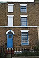
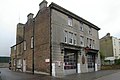
 1 And 3, High Street, Ramsgate.jpg 5,005 × 2,662; 4.98 MB
-
 1 Paragon, Ramsgate 01.jpg 3,280 × 4,032; 4.26 MB
-
 1 Paragon, Ramsgate 02.jpg 3,394 × 3,349; 3.63 MB
-
 10 Paragon, Ramsgate.jpg 2,496 × 4,864; 3.79 MB
-
 11 Paragon, Ramsgate.jpg 2,328 × 4,672; 3.2 MB
-
 11, 13, 15 and 17 Royal Road, Ramsgate.jpg 5,184 × 3,456; 6.15 MB
-
 129-135 Ramsgate High Street - geograph.org.uk - 2262790.jpg 3,072 × 2,304; 1.69 MB
-
 132 Grange Road, Ramsgate.jpg 3,456 × 5,184; 6.28 MB
-
 136 Grange Road, Ramsgate 01.jpg 5,184 × 3,456; 9.29 MB
-
 136 Grange Road, Ramsgate 02.jpg 5,184 × 3,456; 9.6 MB
-
 136 Grange Road, Ramsgate 03.jpg 4,815 × 2,237; 5.79 MB
-
 138 Grange Road, Ramsgate.jpg 3,456 × 5,184; 6.35 MB
-
 14 Paragon, Ramsgate.jpg 2,760 × 4,560; 4.06 MB
-
 140 Grange Road, Ramsgate.jpg 3,456 × 5,184; 9.16 MB
-
 142 Grange Road, Ramsgate.jpg 3,456 × 5,184; 8.08 MB
-
 15 Paragon, Ramsgate.jpg 2,312 × 4,120; 3.23 MB
-
 17-18 Paragon, Ramsgate.jpg 3,392 × 4,232; 4.72 MB
-
 2 and 4 Ashburnham Road, Ramsgate 01.jpg 5,184 × 3,456; 8.32 MB
-
 2 and 4 Ashburnham Road, Ramsgate 02.jpg 3,456 × 5,184; 8.38 MB
-
 2 and 4 Ashburnham Road, Ramsgate 03.jpg 5,184 × 3,456; 6.08 MB
-
 2 Paragon, Ramsgate.jpg 2,688 × 4,360; 3.73 MB
-
 3 Paragon, Ramsgate.jpg 2,720 × 4,992; 4.1 MB
-
 39 Ashburnham Road, Ramsgate.jpg 4,598 × 3,366; 5.74 MB
-
 39, 41, 43 and 45, High Street, Ramsgate.jpg 4,499 × 2,827; 5 MB
-
 4 Paragon, Ramsgate.jpg 2,472 × 3,832; 2.59 MB
-
 4-44 Royal Road, Ramsgate 01.jpg 5,184 × 3,456; 6.63 MB
-
 4-44 Royal Road, Ramsgate 02.jpg 5,184 × 3,456; 5.78 MB
-
 4-44 Royal Road, Ramsgate 03.jpg 5,184 × 3,456; 7.26 MB
-
 42 and 44 West Cliff Road, Ramsgate 02.jpg 5,184 × 3,456; 5.79 MB
-
 42 and 44 West Cliff Road, Ramsgate 03.jpg 5,184 × 3,456; 5.27 MB
-
 42 and 44 West Cliff Road, Ramsgate.jpg 5,184 × 3,456; 5.56 MB
-
 5 Paragon, Ramsgate.jpg 2,624 × 4,856; 3.56 MB
-
 5, 7 and 9 Royal Road, Ramsgate 01.jpg 4,796 × 3,322; 4.82 MB
-
 5, 7 and 9 Royal Road, Ramsgate 02.jpg 4,834 × 3,195; 5.03 MB
-
 50-54 High Street, Ramsgate, August 2021.jpg 3,024 × 4,032; 4.12 MB
-
 52 Harbour Parade from Harbour Street, Ramsgate, August 2021.jpg 4,032 × 3,024; 8.48 MB
-
 54 And 56, Park Road, Ramsgate.jpg 4,147 × 2,727; 4.69 MB
-
 56 and 58 West Cliff Road, Ramsgate 01.jpg 3,288 × 4,088; 4.91 MB
-
 56 and 58 West Cliff Road, Ramsgate 02.jpg 5,184 × 3,456; 6.16 MB
-
 64 And 64A, Park Road, Ramsgate 01.jpg 3,262 × 3,168; 3.92 MB
-
 64 And 64A, Park Road, Ramsgate 02.jpg 3,575 × 3,262; 4 MB
-
 66, Park Road, Ramsgate.jpg 3,814 × 2,630; 3.75 MB
-
 6a-8, Cliff Street - geograph.org.uk - 4249119.jpg 1,142 × 856; 204 KB
-
 8 Paragon, Ramsgate 01.jpg 2,032 × 4,424; 3.12 MB
-
 8 Paragon, Ramsgate 02.jpg 4,378 × 3,338; 5.07 MB
-
 89 High Street under scaffolding, Ramsgate, August 2021.jpg 4,032 × 3,024; 8.75 MB
-

-

-

-
 Aberdeen House Close-up - geograph.org.uk - 2027948.jpg 3,456 × 2,592; 3.2 MB
-
 Aberdeen House Register Office, Ramsgate - geograph.org.uk - 2027943.jpg 3,456 × 2,592; 1,008 KB
-
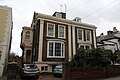
 Alexandra Hotel, Ramsgate.jpg 3,168 × 4,184; 4.69 MB
-
 Alexandra Road, CT11 - geograph.org.uk - 3864770.jpg 640 × 480; 88 KB
-
 Ancient Egyptian-style door knockers. Ramsgate, England.jpg 2,470 × 2,497; 1.91 MB
-
 Artillery Road - geograph.org.uk - 2662969.jpg 640 × 480; 81 KB
-
 Bandstand on Wellington Crescent - geograph.org.uk - 1374325.jpg 640 × 427; 115 KB
-
 Bike Bits, Ramsgate - geograph.org.uk - 2437101.jpg 3,072 × 2,304; 1.66 MB
-
 Boulevard Kiosk - geograph.org.uk - 2730436.jpg 2,304 × 3,072; 1.24 MB
-
 Braces, King Street - geograph.org.uk - 2662921.jpg 640 × 480; 82 KB
-
 Braces, Ramsgate - geograph.org.uk - 2404032.jpg 3,072 × 2,304; 1.65 MB
-
 Bright's Place - geograph.org.uk - 2655325.jpg 640 × 480; 100 KB
-
 Building at the junction of High Street and Chatham Street, Ramsgate, Kent.jpg 3,104 × 4,672; 5.63 MB
-
 Cafe Culture - geograph.org.uk - 2730464.jpg 3,072 × 1,988; 746 KB
-
 Camden Arms - geograph.org.uk - 2661914.jpg 640 × 480; 100 KB
-
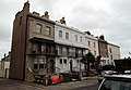
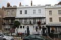
 Carramore Residential Hotel, Ramsgate 01.jpg 5,184 × 3,456; 6.41 MB
-
 Carramore Residential Hotel, Ramsgate 02.jpg 5,071 × 3,361; 6.59 MB
-
 Chapel undergoing renovation - geograph.org.uk - 2262832.jpg 2,304 × 3,072; 1.81 MB
-
 Chatham Street, CT1 (2) - geograph.org.uk - 3863660.jpg 640 × 480; 83 KB
-
 Chatham Street, CT1 - geograph.org.uk - 3863652.jpg 480 × 640; 75 KB
-
 ChathamHouseSchool.jpg 600 × 364; 26 KB
-
 Chilton Farmhouse - geograph.org.uk - 2358577.jpg 3,072 × 2,304; 2.41 MB
-
 Churchill House School, Ramsgate.jpg 4,521 × 3,234; 4.81 MB
-
 Clifton Villa, Ramsgate 01.jpg 5,184 × 3,456; 6.65 MB
-
 Clifton Villa, Ramsgate 02.jpg 4,554 × 3,162; 4.64 MB
-
 Converted chapel, Ramsgate - geograph.org.uk - 2404083.jpg 3,072 × 2,304; 1.87 MB
-
 Custom House, Ramsgate.jpg 4,399 × 3,367; 4.12 MB
-
 Derelict house in Ramsgate - geograph.org.uk - 2551821.jpg 801 × 1,024; 180 KB
-

-
 Disused Gas Works Site, Ramsgate - geograph.org.uk - 29288.jpg 640 × 480; 99 KB
-
 Eagle Lodge, Ramsgate 01.jpg 3,971 × 3,195; 4.43 MB
-
 Eagle Lodge, Ramsgate 02.jpg 5,184 × 3,456; 6.18 MB
-
 Eagle Lodge, Ramsgate 03.jpg 5,184 × 3,456; 8.69 MB
-
 Earl St Vincent, Ramsgate - geograph.org.uk - 2662928.jpg 640 × 480; 87 KB
-
 East Cliff Bandstand, Ramsgate, August 2021.jpg 4,032 × 3,024; 7.1 MB
-
 East Cliff House, Ramsgate, August 2021.jpg 3,024 × 4,032; 2.54 MB
-
 East Cliff Promenade - geograph.org.uk - 2729948.jpg 2,935 × 1,669; 1.07 MB
-
 East Kent Arms, Ramsgate - geograph.org.uk - 2262770.jpg 2,304 × 3,072; 1.5 MB
-
 Empty Block of Flats in Newington - geograph.org.uk - 2262558.jpg 3,072 × 2,304; 1.42 MB
-
 Empty buildings in Ramsgate - geograph.org.uk - 1991455.jpg 3,072 × 2,304; 1.25 MB
-
 Entrance To The Marlowe Academy - geograph.org.uk - 341187.jpg 640 × 480; 114 KB
-
 Flats on Clement's Road, Ramsgate - geograph.org.uk - 2604117.jpg 640 × 480; 123 KB
-
 Focus DIY Superstore, Northwood - geograph.org.uk - 2402694.jpg 3,072 × 2,304; 1.44 MB
-
 For Naughty or Nautical Boys^ - geograph.org.uk - 503832.jpg 640 × 480; 144 KB
-
 Foresters Hall - geograph.org.uk - 1991528.jpg 2,980 × 2,192; 1 MB
-
 Former ice-house, Military Road - geograph.org.uk - 3571113.jpg 1,099 × 803; 203 KB
-
 Former National Westminster Bank - geograph.org.uk - 2425068.jpg 3,072 × 2,304; 2.05 MB
-
 Former Shakespeare pub, Ramsgate 2262759 079f59c3.jpg 3,072 × 2,304; 1.57 MB
-
 Former Smack Boys' Home, Ramsgate 01.jpg 5,184 × 3,456; 7.35 MB
-
 Former Smack Boys' Home, Ramsgate 02.jpg 5,184 × 3,456; 8.25 MB
-
 Gate and gatepiers, 1 Spencer Square, Ramsgate.jpg 3,658 × 2,767; 3.19 MB
-
 Granville Court.jpg 800 × 600; 94 KB
-
 Grey building, York Street, Ramsgate, Kent - August 2021.jpg 3,104 × 4,672; 6.46 MB
-
 Hotel in good order, west Pegwell - geograph.org.uk - 2592807.jpg 640 × 478; 76 KB
-
 House lived in by Karl Marx, 1879.jpg 2,213 × 3,106; 1.47 MB
-
 Houses on Paragon - geograph.org.uk - 1374151.jpg 640 × 427; 100 KB
-
 Houses on the High Street, Ramsgate, Kent - August 2021.jpg 4,672 × 3,104; 6.13 MB
-
 Housing on Marina Esplanade, Ramsgate - geograph.org.uk - 155951.jpg 640 × 480; 118 KB
-
 Interesting building on Harbour Parade - geograph.org.uk - 2027993.jpg 3,456 × 2,592; 2.98 MB
-
 Jenny Marx Longuet, Ramsgate house.jpg 2,364 × 3,469; 2 MB
-
 Kennedy House and car park, Ramsgate, Kent - August 2021.jpg 3,104 × 4,672; 5.85 MB
-

-
 Kennedy House and Trove Court, Ramsgate, Kent - August 2021.jpg 4,672 × 3,104; 5.82 MB
-
 Kennedy House ^ Trove Court - geograph.org.uk - 2661930.jpg 640 × 480; 71 KB
-
 Kennedy House, Ramsgate - geograph.org.uk - 2404022.jpg 2,304 × 3,072; 1.82 MB
-
 Kennedy House, Ramsgate, Kent - August 2021.jpg 3,104 × 4,672; 5.75 MB
-
 Kent Terrace, Ramsgate - geograph.org.uk - 156371.jpg 481 × 640; 76 KB
-
 Kent Terrace, Ramsgate - geograph.org.uk - 1867734.jpg 768 × 1,024; 211 KB
-
 Liverpool Lawn - geograph.org.uk - 1374286.jpg 640 × 480; 114 KB
-
 Main building of Ramsgate General Hospital 01.jpg 4,846 × 3,333; 6.19 MB
-
 Main building of Ramsgate General Hospital 02.jpg 5,184 × 3,456; 7.22 MB
-
 Modern town houses in Ramsgate - geograph.org.uk - 2404100.jpg 3,072 × 2,304; 2.09 MB
-
 Montefiore Cottages (2008), Ramsgate - geograph.org.uk - 985582.jpg 640 × 480; 52 KB
-
 Montefiore Cottages, Ramsgate - geograph.org.uk - 673249.jpg 600 × 450; 47 KB
-
 Montefiore Cottages, Ramsgate - geograph.org.uk - 673253.jpg 600 × 450; 50 KB
-
 Montefioretomb.jpg 522 × 376; 36 KB
-
 Mount Albion.JPG 4,320 × 3,240; 5.45 MB
-
 Nationwide bank, Ramsgate, August 2021.jpg 4,032 × 3,024; 5.81 MB
-
 Natwest bank, Ramsgate, August 2021.jpg 4,032 × 3,024; 8.56 MB
-
 Nelson Crescent, Ramsgate - geograph.org.uk - 1374105.jpg 640 × 480; 90 KB
-
 Nelson Crescent, Ramsgate - geograph.org.uk - 1554078.jpg 640 × 480; 85 KB
-
 New housing off Sussex Street - geograph.org.uk - 2655322.jpg 640 × 480; 95 KB
-
 New Offices off Haine Road - geograph.org.uk - 2076905.jpg 640 × 427; 69 KB
-
 Newington Community Centre - geograph.org.uk - 2088916.jpg 640 × 480; 131 KB
-
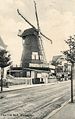
 Newington Mill, Ramsgate.jpg 483 × 777; 131 KB
-
 Northwood Club - geograph.org.uk - 2402706.jpg 3,072 × 2,304; 1.49 MB
-
 Obelisk, Ramsgate.jpg 912 × 2,164; 599 KB
-
 Oriental Chef Chinese Takeaway, Ramsgate, Kent - August 2021.jpg 4,672 × 3,104; 6.2 MB
-
 Paragon Balcony - geograph.org.uk - 503989.jpg 640 × 480; 142 KB
-
 Penistone House, Ramsgate.jpg 3,458 × 2,266; 2.83 MB
-
 Peter's Fish Factory - geograph.org.uk - 2661903.jpg 640 × 480; 104 KB
-
 Pink house in Ramsgate - geograph.org.uk - 2551816.jpg 738 × 1,024; 128 KB
-
 Plaque in Wellington Crescent, Ramsgate, Kent.jpg 2,391 × 2,415; 1.41 MB
-
 Plaque. Jenny Marx Longuet, Ramsgate house.jpg 405 × 378; 72 KB
-
 Police Station, York Street, Ramsgate, Kent - August 2021.jpg 3,104 × 4,672; 5.78 MB
-
 Priory House, Ramsgate.jpg 3,696 × 3,344; 3.89 MB
-
 Project 15 Alternative Curriculum School - geograph.org.uk - 2262599.jpg 3,072 × 2,304; 1.49 MB
-
 Promenade Cafe (geograph 2403952).jpg 3,072 × 2,304; 1.84 MB
-
 Promenade Shelter on East Cliff - geograph.org.uk - 2403938.jpg 3,072 × 2,304; 1.8 MB
-
 Ramsgate - 124 High St01.jpg 1,200 × 841; 350 KB
-

-
 Ramsgate Coat of Arms.jpg 374 × 443; 79 KB
-
 Ramsgate fire station - geograph.org.uk - 1284661.jpg 640 × 427; 211 KB
-
 Ramsgate Grange Rd 1907.jpg 995 × 1,583; 653 KB
-
 Ramsgate Granville from Trove Court - geograph.org.uk - 330280.jpg 480 × 360; 24 KB
-
 Ramsgate home of John Gibson Lockhart.jpg 2,309 × 3,663; 2.19 MB
-
 Ramsgate home of Vincent Van Gogh, 1876.jpg 1,661 × 2,848; 1.08 MB
-
 Ramsgate Maritime Museum - geograph.org.uk - 2594854.jpg 640 × 490; 68 KB
-
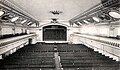 Ramsgate Pav.jpg 801 × 465; 315 KB
-
 Ramsgate Royal Mail Sorting Office - geograph.org.uk - 2263647.jpg 3,072 × 2,304; 1.49 MB
-
 Ramsgate Sorting Office - geograph.org.uk - 1176530.jpg 640 × 480; 96 KB
-
 Ramsgate swimming pool - geograph.org.uk - 722064.jpg 640 × 480; 235 KB
-
 Ramsgate swimming pool - geograph.org.uk - 722069.jpg 640 × 480; 206 KB
-
 Ramsgate Telephone Exchange (1) - geograph.org.uk - 1943285.jpg 3,072 × 2,304; 1.78 MB
-
 Ramsgate Telephone Exchange (2) - geograph.org.uk - 1943295.jpg 3,072 × 2,304; 1.78 MB
-
 Ramsgate, Margate Road railway viaduct - geograph.org.uk - 461634.jpg 640 × 480; 115 KB
-
 Red Arrow Sports and Social Club - geograph.org.uk - 2263583.jpg 3,072 × 2,304; 1.53 MB
-
 Rochester Lodge, Ramsgate.jpg 2,975 × 2,173; 2.47 MB
-
 Royal Esplanade to Western Undercliff, Ramsgate-geograph-1959034.jpg 640 × 480; 97 KB
-
 Royal Sailors Rest, Ramsgate, Kent - August 2021.jpg 3,104 × 4,672; 5.87 MB
-
 Royal Sailors Rest, Ramsgate.jpg 3,456 × 5,184; 6.37 MB
-

-
 Royal Victoria Pavilion, Ramsgate - geograph.org.uk - 156267.jpg 640 × 480; 93 KB
-
 Shelter and houses on Paragon - geograph.org.uk - 1959150.jpg 480 × 640; 96 KB
-
 Shelter on Royal Esplanade, Ramsgate - geograph.org.uk - 1806138.jpg 3,488 × 2,616; 2.69 MB
-

-
 Shops and housing, Plains of Waterloo, Ramsgate, Kent - August 2021.jpg 4,672 × 3,104; 6.91 MB
-
 Smack Boys' Home Ramsgate - geograph.org.uk - 1114431.jpg 3,264 × 2,448; 2.64 MB
-
 Something Fishy, The Little Arch Gallery, Ramsgate Kent - August 2021.jpg 4,672 × 3,104; 6.06 MB
-
 South Lodge, Nethercourt Park - geograph.org.uk - 2359476.jpg 3,072 × 2,304; 2.56 MB
-
 St George's Church Ramsgate, 1830 engraving.jpg 2,295 × 1,605; 1.24 MB
-
 St Mildred's, Ramsgate 01.jpg 3,456 × 5,184; 6.4 MB
-
 St Mildred's, Ramsgate 02.jpg 2,944 × 4,112; 3.66 MB
-
 St Mildred's, Ramsgate 03.jpg 3,096 × 4,944; 4.83 MB
-

-
 St. Lawrence Parish Hall, Ramsgate - geograph.org.uk - 2262836.jpg 3,072 × 2,304; 1.69 MB
-
-
 Stlawrence.jpg 600 × 450; 57 KB
-
 Summerhill Surgery on A254 2262675 32c88c70.jpg 3,072 × 2,304; 1.56 MB
-
 Takeaway Cafes on Grange Road, Ramsgate - geograph.org.uk - 2262806.jpg 3,072 × 2,304; 1.67 MB
-
 Tall Building on Harbour Street - geograph.org.uk - 1374309.jpg 427 × 640; 129 KB
-

-
 Tesco Manston Petrol Station - geograph.org.uk - 2424987.jpg 3,072 × 2,304; 1.59 MB
-
 The Comfort Inn, Ramsgate - geograph.org.uk - 2403945.jpg 3,072 × 2,304; 2.11 MB
-
 The Custom House, Ramsgate - detail - geograph.org.uk - 156361.jpg 459 × 640; 92 KB
-
 The Custom House, Ramsgate - geograph.org.uk - 156333.jpg 640 × 593; 125 KB
-
 The Granville Bars.JPG 3,424 × 2,420; 3.68 MB
-
 The Look-out Cafe, Ramsgate - geograph.org.uk - 2427615.jpg 3,072 × 2,304; 1.96 MB
-
 The Maltings (2), Ramsgate - geograph.org.uk - 2262797.jpg 3,072 × 2,304; 1.54 MB
-
 The Maltings, Ramsgate - geograph.org.uk - 2262793.jpg 3,072 × 2,304; 1.5 MB
-
 The Marine sketch book by H. Moses 1826. RMG PU7929.jpg 1,280 × 778; 692 KB


_-_geograph.org.uk_-_3863660.jpg)


,_Ramsgate_-_geograph.org.uk_-_985582.jpg)


.jpg)


_-_geograph.org.uk_-_1943285.jpg)
_-_geograph.org.uk_-_1943295.jpg)


.jpg)


,_Ramsgate_-_geograph.org.uk_-_2262797.jpg)

