Category:Buerton, Cheshire East
Jump to navigation
Jump to search
English: Buerton is a village at and civil parish in the unitary authority of Cheshire East and the ceremonial county of Cheshire, England, about 7 miles south of the town of Nantwich and 1½ miles east of the village of Audlem, on the border with Shropshire. The parish also includes the small settlements of Hankins Heys, Moblake, Pinder's End and Three Wells, as well as parts of Chapel End, College Fields, Kinsey Heath, Longhill, Raven's Bank, Sandyford and Woolfall. In 2001, the total population was a little under 500. Nearby villages include Adderley, Audlem, Bridgemere, Hankelow, Hatherton, Hunsterson and Woore.
village and civil parish in Cheshire East, England  | |||||
| Upload media | |||||
| Instance of | |||||
|---|---|---|---|---|---|
| Location | Cheshire East, Cheshire, North West England, England | ||||
| Different from | |||||
 | |||||
Media in category "Buerton, Cheshire East"
The following 35 files are in this category, out of 35 total.
-
 Barn at Woolfall Hall Farm - geograph.org.uk - 174591.jpg 640 × 480; 77 KB
-
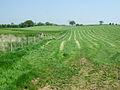 Buerton - Grass Cutting.jpg 640 × 480; 117 KB
-
 Buerton Farm - geograph.org.uk - 174576.jpg 640 × 480; 78 KB
-
 Buerton Moss - geograph.org.uk - 1310969.jpg 640 × 426; 55 KB
-
 Buerton Windmill - geograph.org.uk - 1594606.jpg 426 × 640; 47 KB
-
 Buerton, lodge to Highfields Farm - geograph.org.uk - 189814.jpg 640 × 442; 52 KB
-
 BUERTONHOUSE.png 902 × 591; 354 KB
-
 Drive to College Fields - geograph.org.uk - 1206572.jpg 640 × 457; 101 KB
-
 Entering Cheshire at Sandyford Bridge - geograph.org.uk - 3881558.jpg 3,422 × 2,606; 3.24 MB
-
 Farm pond - geograph.org.uk - 1206587.jpg 457 × 640; 125 KB
-
 Farmland near the Ash - geograph.org.uk - 808221.jpg 640 × 480; 147 KB
-
 Field and farm buildings - geograph.org.uk - 5832770.jpg 1,024 × 768; 355 KB
-
 Footpath over open country - geograph.org.uk - 2055346.jpg 640 × 480; 127 KB
-
 Former parkland,Highfields - geograph.org.uk - 1211225.jpg 640 × 457; 160 KB
-
 Former School Building - Buerton - geograph.org.uk - 3881597.jpg 4,098 × 2,613; 4.67 MB
-
 Holly Farm from higher up Woodhouse Lane - geograph.org.uk - 4010614.jpg 1,064 × 1,600; 431 KB
-
 House beside Regional Cycle Route 75 - geograph.org.uk - 2055445.jpg 640 × 480; 143 KB
-
 Houses near Pendersend Farm - geograph.org.uk - 3881621.jpg 3,630 × 2,324; 3.46 MB
-
 Lane near Holly Farm - geograph.org.uk - 2055399.jpg 640 × 480; 90 KB
-
 Longhill Lane, Chapel End - geograph.org.uk - 2055365.jpg 640 × 480; 152 KB
-
 Over the fields - geograph.org.uk - 793850.jpg 640 × 480; 74 KB
-
 Staffordshire seen from Shropshire - geograph.org.uk - 1211208.jpg 640 × 457; 112 KB
-
 The Ash - geograph.org.uk - 808217.jpg 640 × 480; 131 KB
-
 The Mere and Smith's Drive - geograph.org.uk - 808227.jpg 640 × 480; 152 KB
-

-
 Woore Road near South View Farm - geograph.org.uk - 3881627.jpg 4,596 × 2,775; 4.67 MB
-
 Buerton Bridge - geograph.org.uk - 174572.jpg 640 × 480; 127 KB
-
 Field north west of Norton in Hales - geograph.org.uk - 581823.jpg 640 × 480; 78 KB
-
 Fields Farm drive - geograph.org.uk - 522579.jpg 640 × 480; 83 KB
-
 Hankins Heys Lane, Buerton - geograph.org.uk - 761734.jpg 640 × 398; 68 KB
-
 Holly Farm - geograph.org.uk - 533352.jpg 640 × 354; 68 KB
-
 Mere Farm - geograph.org.uk - 533360.jpg 640 × 473; 109 KB
-
 Pond - geograph.org.uk - 537652.jpg 480 × 640; 174 KB
-
 The Ash and Yew Tree Farm - geograph.org.uk - 533359.jpg 640 × 296; 47 KB
-
 The Cheshire border - geograph.org.uk - 533368.jpg 640 × 332; 62 KB


