Category:Bromsgrove District
Jump to navigation
Jump to search
local government district in Worcestershire, England   | |||||
| Upload media | |||||
| Instance of | |||||
|---|---|---|---|---|---|
| Location | Worcestershire, West Midlands, England | ||||
| Capital | |||||
| Legislative body |
| ||||
| Inception |
| ||||
| Population |
| ||||
| Area |
| ||||
| official website | |||||
 | |||||
Bromsgrove District is a local government district in Worcestershire, England. Its council is based in the town of Bromsgrove.
Subcategories
This category has the following 22 subcategories, out of 22 total.
Media in category "Bromsgrove District"
The following 163 files are in this category, out of 163 total.
-
 140 and 142 New Road, Aston Fields, Bromsgrove (8652141816).jpg 4,288 × 3,216; 1.21 MB
-
 A rotting tree stump - geograph.org.uk - 5732726.jpg 1,024 × 680; 320 KB
-
 A view of Rubery from Waseley Hill - geograph.org.uk - 5413421.jpg 1,600 × 1,183; 581 KB
-
 A view over Rubery from the Waseley Hills - geograph.org.uk - 5412342.jpg 1,600 × 1,200; 332 KB
-
 A38 - Callowbridge Road overbridge - geograph.org.uk - 2842290.jpg 640 × 480; 53 KB
-
 A38 - Whetty Bridge Road overbridge - geograph.org.uk - 2842284.jpg 640 × 480; 57 KB
-
 A38 in Rubery - geograph.org.uk - 2842289.jpg 640 × 480; 51 KB
-

-

-

-
 Beacon Hill Benches Lickey Hills - geograph.org.uk - 5635232.jpg 480 × 640; 85 KB
-
 Beacon Hill Lickey Hills - geograph.org.uk - 5635228.jpg 640 × 480; 60 KB
-
 Beacon Hill view - geograph.org.uk - 2650297.jpg 3,648 × 2,736; 1.78 MB
-
 Beacon Hill Viewpoint - geograph.org.uk - 4758843.jpg 1,024 × 683; 123 KB
-
 Belbroughton , M5 Motorway - geograph.org.uk - 6284811.jpg 6,000 × 4,000; 4.63 MB
-
 Bench on Beacon Hill, Lickey, Worcestershire - geograph.org.uk - 5079385.jpg 1,600 × 1,200; 655 KB
-
 Birmingham - panoramio (57).jpg 2,304 × 1,536; 1.84 MB
-
 Birmingham - panoramio (63).jpg 4,000 × 3,000; 3.14 MB
-
 Birmingham - panoramio (65).jpg 4,000 × 3,000; 4.15 MB
-
 Birmingham - panoramio (66).jpg 4,000 × 3,000; 4.1 MB
-
 Birmingham City Centre from Lickey hills - geograph.org.uk - 5082077.jpg 1,600 × 1,200; 270 KB
-
 Bournheath , Sandy Lane - geograph.org.uk - 6292432.jpg 6,000 × 4,000; 5.67 MB
-

-
 Bromsgrove District , Bristol Road South A38 - geograph.org.uk - 6292433.jpg 6,000 × 4,000; 4.53 MB
-
 Bromsgrove District , Halesowen Road A38 - geograph.org.uk - 6292434.jpg 6,000 × 4,000; 5.99 MB
-
 Bromsgrove District , The M5 Motorway - geograph.org.uk - 3724144.jpg 4,288 × 2,848; 5.59 MB
-
 Bromsgrove District , The M5 Motorway - geograph.org.uk - 3724145.jpg 4,254 × 2,798; 5.63 MB
-
 Bromsgrove UK ward map 2015.svg 691 × 586; 336 KB
-
 Bromsgrove UK ward map 2019.svg 691 × 586; 336 KB
-
 Bromsgrove UK ward map 2023.svg 691 × 586; 336 KB
-
 Bromsgrovedistrictcouncilelection2015.svg 360 × 185; 2 KB
-
 Callowbridge Road bridge over A38 - geograph.org.uk - 6306868.jpg 1,600 × 971; 799 KB
-
 Centenary Avenue - geograph.org.uk - 1108409.jpg 640 × 480; 75 KB
-

-

-

-

-

-
 Countryside at Chadwich - geograph.org.uk - 2278120.jpg 640 × 480; 82 KB
-
 Culvert and stream by M5 - geograph.org.uk - 5677126.jpg 4,128 × 2,322; 2.87 MB
-

-
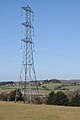 Electricity pylon on Windmill Hill - geograph.org.uk - 5721733.jpg 680 × 1,024; 190 KB
-
 Entrance to Waseley Hills country park southern car park - geograph.org.uk - 4905556.jpg 1,600 × 1,200; 723 KB
-
-
 Farley - panoramio (1).jpg 2,816 × 2,112; 2.74 MB
-
 Farley - panoramio.jpg 2,816 × 2,112; 3.06 MB
-

-
 Father's Barn, New Road, Rubery, near Birmingham - geograph.org.uk - 6019245.jpg 1,024 × 661; 178 KB
-

-
 From one hill to another - geograph.org.uk - 5082096.jpg 1,600 × 1,178; 228 KB
-
 Gannow Lane - geograph.org.uk - 2278315.jpg 640 × 480; 65 KB
-
 Garden in winter - panoramio.jpg 2,816 × 2,112; 2.64 MB
-

-
 Grassy area at Beacon Hill in 1999 - geograph.org.uk - 3025981.jpg 1,024 × 682; 134 KB
-
 Hawthorns Social Club - geograph.org.uk - 5183076.jpg 800 × 533; 196 KB
-
 Hazel Road in the snow - geograph.org.uk - 3389817.jpg 640 × 480; 92 KB
-
 Heading north on the A38 - geograph.org.uk - 2842283.jpg 640 × 480; 62 KB
-
-
 Jack's (1), New Road, Rubery near Birmingham - geograph.org.uk - 5965340.jpg 1,024 × 681; 173 KB
-
 Jack's (2), New Road, Rubery near Birmingham - geograph.org.uk - 5965363.jpg 1,024 × 681; 151 KB
-
 Joseph Court, New Road, Rubery, near Birmingham - geograph.org.uk - 5982025.jpg 1,024 × 664; 225 KB
-
 Junction 4 overbridge, M5 - geograph.org.uk - 4461600.jpg 640 × 359; 38 KB
-

-
 Layby on the northbound A38 - geograph.org.uk - 2842279.jpg 640 × 480; 70 KB
-
 Lickey hill - panoramio (1).jpg 4,000 × 3,000; 3.83 MB
-
 Lickey hill - panoramio (2).jpg 2,633 × 1,683; 1.36 MB
-
 Lickey hill - panoramio (3).jpg 4,000 × 3,000; 3.07 MB
-
 Lickey hill - panoramio.jpg 4,000 × 3,000; 2.97 MB
-
 Lickey Hills from Beacon Hill, Worcestershire - geograph.org.uk - 5082088.jpg 1,600 × 1,166; 348 KB
-
 Lickey Hills Golf Course with a distant Birmingham - geograph.org.uk - 5082098.jpg 1,600 × 1,195; 497 KB
-

-

-
 M5 Bridge over Lane - geograph.org.uk - 5677121.jpg 4,128 × 2,322; 2.6 MB
-
 M5 Bridge over Lane West of Manor Farm - geograph.org.uk - 5677108.jpg 4,128 × 2,322; 3.84 MB
-

-

-
 M5 Junction 4 Closed at Underbridge - geograph.org.uk - 4349519.jpg 640 × 480; 86 KB
-

-

-
 M5 Motorway at junction 4 - geograph.org.uk - 2246037.jpg 640 × 480; 52 KB
-
 M5, northbound - geograph.org.uk - 4461602.jpg 640 × 411; 36 KB
-
 Man walking his dog - geograph.org.uk - 5721403.jpg 1,024 × 680; 365 KB
-
 Milepost Worcester 16 Birmingham 10 - geograph.org.uk - 2421334.jpg 640 × 480; 127 KB
-
 Monarch Way sign, Waseley Hills - geograph.org.uk - 5412353.jpg 1,200 × 1,600; 602 KB
-

-
 Muddy Footpath to Manor Farm - geograph.org.uk - 5677071.jpg 4,128 × 2,322; 2.44 MB
-
 New Longbridge development from Beacon Hill - geograph.org.uk - 5082072.jpg 1,600 × 1,200; 414 KB
-

-
 New Road, Rubery, Birmingham - geograph.org.uk - 5015426.jpg 1,600 × 1,200; 332 KB
-
-

-

-

-
 North Worcestershire Way descends from the Waseley Hills - geograph.org.uk - 5414096.jpg 1,600 × 1,200; 640 KB
-
 Old Birmingham Road, Lydiate Ash, Worcestershire (North) - geograph.org.uk - 5085009.jpg 1,600 × 1,200; 388 KB
-
 Old Birmingham Road, Lydiate Ash, Worcestershire (South) - geograph.org.uk - 5085017.jpg 1,600 × 1,178; 413 KB
-
 Old Lane near Manor Farm - geograph.org.uk - 5677075.jpg 4,128 × 2,322; 3.86 MB
-
 Open grassy area at Beacon Hill - geograph.org.uk - 3000476.jpg 1,024 × 695; 147 KB
-

-

-
 Path on Red Hill - geograph.org.uk - 5847964.jpg 1,024 × 680; 362 KB
-
 Pinewood Close - geograph.org.uk - 3774210.jpg 640 × 480; 52 KB
-

-
 Pond next to the A38 near Lydiate Ash - geograph.org.uk - 4905559.jpg 1,600 × 1,200; 511 KB
-

-
-
 Rea Avenue - geograph.org.uk - 2278328.jpg 640 × 415; 51 KB
-
 Red-brick Georgian house (geograph 5760136).jpg 1,024 × 680; 332 KB
-
 Redhill Lane, Rubery - geograph.org.uk - 5160145.jpg 800 × 600; 690 KB
-
 Rednal Hill Lane in the snow - geograph.org.uk - 3389819.jpg 640 × 480; 65 KB
-
 Roadworks M5 Junction 4 Island - geograph.org.uk - 4196882.jpg 640 × 455; 84 KB
-
 Romsley, UK - panoramio (1).jpg 2,816 × 2,112; 2.72 MB
-
-
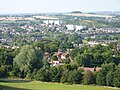 Rubery from Beacon Hill - geograph.org.uk - 5080962.jpg 1,600 × 1,200; 570 KB
-
 Rubery from Beacon Hill - geograph.org.uk - 5082093.jpg 1,600 × 1,184; 673 KB
-
 Rubery High Street, HSBC Now Closed - geograph.org.uk - 4334623.jpg 640 × 480; 76 KB
-

-
 Rubery shopping centre - geograph.org.uk - 6207264.jpg 3,075 × 1,841; 2.93 MB
-
-

-
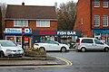
 Shops on New Road Rubery - geograph.org.uk - 5731482.jpg 1,024 × 680; 229 KB
-
 South West Birmingham from Waseley Hill - geograph.org.uk - 5413473.jpg 1,600 × 1,200; 433 KB
-
 South-west Birmingham, an overview (1) - geograph.org.uk - 5081556.jpg 1,600 × 1,200; 531 KB
-
 South-west Birmingham, an overview (2) - geograph.org.uk - 5082082.jpg 1,600 × 1,158; 269 KB
-
 Southbound M5 approaching Junction 4 - geograph.org.uk - 3406610.jpg 640 × 480; 406 KB
-
 Southbound M5, Bridge at Junction 4 - geograph.org.uk - 3406617.jpg 640 × 480; 353 KB
-
 St Chads Church, Rubery - geograph.org.uk - 5731479.jpg 1,024 × 680; 243 KB
-
 St John's Court (geograph 5760175).jpg 1,024 × 680; 258 KB
-

-
 Suburban City - geograph.org.uk - 2650182.jpg 2,736 × 3,648; 1.39 MB
-
 The A38 by Chadwick Wood - geograph.org.uk - 4304974.jpg 1,500 × 999; 118 KB
-
 The A38 runs under Callowbridge Road - geograph.org.uk - 4304973.jpg 1,500 × 999; 112 KB
-

-

-
 The M5 motorway approaching Frankley - geograph.org.uk - 5721714.jpg 1,024 × 680; 252 KB
-
 The M5 runs under the A38 - geograph.org.uk - 5093006.jpg 1,500 × 987; 153 KB
-
 The source of the River Rea - geograph.org.uk - 5717853.jpg 1,024 × 680; 399 KB
-
 The source of the River Rea - geograph.org.uk - 5717854.jpg 1,024 × 680; 419 KB
-
 Timber-framed building, New Road, Bromsgrove (geograph 5760392).jpg 680 × 1,024; 239 KB
-
 Toposcope on Beacon Hill - geograph.org.uk - 5727153.jpg 1,024 × 680; 250 KB
-
 Toposcope on Beacon Hill - geograph.org.uk - 5727349.jpg 1,024 × 680; 268 KB
-
 Toposcope on Windmill Hill - geograph.org.uk - 5721617.jpg 1,024 × 680; 198 KB
-
 Toposcope on Windmill Hill in the Waseley Hill - geograph.org.uk - 5721428.jpg 1,024 × 680; 274 KB
-
 Tower - panoramio (36).jpg 4,000 × 3,000; 3.95 MB
-
 Traffic jam at Lydyate Ash roundabout - geograph.org.uk - 5095693.jpg 1,600 × 1,200; 326 KB
-
 Trees on the Waseley Hills - geograph.org.uk - 5412374.jpg 1,600 × 1,200; 603 KB
-
 Trig point on Lickley Hill - geograph.org.uk - 5732720.jpg 1,024 × 680; 401 KB
-
 UK Bromsgrove Council 2019.svg 360 × 185; 2 KB
-
 View over Frankley Hill - geograph.org.uk - 5721682.jpg 1,024 × 680; 251 KB
-
 View over Rubery - geograph.org.uk - 5721707.jpg 1,024 × 680; 258 KB
-

-
 Waseley Hill and view to the distant Malvern Hills - geograph.org.uk - 5412368.jpg 1,600 × 1,189; 308 KB
-
 Waseley Hill toposcope - geograph.org.uk - 3603326.jpg 640 × 480; 100 KB
-
 Whettybridge Road bridge over A38 - geograph.org.uk - 6306855.jpg 1,600 × 1,162; 1.03 MB
-
 Wildmoor Oak pub. - geograph.org.uk - 1093037.jpg 640 × 480; 82 KB
-
 Windmill Hill Country Park - geograph.org.uk - 2278332.jpg 640 × 480; 85 KB
-
 Woodlands Rd - geograph.org.uk - 2278324.jpg 640 × 415; 55 KB
-
 Worcester ^ Birmingham Canal - panoramio (14).jpg 2,816 × 2,112; 3.1 MB
-
 Array Fruit Farm Entrance - geograph.org.uk - 1140148.jpg 640 × 480; 50 KB
-
 Corn field near Webbhouse Farm - geograph.org.uk - 500282.jpg 640 × 480; 139 KB
-
 North Pepper Wood - geograph.org.uk - 385677.jpg 427 × 640; 193 KB
-

-
 Timberhonger Lane - geograph.org.uk - 203883.jpg 640 × 480; 111 KB
.jpg)


.jpg)
.jpg)
.jpg)
.jpg)


,_65_New_Road,_Rubery,_near_Birmingham_-_geograph.org.uk_-_6016798.jpg)
_-_detail,_65_New_Road,_Rubery,_near_Birmingham_-_geograph.org.uk_-_6016811.jpg)
_-_detail,_65_New_Road,_Rubery,_near_Birmingham_-_geograph.org.uk_-_6019227.jpg)
,_65_New_Road,_Rubery,_near_Birmingham_-_geograph.org.uk_-_6019233.jpg)


.jpg)


,_New_Road,_Rubery_near_Birmingham_-_geograph.org.uk_-_5965340.jpg)
,_New_Road,_Rubery_near_Birmingham_-_geograph.org.uk_-_5965363.jpg)


.jpg)
.jpg)
.jpg)


,_217_New_Road,_Rubery_near_Birmingham_-_geograph.org.uk_-_5965549.jpg)
_-_sign,_217_New_Road,_Rubery_near_Birmingham_-_geograph.org.uk_-_5965566.jpg)
_-_door,_217_New_Road,_Rubery_near_Birmingham_-_geograph.org.uk_-_5965578.jpg)
,_217_New_Road,_Rubery_near_Birmingham_-_geograph.org.uk_-_5965590.jpg)

_-_geograph.org.uk_-_5085009.jpg)
_-_geograph.org.uk_-_5085017.jpg)


.jpg)


.jpg)


_-_geograph.org.uk_-_5081556.jpg)
_-_geograph.org.uk_-_5082082.jpg)


.jpg)


.jpg)


.jpg)


.jpg)


