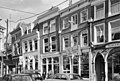
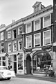
Category:Broederstraat 19, Kampen
Jump to navigation
Jump to search
| Object location | | View all coordinates using: OpenStreetMap |
|---|
 | |||||
| Upload media | |||||
| Instance of |
| ||||
|---|---|---|---|---|---|
| Location | Kampen, Overijssel, Netherlands | ||||
| Located on street | |||||
| Heritage designation |
| ||||
 | |||||
|
This is a category about rijksmonument number 22980
|
| Address |
|
Media in category "Broederstraat 19, Kampen"
The following 4 files are in this category, out of 4 total.
-
 Kampen - Broederstraat 19.jpg 1,944 × 2,592; 1.35 MB
-
 Kampen, Netherlands - panoramio (66).jpg 4,896 × 3,264; 2.22 MB
-
 Voorgevels - Kampen - 20122957 - RCE.jpg 1,200 × 808; 254 KB
-
 Voorgevels - Kampen - 20122959 - RCE.jpg 810 × 1,200; 220 KB
.jpg)

