Category:Broadcast coverage maps
Jump to navigation
Jump to search
Subcategories
This category has the following 4 subcategories, out of 4 total.
Media in category "Broadcast coverage maps"
The following 63 files are in this category, out of 63 total.
-
 Advertisement for Columbus, Ohio radio station WELD (October 1947).gif 628 × 652; 165 KB
-
 Broadcast map 2019-11-05 CKNX-FM (Canada).png 947 × 850; 778 KB
-
 Carte 2017 .jpg 4,134 × 2,836; 4.19 MB
-
 CBC SRC-BC-dbu.png 664 × 504; 22 KB
-
 CBC SRC-nf-dbu.png 664 × 504; 22 KB
-
 Champ studio.jpg 871 × 702; 213 KB
-
 Chonhar radio-tv broadcasting mast coverage.png 461 × 378; 96 KB
-
 CHU-BC-dbu.png 885 × 672; 29 KB
-
 CHUM FM broadcast area map.png 896 × 569; 590 KB
-
 CING FM broadcast area.png 895 × 623; 549 KB
-
 CIUX-FM broadcast area map.png 767 × 521; 529 KB
-
 CJBC AM broadcast area map.png 958 × 760; 554 KB
-
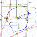
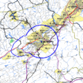
 CKNX AM broadcast area map.png 878 × 592; 468 KB
-
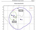
 Conder Plot for RF Coord Example.jpg 537 × 518; 65 KB
-
 Coverage Board.jpg 365 × 286; 30 KB
-
 Dcf weite.jpg 2,174 × 2,578; 1.91 MB
-
 Dcf77 map.png 173 × 227; 9 KB
-
 DCF77-Range.png 3,209 × 2,178; 945 KB
-
 Denivelle.jpg 747 × 525; 136 KB
-
 Diffusion champ fm.png 1,420 × 1,970; 113 KB
-
 Digital terrestrial broadcast in Brazil.svg 780 × 687; 501 KB
-
 EMF visual.jpg 1,024 × 728; 260 KB
-
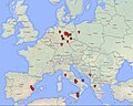
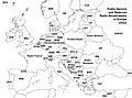 EuHighResRadio.jpg 2,220 × 1,646; 827 KB
-
 Europe DCF77 de.svg 1,401 × 1,198; 4.09 MB
-
 Example Conder Plot.jpg 1,078 × 875; 143 KB
-
 Example radio coverage map.png 2,400 × 1,800; 4.13 MB
-
 FK-BBCWS-SW-dbu.png 664 × 504; 12 KB
-
 Gabin radio mast2.png 2,451 × 2,386; 557 KB
-
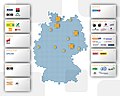
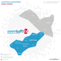 Karte Sendegebiet TV-2048x2048.png 2,048 × 2,048; 563 KB
-
 KDKA-KDPM-WBZ Shortwave relay diagram (1923).jpg 700 × 605; 168 KB
-
 KOAS-FM1 Coverage.jpg 796 × 658; 57 KB
-
 KVGS-FM1 Coverage.jpg 743 × 669; 55 KB
-
 Lancer de rayons.JPG 730 × 472; 44 KB
-
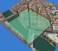
 Maison antenne plan.jpg 1,190 × 1,683; 809 KB
-
 Mithra-REM.jpg 227 × 271; 54 KB
-
 MPR-coverage in cold war Germany.svg 1,075 × 1,273; 491 KB
-
 Ondes simutech.jpg 547 × 547; 98 KB
-
 Perimetre-radio-plus-douvrin.gif 800 × 600; 364 KB
-
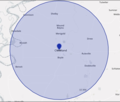
 Radio Chișinău coverage.png 732 × 747; 606 KB
-

-
 Radiofabrik - Broadcast Infographics (13388120564).jpg 2,480 × 2,231; 749 KB
-
 Red mapa 1.jpg 496 × 709; 99 KB
-
 Regiocast Beteiligungen 2020.jpg 3,713 × 2,957; 3.32 MB
-
 Regiocast Beteiligungen 2022.png 2,475 × 1,971; 648 KB
-
 RTV Sendegiebt.jpg 4,905 × 3,357; 2.15 MB
-
 Sendegebiet RTV Regionalfernsehen .jpg 2,480 × 3,508; 1.69 MB
-
 Simulation champ plan.jpg 1,070 × 662; 226 KB
-
 SITE-map-locations.svg 1,486 × 1,734; 450 KB
-
 Skywave Effect of AM.png 1,537 × 1,184; 497 KB
-
 Sölvesborg daytime coverage.jpg 841 × 688; 79 KB
-
 Tote-zone.jpg 1,008 × 804; 252 KB
-
 Visuel propagation de champ.JPG 1,200 × 843; 144 KB
-
 Volume de calcul.jpg 723 × 630; 314 KB
-
 WDSW-LP CoverageArea.png 595 × 504; 203 KB
-
 WEIU-FM Contour Map.gif 700 × 700; 35 KB
-
 Wgsw48dbu.JPG 609 × 600; 99 KB
-
 WIUX Contour Map.gif 700 × 700; 40 KB
-
 WRKC Contour Map.gif 700 × 700; 65 KB
-
 Wtty48dbu.JPG 605 × 599; 98 KB
-
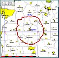
 WTUZ coverage map.jpg 1,700 × 2,338; 1.8 MB
-
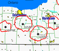 WVBT Rural Radio Network broadcast area map.png 303 × 261; 12 KB
-
 Wvhy54.jpg 595 × 586; 68 KB
-
 Карта мовлення радіо 24.png 800 × 514; 69 KB
.gif)
.png)


.jpg)


.jpg)


.jpg)