Category:Britwell Salome
Jump to navigation
Jump to search
village and civil parish in South Oxfordshire district, Oxfordshire, England  | |||||
| Upload media | |||||
| Instance of | |||||
|---|---|---|---|---|---|
| Location | South Oxfordshire, Oxfordshire, South East England, England | ||||
| Area |
| ||||
| official website | |||||
 | |||||
English: Britwell Salome is a village and civil parish in South Oxfordshire, England, about northeast of Wallingford.
Subcategories
This category has the following 2 subcategories, out of 2 total.
B
- Britwell House (2 F)
N
Media in category "Britwell Salome"
The following 152 files are in this category, out of 152 total.
-
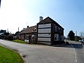
 A Substantial Farm Building - geograph.org.uk - 2031335.jpg 3,424 × 2,472; 2.3 MB
-
 Along the bridleway from Cooper's Farm - geograph.org.uk - 3445600.jpg 427 × 640; 191 KB
-
 Along Turner's Green Lane - geograph.org.uk - 3445544.jpg 640 × 427; 227 KB
-
 Along Turner's Green Lane - geograph.org.uk - 3445550.jpg 640 × 428; 201 KB
-
 Ancient Yew in St Nicholas Churchyard - geograph.org.uk - 2026399.jpg 2,816 × 1,880; 2.1 MB
-
 Ascending onto Swyncombe Downs - geograph.org.uk - 586566.jpg 640 × 480; 113 KB
-
 B4009 at The Priory - geograph.org.uk - 3923841.jpg 640 × 506; 77 KB
-
 B4009 south of St Nicholas Church - geograph.org.uk - 2894373.jpg 3,648 × 2,736; 1.97 MB
-
 B4009 south of St Nicholas Church - geograph.org.uk - 2894381.jpg 3,406 × 2,577; 1.14 MB
-
 B4009 towards Watlington - geograph.org.uk - 3258741.jpg 1,024 × 683; 313 KB
-
 Barn at Lower Farm - geograph.org.uk - 3445569.jpg 640 × 427; 224 KB
-
 Barn near the church, Britwell Salome - geograph.org.uk - 5573621.jpg 1,600 × 1,064; 395 KB
-
 Barn on bricks - geograph.org.uk - 3255605.jpg 1,024 × 683; 252 KB
-
 Barns at Coopers Farm - geograph.org.uk - 2547139.jpg 3,648 × 2,736; 2.56 MB
-
 Bell pulls on St Nicholas - geograph.org.uk - 3257752.jpg 533 × 800; 116 KB
-
 Benifice of Icknield - geograph.org.uk - 3257758.jpg 1,024 × 683; 201 KB
-
 Britwell Hill in Winter - geograph.org.uk - 2247211.jpg 3,648 × 2,736; 1.17 MB
-
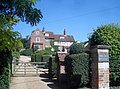
 Britwell House - geograph.org.uk - 2022335.jpg 2,048 × 1,536; 872 KB
-
 Britwell House - geograph.org.uk - 3257861.jpg 1,024 × 683; 169 KB
-
 Britwell Salome Cricket Ground - geograph.org.uk - 2031328.jpg 2,592 × 3,888; 2.02 MB
-
 Britwell Salome Farm Shop - geograph.org.uk - 2549637.jpg 3,216 × 2,424; 2.28 MB
-
 Britwell Salome from B4009 - geograph.org.uk - 3923833.jpg 640 × 405; 56 KB
-
 Britwell Salome, Britwell Hill - geograph.org.uk - 3777847.jpg 640 × 480; 71 KB
-
 Britwell Salome, Britwell Hill - geograph.org.uk - 3777852.jpg 640 × 480; 55 KB
-
 Britwell Salome, lane leading away from the church - geograph.org.uk - 5417911.jpg 1,600 × 1,064; 639 KB
-

-
 Britwell Salome, The B4009 - geograph.org.uk - 3777886.jpg 640 × 475; 73 KB
-
-
 Britwell Salome, The Red Lion - geograph.org.uk - 3777902.jpg 640 × 476; 62 KB
-
 Britwell Salome, The village - geograph.org.uk - 3777868.jpg 640 × 480; 81 KB
-
 Britwell Salome, The village pond - geograph.org.uk - 3777949.jpg 640 × 480; 125 KB
-
 Brown Grass, Blue Tractor - geograph.org.uk - 2022353.jpg 2,048 × 1,536; 760 KB
-
 Certified Old - geograph.org.uk - 2026415.jpg 1,327 × 1,765; 679 KB
-
 Chancel in St Nicholas - geograph.org.uk - 3256816.jpg 533 × 800; 95 KB
-
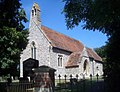 Church of St. Nicholas, Britwell Salome - geograph.org.uk - 2022292.jpg 1,962 × 1,497; 980 KB
-
 Churchyard on the north side - geograph.org.uk - 3257685.jpg 1,024 × 683; 315 KB
-
 Clock on the wall - geograph.org.uk - 3257862.jpg 1,024 × 683; 243 KB
-
 Cooper's Farm - geograph.org.uk - 3445592.jpg 640 × 427; 224 KB
-
 Detail at the base - geograph.org.uk - 3256650.jpg 1,024 × 683; 174 KB
-
-
 Farmland, Britwell Hill - geograph.org.uk - 931574.jpg 640 × 480; 116 KB
-
 Farmland, Britwell Salome - geograph.org.uk - 2122888.jpg 640 × 480; 145 KB
-
 Farmland, Britwell Salome - geograph.org.uk - 2331586.jpg 640 × 480; 136 KB
-
 Farmland, Britwell Salome - geograph.org.uk - 6080464.jpg 1,024 × 768; 238 KB
-
 Farmland, Britwell Salome - geograph.org.uk - 6081522.jpg 1,024 × 768; 201 KB
-

-
 Farmland, Swyncombe Downs - geograph.org.uk - 677191.jpg 640 × 480; 141 KB
-
 Field of Pigs below Britwell Hill - geograph.org.uk - 585796.jpg 640 × 480; 71 KB
-
 Font and cover - geograph.org.uk - 3256596.jpg 533 × 800; 81 KB
-
 From Shakespeare's Way to Cobditch Hill - geograph.org.uk - 2546974.jpg 3,888 × 2,592; 2.6 MB
-
 From the back of the church - geograph.org.uk - 3256828.jpg 1,024 × 683; 111 KB
-
 Gate to the stables - geograph.org.uk - 3257853.jpg 1,024 × 683; 251 KB
-
 Gates to Britwell Salome House - geograph.org.uk - 2039781.jpg 2,048 × 1,536; 942 KB
-
 Graves at the west end - geograph.org.uk - 3257691.jpg 1,024 × 683; 226 KB
-
 House at Britwell Salome - geograph.org.uk - 3445577.jpg 640 × 485; 198 KB
-
 In front of the church - geograph.org.uk - 3257755.jpg 1,024 × 683; 258 KB
-
 Junction, Shakespeare's Way and Ridgeway - geograph.org.uk - 2547010.jpg 3,648 × 2,736; 3.06 MB
-
 Kneelers on the pews - geograph.org.uk - 3256825.jpg 1,024 × 683; 154 KB
-
 Lunch view - geograph.org.uk - 3445642.jpg 640 × 427; 230 KB
-
 Meeting The Ridgeway - geograph.org.uk - 3445635.jpg 640 × 427; 201 KB
-
 Mellow yellow - geograph.org.uk - 5421481.jpg 3,840 × 2,160; 4.82 MB
-
 New Barn near Watlington - geograph.org.uk - 3659399.jpg 1,600 × 1,073; 294 KB
-
 North side of St Nicholas - geograph.org.uk - 3257686.jpg 1,024 × 683; 274 KB
-
 Notice at Cooper's Farm - geograph.org.uk - 3445585.jpg 640 × 476; 246 KB
-
 Organ and font - geograph.org.uk - 3256594.jpg 533 × 800; 98 KB
-
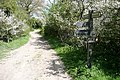
 Path to St Nicholas's church, Britwell Salome - geograph.org.uk - 5573614.jpg 1,064 × 1,600; 598 KB
-
 Path to St. Nicholas - geograph.org.uk - 3256588.jpg 1,024 × 683; 309 KB
-
 Path to the porch - geograph.org.uk - 3257754.jpg 1,024 × 683; 226 KB
-
 Pews in the chancel - geograph.org.uk - 3256823.jpg 533 × 800; 99 KB
-
 Pond at Lower Farm - geograph.org.uk - 3445564.jpg 640 × 427; 235 KB
-
 Pond near Lower Farm - geograph.org.uk - 3257856.jpg 1,024 × 683; 292 KB
-
 Porch on St Nicholas - geograph.org.uk - 3257750.jpg 533 × 800; 122 KB
-
 Private W.G. Robinson - geograph.org.uk - 3257688.jpg 533 × 800; 160 KB
-
 Rev James Stopes - geograph.org.uk - 3256643.jpg 1,024 × 683; 105 KB
-
 Ridgeway at North Farm - geograph.org.uk - 585799.jpg 640 × 480; 101 KB
-
 Ridgeway junction - geograph.org.uk - 3445657.jpg 640 × 467; 217 KB
-
 Road to St Nicholas - geograph.org.uk - 3258740.jpg 1,024 × 683; 180 KB
-
 Road to the B4009 - geograph.org.uk - 3257858.jpg 1,024 × 683; 274 KB
-
 Road, Britwell Salome - geograph.org.uk - 2331572.jpg 640 × 480; 119 KB
-
 Shakespeare's Way near Dame Alice Farm - geograph.org.uk - 3932962.jpg 3,888 × 2,592; 3.98 MB
-
 Sign on the B4009 - geograph.org.uk - 3257860.jpg 1,024 × 683; 235 KB
-
 St Nicholas Benchmark - geograph.org.uk - 3257749.jpg 533 × 800; 224 KB
-
 St Nicholas Church - geograph.org.uk - 3256590.jpg 1,024 × 683; 184 KB
-
 St Nicholas's church, Britwell Salome - geograph.org.uk - 5418554.jpg 1,064 × 1,600; 510 KB
-
 St. Nicholas's church - geograph.org.uk - 3445574.jpg 573 × 640; 296 KB
-
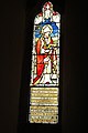
 Stained glass at St Nicholas - geograph.org.uk - 3256645.jpg 533 × 800; 89 KB
-
 Steps to the pulpit - geograph.org.uk - 3256597.jpg 533 × 800; 73 KB
-
 Swans Way - Chiltern Way Crossroads - geograph.org.uk - 51806.jpg 640 × 481; 75 KB
-
 Swyncombe Downs - geograph.org.uk - 677181.jpg 640 × 480; 120 KB
-
 Swyncombe Downs - geograph.org.uk - 677190.jpg 640 × 480; 154 KB
-

-
 Telephone box equipped with defibrillator - geograph.org.uk - 4422651.jpg 4,320 × 3,240; 5.6 MB
-
 The approaching Chilterns - geograph.org.uk - 3445627.jpg 640 × 427; 223 KB
-
 The B4009 in Britwell Salome - geograph.org.uk - 4542898.jpg 1,500 × 999; 257 KB
-
 The B4009 into Britwell Salome - geograph.org.uk - 4542896.jpg 1,500 × 999; 166 KB
-
 The B4009 through Britwell Salome - geograph.org.uk - 4542900.jpg 1,500 × 999; 173 KB
-
 The B4009 to Benson - geograph.org.uk - 4542901.jpg 1,500 × 999; 140 KB
-
 The B4009 to Benson - geograph.org.uk - 4542902.jpg 1,500 × 999; 179 KB
-
 The Chancel Arch - geograph.org.uk - 3256819.jpg 1,024 × 683; 108 KB
-
 The chancel window - geograph.org.uk - 3256648.jpg 533 × 800; 134 KB
-
 The font cover - geograph.org.uk - 3256601.jpg 533 × 800; 107 KB
-
 The Goose - geograph.org.uk - 2022383.jpg 1,843 × 1,371; 672 KB
-
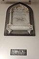 The Newton Family Memorial - geograph.org.uk - 3256641.jpg 533 × 800; 71 KB
-
 The Old Rectory - geograph.org.uk - 3255610.jpg 1,024 × 683; 255 KB
-
 The Old Rectory, Britwell Salome - geograph.org.uk - 2022322.jpg 1,903 × 1,416; 935 KB
-
 The Old Rectory, Britwell Salome - geograph.org.uk - 5418547.jpg 1,600 × 1,064; 611 KB
-
 The pastor's entrance - geograph.org.uk - 3257684.jpg 1,024 × 683; 239 KB
-
 The Red Lion, Britwell Salome - geograph.org.uk - 4422656.jpg 4,320 × 3,240; 3.77 MB
-
 The second stained glass window - geograph.org.uk - 3256646.jpg 533 × 800; 89 KB
-
 The third stained glass window - geograph.org.uk - 3256651.jpg 533 × 800; 93 KB
-
 Towards Watlington Hill - geograph.org.uk - 3445664.jpg 640 × 428; 248 KB
-
 Track round the back - geograph.org.uk - 3257854.jpg 1,024 × 683; 282 KB
-
 Turner's Green - geograph.org.uk - 3445558.jpg 640 × 464; 238 KB
-
 Turner's Green Lane, Britwell Salome - geograph.org.uk - 2331129.jpg 640 × 480; 180 KB
-
 View across fields to a mock-castle, Britwell Salome - geograph.org.uk - 5573626.jpg 1,600 × 1,064; 334 KB
-
 View from Shakespeare's Way - geograph.org.uk - 3445608.jpg 640 × 427; 214 KB
-
 View from Turner's Green Lane - geograph.org.uk - 3445535.jpg 640 × 427; 213 KB
-
 View north from Britwell Road - geograph.org.uk - 3833985.jpg 640 × 480; 93 KB
-
 Village Hall - geograph.org.uk - 1297061.jpg 640 × 480; 67 KB
-
 West Churchyard - geograph.org.uk - 3256592.jpg 1,024 × 683; 295 KB
-
 West End of St Nicholas - geograph.org.uk - 3257689.jpg 533 × 800; 133 KB
-
 Words on the window - geograph.org.uk - 3256814.jpg 533 × 800; 125 KB
-
 Bridleway, Ewelme - geograph.org.uk - 677195.jpg 640 × 480; 149 KB
-
 Britwell Hill - geograph.org.uk - 93503.jpg 640 × 481; 42 KB
-
 Britwell Salome - geograph.org.uk - 9533.jpg 640 × 427; 250 KB
-
 Coates Copse - geograph.org.uk - 52353.jpg 640 × 481; 47 KB
-
 Coates Copse from The Ridgeway - geograph.org.uk - 586579.jpg 640 × 480; 82 KB
-
 Cookley Green - geograph.org.uk - 298642.jpg 640 × 480; 146 KB
-
 Cookley Green - geograph.org.uk - 51797.jpg 640 × 481; 71 KB
-
 Ewelme Down Farm - geograph.org.uk - 138014.jpg 640 × 480; 93 KB
-
 Ewelme Downs - geograph.org.uk - 138011.jpg 640 × 480; 89 KB
-
 Farm road, Ewelme Downs - geograph.org.uk - 138012.jpg 640 × 480; 79 KB
-
 Farmland and copse, Swyncombe - geograph.org.uk - 677176.jpg 640 × 480; 128 KB
-
 Farmland, Swyncombe - geograph.org.uk - 677193.jpg 640 × 480; 100 KB
-
 Farmland, Swyncombe Downs - geograph.org.uk - 677188.jpg 640 × 480; 119 KB
-
 Farmland, Swyncombe Downs - geograph.org.uk - 677189.jpg 640 × 480; 117 KB
-
 Footpath to Ewelme - geograph.org.uk - 51809.jpg 640 × 481; 44 KB
-
 Footpath to Park Corner - geograph.org.uk - 51787.jpg 640 × 481; 40 KB
-
 Icknield Way-Ridgeway Crossing - geograph.org.uk - 93506.jpg 640 × 481; 29 KB
-
 New Plantation - geograph.org.uk - 51810.jpg 640 × 481; 47 KB
-
 Pasture, Swyncombe - geograph.org.uk - 677167.jpg 640 × 480; 125 KB
-
 Pasture, Swyncombe - geograph.org.uk - 677169.jpg 640 × 480; 122 KB
-
 Pasture, Swyncombe - geograph.org.uk - 677172.jpg 640 × 480; 132 KB
-
 Pasture, Swyncombe - geograph.org.uk - 677173.jpg 640 × 480; 151 KB
-
 Pasture, Swyncombe - geograph.org.uk - 677175.jpg 640 × 480; 128 KB
-
 Redpitts Manor Farm - geograph.org.uk - 51790.jpg 640 × 481; 71 KB
-
 Sliding Hill - geograph.org.uk - 51804.jpg 640 × 481; 51 KB
-
 Sliding Hill, Swyncombe Downs - geograph.org.uk - 138006.jpg 640 × 480; 86 KB
-
 Swyncombe Downs - geograph.org.uk - 677192.jpg 640 × 480; 138 KB
-
 The Farmhouse at Lower Farm - geograph.org.uk - 51800.jpg 640 × 481; 79 KB
-
 The outskirts of Britwell Salome - geograph.org.uk - 93508.jpg 640 × 481; 53 KB
-
 The top of Swyncombe Downs - geograph.org.uk - 138004.jpg 640 × 480; 84 KB


