Category:Brisley
Jump to navigation
Jump to search
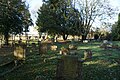
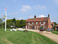
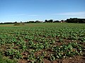
English: Brisley is a village in the English county of Norfolk located about halfway between Fakenham and East Dereham. It covers an area of and had a population of 276 in 117 households as of the
village in the United Kingdom .JPG) | |||||
| Upload media | |||||
| Instance of | |||||
|---|---|---|---|---|---|
| Location | Breckland, Norfolk, East of England, England | ||||
| Area |
| ||||
| official website | |||||
 | |||||
Subcategories
This category has the following 3 subcategories, out of 3 total.
B
- Brisley War Memorial (1 F)
Media in category "Brisley"
The following 117 files are in this category, out of 117 total.
-
 Aircrew crash memorial at Brisley - geograph.org.uk - 5587873.jpg 3,456 × 2,592; 4.01 MB
-
 Alms Cottages, Brisley - geograph.org.uk - 451676.jpg 640 × 480; 148 KB
-
 B1146 with 7 miles to Fakenham - geograph.org.uk - 5015228.jpg 1,987 × 1,338; 1.77 MB
-
 Bell public house, Brisley, Norfolk 14 06 2010.JPG 4,000 × 3,000; 2.32 MB
-
 Bilney Hall - geograph.org.uk - 505070.jpg 640 × 427; 85 KB
-
 Bridge over Panford Beck - geograph.org.uk - 523467.jpg 640 × 480; 136 KB
-
 Brisley almshouses - geograph.org.uk - 4128029.jpg 4,320 × 3,240; 2.87 MB
-
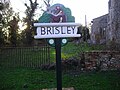
 Brisley village sign - geograph.org.uk - 4128081.jpg 4,320 × 3,240; 2.92 MB
-
 Brisley Village Sign 7th November 2007 (1).JPG 2,560 × 1,920; 954 KB
-
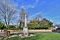 Brisley War Memorial - geograph.org.uk - 6092763.jpg 5,721 × 3,814; 6.77 MB
-
 Brisley, 'Alms Cottage', Church Street - geograph.org.uk - 6177933.jpg 6,349 × 4,232; 6.07 MB
-
 Brisley, 'Oak House, Church Street - geograph.org.uk - 6177931.jpg 6,590 × 4,394; 7.39 MB
-
 Brisley, A field of buttercups - geograph.org.uk - 6177928.jpg 6,753 × 4,502; 5.56 MB
-

-

-

-
 Brisley, St. Bartholomew's Church - geograph.org.uk - 6177630.jpg 6,067 × 4,044; 5.34 MB
-

-

-

-

-

-
 Brisley, St. Bartholomew's Church, c15th bench end 1 - geograph.org.uk - 6092777.jpg 6,528 × 4,352; 4.6 MB
-
 Brisley, St. Bartholomew's Church, c15th bench end 2 - geograph.org.uk - 6092796.jpg 7,197 × 4,797; 4.43 MB
-
 Brisley, St. Bartholomew's Church, c15th poppy head 1 - geograph.org.uk - 6092775.jpg 7,359 × 4,907; 4.52 MB
-
 Brisley, St. Bartholomew's Church, c15th poppy head 2 - geograph.org.uk - 6092776.jpg 7,181 × 4,788; 4.05 MB
-
 Brisley, St. Bartholomew's Church, c15th poppy head 3 - geograph.org.uk - 6092779.jpg 6,866 × 4,578; 4.27 MB
-
 Brisley, St. Bartholomew's Church, c15th poppy head 4 - geograph.org.uk - 6092795.jpg 7,428 × 4,952; 4.46 MB
-

-

-
 Brisley, St. Bartholomew's Church, East window 1855 (detail) - geograph.org.uk - 6180271.jpg 6,139 × 4,093; 5.74 MB
-
 Brisley, St. Bartholomew's Church, East window 1855 - geograph.org.uk - 6180268.jpg 4,680 × 7,021; 7.4 MB
-

-

-

-

-

-

-

-

-

-

-
 Brisley, St. Bartholomew's Church, Memorial brass - geograph.org.uk - 6180262.jpg 5,671 × 3,781; 5.56 MB
-

-
 Brisley, St. Bartholomew's Church, North porch east window - geograph.org.uk - 6092770.jpg 5,655 × 3,770; 6.15 MB
-
 Brisley, St. Bartholomew's Church, North western aspect - geograph.org.uk - 6092771.jpg 6,490 × 4,327; 6.85 MB
-

-
 Brisley, St. Bartholomew's Church, Roof corbel 1 - geograph.org.uk - 6092807.jpg 6,040 × 4,026; 4.23 MB
-
 Brisley, St. Bartholomew's Church, Roof corbel 2 - geograph.org.uk - 6092809.jpg 5,692 × 3,795; 2.6 MB
-
 Brisley, St. Bartholomew's Church, Roof corbel 3 - geograph.org.uk - 6092812.jpg 5,845 × 3,897; 3.22 MB
-
 Brisley, St. Bartholomew's Church, Roof detail 1 - geograph.org.uk - 6092827.jpg 7,162 × 4,774; 5.69 MB
-
 Brisley, St. Bartholomew's Church, Roof detail 2 - geograph.org.uk - 6092828.jpg 7,366 × 4,910; 5.17 MB
-

-
 Brisley, St. Bartholomew's Church, South western aspect - geograph.org.uk - 6092764.jpg 5,803 × 3,868; 7.11 MB
-
 Brisley, St. Bartholomew's Church, South western aspect - geograph.org.uk - 6177935.jpg 4,062 × 6,092; 5.43 MB
-

-

-

-
 Brisley, St. Bartholomew's Church, The altar - geograph.org.uk - 6092782.jpg 7,424 × 4,949; 5.2 MB
-
 Brisley, St. Bartholomew's Church, The c15th screen 1 - geograph.org.uk - 6092824.jpg 7,495 × 4,996; 5.82 MB
-
 Brisley, St. Bartholomew's Church, The c15th screen 2 - geograph.org.uk - 6092825.jpg 6,830 × 4,554; 4.91 MB
-

-
 Brisley, St. Bartholomew's Church, The c15th tower - geograph.org.uk - 6092768.jpg 4,309 × 6,464; 6.55 MB
-

-
 Brisley, St. Bartholomew's Church, The date on a pew - geograph.org.uk - 6092802.jpg 7,321 × 4,881; 6.43 MB
-
 Brisley, St. Bartholomew's Church, The font - geograph.org.uk - 6092774.jpg 7,602 × 5,068; 6.61 MB
-
 Brisley, St. Bartholomew's Church, The font - geograph.org.uk - 6092834.jpg 6,550 × 4,367; 4.5 MB
-
 Brisley, St. Bartholomew's Church, The font - geograph.org.uk - 6180276.jpg 4,885 × 7,326; 6.14 MB
-
 Brisley, St. Bartholomew's Church, The font cover - geograph.org.uk - 6092835.jpg 6,961 × 4,641; 4.96 MB
-
 Brisley, St. Bartholomew's Church, The nave - geograph.org.uk - 6092773.jpg 7,760 × 5,172; 7.14 MB
-
 Brisley, St. Bartholomew's Church, The screen (detail) - geograph.org.uk - 6180265.jpg 6,642 × 4,428; 7.45 MB
-

-
 Brisley, St. Bartholomew's Church, Three-decker pulpit - geograph.org.uk - 6092781.jpg 7,060 × 4,707; 6.88 MB
-
 Brisley, St. Bartholomew's Church, Three-decker pulpit - geograph.org.uk - 6092803.jpg 6,185 × 4,123; 4.29 MB
-

-
 Brisley, St. Bartholomew's Church, Window roundel - geograph.org.uk - 6092800.jpg 5,853 × 3,902; 3.05 MB
-
 Brisley, The junction of School Road and Gately Road - geograph.org.uk - 6177623.jpg 7,010 × 4,673; 6.99 MB
-
 Driveway to Old Hall Farm - geograph.org.uk - 574758.jpg 640 × 480; 64 KB
-

-
 Gateley, Farmland - geograph.org.uk - 6092181.jpg 6,258 × 4,171; 7.2 MB
-
 Gateley, Farmland - geograph.org.uk - 6092184.jpg 5,596 × 3,730; 6.48 MB
-
 Gateley, Gateley Road - geograph.org.uk - 6092185.jpg 5,095 × 3,397; 4.74 MB
-
-
 Manor Farm, Brisley Green - geograph.org.uk - 5978691.jpg 1,600 × 1,064; 790 KB
-
 Panford Beck gathers strength.jpg 480 × 640; 163 KB
-
 Pillbox on Elmham Road, Brisley Green - geograph.org.uk - 5978689.jpg 1,600 × 1,064; 925 KB
-
 Sign of The Bell public house - geograph.org.uk - 6286444.jpg 1,143 × 1,353; 105 KB
-
 St Bartholomew's church, Brisley - geograph.org.uk - 4128005.jpg 4,320 × 3,240; 2.89 MB
-
 St Bartholomew's Church, Brisley - geograph.org.uk - 5978708.jpg 1,600 × 1,064; 478 KB
-
 St Bartholomew's Church, Brisley - geograph.org.uk - 5978709.jpg 1,064 × 1,600; 572 KB
-
 St Bartholomew's Church, Brisley - geograph.org.uk - 5978710.jpg 1,089 × 1,600; 733 KB
-
 St Bartholomew's Church, Brisley - geograph.org.uk - 5978711.jpg 1,600 × 1,064; 496 KB
-
 St Bartholomew's Church, Brisley - geograph.org.uk - 5978712.jpg 1,600 × 1,064; 940 KB
-
 St Bartholomew's Church, Brisley - geograph.org.uk - 5978713.jpg 1,064 × 1,600; 713 KB
-
 The Bell Inn, Brisley Green - geograph.org.uk - 5978694.jpg 1,600 × 1,064; 768 KB
-
 The Bell public house at Brisley - geograph.org.uk - 6286443.jpg 3,600 × 2,038; 1.62 MB
-
 The Brisley Bell Inn - geograph.org.uk - 1330495.jpg 640 × 480; 103 KB
-
 The Brisley Bell pub and restaurant - geograph.org.uk - 4128096.jpg 4,320 × 3,240; 2.95 MB
-
 View NE towards The Green - geograph.org.uk - 574772.jpg 640 × 480; 91 KB
-
 View north across farmland - geograph.org.uk - 574751.jpg 640 × 480; 61 KB
-
 Village Sign - geograph.org.uk - 1269241.jpg 480 × 640; 112 KB
-
 Water tower - geograph.org.uk - 383783.jpg 480 × 640; 96 KB
-
 Where the B1145 becomes the B1146 - geograph.org.uk - 4562253.jpg 640 × 480; 123 KB
-
 WW1 ^ 2 war memorial - geograph.org.uk - 5971439.jpg 948 × 1,600; 466 KB
-
 WW2 pillbox, Brisley - geograph.org.uk - 4128116.jpg 4,320 × 3,240; 3.67 MB
-
 A perfectly round pond - geograph.org.uk - 574755.jpg 640 × 480; 95 KB
-
 Black Water from East Bilney Bridge - geograph.org.uk - 588315.jpg 640 × 425; 115 KB
-
 Black Water from East Bilney Bridge - geograph.org.uk - 588330.jpg 425 × 640; 112 KB
-
 Field boundary at Brisley - geograph.org.uk - 505036.jpg 640 × 427; 95 KB
-
 Footpath to Brisley. - geograph.org.uk - 505064.jpg 427 × 640; 111 KB
-
 Footpath to Broom Hill - geograph.org.uk - 574765.jpg 480 × 640; 105 KB
-

-
 Harper's Green pumping station - geograph.org.uk - 504991.jpg 640 × 427; 67 KB
-
 Heading south on Fludge's Lane - geograph.org.uk - 574757.jpg 640 × 480; 47 KB
-
 Old Hall Farm - geograph.org.uk - 574760.jpg 640 × 480; 79 KB
-
 Park Farm near Great Heath - geograph.org.uk - 525313.jpg 640 × 460; 50 KB
-
 Restricted Byway to Bilney Common - geograph.org.uk - 574749.jpg 480 × 640; 101 KB


_-_geograph.org.uk_-_6180271.jpg)


_brass_-_geograph.org.uk_-_6180259.jpg)


_-_geograph.org.uk_-_6180265.jpg)


