Category:Brinscall
Jump to navigation
Jump to search
English: Brinscall is a village in the borough of Chorley, Lancashire, England. Located approximately five miles north-east of Chorley, Brinscall borders the similar-sized villages of Withnell and Abbey Village. Brinscall is part of the civil parish of Withnell but does not have its own boundaries. However, an area used in the 2001 census that covers approximately the same area as the village has a population of 1,431.
village in Lancashire, United Kingdom  | |||||
| Upload media | |||||
| Instance of | |||||
|---|---|---|---|---|---|
| Location | Withnell, Chorley, Lancashire, North West England, England | ||||
 | |||||
Media in category "Brinscall"
The following 58 files are in this category, out of 58 total.
-

-
 Dean Brook - White Coppice Geology Trail - geograph.org.uk - 197174.jpg 640 × 480; 196 KB
-
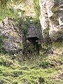 Lead Mine Opening - geograph.org.uk - 197201.jpg 480 × 640; 300 KB
-
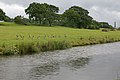
 Leeds-Liverpool canal - geograph.org.uk - 74910.jpg 640 × 480; 119 KB
-
 Site of Brinscall Station - geograph.org.uk - 1909066.jpg 640 × 380; 112 KB
-
 The Old Bank, Brinscall.jpg 4,256 × 2,832; 6.68 MB
-
 THe Old Bank, Brinscall.jpg 4,256 × 2,832; 7.93 MB
-
 Wheelton plantation - geograph.org.uk - 923251.jpg 422 × 640; 160 KB
-
 White Coppice - geograph.org.uk - 197237.jpg 640 × 480; 204 KB
-
 White coppice moors - panoramio - jim walton (4).jpg 1,000 × 652; 218 KB
-
 Anglezarke Moor - geograph.org.uk - 225728.jpg 640 × 480; 66 KB
-
 Anglezarke Moor - geograph.org.uk - 475405.jpg 640 × 426; 318 KB
-
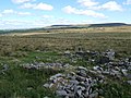
 Bell Pits on Wheelton Moor - geograph.org.uk - 197231.jpg 640 × 480; 217 KB
-
 Black Brook - geograph.org.uk - 303638.jpg 640 × 426; 160 KB
-
 Black Coppice Quarry - geograph.org.uk - 197147.jpg 640 × 480; 246 KB
-
 Blocks of Fletcher Moss Grit - geograph.org.uk - 197148.jpg 640 × 502; 258 KB
-
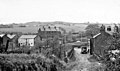
 Brinscall - geograph.org.uk - 73319.jpg 640 × 480; 170 KB
-

-
 Cotton Grass on Anglezarke Moor - geograph.org.uk - 475414.jpg 640 × 426; 370 KB
-
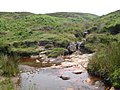
 Dean Brook - geograph.org.uk - 197182.jpg 640 × 480; 197 KB
-
 Dean Brook - geograph.org.uk - 197208.jpg 640 × 480; 180 KB
-
 Dean Brook - geograph.org.uk - 197220.jpg 640 × 480; 210 KB
-
 Dick Lane, Brinscall - geograph.org.uk - 72140.jpg 640 × 480; 193 KB
-
 Drinkwaters and Great Hill - geograph.org.uk - 303680.jpg 640 × 480; 76 KB
-
-
 Grimes - geograph.org.uk - 478858.jpg 640 × 426; 340 KB
-
 Grouse Butt on Heapey Moor - geograph.org.uk - 477594.jpg 640 × 426; 316 KB
-
 Harbour Lane, near Wheelton - geograph.org.uk - 131062.jpg 640 × 480; 147 KB
-
 Hillside Methodist Church, Brinscall - geograph.org.uk - 508374.jpg 640 × 480; 174 KB
-
 Lightning Tree - geograph.org.uk - 197185.jpg 480 × 640; 129 KB
-
 Limestone Brook - geograph.org.uk - 225722.jpg 640 × 480; 79 KB
-
 Lone tree on Withnell Moor - geograph.org.uk - 225022.jpg 640 × 480; 105 KB
-
 Railway Bridge, Brinscall - geograph.org.uk - 525721.jpg 640 × 480; 141 KB
-
 Railway Road, Brinscall - geograph.org.uk - 71616.jpg 480 × 640; 100 KB
-
 Railway Road, Brinscall - geograph.org.uk - 71620.jpg 480 × 640; 99 KB
-
 Ramblers Association Footpath Sign - geograph.org.uk - 197233.jpg 640 × 480; 210 KB
-
 Ratten Clough - geograph.org.uk - 477597.jpg 640 × 423; 328 KB
-
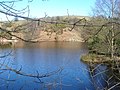 Reservoir on The Lowe, White Coppice - geograph.org.uk - 131038.jpg 640 × 480; 124 KB
-
 River cliff on Dean Brook - geograph.org.uk - 197214.jpg 640 × 480; 280 KB
-
 River Goit from a bridge at White Coppice - geograph.org.uk - 131048.jpg 480 × 640; 129 KB
-
 Road on Withnell Moor - geograph.org.uk - 225025.jpg 640 × 480; 110 KB
-
 Round Loaf - geograph.org.uk - 303599.jpg 640 × 426; 136 KB
-
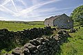
 Ruined farmhouse - geograph.org.uk - 224985.jpg 640 × 480; 103 KB
-
 Ruined farmhouse on Withnell Moor - geograph.org.uk - 225003.jpg 640 × 480; 106 KB
-
 Ruins of Calico Hall - geograph.org.uk - 477592.jpg 640 × 426; 365 KB
-
 Ruins of Drinkwaters Farm - geograph.org.uk - 475624.jpg 640 × 426; 405 KB
-
 Ruins of Solomon's Temple - geograph.org.uk - 477600.jpg 640 × 426; 320 KB
-
 Shale exposure - geograph.org.uk - 197216.jpg 640 × 480; 341 KB
-
 Small pond on Wheelton Moor - geograph.org.uk - 478805.jpg 426 × 640; 309 KB
-
 Stream coming down to feed The Goit - geograph.org.uk - 131052.jpg 640 × 480; 126 KB
-
 The track to Butterworth Brow - geograph.org.uk - 477604.jpg 640 × 426; 427 KB
-
 Tributary Joins Dean Brook - geograph.org.uk - 197191.jpg 640 × 480; 218 KB
-
-
 Wheelton Moor - geograph.org.uk - 71643.jpg 480 × 640; 125 KB
-
 Wheelton Plantation - geograph.org.uk - 131072.jpg 480 × 640; 156 KB
-
 White Coppice Quarry - geograph.org.uk - 197239.jpg 640 × 480; 95 KB
-
 Windy Harbour Farm and Mast - geograph.org.uk - 131067.jpg 480 × 640; 70 KB
-
 Withnell Moor Public Footpath - geograph.org.uk - 224993.jpg 640 × 480; 94 KB


.jpg)


