Category:Brinklow
Jump to navigation
Jump to search
village and civil parish in Warwickshire, United Kingdom  Motte castrale de Brinklow | |||||
| Upload media | |||||
| Instance of | |||||
|---|---|---|---|---|---|
| Location | Rugby, Warwickshire, West Midlands, England | ||||
| Population |
| ||||
| Area |
| ||||
 | |||||
Subcategories
This category has the following 2 subcategories, out of 2 total.
C
- Brinklow Castle (8 F)
J
- St John the Baptist's, Brinklow (14 F)
Media in category "Brinklow"
The following 199 files are in this category, out of 199 total.
-
 'Rosette' at Stretton Stop - geograph.org.uk - 4954699.jpg 1,280 × 851; 413 KB
-
 45287 passes Stretton Stop, 1964 - geograph.org.uk - 3917272.jpg 640 × 428; 102 KB
-
 45493 passes Stretton Stop - geograph.org.uk - 1609080.jpg 640 × 427; 82 KB
-

-
 All Oaks Wood - geograph.org.uk - 605496.jpg 640 × 480; 108 KB
-
 B4029 towards Shilton - geograph.org.uk - 5219211.jpg 640 × 480; 101 KB
-
 B4428 Lutterworth Road towards Brinklow - geograph.org.uk - 4489849.jpg 1,024 × 811; 304 KB
-
 B4455 Fosse Way heading north - geograph.org.uk - 6238164.jpg 1,024 × 684; 324 KB
-
 Boats on the Oxford Canal near Stretton Stop - geograph.org.uk - 4473781.jpg 1,024 × 831; 272 KB
-
 Boatyard shed at Stretton - geograph.org.uk - 5045971.jpg 640 × 427; 78 KB
-
 Bretford - geograph.org.uk - 33680.jpg 640 × 480; 132 KB
-
 Bridge 30, Fosse Way Road Bridge - geograph.org.uk - 4473926.jpg 1,024 × 813; 315 KB
-
 Bridge 32 along the Oxford Canal - geograph.org.uk - 4474023.jpg 1,024 × 732; 445 KB
-
 Bridge 32 along the Oxford Canal - geograph.org.uk - 4474031.jpg 1,024 × 768; 373 KB
-
 Bridge 32 along the Oxford Canal - geograph.org.uk - 4474034.jpg 768 × 1,024; 238 KB
-
 Bridge 34, Easenhall Lane Bridge - geograph.org.uk - 4474049.jpg 1,024 × 768; 249 KB
-

-

-
 Bridge ^30 Fosse Way, Oxford Canal - geograph.org.uk - 6251438.jpg 1,600 × 1,065; 887 KB
-
 Bridge ^34 Brinklow Road, Oxford Canal - geograph.org.uk - 6251443.jpg 1,600 × 1,065; 791 KB
-
 Bridges across Smeaton Lane - geograph.org.uk - 4173754.jpg 1,284 × 1,600; 753 KB
-
 Bridges in Smeaton Lane - geograph.org.uk - 5453168.jpg 1,600 × 900; 524 KB
-
 Bridleway to Bretford - geograph.org.uk - 5154687.jpg 1,280 × 851; 599 KB
-
 Bridleway to Bretford - geograph.org.uk - 5154692.jpg 1,280 × 851; 602 KB
-

-
 Brinklow - geograph.org.uk - 459325.jpg 640 × 480; 170 KB
-
 Brinklow -Rugby Road - geograph.org.uk - 798103.jpg 640 × 480; 78 KB
-
 Brinklow Arches - geograph.org.uk - 2957901.jpg 640 × 480; 93 KB
-
 Brinklow Arm, Oxford Canal - geograph.org.uk - 3276403.jpg 1,280 × 856; 520 KB
-
 Brinklow Arm, Oxford Canal - geograph.org.uk - 3276426.jpg 1,280 × 856; 371 KB
-
 Brinklow Cemetery - geograph.org.uk - 798096.jpg 640 × 480; 128 KB
-
 Brinklow Church Room - geograph.org.uk - 803563.jpg 640 × 480; 70 KB
-
 Brinklow Community Hall - geograph.org.uk - 5142441.jpg 1,024 × 768; 162 KB
-
 Brinklow Cutting, Oxford Canal - geograph.org.uk - 3276433.jpg 1,280 × 856; 367 KB
-
 Brinklow Farmland - geograph.org.uk - 2961079.jpg 640 × 480; 124 KB
-
 Brinklow FC Reserves (11948581325).jpg 2,273 × 1,749; 3.57 MB
-
 Brinklow FC Reserves (11948898943).jpg 2,429 × 1,824; 3.04 MB
-
 Brinklow FC Reserves (11948902203).jpg 1,338 × 1,308; 1.49 MB
-
 Brinklow FC Reserves (11949422896).jpg 2,168 × 1,383; 2.51 MB
-
 Brinklow FC Reserves (11949432316).jpg 2,429 × 1,824; 3.54 MB
-
 Brinklow fire station - geograph.org.uk - 288317.jpg 640 × 427; 193 KB
-
 Brinklow Heath - geograph.org.uk - 5153100.jpg 1,280 × 851; 439 KB
-
 Brinklow Heath - geograph.org.uk - 813446.jpg 640 × 480; 137 KB
-
 Brinklow Heath - geograph.org.uk - 814533.jpg 640 × 480; 110 KB
-
 Brinklow high st 6y07.JPG 2,592 × 1,944; 2.45 MB
-
 Brinklow Post Office - geograph.org.uk - 794208.jpg 640 × 480; 65 KB
-
 Brinklow Post Office, Broad Street - geograph.org.uk - 2080054.jpg 640 × 480; 76 KB
-
 Brinklow Pumping Station - geograph.org.uk - 2973897.jpg 640 × 480; 99 KB
-
 Brinklow Quarry - geograph.org.uk - 794188.jpg 640 × 480; 50 KB
-
 Brinklow Road heading east - geograph.org.uk - 3155647.jpg 640 × 480; 56 KB
-
 Brinklow Station site of 1909050 ee557af2.jpg 640 × 344; 111 KB
-

-
 Brinklow, UK - panoramio (1).jpg 5,472 × 3,648; 9.53 MB
-
 Brinklow, UK - panoramio.jpg 5,472 × 3,648; 12.36 MB
-
 Brinklow-Broad Street - geograph.org.uk - 794201.jpg 640 × 480; 78 KB
-
 Brinklow-Bull's Head - geograph.org.uk - 814513.jpg 640 × 480; 70 KB
-
 Brinklow-Coventry Road - geograph.org.uk - 798098.jpg 640 × 480; 70 KB
-
 Brinklow-Coventry Way - geograph.org.uk - 820552.jpg 640 × 480; 109 KB
-
 Brinklow-Fosse Way - geograph.org.uk - 814023.jpg 640 × 480; 77 KB
-
 Brinklow-Heath Lane - geograph.org.uk - 813999.jpg 640 × 480; 93 KB
-
 Brinklow-Oxford Canal - geograph.org.uk - 2794438.jpg 640 × 480; 120 KB
-
 Brinklow-Oxford Canal - geograph.org.uk - 2794450.jpg 640 × 480; 115 KB
-
 Brinklow-Oxford Canal - geograph.org.uk - 2956389.jpg 640 × 480; 124 KB
-
 Brinklow-Oxford Canal - geograph.org.uk - 2961043.jpg 640 × 480; 83 KB
-
 Brinklow-Oxford Canal - geograph.org.uk - 798091.jpg 640 × 480; 71 KB
-
 Brinklow-Oxford Canal - geograph.org.uk - 803590.jpg 640 × 480; 88 KB
-
 Brinklow-Rugby Road - geograph.org.uk - 3833268.jpg 1,024 × 768; 126 KB
-
 Brinklow-Smite Brook - geograph.org.uk - 803582.jpg 640 × 480; 118 KB
-
 Brinklow-The Crescent - geograph.org.uk - 798095.jpg 640 × 480; 88 KB
-
 Brinklow-The Raven - geograph.org.uk - 803613.jpg 640 × 480; 45 KB
-
 Brinklow-West Coast Mainline - geograph.org.uk - 803600.jpg 640 × 480; 80 KB
-
 Brinklow-Wood Hill - geograph.org.uk - 794161.jpg 640 × 480; 89 KB
-
 Broad Street, Brinklow - geograph.org.uk - 4591423.jpg 1,920 × 1,134; 463 KB
-
 Chapel, Chinese and Chippy, Brinklow - geograph.org.uk - 48152.jpg 640 × 480; 89 KB
-
 Cottage, Broad Street, Brinklow - geograph.org.uk - 5142679.jpg 1,024 × 768; 236 KB
-
 Cottages, Broad Street, Brinklow - geograph.org.uk - 5142438.jpg 1,024 × 768; 161 KB
-

-

-
 Easenhall Lane Bridge (no 34), from the south - geograph.org.uk - 5612645.jpg 1,024 × 768; 205 KB
-

-
 Easenhall Lane Bridge, Oxford Canal - geograph.org.uk - 3276407.jpg 856 × 1,280; 426 KB
-
 Easenhall Lane Bridge, Oxford Canal - geograph.org.uk - 3276450.jpg 1,280 × 856; 413 KB
-
 Elm Tree Hill - geograph.org.uk - 5618306.jpg 1,600 × 900; 460 KB
-
 Entrance to the Brinklow Arm in Warwickshire - geograph.org.uk - 5726162.jpg 1,280 × 900; 1.54 MB
-
 Farmland near Brinklow - geograph.org.uk - 5152006.jpg 1,280 × 851; 400 KB
-
 Farmland near Brinklow - geograph.org.uk - 5154179.jpg 851 × 1,280; 646 KB
-
 Farmland near Brinklow - geograph.org.uk - 5154690.jpg 1,280 × 851; 308 KB
-
 Farmland off Ell Lane - geograph.org.uk - 3155642.jpg 640 × 480; 75 KB
-
 Farmland south of Brinklow - geograph.org.uk - 3276393.jpg 1,280 × 856; 317 KB
-
 Farmland, Brinklow - geograph.org.uk - 3155628.jpg 640 × 480; 79 KB
-
 Farmyard clutter, Brinklow - geograph.org.uk - 5120667.jpg 1,024 × 768; 184 KB
-
 Field edge near Brinklow - geograph.org.uk - 5120665.jpg 1,024 × 768; 188 KB
-
 Field entrance off Ell Lane - geograph.org.uk - 3155656.jpg 640 × 480; 92 KB
-
 Field on Smeaton Lane, Brinklow - geograph.org.uk - 1613206.jpg 640 × 480; 114 KB
-

-
 Footpath to Brinklow - geograph.org.uk - 5154197.jpg 1,280 × 851; 466 KB
-
 Fosse Way - Bretford - geograph.org.uk - 38491.jpg 640 × 480; 91 KB
-
 Fosse Way at Kings Newnham turn - geograph.org.uk - 2080048.jpg 640 × 480; 52 KB
-
 Grass field and the Motte, Brinklow - geograph.org.uk - 5142344.jpg 1,024 × 723; 211 KB
-
 Grazing off Lutterworth Road - geograph.org.uk - 3155660.jpg 640 × 480; 118 KB
-
 Grazing off the B4029 - geograph.org.uk - 5219208.jpg 640 × 480; 61 KB
-
 Heath Lane - geograph.org.uk - 4732800.jpg 640 × 480; 40 KB
-
 Heath Lane - geograph.org.uk - 5503795.jpg 1,600 × 900; 623 KB
-
 Heath Lane - geograph.org.uk - 5503798.jpg 1,600 × 900; 411 KB
-
 Heath Lane - geograph.org.uk - 5605988.jpg 640 × 480; 53 KB
-
 Heath Lane, Brinklow - geograph.org.uk - 5154154.jpg 1,280 × 851; 601 KB
-
 High Wood - geograph.org.uk - 59307.jpg 640 × 480; 261 KB
-
 Houses in Brinklow - geograph.org.uk - 4591370.jpg 1,920 × 1,463; 588 KB
-
 Houses in Brinklow - geograph.org.uk - 4591403.jpg 1,920 × 1,176; 372 KB
-
 Houses in Brinklow - geograph.org.uk - 5142396.jpg 1,024 × 768; 170 KB
-
 Houses in The Crescent, Brinklow - geograph.org.uk - 5142705.jpg 1,024 × 768; 185 KB
-
 Houses, Broad Street, Brinklow - geograph.org.uk - 5142430.jpg 1,024 × 768; 176 KB
-
 Hungerfield - geograph.org.uk - 457540.jpg 640 × 480; 98 KB
-
 Hungerfield - geograph.org.uk - 459335.jpg 640 × 480; 131 KB
-

-

-
 Looking back at Stretton Stop - geograph.org.uk - 5045973.jpg 640 × 427; 86 KB
-
 Lutterworth Road (B4428) - geograph.org.uk - 3155665.jpg 640 × 480; 101 KB
-

-
 Mallard and ducklings - geograph.org.uk - 4473798.jpg 1,024 × 571; 194 KB
-
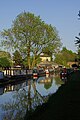
 Moored narrow boats on the Oxford Canal - geograph.org.uk - 59351.jpg 640 × 480; 250 KB
-

-
 Motte and bailey, Brinklow - geograph.org.uk - 5142326.jpg 1,024 × 768; 221 KB
-
 Motte, Brinklow - geograph.org.uk - 5142330.jpg 1,024 × 768; 187 KB
-
 Narrowboats along the Oxford Canal - geograph.org.uk - 4473999.jpg 1,024 × 768; 337 KB
-
 Narrowboats at Stretton Stop - geograph.org.uk - 4957791.jpg 1,280 × 851; 585 KB
-
 Narrowboats east of Brinklow in Warwickshire - geograph.org.uk - 5726185.jpg 1,280 × 878; 1.48 MB
-
 Narrowboats moored along the Oxford Canal - geograph.org.uk - 4474081.jpg 1,024 × 844; 298 KB
-
 Narrowboats moored on the Oxford Canal - geograph.org.uk - 4173786.jpg 1,600 × 1,269; 668 KB
-

-

-
 Newnham Grounds - geograph.org.uk - 59346.jpg 640 × 480; 197 KB
-
 North on Broad Street, Brinklow - geograph.org.uk - 5020537.jpg 640 × 480; 67 KB
-
 Old route of Fosse Way, Bretford - geograph.org.uk - 38494.jpg 640 × 480; 62 KB
-
 Oxford Canal - geograph.org.uk - 3110483.jpg 2,041 × 1,340; 995 KB
-
 Oxford Canal Aqueduct - geograph.org.uk - 2590174.jpg 640 × 480; 89 KB
-
 Oxford Canal Bridge 43 - geograph.org.uk - 2067275.jpg 640 × 359; 104 KB
-
 Oxford Canal enters wooded cutting - geograph.org.uk - 3460956.jpg 1,000 × 1,333; 1.4 MB
-
 Oxford Canal near Brinklow Arches - geograph.org.uk - 5046077.jpg 640 × 427; 93 KB
-
 Oxford Canal Walk - geograph.org.uk - 5207766.jpg 640 × 480; 93 KB
-
 Oxford Canal Walk - geograph.org.uk - 5207780.jpg 640 × 480; 99 KB
-
 Oxford Canal Walk - geograph.org.uk - 5207790.jpg 640 × 480; 69 KB
-
 Oxford Canal, 1984 - geograph.org.uk - 3485801.jpg 428 × 640; 118 KB
-

-

-

-
 Oxford Canal, Brinklow cutting - geograph.org.uk - 3153505.jpg 640 × 480; 89 KB
-
 Oxford Canal, near Brinklow - geograph.org.uk - 3276387.jpg 1,280 × 856; 412 KB
-
 Oxford Canal, near Stretton Stop - geograph.org.uk - 2721591.jpg 1,280 × 856; 196 KB
-
 Oxford Canal, Reach near Brinklow - geograph.org.uk - 3153423.jpg 640 × 480; 75 KB
-
 Oxford Canal, Stretton Stop - geograph.org.uk - 2720870.jpg 1,280 × 856; 122 KB
-
 Rugby Road, Brinklow - geograph.org.uk - 3155635.jpg 640 × 480; 87 KB
-
 Rural road junction - geograph.org.uk - 5618308.jpg 1,600 × 900; 369 KB
-

-

-

-
 Stretton Stop - geograph.org.uk - 2067266.jpg 640 × 386; 84 KB
-
 Stretton Stop - geograph.org.uk - 4954826.jpg 1,280 × 851; 417 KB
-
 Stretton Stop - geograph.org.uk - 4956250.jpg 851 × 1,280; 412 KB
-
 Stretton Stop along the Oxford Canal - geograph.org.uk - 4173771.jpg 1,600 × 1,268; 937 KB
-
 Stretton Stop along the Oxford Canal - geograph.org.uk - 4473833.jpg 1,024 × 660; 153 KB
-
 Stretton Stop, Brinklow - geograph.org.uk - 2266432.jpg 394 × 640; 44 KB
-
 Stretton Stop, Oxford Canal - geograph.org.uk - 2720638.jpg 1,280 × 856; 158 KB
-
 Swing footbridge at Stretton Wharf - geograph.org.uk - 5175044.jpg 4,149 × 2,318; 5.41 MB
-
 Thatched Cottage, Brinklow - geograph.org.uk - 48154.jpg 640 × 480; 104 KB
-
 The Brinklow cutting along the Oxford Canal - geograph.org.uk - 4474042.jpg 1,024 × 695; 296 KB
-
 The Coventry Way - geograph.org.uk - 5605990.jpg 640 × 480; 36 KB
-
 The Crescent, Brinklow - geograph.org.uk - 625626.jpg 640 × 428; 135 KB
-
 The Crescent, Brinklow - geograph.org.uk - 825877.jpg 640 × 427; 120 KB
-
 The Grange - geograph.org.uk - 5219214.jpg 640 × 480; 58 KB
-
 The Oxford canal - geograph.org.uk - 5503801.jpg 1,600 × 900; 474 KB
-
 The Oxford Canal near Brinklow - geograph.org.uk - 59348.jpg 640 × 480; 283 KB
-
 The Raven, Brinklow - geograph.org.uk - 625595.jpg 640 × 428; 80 KB
-

-
 The Thatch, The Crescent, Brinklow - geograph.org.uk - 825972.jpg 640 × 427; 106 KB
-
 The White Lion in Brinklow - geograph.org.uk - 4489832.jpg 1,024 × 815; 220 KB
-
 The White Lion, Brinklow - geograph.org.uk - 6238170.jpg 1,024 × 684; 271 KB
-
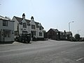
 The White Lion, Brinklow - geograph.org.uk - 625572.jpg 640 × 426; 95 KB
-

-

-

-
 View from near East Lodge - geograph.org.uk - 59305.jpg 640 × 480; 245 KB
-
 View from the bailey of Brinklow Castle - geograph.org.uk - 5142701.jpg 1,024 × 768; 208 KB
-
 War Memorial, Brinklow - geograph.org.uk - 5142362.jpg 768 × 1,024; 280 KB
-
 Willow Farm Equestrian Centre - geograph.org.uk - 392065.jpg 640 × 427; 51 KB
-
 19-27 The Crescent, Brinklow - geograph.org.uk - 825898.jpg 640 × 427; 123 KB
-
 31 The Crescent, Brinklow - geograph.org.uk - 825957.jpg 640 × 479; 103 KB
-
 Bailey and church - geograph.org.uk - 329501.jpg 640 × 480; 94 KB
-
 Bretford - geograph.org.uk - 38487.jpg 640 × 480; 74 KB
-
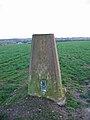 Bretford triangulation station - geograph.org.uk - 332727.jpg 480 × 640; 76 KB
-
 Brinklow - geograph.org.uk - 48148.jpg 640 × 480; 81 KB
-
 Broad Street, Brinklow - geograph.org.uk - 48153.jpg 640 × 480; 96 KB
-
 Bull's Head, Brinklow - geograph.org.uk - 48150.jpg 640 × 480; 78 KB
-
 Cottage Farm, near Brinklow - geograph.org.uk - 48147.jpg 640 × 480; 82 KB
-
 East Lodge - geograph.org.uk - 59301.jpg 640 × 480; 266 KB
-
 East of Brinklow - geograph.org.uk - 329562.jpg 640 × 480; 95 KB
-
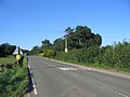 Fosse Way near Brinklow - geograph.org.uk - 48157.jpg 640 × 480; 86 KB
-
 Look, Rugby^ - geograph.org.uk - 329481.jpg 640 × 480; 94 KB
-
 The Grange - geograph.org.uk - 59344.jpg 640 × 480; 234 KB


,_Warwickshire_-_geograph.org.uk_-_5725984.jpg)
,_Warwickshire_-_geograph.org.uk_-_5726157.jpg)


.jpg)
.jpg)
.jpg)
.jpg)
.jpg)


.jpg)


,_from_the_south_-_geograph.org.uk_-_5612645.jpg)


_-_geograph.org.uk_-_3155665.jpg)


