Category:Brimpsfield
Jump to navigation
Jump to search
village in the United Kingdom _(29856658892).jpg) Eglwys Sant Mihangel, Brimpsfield | |||||
| Upload media | |||||
| Instance of | |||||
|---|---|---|---|---|---|
| Location | Cotswold, Gloucestershire, South West England, England | ||||
 | |||||
Subcategories
This category has the following 5 subcategories, out of 5 total.
B
- Brimpsfield Castle (7 F)
- Brimpsfield War Memorial (3 F)
C
- Caudle Green (21 F)
G
- Golden Heart Inn, Nettleton (5 F)
Media in category "Brimpsfield"
The following 110 files are in this category, out of 110 total.
-

-
 A boggy woodland bottom in Barn Wood - geograph.org.uk - 5071200.jpg 3,648 × 2,048; 3.32 MB
-
 A field of ripe cereal crop - geograph.org.uk - 5071170.jpg 3,648 × 2,048; 2.32 MB
-
 A secluded valley below Caudle Green - geograph.org.uk - 5071125.jpg 3,648 × 2,048; 2.55 MB
-
 A small stream in Moorhouse Bank Wood - geograph.org.uk - 5071207.jpg 3,648 × 2,048; 2.64 MB
-
 A417 - let's play "spot the hazard" - geograph.org.uk - 2091417.jpg 640 × 480; 76 KB
-

-
 A417 approaching Golden Heart Inn - geograph.org.uk - 4743161.jpg 640 × 450; 136 KB
-
 A417 approaching Granny's Pumps - geograph.org.uk - 4743295.jpg 640 × 465; 117 KB
-
 A417 approaching roundabout - geograph.org.uk - 3684981.jpg 2,194 × 1,386; 1.59 MB
-
 A417 at Nettleton village boundary - geograph.org.uk - 4242182.jpg 640 × 480; 99 KB
-
 A417 at Stockwell turn - geograph.org.uk - 4242185.jpg 640 × 481; 53 KB
-
 A417 at the Stockwell turn - geograph.org.uk - 2091428.jpg 640 × 480; 62 KB
-
 A417 crossing the bridleway - geograph.org.uk - 2766464.jpg 2,048 × 1,536; 594 KB
-
 A417 entering Nettleton - geograph.org.uk - 3684983.jpg 2,289 × 1,470; 2.08 MB
-
 A417 in Highgate Farm cutting - geograph.org.uk - 2091376.jpg 640 × 480; 45 KB
-
 A417 junction to Stockwell and Parking area - geograph.org.uk - 3684985.jpg 2,352 × 1,459; 1.66 MB
-

-
 A417 nearing the Birdlip bottleneck - geograph.org.uk - 2091387.jpg 640 × 480; 54 KB
-

-

-
 A417, The Golden Heart Inn at Nettleton - geograph.org.uk - 3410144.jpg 640 × 480; 471 KB
-
 Access land at Groveridge Hill - geograph.org.uk - 3769017.jpg 800 × 450; 233 KB
-

-
 Approaching Brimpsfield - geograph.org.uk - 3770191.jpg 800 × 450; 229 KB
-
 Arable land near Sidelands - geograph.org.uk - 3770150.jpg 800 × 600; 320 KB
-
 Barn, Moor House Farm - geograph.org.uk - 2227726.jpg 640 × 480; 52 KB
-
 Bridleway to Blacklains - geograph.org.uk - 3770155.jpg 800 × 600; 309 KB
-
 Bridleway, Climperwell - geograph.org.uk - 2227826.jpg 640 × 480; 90 KB
-
 Brime's field^ - Brimpsfield, Gloucestershire - geograph.org.uk - 5231843.jpg 3,072 × 2,304; 1.28 MB
-
 Brimpsfield Saint Michael ^ All Angels, Gloucestershire - geograph.org.uk - 5025149.jpg 2,304 × 1,728; 895 KB
-
 Brimpsfield Saint Michael ^ All Angels, Gloucestershire - geograph.org.uk - 5025153.jpg 1,728 × 2,304; 864 KB
-
 Brimpsfield, Gloucestershire - geograph.org.uk - 3770183.jpg 800 × 600; 308 KB
-
 Buckholt Road, south of Birdlip - geograph.org.uk - 2783020.jpg 640 × 480; 146 KB
-
 Buckle Wood, the B4070 - geograph.org.uk - 2440879.jpg 1,024 × 768; 281 KB
-
 Buckle Wood, the B4070 - geograph.org.uk - 2440880.jpg 1,024 × 768; 285 KB
-
 Climperwell Cottage - geograph.org.uk - 2227816.jpg 640 × 480; 73 KB
-
 Complicated junction - geograph.org.uk - 2766449.jpg 2,048 × 1,536; 648 KB
-
 Cotswold bus stop - Brimpsfield, Gloucestershire - geograph.org.uk - 5231838.jpg 3,072 × 2,304; 2.69 MB
-
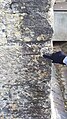
 Cotswold dry stone wall - geograph.org.uk - 3770659.jpg 800 × 450; 237 KB
-
 Cotswold signpost - geograph.org.uk - 3770651.jpg 800 × 450; 235 KB
-
 Double bends -Brimpsfield, Gloucestershire - geograph.org.uk - 5231458.jpg 3,072 × 2,304; 2.38 MB
-
 Eastbound A417 approaching Nettleton - geograph.org.uk - 3410130.jpg 640 × 480; 399 KB
-
 Footbridge over a small stream - geograph.org.uk - 5070884.jpg 3,648 × 2,048; 3.29 MB
-
 Footpath into Poston Wood - geograph.org.uk - 3770675.jpg 800 × 450; 249 KB
-
 Footpath near Birdlip - geograph.org.uk - 3633862.jpg 640 × 480; 135 KB
-
 Footpath to Cowley - geograph.org.uk - 5490598.jpg 1,024 × 768; 249 KB
-
 Footpath to Eddington - geograph.org.uk - 3769163.jpg 800 × 600; 372 KB
-
 Footpath to Moor House - geograph.org.uk - 3770654.jpg 800 × 450; 261 KB
-
 Footpath to Stoneyhill Farm - geograph.org.uk - 3769152.jpg 800 × 450; 241 KB
-
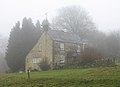
 Georgian Cotswold house (geograph 7373613).jpg 1,600 × 1,069; 455 KB
-
 Grand entrance to Cranham Lodge Sawmills - geograph.org.uk - 3835985.jpg 800 × 600; 249 KB
-
 Grass field and houses near Birdlip - geograph.org.uk - 5497423.jpg 1,024 × 788; 205 KB
-
 Grassy hillside adjacent to footpath - geograph.org.uk - 5070892.jpg 3,648 × 2,048; 2.32 MB
-
 Grey Cotswold buildings - geograph.org.uk - 3770160.jpg 800 × 455; 221 KB
-
 Highgate Farm - geograph.org.uk - 3696889.jpg 4,364 × 1,608; 1.51 MB
-
 Horse, near Sidelands Farm, Birdlip - geograph.org.uk - 3633784.jpg 640 × 480; 93 KB
-
 Horses, near Sidelands Farm, Birdlip - geograph.org.uk - 3633855.jpg 640 × 480; 108 KB
-
 House in Brimpsfield - geograph.org.uk - 584593.jpg 640 × 426; 119 KB
-
 Ice on pond, River Frome - geograph.org.uk - 2227093.jpg 640 × 480; 77 KB
-
 Junction for Stockwell from A417 - geograph.org.uk - 3274679.jpg 1,024 × 768; 519 KB
-

-
 Lane at Climperwell - geograph.org.uk - 2227760.jpg 640 × 480; 93 KB
-
 Lay by opposite Cowley turning - geograph.org.uk - 4743154.jpg 640 × 415; 100 KB
-
 Moor House Farm - geograph.org.uk - 2227742.jpg 640 × 465; 48 KB
-
 Near the now-vanished Cranham Lodge - geograph.org.uk - 2239871.jpg 1,440 × 1,080; 721 KB
-
 Nettleton - geograph.org.uk - 3690226.jpg 3,492 × 2,544; 1.63 MB
-
 Ordnance Survey Bench Mark - geograph.org.uk - 6390784.jpg 576 × 1,024; 284 KB
-
 Ornamental lake and wildlife resource - geograph.org.uk - 5070806.jpg 3,648 × 2,048; 3.01 MB
-
 Pastoral view to Blacklains Farm - geograph.org.uk - 3770145.jpg 800 × 600; 347 KB
-
 Path in Witcombe Woods - geograph.org.uk - 3835988.jpg 800 × 561; 250 KB
-
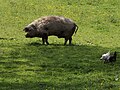 Pigs on Brimpsfield green.JPG 4,288 × 3,216; 3.66 MB
-
 Police observation ramp by A417 - geograph.org.uk - 3274810.jpg 1,024 × 512; 374 KB
-
 Road to Stockwell - geograph.org.uk - 1154743.jpg 640 × 426; 65 KB
-
 Row of beeches - geograph.org.uk - 3770196.jpg 800 × 450; 230 KB
-
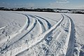 Snow covered Cotswold landscape - geograph.org.uk - 1154564.jpg 640 × 426; 65 KB
-
 St Michael's Church, Brimpsfield - geograph.org.uk - 6390783.jpg 1,024 × 576; 201 KB
-
 The A417 approaching a roundabout - geograph.org.uk - 3047974.jpg 1,024 × 698; 77 KB
-
 The A417 approaching the turning for Stockwell - geograph.org.uk - 3048210.jpg 1,024 × 653; 135 KB
-
 The B4070 through Witcombe Wood - geograph.org.uk - 1938090.jpg 640 × 480; 131 KB
-

-
 The Golden Heart Inn, Nettleton, Glos - geograph.org.uk - 4939711.jpg 1,600 × 1,200; 430 KB
-
 Three-way junction - geograph.org.uk - 3770652.jpg 800 × 450; 210 KB
-
 Towards Witcombe Wood - geograph.org.uk - 878504.jpg 640 × 480; 83 KB
-
 Trees in the mist - geograph.org.uk - 3835987.jpg 600 × 800; 233 KB
-
 Underneath the arches-Brimpsfield, Glos - geograph.org.uk - 3626276.jpg 3,072 × 2,304; 3.08 MB
-

-
 Village sign post-Caudle Green - geograph.org.uk - 5071168.jpg 3,648 × 2,048; 2.25 MB
-
 Wall and fence - geograph.org.uk - 3770663.jpg 800 × 450; 229 KB
-

-
 West Tump ( Long Barrow ) - geograph.org.uk - 937490.jpg 626 × 473; 149 KB
-
 Wheat to the left-maize to the right - geograph.org.uk - 5071187.jpg 3,648 × 2,048; 2.39 MB
-

-
 Wild flower meadow - geograph.org.uk - 5071192.jpg 3,648 × 2,048; 2.79 MB
-
 Witcombe Wood, south of Bridlip - geograph.org.uk - 2783015.jpg 640 × 480; 164 KB
-
 Woodland old and young - geograph.org.uk - 2766492.jpg 2,640 × 1,980; 1.36 MB
-
 Yew arches - geograph.org.uk - 5497404.jpg 1,024 × 768; 374 KB
-

-

-
 Bridleway through Climperwell Wood - geograph.org.uk - 585728.jpg 426 × 640; 165 KB
-
 Brimpsfield House - geograph.org.uk - 352964.jpg 631 × 640; 110 KB
-
 Climperwell Farm, near Brimpsfield - geograph.org.uk - 585734.jpg 640 × 426; 118 KB
-
 Farmland near Blacklains Farm, Birdlip - geograph.org.uk - 586309.jpg 640 × 426; 102 KB
-
 Field gate and footpath to Brimspfield - geograph.org.uk - 585730.jpg 640 × 426; 109 KB
-
 Grazing Land near Morcombe Farm - geograph.org.uk - 130488.jpg 640 × 479; 67 KB
-
 Pool in Brimpsfield Park - geograph.org.uk - 586402.jpg 640 × 426; 89 KB
-
 Pool in Climperwell Wood - geograph.org.uk - 585732.jpg 640 × 426; 172 KB
-
 Reservoir, near Moor House - geograph.org.uk - 130472.jpg 640 × 479; 118 KB
-
 Sports stand^ Near Brimpsfield - geograph.org.uk - 586320.jpg 426 × 640; 133 KB
-
 Track into Poston Wood - geograph.org.uk - 586405.jpg 426 × 640; 118 KB
_-_geograph.org.uk_-_3274807.jpg)


.jpg)


_-_geograph.org.uk_-_937490.jpg)


