Category:Bridges in Cornwall
Jump to navigation
Jump to search
Ceremonial counties of England: Bedfordshire · Berkshire · Buckinghamshire · Cambridgeshire · Cheshire · Cornwall · Cumbria · Derbyshire · Devon · Dorset · Durham · East Riding of Yorkshire · East Sussex · Essex · Gloucestershire · Greater London · Greater Manchester · Hampshire · Herefordshire · Hertfordshire · Kent · Lancashire · Leicestershire · Lincolnshire · Merseyside · Norfolk · North Yorkshire · Northamptonshire · Northumberland · Nottinghamshire · Oxfordshire · Rutland · Shropshire · Somerset · South Yorkshire · Staffordshire · Suffolk · Surrey · Tyne and Wear · Warwickshire · West Midlands · West Sussex · West Yorkshire · Wiltshire · Worcestershire
City-counties: Bristol · City of London
Former historic counties: Huntingdonshire · Westmorland · Yorkshire
Other former counties:
City-counties: Bristol · City of London
Former historic counties: Huntingdonshire · Westmorland · Yorkshire
Other former counties:
Wikimedia category | |||||
| Upload media | |||||
| Instance of | |||||
|---|---|---|---|---|---|
| Category combines topics | |||||
| Cornwall | |||||
historic county of England; Celtic nation    | |||||
| Instance of | |||||
| Part of | |||||
| Location |
| ||||
| Capital | |||||
| Heritage designation | |||||
| Population |
| ||||
| Area |
| ||||
| Different from | |||||
| official website | |||||
 | |||||
Subcategories
This category has the following 17 subcategories, out of 17 total.
Media in category "Bridges in Cornwall"
The following 179 files are in this category, out of 179 total.
-
 5 Arches. - panoramio.jpg 4,000 × 2,248; 4.49 MB
-
 A39 Roadbridge at Wadebridge. - panoramio.jpg 2,816 × 2,112; 2.01 MB
-
 A39 Roadbridge near Wadebridge. - panoramio.jpg 2,816 × 2,112; 2.65 MB
-
 Ancient bridge at Bowithick ford. - geograph.org.uk - 2015736.jpg 640 × 480; 75 KB
-
 Beacon Road - 08444.jpg 1,366 × 910; 656 KB
-
-
 Bridge across the River Allen - geograph.org.uk - 1710699.jpg 640 × 480; 128 KB
-
 Bridge and stream, Lydcott Woods - geograph.org.uk - 191020.jpg 640 × 427; 309 KB
-
 Bridge at Gweek - geograph.org.uk - 892566.jpg 640 × 480; 130 KB
-
 Bridge at Helebridge - geograph.org.uk - 1535032.jpg 640 × 426; 121 KB
-
 Bridge at Mellangoose - geograph.org.uk - 980480.jpg 640 × 480; 108 KB
-
 Bridge at Tolcarne-Wartha - geograph.org.uk - 906470.jpg 640 × 480; 88 KB
-

-
 Bridge in Peckhill Wood - geograph.org.uk - 1215279.jpg 640 × 426; 113 KB
-
 Bridge near Linnick Farm - geograph.org.uk - 1731987.jpg 640 × 480; 133 KB
-
 Bridge near Polyphant - geograph.org.uk - 708340.jpg 640 × 480; 118 KB
-
 Bridge of Railway Line St Ives - panoramio.jpg 3,648 × 2,736; 1.75 MB
-
 Bridge on the Saints Way - geograph.org.uk - 354116.jpg 640 × 480; 171 KB
-

-
 Bridge over Lowley Brook - geograph.org.uk - 1730117.jpg 640 × 480; 117 KB
-
 Bridge over Lynher Tributary - geograph.org.uk - 532347.jpg 640 × 480; 201 KB
-
 Bridge over Red River, Marazion - geograph.org.uk - 782125.jpg 640 × 480; 136 KB
-
 Bridge over River Amble. - panoramio.jpg 2,816 × 2,112; 2.78 MB
-
 Bridge over stream near Hugos Farm - geograph.org.uk - 799819.jpg 640 × 480; 139 KB
-
 Bridge over the Camel Trail - geograph.org.uk - 962189.jpg 640 × 427; 143 KB
-
 Bridge over the disused railway - geograph.org.uk - 1261485.jpg 640 × 480; 97 KB
-
 Bridge over the old railway track - geograph.org.uk - 4152853.jpg 640 × 480; 170 KB
-

-
 Bridge over the Red River at Menadarva - geograph.org.uk - 1036010.jpg 480 × 640; 102 KB
-
 Bridge over the River Camel at Polbrock - geograph.org.uk - 962897.jpg 640 × 427; 125 KB
-
 Bridge over the River Fowey - geograph.org.uk - 1521193.jpg 640 × 480; 112 KB
-

-
 Bridge over the River Gannel at Gwills - geograph.org.uk - 1390456.jpg 640 × 427; 123 KB
-
 Bridge over the River Inny at Bealsmill - geograph.org.uk - 416056.jpg 640 × 427; 104 KB
-
 Bridge over the River Inny at Laneast - geograph.org.uk - 819817.jpg 640 × 480; 109 KB
-

-
 Bridge over the River Kenwyn - geograph.org.uk - 998630.jpg 640 × 480; 131 KB
-

-
 Bridge over the stream at Bonallack - geograph.org.uk - 1380738.jpg 640 × 427; 129 KB
-
 Bridge over the stream at Crean Mill - geograph.org.uk - 1301623.jpg 640 × 427; 106 KB
-
 Bridge over the stream at Ninnis - geograph.org.uk - 1527118.jpg 640 × 480; 122 KB
-
 Bridge over the stream at Resugga - geograph.org.uk - 1520026.jpg 640 × 480; 116 KB
-
 Bridge over the stream at Tangies - geograph.org.uk - 892758.jpg 640 × 480; 120 KB
-
 Bridge over the stream at Tregonwell Mill - geograph.org.uk - 892712.jpg 480 × 640; 101 KB
-

-
 Bridge over the Warleggan River - geograph.org.uk - 1547318.jpg 640 × 427; 113 KB
-
 Bridge over Wanson Water - geograph.org.uk - 839259.jpg 640 × 480; 129 KB
-
 Bridge over West Looe River - geograph.org.uk - 510829.jpg 640 × 480; 165 KB
-
 Bridge to 1 ^ 2. ~ twilight - panoramio.jpg 2,992 × 2,992; 3.56 MB
-
 Bridge to Gardens, St Neot, Cornwall - geograph.org.uk - 957112.jpg 640 × 480; 116 KB
-
 Bridge ^ Steps. - panoramio.jpg 4,000 × 3,000; 5.23 MB
-
 Bridge, Eden Project - geograph.org.uk - 815598.jpg 427 × 640; 246 KB
-
 Bridge, Treesmill Valley - geograph.org.uk - 1756567.jpg 640 × 469; 140 KB
-
 Bude - panoramio.jpg 2,048 × 1,536; 778 KB
-
 Carlyon Bridge.jpg 800 × 600; 158 KB
-

-
 Crouch's Mill - geograph.org.uk - 492675.jpg 640 × 480; 110 KB
-
 Cycling onto the Iron Bridge - geograph.org.uk - 1540937.jpg 640 × 480; 118 KB
-
 2012 at Defiance Platform.jpg 1,024 × 768; 533 KB
-
 Disused A30 bridge over St Ives branch line. - panoramio.jpg 3,648 × 2,056; 5.46 MB
-
 Disused Canal Bridge near Bridgetown 1978 - geograph.org.uk - 64687.jpg 640 × 409; 153 KB
-
 Disused railway bridge - geograph.org.uk - 3441995.jpg 525 × 393; 100 KB
-
 Draynes Bridge - geograph.org.uk - 1510523.jpg 640 × 480; 124 KB
-
 Driver's eye view - A38 bridge (from 52054).jpg 910 × 1,366; 309 KB
-
 Fenteroon Bridge - geograph.org.uk - 1910246.jpg 3,872 × 2,592; 3.96 MB
-
 Footbridge, Coosebean Greenway, Truro, Cornwall - May 2023.jpg 4,608 × 3,456; 4.77 MB
-
 Ford ^ Footbridge. - panoramio.jpg 2,992 × 2,992; 3.61 MB
-
-
 Harlyn Bridge - geograph.org.uk - 1285799.jpg 600 × 432; 117 KB
-
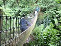 Heligan Rope Bridge.jpg 3,561 × 2,671; 9.49 MB
-
 Helland Bridge - geograph.org.uk - 1095392.jpg 640 × 480; 111 KB
-
 Higher new bridge. Cornwall. - panoramio.jpg 4,000 × 2,672; 6.17 MB
-
 Iron bridge on the Camel Trail (2) - geograph.org.uk - 1286398.jpg 640 × 426; 98 KB
-
 L 2 - panoramio.jpg 4,000 × 2,672; 6.2 MB
-
 Little Petherick Creek bridge - geograph.org.uk - 5399205.jpg 3,072 × 2,048; 1.08 MB
-
 Looe river - geograph.org.uk - 140491.jpg 640 × 234; 43 KB
-
 Missing bridge on the Bude Canal - geograph.org.uk - 611792.jpg 640 × 480; 136 KB
-
 New bridge - Feb 2012 - panoramio.jpg 3,000 × 4,000; 4.87 MB
-
 Newbridge - geograph.org.uk - 410793.jpg 640 × 427; 99 KB
-
 NewMillsCornwallUK.jpg 640 × 480; 156 KB
-
-

-
 North Cornwall Railway Trequite - geograph.org.uk - 2104093.jpg 640 × 428; 86 KB
-
 Old Bridge by Cork Wood - geograph.org.uk - 2547252.jpg 3,040 × 2,288; 2.9 MB
-
 Old Dunstan's Bridge - geograph.org.uk - 845398.jpg 640 × 427; 119 KB
-
 Old railway bridge - geograph.org.uk - 192446.jpg 640 × 480; 125 KB
-
 Old Railway bridge - geograph.org.uk - 222279.jpg 640 × 480; 82 KB
-
 Old railway bridge abutment - geograph.org.uk - 1710722.jpg 640 × 480; 108 KB
-
 Old railway bridge abutments at Rejerrah - geograph.org.uk - 1776236.jpg 640 × 480; 126 KB
-
 Old ^ new. - panoramio.jpg 3,648 × 2,432; 5.32 MB
-
 Parapet, Brockle Ford - geograph.org.uk - 1731497.jpg 640 × 491; 131 KB
-
 Pendavey bridge Feb2008.JPG 3,072 × 2,304; 3.35 MB
-
 PenroseManorBridge.jpg 5,836 × 3,891; 20.78 MB
-
 Poley's Bridge - geograph.org.uk - 793251.jpg 640 × 436; 108 KB
-
 Polperro Stone Bridge - panoramio (1).jpg 3,648 × 2,736; 3.51 MB
-
 Polperro Stone Bridge - panoramio.jpg 3,648 × 2,736; 3.44 MB
-
 Porkellis Bridge - geograph.org.uk - 906466.jpg 640 × 480; 105 KB
-
 Railway bridge in Arch Lane - geograph.org.uk - 1575734.jpg 640 × 427; 73 KB
-
 Railway bridges at Wearde Quay - geograph.org.uk - 1190987.jpg 480 × 640; 91 KB
-
 Relubbus bridge. - panoramio.jpg 3,648 × 2,736; 6.07 MB
-
 Road ^ Rail,River Hayle. - panoramio.jpg 4,000 × 2,672; 5.81 MB
-
 Sett Bridge, near Ruan Lanihorne - geograph.org.uk - 1124962.jpg 640 × 427; 96 KB
-
 Sladesbridge bridge - geograph.org.uk - 1288590.jpg 640 × 477; 149 KB
-
 SP A0036.jpg 1,163 × 788; 1 MB
-
 St Andrew's Bridge, Par - geograph.org.uk - 563055.jpg 640 × 427; 122 KB
-
 St Austell - FGW 43012 under Menacuddle Bridge.jpg 2,048 × 1,536; 1.88 MB
-
 Stara Bridge.jpg 4,592 × 3,448; 6.51 MB
-
 Stone Bridge near Looe - panoramio.jpg 4,320 × 3,240; 2.93 MB
-
 Stone Bridge over Looe Harbour - panoramio.jpg 4,320 × 3,240; 3.21 MB
-
 Swing bridge by Penzance harbour - geograph.org.uk - 1389779.jpg 640 × 480; 75 KB
-
 Swing bridge. - panoramio.jpg 3,648 × 2,432; 5.63 MB
-
 Temple bridge - geograph.org.uk - 1543939.jpg 640 × 427; 73 KB
-
 Temple Old Bridge - geograph.org.uk - 748861.jpg 640 × 480; 102 KB
-

-

-
 The Camel Trail at Guineaport - geograph.org.uk - 43654.jpg 640 × 427; 92 KB
-
 The Falmouth Branch Line - geograph.org.uk - 161361.jpg 640 × 427; 159 KB
-
 The house on the props (496610621).jpg 1,371 × 2,048; 772 KB
-
-

-
 The Main Railway Line - geograph.org.uk - 171418.jpg 640 × 427; 143 KB
-
 The mainline railway bridges Old Mill Lane - geograph.org.uk - 58562.jpg 640 × 480; 135 KB
-
 The Marazion Bridge - geograph.org.uk - 923339.jpg 640 × 402; 266 KB
-
 The new bridge at Cardinham Woods - Feb 2012 - panoramio.jpg 4,000 × 3,000; 4.72 MB
-
 The old Trevemper Bridge - geograph.org.uk - 1775522.jpg 640 × 480; 113 KB
-

-

-
 Tintagel Castle Cornwall United Kingdom (68623237).jpeg 1,365 × 2,048; 1.94 MB
-
 Tintagel-Castle-Bridge old-and-new.jpg 5,472 × 3,648; 2.92 MB
-
 Trequite railway bridge - geograph.org.uk - 513532.jpg 640 × 480; 136 KB
-
 Tresillian bridge - geograph.org.uk - 1236009.jpg 640 × 480; 67 KB
-
 Trewen Bridge - geograph.org.uk - 734526.jpg 480 × 640; 121 KB
-
 Underneath. - panoramio.jpg 3,648 × 2,056; 5.04 MB
-
 A Pointless Bridge - geograph.org.uk - 367619.jpg 640 × 480; 129 KB
-
 A39 bridge over the Camel - geograph.org.uk - 690295.jpg 640 × 427; 231 KB
-
 Approaching Broxwater - geograph.org.uk - 839457.jpg 640 × 480; 105 KB
-

-
 Approaching Trehannick Bridge - geograph.org.uk - 379790.jpg 640 × 480; 112 KB
-
 Bearland Bridge - geograph.org.uk - 444906.jpg 640 × 480; 124 KB
-
 Bridge - geograph.org.uk - 536777.jpg 640 × 427; 176 KB
-
 Bridge and track on Badgall Downs - geograph.org.uk - 714016.jpg 640 × 480; 83 KB
-
 Bridge at Little Kirland - geograph.org.uk - 492786.jpg 640 × 480; 110 KB
-
 Bridge near Badgall - geograph.org.uk - 721273.jpg 640 × 480; 146 KB
-
 Bridge near Tremail - geograph.org.uk - 729116.jpg 640 × 481; 103 KB
-
 Bridge near Woodford - geograph.org.uk - 405006.jpg 640 × 480; 301 KB
-
 Bridge over a creek, St Veep - geograph.org.uk - 660245.jpg 640 × 452; 102 KB
-
 Bridge over St Neot River - geograph.org.uk - 290073.jpg 640 × 427; 147 KB
-
-
 Bridge over the Lynher, Bathpool - geograph.org.uk - 534098.jpg 640 × 480; 187 KB
-
 Bridge over the River Camel - geograph.org.uk - 379836.jpg 640 × 480; 145 KB
-

-
 Bridge over the stream below Kestle Farm - geograph.org.uk - 1519831.jpg 640 × 480; 129 KB
-
 Bridge over the Trebant Water - geograph.org.uk - 434204.jpg 640 × 427; 144 KB
-

-
 Bridge west of Hatt - geograph.org.uk - 179927.jpg 640 × 427; 304 KB
-
 Bridge works at Two Bridges - geograph.org.uk - 163319.jpg 640 × 480; 125 KB
-
 Clapper Bridge - upstream side - geograph.org.uk - 709904.jpg 640 × 427; 323 KB
-
 Connon bridge and brook - geograph.org.uk - 492531.jpg 640 × 480; 137 KB
-
 Delightful Bridge - geograph.org.uk - 212789.jpg 640 × 480; 141 KB
-
 Egloskerry, Hellescott Bridge - geograph.org.uk - 576088.jpg 640 × 427; 235 KB
-
 Little bridge - geograph.org.uk - 582497.jpg 640 × 427; 140 KB
-
 Look out from the bridge - geograph.org.uk - 54514.jpg 640 × 427; 74 KB
-
 Lostwithiel, low bridge - geograph.org.uk - 571350.jpg 640 × 429; 116 KB
-
 Otter Bridge - geograph.org.uk - 34905.jpg 640 × 480; 138 KB
-
 Over the stream at Nantithet - geograph.org.uk - 384972.jpg 640 × 480; 133 KB
-
 Plushabridge - geograph.org.uk - 410622.jpg 640 × 427; 151 KB
-
 Railway Bridge - geograph.org.uk - 212782.jpg 640 × 480; 92 KB
-
 Railway bridge at Criggan - geograph.org.uk - 474691.jpg 640 × 434; 119 KB
-
 Railway Bridge over a Minor Road - geograph.org.uk - 571496.jpg 640 × 480; 120 KB
-
 River Amble Valley at Chapel Amble - geograph.org.uk - 205640.jpg 640 × 427; 118 KB
-
 The bridge - geograph.org.uk - 54519.jpg 640 × 427; 58 KB
-
 The bridge at Bicton Mill - geograph.org.uk - 465219.jpg 640 × 427; 116 KB
-

-
 The Island, Newquay - geograph.org.uk - 653063.jpg 640 × 480; 91 KB
-
 Trecarrell Bridge - geograph.org.uk - 459195.jpg 640 × 480; 154 KB
-
 Trecarrell Bridge - geograph.org.uk - 463478.jpg 480 × 640; 115 KB
-
 Tregony Bridge. - geograph.org.uk - 418452.jpg 640 × 480; 104 KB
-
 Trekenner Bridge - geograph.org.uk - 426934.jpg 640 × 427; 138 KB
-
 Trekenner Bridge - geograph.org.uk - 426939.jpg 640 × 427; 125 KB


.jpg)


_-_geograph.org.uk_-_1286398.jpg)


.jpg)


.jpg)


.jpeg)


_-_geograph.org.uk_-_26463.jpg)


