Category:Brick churches in Warwickshire
Jump to navigation
Jump to search
Ceremonial counties of England: Bedfordshire · Berkshire · Buckinghamshire · Cambridgeshire · Cheshire · Cornwall · Cumbria · Derbyshire · Devon · Dorset · Durham · East Riding of Yorkshire · East Sussex · Essex · Gloucestershire · Greater London · Greater Manchester · Hampshire · Herefordshire · Hertfordshire · Kent · Lancashire · Leicestershire · Lincolnshire · Merseyside · Norfolk · North Yorkshire · Northamptonshire · Northumberland · Nottinghamshire · Oxfordshire · Shropshire · Somerset · South Yorkshire · Staffordshire · Suffolk · Surrey · Tyne and Wear · Warwickshire · West Midlands · West Sussex · West Yorkshire · Wiltshire · Worcestershire
City-counties: Bristol ·
Former historic counties: Middlesex ·
Other former counties:
City-counties: Bristol ·
Former historic counties: Middlesex ·
Other former counties:
Subcategories
This category has the following 16 subcategories, out of 16 total.
*
A
- All Saints' Church, Warwick (6 F)
B
D
- St Denis' Church, Pailton (1 F)
G
L
- St Paul's Church, Leamington Spa (13 F)
- Lillington Free Church (4 F)
R
S
T
W
Media in category "Brick churches in Warwickshire"
The following 28 files are in this category, out of 28 total.
-
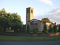
 United Reformed Church - geograph.org.uk - 195583.jpg 640 × 480; 100 KB
-
 Old Bilton - geograph.org.uk - 75711.jpg 640 × 480; 57 KB
-
 Our Lady of the Sacred Heart Bulkington.jpg 640 × 480; 97 KB
-
 Dunchurch - geograph.org.uk - 165590.jpg 640 × 480; 83 KB
-
 Dunchurch - geograph.org.uk - 234684.jpg 640 × 480; 141 KB
-
 Hampton on the Hill - geograph.org.uk - 6064.jpg 640 × 480; 78 KB
-
 Hillmorton - English Martyrs Church - geograph.org.uk - 43618.jpg 640 × 480; 96 KB
-
 Hillmorton-Grapevine - geograph.org.uk - 667128.jpg 640 × 480; 69 KB
-
 Langley - geograph.org.uk - 21512.jpg 640 × 480; 152 KB
-
 The Old Chapel, Chessetts Wood - geograph.org.uk - 40998.jpg 640 × 480; 135 KB
-
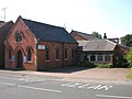
 Long Lawford-Chapel Street - geograph.org.uk - 601285.jpg 640 × 480; 94 KB
-
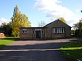 Long Lawford-School Street - geograph.org.uk - 610511.jpg 640 × 480; 70 KB
-
 Methodist Chapel, Upper Brailes - geograph.org.uk - 509746.jpg 640 × 426; 118 KB
-
 Newbold-On-Avon - geograph.org.uk - 201083.jpg 640 × 480; 101 KB
-
 Old Bilton-Main Street - geograph.org.uk - 79280.jpg 640 × 480; 139 KB
-
 Rugby - Hillmorton Road - geograph.org.uk - 122938.jpg 640 × 480; 133 KB
-
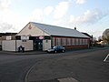
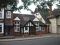 Rugby - Regent Place - geograph.org.uk - 192365.jpg 640 × 480; 116 KB
-
 Rugby - Russelsheim Way - geograph.org.uk - 140052.jpg 640 × 480; 55 KB
-
 Rugby - West Leys - geograph.org.uk - 159476.jpg 640 × 480; 84 KB
-
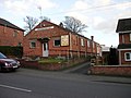
 Rugby-Bilton Road - geograph.org.uk - 314335.jpg 640 × 480; 109 KB
-
 Rugby - Oliver St - geograph.org.uk - 158532.jpg 640 × 480; 108 KB
-
 Rugby-St George's Church - geograph.org.uk - 37592.jpg 640 × 480; 100 KB
-
 Rugby-Woodlands Estate - geograph.org.uk - 400763.jpg 640 × 480; 102 KB
-
 Southam-Wood Street - geograph.org.uk - 507905.jpg 640 × 480; 121 KB
-
 Tiddington church - geograph.org.uk - 90924.jpg 640 × 480; 76 KB
-
 Willoughby - geograph.org.uk - 52488.jpg 640 × 480; 162 KB
-
 Wolvey - geograph.org.uk - 210643.jpg 640 × 480; 111 KB
-
 Hockley Heath Baptist Church - geograph.org.uk - 87348.jpg 640 × 480; 92 KB


