Category:Brent Pelham
Jump to navigation
Jump to search
English: Brent Pelham is a village and civil parish in Hertfordshire, England. The village is one of the Pelhams, along with Stocking Pelham and Furneaux Pelham. Near St Mary's church are ancient stocks which could accommodate up to three people at once.[1] A derelict windmill survives in the village.
village in the United Kingdom  | |||||
| Upload media | |||||
| Instance of | |||||
|---|---|---|---|---|---|
| Location | East Hertfordshire, Hertfordshire, East of England, England | ||||
 | |||||
Subcategories
This category has the following 3 subcategories, out of 3 total.
B
- Brent Pelham War Memorial (2 F)
M
Media in category "Brent Pelham"
The following 70 files are in this category, out of 70 total.
-
 Brent Pelham church and cottage Hertfordshire England.jpg 5,345 × 3,563; 22.54 MB
-
 B1038 road near Brent Pelham - geograph.org.uk - 6382010.jpg 1,024 × 768; 124 KB
-
 B1038 road near Brent Pelham - geograph.org.uk - 6382013.jpg 1,024 × 768; 127 KB
-
 B1038 towards Brent Pelham - geograph.org.uk - 3365505.jpg 640 × 480; 48 KB
-
 B1038 towards Great Hormead - geograph.org.uk - 3365503.jpg 640 × 467; 44 KB
-

-
 Black Horse, Brent Pelham - geograph.org.uk - 2485083.jpg 1,024 × 810; 199 KB
-
 Black Horse, Brent Pelham - geograph.org.uk - 6380232.jpg 1,024 × 768; 176 KB
-
 Brent Pelham and Meesden parish notice board Hertfordshire England.jpg 4,864 × 3,648; 15.2 MB
-
 Brent Pelham B1038 road and Church Cottage Hertfordshire England 1.jpg 3,648 × 5,472; 22.34 MB
-
 Brent Pelham B1038 road and Church Cottage Hertfordshire England 2.jpg 5,268 × 3,512; 16.65 MB
-
 Brent Pelham B1038 road and Church Cottage Hertfordshire England 3.jpg 5,240 × 3,492; 22.75 MB
-
 Brent Pelham Elizabeth II Diamond Jubilee seat Hertfordshire England.jpg 4,864 × 3,648; 20.79 MB
-
 Brent Pelham Hall gates Hertfordshire England.jpg 5,472 × 3,648; 22.16 MB
-
 Brent Pelham phone and post box Hertfordshire England.jpg 3,648 × 5,472; 22.8 MB
-
 Brent Pelham road signage Hertfordshire England.jpg 5,472 × 3,648; 25.67 MB
-
 Brent Pelham village hall - geograph.org.uk - 6379704.jpg 1,024 × 768; 213 KB
-
 Brent Pelham war memorial - geograph.org.uk - 6379706.jpg 1,024 × 768; 228 KB
-
 Brent Pelham, Hertfordshire - geograph.org.uk - 6380233.jpg 1,024 × 768; 120 KB
-
 Bridleway, Brent Pelham - geograph.org.uk - 6380223.jpg 1,024 × 768; 290 KB
-
 Cakebread's Lane - geograph.org.uk - 579516.jpg 640 × 425; 71 KB
-
 Chamberlain's Wood - geograph.org.uk - 4233444.jpg 640 × 480; 190 KB
-
 Church Cottage Brent Pelham - geograph.org.uk - 202043.jpg 600 × 411; 119 KB
-
 Church of St. Mary the Virgin, Brent Pelham - geograph.org.uk - 6380216.jpg 1,024 × 768; 155 KB
-
 Church of St. Mary the Virgin, Brent Pelham - geograph.org.uk - 6381972.jpg 1,024 × 768; 156 KB
-
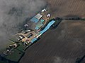 Cole Green Farm from the air - geograph.org.uk - 4680522.jpg 640 × 480; 94 KB
-
 Conduit Lane west of Brent Pelham - geograph.org.uk - 5586931.jpg 2,048 × 1,536; 1.57 MB
-
 Cottage in Brent Pelham - geograph.org.uk - 5586184.jpg 2,048 × 1,536; 1.75 MB
-
 Country lane at Washall Green, near Brent Pelham - geograph.org.uk - 6382022.jpg 1,024 × 768; 140 KB
-
 Country lane near Brent Pelham - geograph.org.uk - 6380237.jpg 1,024 × 768; 153 KB
-
 Country lane near Brent Pelham - geograph.org.uk - 6380245.jpg 1,024 × 768; 171 KB
-
 Country lane near Brent Pelham - geograph.org.uk - 6380256.jpg 1,024 × 768; 149 KB
-
 Country lane near Brent Pelham - geograph.org.uk - 6380259.jpg 1,024 × 768; 163 KB
-
 Country lane near Brent Pelham - geograph.org.uk - 6380272.jpg 1,024 × 768; 242 KB
-
 Country lane near Stocking Pelham - geograph.org.uk - 6378338.jpg 1,024 × 768; 118 KB
-
 Country lanes near Stocking Pelham - geograph.org.uk - 6378347.jpg 1,024 × 768; 261 KB
-
 Double bend near Brent Pelham - geograph.org.uk - 6381982.jpg 1,024 × 768; 118 KB
-
 Driveway and public bridleway, Brent Pelham - geograph.org.uk - 6379687.jpg 1,024 × 768; 217 KB
-
 Farm at Brent Pelham - geograph.org.uk - 6379679.jpg 1,024 × 768; 150 KB
-
 Farmland at Borley Green - geograph.org.uk - 444388.jpg 640 × 480; 71 KB
-
 GOC The Pelhams 031 K6 telephone kiosk, Brent Pelham (28166689855).jpg 3,031 × 4,044; 3.09 MB
-
 Hertfordshire-Essex fieldscape - geograph.org.uk - 5478051.jpg 3,264 × 2,448; 3.2 MB
-
 House at Washall Green, Herts. - geograph.org.uk - 209170.jpg 640 × 441; 74 KB
-
 Lane entering Brent Pelham - geograph.org.uk - 6380236.jpg 1,024 × 768; 246 KB
-
 Lane near Stocking Pelham - geograph.org.uk - 6378336.jpg 1,024 × 768; 193 KB
-
 March of the pylons - geograph.org.uk - 444395.jpg 640 × 480; 64 KB
-
 Mill mound near Coles Green - geograph.org.uk - 444402.jpg 640 × 480; 147 KB
-
 Minor lane at Brent Pelham - geograph.org.uk - 6380234.jpg 1,024 × 768; 168 KB
-
 Near Down Hall Farm - geograph.org.uk - 4496866.jpg 4,320 × 3,240; 5.13 MB
-
 Parish Acre - geograph.org.uk - 5577491.jpg 1,024 × 768; 244 KB
-
 Pelham Road, Starling's Green - geograph.org.uk - 5588005.jpg 1,900 × 1,424; 963 KB
-
 Public footpath near Stocking Pelham - geograph.org.uk - 6378343.jpg 1,024 × 768; 324 KB
-
 Pump Hill, Brent Pelham - geograph.org.uk - 6379685.jpg 1,024 × 768; 161 KB
-
 Pump Hill, Brent Pelham - geograph.org.uk - 6380218.jpg 1,024 × 768; 204 KB
-
 Pump Hill, Washall Green - geograph.org.uk - 5587993.jpg 1,890 × 1,418; 1.41 MB
-
 Pylons across the fields - geograph.org.uk - 579545.jpg 640 × 425; 70 KB
-
 Road into Brent Pelham - geograph.org.uk - 6381966.jpg 1,024 × 768; 125 KB
-

-
 St Mary's, Brent Pelham - geograph.org.uk - 1269520.jpg 640 × 421; 95 KB
-

-
 Thatched cottage, Brent Pelham - geograph.org.uk - 3703516.jpg 1,024 × 768; 879 KB
-
 The 'Black Horse', Brent Pelham - geograph.org.uk - 3535333.jpg 750 × 1,024; 211 KB
-
 The Black Horse pub, Brent Pelham - geograph.org.uk - 4496939.jpg 4,320 × 3,240; 5.11 MB
-
 The Causeway, Brent Pelham - geograph.org.uk - 6379683.jpg 1,024 × 768; 229 KB
-
 The Causeway, near Brent Pelham - geograph.org.uk - 6379665.jpg 1,024 × 768; 135 KB
-
 The Causeway, near Brent Pelham - geograph.org.uk - 6379673.jpg 1,024 × 768; 152 KB
-
 The war memorial in Brent Pelham - geograph.org.uk - 5586922.jpg 1,781 × 1,336; 1.57 MB
-
 Track and Fields south of B1038 - geograph.org.uk - 3365506.jpg 640 × 471; 59 KB
-
 Track through rape seed - geograph.org.uk - 4496943.jpg 4,320 × 3,240; 5.66 MB
-
 Wood on a hill - geograph.org.uk - 4233425.jpg 640 × 480; 155 KB


.jpg)


