Category:Brecon
Jump to navigation
Jump to search
market town in Powys, Wales, United Kingdom  | |||||
| Upload media | |||||
| Instance of | |||||
|---|---|---|---|---|---|
| Located in protected area | |||||
| Location | Brecon, Powys, Wales | ||||
| Located in or next to body of water | |||||
| Population |
| ||||
| Different from | |||||
 | |||||
Subcategories
This category has the following 15 subcategories, out of 15 total.
Media in category "Brecon"
The following 200 files are in this category, out of 1,540 total.
(previous page) (next page)-
 10 - 14 Priory Hill, Brecon - geograph.org.uk - 4252984.jpg 5,550 × 3,485; 2.89 MB
-

-
 18 miles from Brecon to Abergavenny - geograph.org.uk - 3123736.jpg 640 × 482; 85 KB
-
 18 swallows - geograph.org.uk - 2608293.jpg 800 × 372; 157 KB
-
 1853 flood height marker, Brecon - geograph.org.uk - 3511961.jpg 582 × 800; 98 KB
-

-
 20 Ship Street, Brecon - geograph.org.uk - 5081261.jpg 800 × 624; 126 KB
-
-
 21 miles to Builth Wells from Brecon - geograph.org.uk - 3123749.jpg 640 × 533; 92 KB
-
 30mph speed limit in Brecon - geograph.org.uk - 2980027.jpg 572 × 640; 92 KB
-
 A corner of Pontwilym, Brecon - geograph.org.uk - 3403378.jpg 640 × 409; 64 KB
-
 A day out on the tiles - geograph.org.uk - 3089378.jpg 1,704 × 2,304; 1.12 MB
-
 A Market Street car park, Brecon - geograph.org.uk - 3643954.jpg 800 × 600; 124 KB
-

-

-
 A River Usk landing stage, Brecon - geograph.org.uk - 3366661.jpg 640 × 480; 78 KB
-
 A side arm of Pontwilym, Brecon - geograph.org.uk - 3403391.jpg 640 × 407; 55 KB
-
 A small wood near the A40, Brecon - geograph.org.uk - 2629744.jpg 640 × 536; 80 KB
-
 A southern side arm of Pontwilym, Brecon - geograph.org.uk - 5971701.jpg 1,024 × 601; 144 KB
-
 A taste of home cooking^ - geograph.org.uk - 3083790.jpg 1,704 × 2,304; 1.31 MB
-

-
 A view from the Promenade, Brecon - geograph.org.uk - 3160847.jpg 640 × 480; 79 KB
-

-

-
-
 A40 Approaching Brynich Roundabout - geograph.org.uk - 5228740.jpg 640 × 427; 358 KB
-
 A40 Brecon bypass - geograph.org.uk - 2224734.jpg 640 × 480; 50 KB
-
 A40 Brecon Bypass - geograph.org.uk - 396940.jpg 640 × 480; 135 KB
-

-

-
 A40, South of Brecon - geograph.org.uk - 5228674.jpg 640 × 480; 393 KB
-

-
-
 A470 descends towards Brecon - geograph.org.uk - 3124134.jpg 640 × 595; 91 KB
-
 A470 just south of A40 roundabout - geograph.org.uk - 3132160.jpg 640 × 421; 102 KB
-
 A470 lay-by east of Brecon - geograph.org.uk - 2224751.jpg 640 × 480; 65 KB
-
 A470 looking north - geograph.org.uk - 3286171.jpg 640 × 480; 43 KB
-
 Abbey Vets, Brecon - geograph.org.uk - 6027822.jpg 1,024 × 904; 339 KB
-
 Abbeyfield House, Brecon - geograph.org.uk - 6024746.jpg 1,024 × 694; 114 KB
-
 Aberhonddu - Brecon - geograph.org.uk - 4551703.jpg 640 × 446; 80 KB
-

-
 Abutments of former railway bridge in Brecon - geograph.org.uk - 3431820.jpg 4,000 × 3,000; 3.8 MB
-

-
 Access road for Crug Villa - geograph.org.uk - 3912811.jpg 1,500 × 1,000; 1.74 MB
-

-
 Across a long weir, Brecon - geograph.org.uk - 3366649.jpg 640 × 480; 118 KB
-
 Across Castle Bridge, Brecon - geograph.org.uk - 5969443.jpg 1,024 × 768; 152 KB
-
 Across the Usk at Brecon - geograph.org.uk - 3431776.jpg 4,000 × 3,000; 2.83 MB
-
 Across the Usk in Brecon - geograph.org.uk - 5349995.jpg 4,319 × 2,708; 2.38 MB
-
 Across Usk Bridge towards Brecon town centre - geograph.org.uk - 5995560.jpg 1,024 × 601; 112 KB
-
 Afon Honddu (River Honddu) at Brecon - geograph.org.uk - 4930562.jpg 640 × 481; 640 KB
-
 Afon Honddu , Brecon - geograph.org.uk - 1840514.jpg 2,816 × 1,880; 2.58 MB
-
 Afon Honddu from bridge on Priory Hill, Brecon.jpg 6,000 × 4,000; 19.36 MB
-
 Afon Honddu, Aberhonddu - geograph.org.uk - 564798.jpg 640 × 480; 110 KB
-

-
 Afon Wysg - Usk River - geograph.org.uk - 4551690.jpg 640 × 480; 101 KB
-

-
 Aldi direction sign on a Brecon corner - geograph.org.uk - 6377388.jpg 748 × 1,024; 209 KB
-
 Alexandra Road Car Park, Brecon - geograph.org.uk - 6009586.jpg 1,024 × 688; 213 KB
-
 Alexandra Road houses, Brecon - geograph.org.uk - 3480562.jpg 800 × 622; 106 KB
-
 All bets are off - geograph.org.uk - 3085758.jpg 2,304 × 1,704; 1.7 MB
-
-
 Alzeim, Brecon Enterprise Park - geograph.org.uk - 3020207.jpg 640 × 467; 51 KB
-

-
 ARAF-SLOW on the B4520, Brecon - geograph.org.uk - 5971913.jpg 1,024 × 965; 270 KB
-
 ARAF-SLOW on the B4601, Brecon - geograph.org.uk - 6398771.jpg 1,600 × 1,304; 510 KB
-

-
 Ardent Gallery, Brecon - geograph.org.uk - 3480435.jpg 666 × 800; 103 KB
-
 Arfon House, Free Street, Brecon - geograph.org.uk - 6197740.jpg 1,600 × 1,293; 425 KB
-
 Arosfa Day Centre, Brecon - geograph.org.uk - 3617313.jpg 800 × 659; 171 KB
-
 Ashfield Place, Brecon - geograph.org.uk - 3005524.jpg 640 × 496; 68 KB
-
 Ashfield Place-Maes Ashfield, Brecon - geograph.org.uk - 6027803.jpg 1,024 × 623; 156 KB
-
 ATS Euromaster Brecon - geograph.org.uk - 6332633.jpg 1,600 × 1,117; 314 KB
-
 ATS Euromaster Brecon name sign - geograph.org.uk - 6332637.jpg 847 × 1,600; 290 KB
-
 Autumn fallen leaves, Llanfaes, Brecon - geograph.org.uk - 6200834.jpg 1,600 × 1,281; 449 KB
-
 B.Jenkins builders merchants, Brecon - geograph.org.uk - 6329188.jpg 1,600 × 1,355; 386 KB
-
 B.Jenkins ^ Sons Ltd, Brecon - geograph.org.uk - 2596646.jpg 640 × 387; 56 KB
-
 B4520 beyond the northern edge of Brecon - geograph.org.uk - 5970864.jpg 1,024 × 1,004; 308 KB
-
 B4520 descends into Brecon - geograph.org.uk - 3403358.jpg 640 × 480; 110 KB
-
 B4520 heads south towards Brecon - geograph.org.uk - 3403484.jpg 640 × 432; 49 KB
-
 B4601 Heol Gouesnou, Brecon - geograph.org.uk - 6377176.jpg 1,596 × 1,600; 387 KB
-
 Bailihelig Road to the south of Brecon - geograph.org.uk - 6000831.jpg 1,024 × 830; 191 KB
-
 Bank in Brecon - geograph.org.uk - 4863043.jpg 640 × 428; 68 KB
-
 Barclays Bank, Brecon - geograph.org.uk - 5995049.jpg 827 × 1,024; 165 KB
-
 Bargain Booze and Costa, High Street, Brecon - geograph.org.uk - 5994996.jpg 1,024 × 784; 153 KB
-
 Bargain Booze in Brecon - geograph.org.uk - 5057753.jpg 800 × 742; 118 KB
-
 Barracks, Brecon - geograph.org.uk - 4532801.jpg 1,920 × 1,303; 413 KB
-
 Barracks, Brecon - geograph.org.uk - 4532804.jpg 1,920 × 1,139; 479 KB
-
 Barry Tomlinson office in Brecon - geograph.org.uk - 5947893.jpg 1,024 × 744; 204 KB
-

-
 BCA office in Brecon - geograph.org.uk - 5932008.jpg 980 × 1,024; 175 KB
-

-
 Beacons Antiques, Brecon - geograph.org.uk - 3362818.jpg 480 × 640; 63 KB
-
 Beacons Crafts shop, Bethel Square, Brecon - geograph.org.uk - 5965150.jpg 908 × 1,024; 190 KB
-

-
 Beacons Guest House, Bridge Street, Brecon - geograph.org.uk - 5995585.jpg 1,024 × 1,022; 172 KB
-

-

-
 Beacons Laundry, St Mary Street, Brecon - geograph.org.uk - 5992035.jpg 886 × 1,024; 149 KB
-
 Bear-shaped litter bin in Brecon - geograph.org.uk - 6024749.jpg 1,024 × 895; 243 KB
-
 Belle Vue Gardens, Brecon - geograph.org.uk - 2655942.jpg 640 × 480; 67 KB
-
 Belle Vue Road, Brecon - geograph.org.uk - 3115813.jpg 640 × 480; 89 KB
-
 Bench and litter bin on a Brecon corner - geograph.org.uk - 5933723.jpg 909 × 1,024; 198 KB
-

-
 Bench for Prince George of Cambridge, Prior Hill, Brecon, January 2019 (1).jpg 4,032 × 3,024; 3.35 MB
-
 Bench for Prince George of Cambridge, Prior Hill, Brecon, January 2019 (2).jpg 4,032 × 3,024; 3.46 MB
-

-
 Bend in Old Station Close, Brecon - geograph.org.uk - 6024748.jpg 1,024 × 884; 204 KB
-
 Bend in the road near Priory Mills Farm - geograph.org.uk - 3954472.jpg 640 × 480; 106 KB
-
 Bethel Square - geograph.org.uk - 4249189.jpg 3,264 × 5,462; 2.47 MB
-
 Bethel Square, Brecon - geograph.org.uk - 4249247.jpg 5,826 × 3,874; 3.37 MB
-
 Bethel Square, Brecon - geograph.org.uk - 5472805.jpg 640 × 427; 71 KB
-
 Beynon House, Brecon - geograph.org.uk - 6398775.jpg 1,600 × 1,107; 300 KB
-
 Bi - 14668979821.jpg 2,083 × 3,277; 994 KB
-
 Bi Plate.jpg 2,609 × 2,304; 698 KB
-
 Bikers in a parking area near Brecon bus station - geograph.org.uk - 6112529.jpg 1,024 × 721; 175 KB
-
 Bikes - hikes, Brecon - geograph.org.uk - 2834908.jpg 640 × 480; 83 KB
-
 Bilingual Cambrian Way direction sign, Brecon - geograph.org.uk - 6332735.jpg 1,600 × 1,404; 565 KB
-
 Bilingual direction sign at the edge of Watton, Brecon - geograph.org.uk - 6332652.jpg 1,600 × 1,409; 444 KB
-

-
 Bilingual name sign, Cambrian Close, Brecon - geograph.org.uk - 6420366.jpg 1,024 × 869; 366 KB
-
 Bilingual name sign, Pegasus Lane, Brecon - geograph.org.uk - 5991551.jpg 722 × 1,024; 102 KB
-

-

-
 Bilingual street name on a Brecon corner - geograph.org.uk - 5978990.jpg 1,351 × 1,586; 523 KB
-
 Bilingual street name sign in Brecon - geograph.org.uk - 5964880.jpg 1,024 × 711; 216 KB
-
 Bilingual street name sign in Brecon town centre - geograph.org.uk - 6197907.jpg 1,600 × 1,438; 558 KB
-
 Bilingual street name sign on a Brecon corner - geograph.org.uk - 5947840.jpg 1,024 × 866; 180 KB
-
 Biped Cycles, Brecon - geograph.org.uk - 3161119.jpg 480 × 640; 60 KB
-
 Biped Cycles, Brecon - geograph.org.uk - 5081286.jpg 800 × 600; 89 KB
-
 Bishop Bevan Hall, Brecon - geograph.org.uk - 3575773.jpg 800 × 666; 123 KB
-
 Bishop Williamson Garden, Brecon - geograph.org.uk - 5964899.jpg 1,024 × 768; 222 KB
-
 Black and White in Brecon - geograph.org.uk - 4253875.jpg 5,610 × 3,640; 2.75 MB
-
 Blackfriars Court, Brecon - geograph.org.uk - 3005301.jpg 640 × 443; 59 KB
-
 Blockbuster, Brecon - geograph.org.uk - 3093918.jpg 640 × 548; 94 KB
-
 Blue, green ^ grey, Watton, Brecon - geograph.org.uk - 6377135.jpg 998 × 1,024; 207 KB
-

-
 Bo Country, 89 Watton, Brecon - geograph.org.uk - 6329196.jpg 1,600 × 1,561; 434 KB
-
 Boar's Head name sign, Brecon - geograph.org.uk - 5953001.jpg 970 × 1,024; 150 KB
-
 Boards near Camden Stores Farm Shop, Brecon - geograph.org.uk - 6328158.jpg 1,433 × 1,547; 600 KB
-
 Boats for hire - geograph.org.uk - 536292.jpg 640 × 480; 140 KB
-
 Bobbins Brecon - geograph.org.uk - 3480691.jpg 637 × 640; 77 KB
-
 Books, Maps and Prints, Brecon - geograph.org.uk - 2758341.jpg 640 × 480; 62 KB
-
 Borderers B^B, Brecon - geograph.org.uk - 3617640.jpg 800 × 598; 99 KB
-
 Borderers Guest House in Brecon - geograph.org.uk - 6328637.jpg 1,600 × 1,573; 429 KB
-
 Borderers Way, Brecon - geograph.org.uk - 6329201.jpg 1,600 × 1,470; 448 KB
-
 Boulders in Afon Tarell, Brecon - geograph.org.uk - 6200751.jpg 1,600 × 1,200; 664 KB
-
 Breakers on the Honddu - geograph.org.uk - 4253034.jpg 5,863 × 3,898; 5.15 MB
-
 Brecknock (1132018).jpg 1,000 × 899; 303 KB
-
 Ffynnon Eluned, (tu mewn).jpg 1,080 × 1,920; 571 KB
-
 Ffynnon y Llan, Aberhonddu.jpg 1,920 × 1,080; 1.02 MB
-
 Y ffynnon a'r pwll ymdrochu.jpg 1,920 × 1,080; 1.2 MB
-

-
 Brecon - geograph.org.uk - 3825190.jpg 640 × 480; 76 KB
-
 Brecon - Phone Box At Camden Road Corner - geograph.org.uk - 1413083.jpg 640 × 480; 207 KB
-
 Brecon - River Usk, Looking West - geograph.org.uk - 1413092.jpg 640 × 480; 166 KB
-
 Brecon 01.JPG 2,338 × 1,359; 655 KB
-
 Brecon Amateur Boxing Club premises - geograph.org.uk - 2975878.jpg 640 × 480; 80 KB
-
 Brecon Ambulance Station - geograph.org.uk - 2655975.jpg 640 × 480; 62 KB
-

-
 Brecon Barbers shop in Brecon town centre - geograph.org.uk - 5933773.jpg 991 × 1,024; 203 KB
-
 Brecon basin - geograph.org.uk - 6329473.jpg 4,896 × 3,264; 3.15 MB
-
 Brecon Beacons field (Unsplash).jpg 3,226 × 2,422; 2.19 MB
-

-

-
 Brecon Beacons, Brecon, United Kingdom (Unsplash np6vWL0mr0Y).jpg 5,184 × 2,916; 9.62 MB
-
 Brecon Books, Brecon - geograph.org.uk - 5931930.jpg 1,024 × 758; 143 KB
-
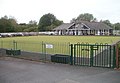 Brecon Bowling Club - geograph.org.uk - 3160989.jpg 640 × 442; 63 KB
-
 Brecon Car Sales, Llanfaes, Brecon - geograph.org.uk - 3005203.jpg 640 × 438; 53 KB
-
 Brecon Car Sales, Penpentre, Llanfaes, Brecon - geograph.org.uk - 6006662.jpg 1,024 × 641; 104 KB
-
 Brecon Castle - geograph.org.uk - 3154992.jpg 1,712 × 2,288; 795 KB
-
 Brecon Castle - geograph.org.uk - 3643921.jpg 800 × 619; 122 KB
-
 Brecon Castle - geograph.org.uk - 5613220.jpg 640 × 480; 89 KB
-
 Brecon Castle and Castle Hotel, Brecon - geograph.org.uk - 3643923.jpg 800 × 636; 144 KB
-
 Brecon Cathedral - geograph.org.uk - 3431787.jpg 4,000 × 3,000; 3.05 MB
-
 Brecon Cathedral - geograph.org.uk - 4250699.jpg 5,693 × 3,637; 3.99 MB
-
 Brecon Cathedral - geograph.org.uk - 4251337.jpg 5,468 × 3,770; 4.44 MB
-
 Brecon Cathedral - geograph.org.uk - 4930599.jpg 481 × 640; 497 KB
-
 Brecon Cathedral - geograph.org.uk - 5704822.jpg 1,600 × 1,200; 1.06 MB
-
 Brecon Cathedral - geograph.org.uk - 5705990.jpg 680 × 1,024; 350 KB
-
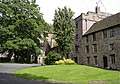 Brecon Cathedral Close - geograph.org.uk - 3103387.jpg 1,878 × 1,313; 1.48 MB
-
 Brecon Cathedral grounds - geograph.org.uk - 3103380.jpg 1,578 × 1,103; 1.23 MB
-
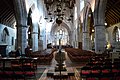 Brecon Cathedral, looking East - geograph.org.uk - 4252572.jpg 5,869 × 3,901; 2.63 MB
-
 Brecon Chicken ^ Pizza Land, Brecon - geograph.org.uk - 5052527.jpg 694 × 800; 110 KB
-
 Brecon Chocolates shop, Lion Street, Brecon - geograph.org.uk - 5984278.jpg 1,024 × 1,002; 264 KB
-
 Brecon Convenience Store - geograph.org.uk - 5995188.jpg 856 × 1,024; 188 KB
-
 Brecon cricket field - geograph.org.uk - 3103478.jpg 1,785 × 1,256; 1.14 MB
-
 Brecon Driving Test Centre - geograph.org.uk - 2433335.jpg 640 × 480; 91 KB
-
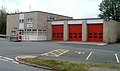 Brecon Fire Station - geograph.org.uk - 2433313.jpg 640 × 380; 55 KB
-
 Brecon Fire Station - geograph.org.uk - 3184104.jpg 640 × 480; 77 KB
-
 Brecon Fire Station - geograph.org.uk - 3184106.jpg 640 × 480; 82 KB
-
 Brecon Fire Station - geograph.org.uk - 3184114.jpg 640 × 480; 60 KB
-
 Brecon Fire Station - geograph.org.uk - 3184118.jpg 640 × 480; 77 KB
-
 Brecon Fire Station and tower - geograph.org.uk - 3617330.jpg 800 × 586; 100 KB
-
 Brecon Fire Station office - geograph.org.uk - 3617338.jpg 800 × 615; 104 KB
-
 Brecon Fire Station tower - geograph.org.uk - 2433305.jpg 640 × 593; 83 KB
-
 Brecon Ford, Brecon Enterprise Park - geograph.org.uk - 3020169.jpg 640 × 381; 42 KB
-
 Brecon Golf Club car park - geograph.org.uk - 6027853.jpg 1,024 × 945; 280 KB
-
 Brecon High Street - geograph.org.uk - 6266242.jpg 5,120 × 3,840; 3.35 MB
-
 Brecon High Street at dusk - geograph.org.uk - 4253642.jpg 5,965 × 3,796; 3.06 MB


_-_geograph.org.uk_-_2629763.jpg)

_-_geograph.org.uk_-_2629765.jpg)


_at_Brecon_-_geograph.org.uk_-_4930562.jpg)


.jpg)


.jpg)
.jpg)


.jpg)
.jpg)


.jpg)
.jpg)