Category:Brauncewell
Jump to navigation
Jump to search
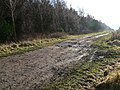
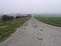
English: Brauncewell is a small hamlet situated between Leadenham and Sleaford in the county of Lincolnshire. It lies north of and in close proximity to the RAF Cranwell base. The hamlet has just a few houses and a redundant church, and there is a reasonably large quarry nearby.
village located in North Kesteven, United Kingdom  | |||||
| Upload media | |||||
| Instance of |
| ||||
|---|---|---|---|---|---|
| Location | Cranwell, Brauncewell and Byard's Leap, North Kesteven, Lincolnshire, East Midlands, England | ||||
 | |||||
Subcategories
This category has only the following subcategory.
A
Media in category "Brauncewell"
The following 38 files are in this category, out of 38 total.
-
 Brauncewell Home Close (geograph 3817758).jpg 800 × 533; 152 KB
-
 Ermine Street Roman Road - geograph.org.uk - 95635.jpg 640 × 480; 148 KB
-
 Ermine Street Roman Road - geograph.org.uk - 95640.jpg 640 × 480; 93 KB
-
 Ermine Street Roman Road - geograph.org.uk - 95646.jpg 640 × 480; 138 KB
-
 Ermine Street Roman Road - geograph.org.uk - 95665.jpg 640 × 480; 168 KB
-
 Ermine Street Roman Road - geograph.org.uk - 95674.jpg 640 × 480; 110 KB
-
 Farm buildings, Brauncewell - geograph.org.uk - 4408290.jpg 1,024 × 768; 158 KB
-
 Farm track at Brauncewell - geograph.org.uk - 4408342.jpg 1,024 × 768; 257 KB
-
 Old building at Brauncewell (2) - geograph.org.uk - 3009906.jpg 640 × 427; 85 KB
-
 Old building at Brauncewell (3) - geograph.org.uk - 3009911.jpg 640 × 427; 61 KB
-
 Old building at Brauncewell - geograph.org.uk - 3009903.jpg 640 × 427; 76 KB
-

-
 Texaco Water Tank - geograph.org.uk - 554457.jpg 640 × 480; 113 KB
-
 A Glint of Sun - geograph.org.uk - 952752.jpg 640 × 480; 80 KB
-

-
 Brauncewell Horse Gin - geograph.org.uk - 554469.jpg 640 × 480; 147 KB
-
 Bridleway to Cranwell - geograph.org.uk - 382382.jpg 640 × 480; 59 KB
-
 Climbing Avenue - geograph.org.uk - 214621.jpg 640 × 480; 99 KB
-
 Farmland near Brauncewell, Lincs - geograph.org.uk - 489428.jpg 640 × 480; 113 KB
-
 Farmland near Cranwell - geograph.org.uk - 491485.jpg 640 × 427; 100 KB
-
 Farmland off High Dyke - geograph.org.uk - 496836.jpg 640 × 427; 111 KB
-
 Farmland off High Dyke - geograph.org.uk - 496856.jpg 640 × 427; 84 KB
-
 Fields to the East - geograph.org.uk - 481113.jpg 640 × 480; 74 KB
-
 Footpath to Temple Bruer - geograph.org.uk - 382385.jpg 640 × 480; 99 KB
-
 Footpath to the A15 - geograph.org.uk - 382386.jpg 640 × 480; 77 KB
-
 From Brauncewell Lane End - geograph.org.uk - 166508.jpg 640 × 427; 62 KB
-
 Hidden Wall - geograph.org.uk - 463326.jpg 480 × 640; 148 KB
-
 Long Track - geograph.org.uk - 210936.jpg 640 × 480; 87 KB
-

-
 Moor Wood in the Distance - geograph.org.uk - 463348.jpg 640 × 480; 126 KB
-
 Old School^ - geograph.org.uk - 214622.jpg 640 × 480; 91 KB
-
 Pea Souper - geograph.org.uk - 463355.jpg 640 × 480; 155 KB
-
 Rat Run - geograph.org.uk - 463336.jpg 640 × 480; 131 KB
-
 Rolling Stubble - geograph.org.uk - 382383.jpg 640 × 480; 89 KB
-
 Roof of the Horse Gin - geograph.org.uk - 554474.jpg 640 × 480; 75 KB
-
 Temple Farm and Tower - geograph.org.uk - 214619.jpg 640 × 480; 97 KB
-
 View to Temple Farm - geograph.org.uk - 330504.jpg 640 × 427; 37 KB
-
 Wheat and Wood - geograph.org.uk - 214620.jpg 640 × 480; 98 KB
.jpg)


_-_geograph.org.uk_-_3009906.jpg)
_-_geograph.org.uk_-_3009911.jpg)

.jpg)


