Category:Brampton Bierlow
Jump to navigation
Jump to search
English: Brampton Bierlow, often known simply as Brampton, is a former mining village and civil parish situated in the Metropolitan Borough of Rotherham, South Yorkshire, England, on the south side of the Dearne Valley, between Barnsley and Rotherham. According to the 2001 census, the parish had a population of 3,658. Brampton was within the historic county boundaries of the West Riding of Yorkshire.
Nederlands: Brampton Bierlow is een dorp (village) en civil parish in het bestuurlijke gebied Rotherham, in het Engelse graafschap South Yorkshire. De civil parish telt
village and civil parish in South Yorkshire, United Kingdom  | |||||
| Upload media | |||||
| Instance of | |||||
|---|---|---|---|---|---|
| Location | Rotherham, South Yorkshire, Yorkshire and the Humber, England | ||||
 | |||||
Subcategories
This category has the following 2 subcategories, out of 2 total.
C
- Christ Church, West Melton (3 F)
R
- Rainborough Lodges (2 F)
Media in category "Brampton Bierlow"
The following 162 files are in this category, out of 162 total.
-
 "Horse Power" - geograph.org.uk - 1125144.jpg 640 × 427; 75 KB
-
 "The Bull's Head" at Brampton - geograph.org.uk - 5034856.jpg 4,846 × 3,521; 3.38 MB
-

-
 A group of Waxwings - geograph.org.uk - 1154391.jpg 640 × 447; 87 KB
-
 Angling Centre, Brampton Bierlow, near Barnsley - geograph.org.uk - 3134001.jpg 1,777 × 1,316; 825 KB
-
 Another covered walkway at Morrison's - geograph.org.uk - 2126276.jpg 768 × 1,024; 197 KB
-

-
 Brampton Bierlow Pond - geograph.org.uk - 2185049.jpg 800 × 533; 84 KB
-
 Brampton Bierlow Roundabout, near Barnsley - geograph.org.uk - 3133994.jpg 3,584 × 2,688; 2.19 MB
-
 Brampton Brierlow - Hoober Stand.jpg 640 × 480; 127 KB
-
 Brampton Fixings on Brampton Road - geograph.org.uk - 4008837.jpg 1,600 × 1,064; 429 KB
-
 Brampton Hall, Manor Lane, Brampton Bierlow - geograph.org.uk - 1674516.jpg 2,057 × 1,372; 519 KB
-
 Brampton.jpg 640 × 480; 94 KB
-

-

-

-

-
 B^Q entrance Cortonwood retail park - geograph.org.uk - 2057346.jpg 640 × 480; 67 KB
-

-
 Century business park. - geograph.org.uk - 528390.jpg 640 × 480; 79 KB
-
 Cortonwood Bowling Club - geograph.org.uk - 341842.jpg 640 × 480; 109 KB
-

-

-
 CortonwoodShoppingCentre.jpg 640 × 480; 80 KB
-
 Cottage of Content Crossroads - geograph.org.uk - 1125117.jpg 640 × 427; 92 KB
-

-
 Dearne Valley Parkway - geograph.org.uk - 197519.jpg 640 × 480; 71 KB
-
 Duck on Pond - Brampton Bierlow - geograph.org.uk - 2576674.jpg 4,320 × 2,432; 417 KB
-

-
 Eastern end of Hoober Hall Lane - geograph.org.uk - 1125083.jpg 640 × 427; 115 KB
-
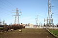
 Electricity Transmission Tower - geograph.org.uk - 3850016.jpg 680 × 1,024; 204 KB
-
 Elsecar Heritage Railway extension to Cortonwood - geograph.org.uk - 5275047.jpg 1,024 × 768; 157 KB
-
 Elsecar Road - geograph.org.uk - 4319959.jpg 640 × 480; 60 KB
-
 Entering the Elsecar greenway. - geograph.org.uk - 550465.jpg 640 × 480; 171 KB
-
 Entrance lodges to Wentworth Estate. - geograph.org.uk - 539909.jpg 640 × 319; 69 KB
-

-
 Farmland and power lines - geograph.org.uk - 4319958.jpg 640 × 480; 46 KB
-
 Fields near Bramptom Bierlow - geograph.org.uk - 5285964.jpg 4,608 × 3,456; 3.86 MB
-
 Fire station practice tower. - geograph.org.uk - 539893.jpg 640 × 416; 75 KB
-
 Follow your father and keep up ^ - geograph.org.uk - 717914.jpg 640 × 427; 51 KB
-

-

-

-
 Garden Flowers - geograph.org.uk - 1993800.jpg 3,072 × 2,048; 257 KB
-

-
 Going going gone - geograph.org.uk - 4967440.jpg 1,024 × 768; 184 KB
-
 Golden Plovers at Old Moor - geograph.org.uk - 717921.jpg 640 × 480; 67 KB
-
 Goldfinches at Old Moor - geograph.org.uk - 717892.jpg 640 × 427; 42 KB
-

-
 Hoober Hall, Brampton, Rotherham - geograph.org.uk - 1125073.jpg 640 × 427; 99 KB
-
 Houses on Pontefract Road, Brampton - geograph.org.uk - 4008829.jpg 1,600 × 1,354; 502 KB
-
 Housing Development at Brampton Bierlow c1999 - geograph.org.uk - 3296534.jpg 2,124 × 752; 1.22 MB
-

-

-
 Knollbeck Avenue, Brampton - geograph.org.uk - 4008842.jpg 1,600 × 1,055; 393 KB
-
 Looking North down Westfield Road - geograph.org.uk - 1125163.jpg 640 × 427; 114 KB
-

-

-
 Looking West up Elsecar Road - geograph.org.uk - 1125126.jpg 640 × 427; 72 KB
-

-

-
 More Cortonwood trolleys - geograph.org.uk - 2057349.jpg 746 × 1,024; 260 KB
-
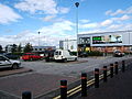
 Morrisons at Cortonwood Retail Park - geograph.org.uk - 3332252.jpg 4,000 × 3,000; 313 KB
-

-

-

-

-

-

-
 New housing estate. - geograph.org.uk - 539896.jpg 640 × 410; 78 KB
-

-
 New Housing, Meadow Walk - geograph.org.uk - 3031019.jpg 640 × 480; 77 KB
-
 New offices under construction by MSSR. - geograph.org.uk - 528388.jpg 640 × 561; 134 KB
-
 No mistaking where you are ... Brampton Bierlow - geograph.org.uk - 1674478.jpg 2,576 × 1,932; 992 KB
-
 North Down Coaley Lane - geograph.org.uk - 1124594.jpg 640 × 427; 97 KB
-
 Paddock on Westfield Road - geograph.org.uk - 5286589.jpg 4,406 × 3,228; 3.28 MB
-

-

-
 Pheasants on Hoober Lane in Brampton Bierlow, South Yorkshire.jpg 640 × 367; 116 KB
-

-

-
 Pit Row, Hemmingfield - geograph.org.uk - 1505211.jpg 640 × 426; 89 KB
-
 Pit Winding Wheel - geograph.org.uk - 254315.jpg 640 × 480; 155 KB
-

-
 Power Lines near Brampton Bierlow - geograph.org.uk - 2012260.jpg 3,072 × 2,048; 276 KB
-
 Rainbow over Pond - geograph.org.uk - 2942192.jpg 640 × 360; 66 KB
-

-

-

-

-

-
 Smithy Bridge Lane (B6097) - geograph.org.uk - 4319966.jpg 640 × 480; 70 KB
-
 Smithy Bridge Lane - geograph.org.uk - 1105980.jpg 640 × 427; 74 KB
-
 Southern gatehouse to the Wentworth estate - geograph.org.uk - 3260280.jpg 4,320 × 2,432; 484 KB
-

-
 Start of a New Era - geograph.org.uk - 577931.jpg 640 × 427; 104 KB
-
 The Bulls Head, Brampton - geograph.org.uk - 4319971.jpg 640 × 480; 64 KB
-
 The Cottage of Content, Brampton - geograph.org.uk - 4319954.jpg 640 × 480; 54 KB
-
 The Counting Houses - geograph.org.uk - 5286563.jpg 4,179 × 2,969; 2.82 MB
-
 The Counting Houses, Brampton - geograph.org.uk - 4319961.jpg 640 × 419; 55 KB
-
 The Trans Pennine Trail - geograph.org.uk - 2699679.jpg 1,024 × 768; 361 KB
-
 The Trans Pennine Trail - geograph.org.uk - 4320016.jpg 640 × 480; 126 KB
-
 The war memorial at Brampton - geograph.org.uk - 5034860.jpg 5,184 × 3,888; 5.33 MB
-
 Trans Pennine Trail - geograph.org.uk - 518414.jpg 640 × 480; 75 KB
-

-

-

-

-
 View of Hoober Stand - geograph.org.uk - 2012273.jpg 3,072 × 2,048; 221 KB
-
 View Over Former Shaft to Westpit Hill - geograph.org.uk - 5286598.jpg 4,095 × 2,827; 2.76 MB
-
 View over Hemingfield - geograph.org.uk - 2004208.jpg 3,072 × 2,048; 170 KB
-

-
 Warren Vale Road.jpg 2,592 × 1,936; 911 KB
-

-
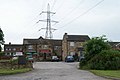
 West Melton Sub Station - geograph.org.uk - 1125135.jpg 640 × 427; 61 KB
-
 Westfield Road at Brampton Bierlow - geograph.org.uk - 5286579.jpg 4,608 × 3,456; 3.91 MB
-
 Westfield Road, Brampton - geograph.org.uk - 4319969.jpg 640 × 480; 49 KB
-

-
 Winter Lake in Brampton Bierlow - geograph.org.uk - 1152826.jpg 640 × 427; 59 KB
-
 Wintering Waxwings - geograph.org.uk - 3251963.jpg 2,544 × 1,615; 244 KB
-
 Wintery Pond - geograph.org.uk - 3332243.jpg 4,320 × 2,432; 1.07 MB
-

-

-

-
 Blue bridge at Wath upon Dearne. - geograph.org.uk - 523280.jpg 574 × 477; 55 KB
-

-

-
 Bullrushes and stream at Old Moor - geograph.org.uk - 717874.jpg 480 × 640; 126 KB
-

-
 Colours. - geograph.org.uk - 528384.jpg 640 × 480; 99 KB
-
 Dearne Valley Parkway - geograph.org.uk - 577940.jpg 640 × 427; 53 KB
-

-
 Early morning light on Hoober Hall - geograph.org.uk - 587615.jpg 640 × 377; 97 KB
-
 Electricity pylon - geograph.org.uk - 481043.jpg 521 × 640; 121 KB
-

-
 End of the line. - geograph.org.uk - 553825.jpg 640 × 385; 112 KB
-
 Entrance to Manvers. - geograph.org.uk - 528396.jpg 640 × 518; 131 KB
-
 Fore^ - geograph.org.uk - 528364.jpg 640 × 387; 79 KB
-
 Gannets Cafe at RSPB Old Moor - geograph.org.uk - 717881.jpg 427 × 640; 45 KB
-
 Green Lane 9 steps to heaven - geograph.org.uk - 568680.jpg 640 × 480; 114 KB
-
 Hoober Hall Cottage. - geograph.org.uk - 550534.jpg 640 × 441; 129 KB
-
 Hoober Hall Lane - geograph.org.uk - 587612.jpg 640 × 480; 183 KB
-

-

-
 Lane from Hoober to Packman Road - geograph.org.uk - 572978.jpg 640 × 480; 103 KB
-
 Lions Lodge Gate House - geograph.org.uk - 570359.jpg 640 × 427; 136 KB
-
 Looking east from the blue bridge. - geograph.org.uk - 528380.jpg 640 × 385; 70 KB
-
 Looking west from the blue bridge. - geograph.org.uk - 528377.jpg 640 × 480; 84 KB
-
 Man made lake Wath. - geograph.org.uk - 528371.jpg 640 × 319; 67 KB
-
 Man made lake. - geograph.org.uk - 539904.jpg 640 × 369; 61 KB
-
 Morrison's supermarket Cortonwood. - geograph.org.uk - 525738.jpg 640 × 373; 82 KB
-
 New houses in Brampton Bierlow - geograph.org.uk - 577284.jpg 640 × 427; 50 KB
-

-
 Newish lake at Express park. - geograph.org.uk - 528367.jpg 640 × 480; 81 KB
-

-
 No fly tipping - geograph.org.uk - 572983.jpg 640 × 480; 109 KB
-
 Northeast down Coaly Lane - geograph.org.uk - 577204.jpg 640 × 427; 43 KB
-

-
 Public house being built - geograph.org.uk - 523286.jpg 640 × 339; 71 KB
-
 Rubbish^ - geograph.org.uk - 527874.jpg 480 × 640; 131 KB
-
 Steps into Newhill Park. - geograph.org.uk - 550539.jpg 640 × 463; 83 KB
-
 Summer in the City. - geograph.org.uk - 550544.jpg 640 × 343; 77 KB


_-_geograph.org.uk_-_4319966.jpg)


