Category:Brafferton, County Durham
Jump to navigation
Jump to search
English: Brafferton is a village in the borough of Darlington and the traditional and ceremonial counties of Durham in England. It is situated between Darlington and Newton Aycliffe, a short distance from Coatham Mundeville.
village and civil parish in County Durham, UK  | |||||
| Upload media | |||||
| Instance of | |||||
|---|---|---|---|---|---|
| Location | Darlington, County Durham, North East England, England | ||||
 | |||||
Media in category "Brafferton, County Durham"
The following 108 files are in this category, out of 108 total.
-
 A farmhouse in Brafferton - geograph.org.uk - 1745808.jpg 640 × 480; 129 KB
-
 A marker stone by Brafferton rail bridge - geograph.org.uk - 1745831.jpg 480 × 640; 134 KB
-
 A1(M) - geograph.org.uk - 5258596.jpg 1,024 × 683; 257 KB
-
 A1(M) approaching Junction 59 - geograph.org.uk - 3227970.jpg 640 × 480; 57 KB
-
 A1(M) north of Junction 59 - geograph.org.uk - 5829007.jpg 1,024 × 791; 86 KB
-
 A1(M) northbound - geograph.org.uk - 3104218.jpg 640 × 480; 52 KB
-
 Access to Brafferton Village - geograph.org.uk - 1745797.jpg 640 × 480; 57 KB
-
 Approach to Lime Lane rail bridge - geograph.org.uk - 1744969.jpg 640 × 480; 50 KB
-

-
 Barn at southern angle of field - geograph.org.uk - 6263933.jpg 1,600 × 1,086; 406 KB
-
 Bend on Lime Lane - geograph.org.uk - 5258535.jpg 1,024 × 683; 276 KB
-
 Brafferton rail bridge - geograph.org.uk - 1745795.jpg 640 × 466; 63 KB
-
 Brafferton rail bridge - geograph.org.uk - 1745833.jpg 640 × 480; 55 KB
-
 Brafferton Village Hall , Built 1971. - geograph.org.uk - 178130.jpg 640 × 479; 111 KB
-
 Brafferton Village.jpg 640 × 479; 105 KB
-
 Bus shelter, Brafferton - geograph.org.uk - 5258502.jpg 1,024 × 683; 294 KB
-
 Clump of trees, Brafferton - geograph.org.uk - 5258589.jpg 1,024 × 683; 228 KB
-
 Communications mast off Lime Lane - geograph.org.uk - 3227963.jpg 503 × 640; 65 KB
-
 Countryside south of Brafferton - geograph.org.uk - 2331488.jpg 640 × 393; 36 KB
-
 Double hedged narrow lane to Newton Ketton - geograph.org.uk - 3101626.jpg 3,648 × 2,736; 2.39 MB
-
 Down-line at Brafferton - geograph.org.uk - 1745828.jpg 640 × 480; 83 KB
-
 East Coast Main Line at Brafferton - geograph.org.uk - 1745825.jpg 640 × 480; 118 KB
-
 Entrance to Catkill Lane from Salters Lane - geograph.org.uk - 3101450.jpg 3,648 × 2,736; 2.8 MB
-
 Entrance to Fir Tree Farm off Salters Lane - geograph.org.uk - 3101433.jpg 3,648 × 2,736; 3.21 MB
-
 Entrance to recently diverted footpath off Salters Lane - geograph.org.uk - 3101476.jpg 3,648 × 2,736; 2.34 MB
-
 Entrance to Village Hall - geograph.org.uk - 1745802.jpg 640 × 447; 81 KB
-
 Farm buildings at Newton Ketton Farm - geograph.org.uk - 3101586.jpg 3,648 × 2,736; 1.97 MB
-
 Farmhouse at High House Farm - geograph.org.uk - 3101665.jpg 3,648 × 2,736; 2.03 MB
-
 Farmland and copse north of Ketton Hall - geograph.org.uk - 6345387.jpg 1,024 × 768; 290 KB
-
 Farmland and the River Skerne - geograph.org.uk - 2878631.jpg 640 × 480; 55 KB
-
 Farmland below East Ketton - geograph.org.uk - 6361948.jpg 1,024 × 768; 280 KB
-
 Farmland between Ketton Hall and East Ketton - geograph.org.uk - 6361963.jpg 1,024 × 768; 241 KB
-
 Farmland east of Ketton Hall - geograph.org.uk - 6361943.jpg 1,024 × 768; 321 KB
-
 Farmland in the valley of the River Skerne - geograph.org.uk - 6360082.jpg 1,024 × 768; 284 KB
-
 Farmland near the River Skerne - geograph.org.uk - 2878636.jpg 640 × 480; 53 KB
-
 Farmland north of Ketton Hall - geograph.org.uk - 6360135.jpg 1,024 × 768; 227 KB
-
 Farmland north of Ketton Lane - geograph.org.uk - 6360096.jpg 1,024 × 768; 242 KB
-
 Farmland south of Brafferton - geograph.org.uk - 1886553.jpg 640 × 480; 59 KB
-
 Farmland south of Brafferton - geograph.org.uk - 2420034.jpg 640 × 430; 28 KB
-
 Farmland south of Brafferton - geograph.org.uk - 3557486.jpg 3,072 × 2,304; 2.19 MB
-
 Farmland south of Brafferton - geograph.org.uk - 6360093.jpg 1,024 × 768; 222 KB
-
 Farmland south of East Ketton (2) - geograph.org.uk - 6360133.jpg 1,024 × 768; 320 KB
-
 Farmland south of East Ketton (2) - geograph.org.uk - 6361970.jpg 1,024 × 768; 309 KB
-
 Farmland south of East Ketton - geograph.org.uk - 6360120.jpg 1,024 × 768; 323 KB
-
 Farmland south of Peartree House - geograph.org.uk - 6360107.jpg 1,024 × 768; 240 KB
-
 Farmland towards the A1 (M) - geograph.org.uk - 3227952.jpg 640 × 480; 45 KB
-
 Farmland, High House Farm - geograph.org.uk - 3227940.jpg 2,799 × 1,642; 881 KB
-
 Farmstead in Brafferton - geograph.org.uk - 1745814.jpg 640 × 480; 52 KB
-
 Footpath from Salters Lane at Newton Ketton - geograph.org.uk - 3101597.jpg 3,648 × 2,736; 4.14 MB
-
 Footpath to Newton Ketton - geograph.org.uk - 3101611.jpg 3,648 × 2,736; 2.82 MB
-
 Gated access to High Grange - geograph.org.uk - 1744919.jpg 640 × 480; 88 KB
-
 Gated entrance to Nelson's Lane from Brafferton - geograph.org.uk - 3095382.jpg 3,648 × 2,736; 3.62 MB
-
 Grange Farm, Brafferton - geograph.org.uk - 3557493.jpg 3,765 × 2,535; 3 MB
-
 Grazing off Lime Lane - geograph.org.uk - 3227966.jpg 640 × 445; 47 KB
-

-
 Ha-ha at the south east boundary of Ketton Hall - geograph.org.uk - 3381621.jpg 2,519 × 1,824; 2.84 MB
-
 High Clump - geograph.org.uk - 3227950.jpg 1,024 × 609; 126 KB
-
 High Clump - geograph.org.uk - 5258582.jpg 1,024 × 683; 312 KB
-
 High House Lane - geograph.org.uk - 4611738.jpg 3,240 × 4,320; 4.28 MB
-
 Holme Mill and rail viaduct - geograph.org.uk - 1745766.jpg 640 × 389; 42 KB
-
 House in Brafferton Village - geograph.org.uk - 1745798.jpg 640 × 480; 70 KB
-

-
 Ketton Hall - geograph.org.uk - 6360113.jpg 1,024 × 768; 298 KB
-
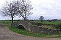 Ketton Packhorse Bridge. - geograph.org.uk - 161090.jpg 640 × 428; 104 KB
-

-
 Lime Lane - geograph.org.uk - 5258584.jpg 1,024 × 683; 308 KB
-
 Lime Lane crosses the A1 - geograph.org.uk - 5258600.jpg 1,024 × 683; 291 KB
-
 Lime Lane heading west - geograph.org.uk - 3227945.jpg 640 × 480; 82 KB
-
 Lime Lane heading west - geograph.org.uk - 3227961.jpg 640 × 480; 53 KB
-
 Lime Lane near Brafferton - geograph.org.uk - 2580128.jpg 3,648 × 2,736; 2.02 MB
-
 Lime Lane overbridge, A1(M) - geograph.org.uk - 2575078.jpg 640 × 430; 45 KB
-
 Lime Lane rail bridge - geograph.org.uk - 1745733.jpg 640 × 480; 60 KB
-
 Lime Lane towards Newton Aycliffe - geograph.org.uk - 3227964.jpg 640 × 480; 54 KB
-
 Mast by East Coast Main Line - geograph.org.uk - 1745741.jpg 480 × 640; 30 KB
-
 Mill Bridge , Coatham Munderville - geograph.org.uk - 150444.jpg 640 × 479; 126 KB
-
 Old Hawthorth hedge alongside footpath from High House Lane - geograph.org.uk - 3101634.jpg 3,648 × 2,736; 2.41 MB
-

-
 Pasture at High House Farm - geograph.org.uk - 4611747.jpg 4,320 × 3,240; 3.47 MB
-
 Ploughed field below East Ketton - geograph.org.uk - 6345391.jpg 1,024 × 768; 313 KB
-
 Ploughed field west of Ketton Lane - geograph.org.uk - 6361958.jpg 1,024 × 768; 369 KB
-
 Pond at High House Farm - geograph.org.uk - 4611744.jpg 4,320 × 3,240; 3.31 MB
-
 Pylon by the East Coast Main Line - geograph.org.uk - 2331499.jpg 640 × 360; 32 KB
-
 Railway Bridge over River Skerne - geograph.org.uk - 6275932.jpg 1,024 × 768; 228 KB
-
 Rainbow At The End of The Road - geograph.org.uk - 1600527.jpg 640 × 480; 63 KB
-
 River Skerne towards Peartree House - geograph.org.uk - 6275945.jpg 1,024 × 768; 186 KB
-
 Salters Lane north of Fir Tree Farm - geograph.org.uk - 3101427.jpg 3,648 × 2,736; 3.27 MB
-
 Shalters Bridge - geograph.org.uk - 1745748.jpg 640 × 362; 41 KB
-

-

-
 Stone bridge carrying a footpath over Newton Beck - geograph.org.uk - 3381681.jpg 3,648 × 2,736; 3.51 MB
-
 Telecom mast on Lime Lane - geograph.org.uk - 1744940.jpg 640 × 480; 35 KB
-
 Telecommunications mast at Lime Lane near Brafferton - geograph.org.uk - 3030503.jpg 3,648 × 2,736; 1.98 MB
-
 The granary at Newton Ketton farm - geograph.org.uk - 3101593.jpg 3,648 × 2,736; 2.43 MB
-
 Track to High House Farm - geograph.org.uk - 3227942.jpg 640 × 480; 59 KB
-
 Track towards High Grange - geograph.org.uk - 3227957.jpg 640 × 480; 103 KB
-
 Tree line above Ord's Gill seen from Salters Lane - geograph.org.uk - 3101460.jpg 2,809 × 2,116; 904 KB
-
 Up-line at Brafferton - geograph.org.uk - 1745826.jpg 640 × 480; 77 KB
-
 Viaduct over River Skerne - geograph.org.uk - 4340818.jpg 1,500 × 1,125; 1.6 MB
-
 View across A1(M) - geograph.org.uk - 1744993.jpg 640 × 480; 66 KB
-
 View north up A1(M) - geograph.org.uk - 1745716.jpg 640 × 480; 49 KB
-
 View south down A1(M) from Lime Lane - geograph.org.uk - 1744977.jpg 640 × 480; 47 KB
-
 Village Hall, Brafferton - geograph.org.uk - 1745818.jpg 640 × 448; 64 KB
-
 Warning to vermin - geograph.org.uk - 5258538.jpg 1,024 × 683; 331 KB
-
 West end of Brafferton village - geograph.org.uk - 4611806.jpg 4,320 × 3,240; 3.15 MB
-
 Woodland near Holme Mill - geograph.org.uk - 6282502.jpg 1,024 × 512; 188 KB
-

-
 Lovesome Hill Farm sign - geograph.org.uk - 418737.jpg 640 × 480; 101 KB
-
 Road to Lovesome Hill Farm - geograph.org.uk - 418723.jpg 640 × 480; 133 KB


_-_geograph.org.uk_-_5258596.jpg)
_approaching_Junction_59_-_geograph.org.uk_-_3227970.jpg)
_north_of_Junction_59_-_geograph.org.uk_-_5829007.jpg)
_northbound_-_geograph.org.uk_-_3104218.jpg)


_-_geograph.org.uk_-_6360133.jpg)
_-_geograph.org.uk_-_6361970.jpg)


_-_geograph.org.uk_-_3227952.jpg)


_-_geograph.org.uk_-_2575078.jpg)


_-_geograph.org.uk_-_6360088.jpg)


_-_geograph.org.uk_-_1744993.jpg)
_-_geograph.org.uk_-_1745716.jpg)
_from_Lime_Lane_-_geograph.org.uk_-_1744977.jpg)


