Category:Braddan
Jump to navigation
Jump to search
parish of the Isle of Man  | |||||
| Upload media | |||||
| Instance of |
| ||||
|---|---|---|---|---|---|
| Location | Middle, Isle of Man, Irish Sea | ||||
 | |||||
Subcategories
This category has the following 3 subcategories, out of 3 total.
Media in category "Braddan"
The following 200 files are in this category, out of 359 total.
(previous page) (next page)-
 'Fort North' - geograph.org.uk - 1979860.jpg 2,816 × 2,112; 1.01 MB
-
 1st Douglas Scout Group Bunkhouse near Ballachrink - geograph.org.uk - 5722649.jpg 1,600 × 1,065; 791 KB
-
 A18 towards Beinn - Phott Road - geograph.org.uk - 5722707.jpg 1,600 × 1,065; 535 KB
-
 A18 towards Brandywell - geograph.org.uk - 5740704.jpg 1,600 × 1,065; 545 KB
-
 A37 at Keristal on the cliffs - geograph.org.uk - 3153110.jpg 2,592 × 1,936; 1.86 MB
-
 A37 at Port Soderick - geograph.org.uk - 3151499.jpg 2,592 × 1,936; 1.76 MB
-
 A37 by the coast - geograph.org.uk - 3151509.jpg 2,592 × 1,936; 2.11 MB
-
 A37 road towards Port Soderick - geograph.org.uk - 6176991.jpg 5,202 × 3,465; 3.1 MB
-
 A6 road from bridge on IOMR - geograph.org.uk - 3107482.jpg 4,608 × 3,456; 5.72 MB
-
 Along the platform - geograph.org.uk - 3138055.jpg 1,936 × 2,592; 2.35 MB
-
 Andromeda J off Little Ness - geograph.org.uk - 4412700.jpg 4,608 × 3,456; 3.41 MB
-
 Anemone ^ Ramsons by the River Dhoo - geograph.org.uk - 4428569.jpg 459 × 640; 144 KB
-
 Approaching Port Soderick station - geograph.org.uk - 3125523.jpg 480 × 640; 77 KB
-
 Approaching the 'chicane' on A25 - geograph.org.uk - 2600337.jpg 3,296 × 2,472; 1.99 MB
-
 Arch to former tramway - geograph.org.uk - 3620657.jpg 640 × 480; 98 KB
-
 Archway on Marine Drive, Douglas - geograph.org.uk - 2145312.jpg 1,024 × 768; 202 KB
-
 At Windy Corner on the TT course - geograph.org.uk - 4876280.jpg 5,184 × 3,888; 4.77 MB
-
 B23 by Port Soderick Glen - geograph.org.uk - 3151485.jpg 2,592 × 1,936; 2.76 MB
-
 Baldwin - Narrow road from Millennium Way to B22 - geograph.org.uk - 1701101.jpg 1,718 × 1,145; 1.81 MB
-
 Baldwin area - The Creg from St Luke's Church - geograph.org.uk - 1719721.jpg 3,531 × 1,211; 3.14 MB
-
 Baldwin reservoir - geograph.org.uk - 3775252.jpg 1,600 × 1,067; 590 KB
-
 Baldwin River near Eary Ween - geograph.org.uk - 5740467.jpg 1,600 × 1,065; 1.02 MB
-
 Ballacottier School entrance - geograph.org.uk - 2305529.jpg 3,456 × 2,592; 3.44 MB
-

-
 Ballakinnish, Energy from Waste Plant - geograph.org.uk - 4619313.jpg 768 × 1,024; 117 KB
-
 Ballamodha Road - geograph.org.uk - 5722639.jpg 1,600 × 1,065; 818 KB
-
 Ballamodha Road at East Baldwin Road - geograph.org.uk - 5738442.jpg 1,600 × 1,065; 411 KB
-
 Ballamodha Road near Ballamodda Farm - geograph.org.uk - 5738367.jpg 1,600 × 1,065; 596 KB
-
 Ballamodha Road towards Ballamodda - geograph.org.uk - 5738324.jpg 1,600 × 1,065; 801 KB
-
 Ballamodha Road towards Ballamodda - geograph.org.uk - 5738337.jpg 1,600 × 1,065; 702 KB
-
 Ballamodha Road towards St Lukes Church - geograph.org.uk - 5738374.jpg 1,600 × 1,065; 696 KB
-
 Ballamodha Road towards St Lukes Church - geograph.org.uk - 5738376.jpg 1,600 × 1,065; 616 KB
-
 Ballamodha Road towards St Lukes Church - geograph.org.uk - 5738439.jpg 1,600 × 1,065; 564 KB
-
 Bay below Keristal - geograph.org.uk - 3153098.jpg 2,592 × 1,936; 2.02 MB
-
 Booilshuggel, East Baldwin - geograph.org.uk - 5740226.jpg 1,600 × 1,065; 625 KB
-
 Braddan Bridge - geograph.org.uk - 4428592.jpg 640 × 424; 89 KB
-
 Bridge carrying the railway - geograph.org.uk - 3151482.jpg 1,936 × 2,592; 3.33 MB
-
 Bridge over stream - geograph.org.uk - 5780709.jpg 640 × 427; 108 KB
-
 Bridge under IOMSR - geograph.org.uk - 3636142.jpg 480 × 640; 132 KB
-
 Building at Port Soderick station - geograph.org.uk - 3151472.jpg 2,592 × 1,936; 2.6 MB
-
 Building on Ballamodha Road, Baldwin - geograph.org.uk - 5738316.jpg 1,600 × 1,065; 819 KB
-
 Bushey's Brewery - geograph.org.uk - 5345829.jpg 640 × 424; 72 KB
-
 Bushey's Brewery Tap - geograph.org.uk - 5345893.jpg 640 × 424; 66 KB
-
 Bushey's Fermenters - geograph.org.uk - 5345864.jpg 424 × 640; 70 KB
-

-
 Cliff Path on Little Ness - geograph.org.uk - 4428742.jpg 424 × 640; 57 KB
-
 Cliffs and Coastal Flora - geograph.org.uk - 4428737.jpg 424 × 640; 86 KB
-
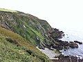 Cliffs at Port Soderick - geograph.org.uk - 3153119.jpg 2,592 × 1,936; 2.01 MB
-
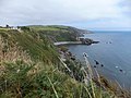
 Cliffs from Marine Drive - geograph.org.uk - 3153141.jpg 2,592 × 1,936; 2.43 MB
-
 Cliffs ^ Marine Drive - geograph.org.uk - 4428733.jpg 424 × 640; 62 KB
-
 Clifftop at Little Ness - geograph.org.uk - 4428747.jpg 640 × 424; 70 KB
-
 Clifftop Sunrise - geograph.org.uk - 1815138.jpg 428 × 640; 46 KB
-
 Clybane Park - geograph.org.uk - 2305537.jpg 3,456 × 2,592; 4.01 MB
-
 Clybane Rise - geograph.org.uk - 2305884.jpg 3,456 × 2,592; 3.71 MB
-
 Coast at Port Soderick - geograph.org.uk - 2537696.jpg 640 × 426; 39 KB
-
 Coastal path at Port Soderick - geograph.org.uk - 5726695.jpg 1,600 × 1,065; 748 KB
-
 Coastal path sign - geograph.org.uk - 3153096.jpg 1,936 × 2,592; 2.04 MB
-
 Coastal scene - geograph.org.uk - 4412626.jpg 4,608 × 3,456; 4.79 MB
-
 Coastal View East Along Marine Drive - geograph.org.uk - 3412848.jpg 2,560 × 1,920; 3.01 MB
-
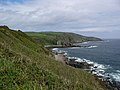
 Coastline along Marine Drive - geograph.org.uk - 3153161.jpg 2,592 × 1,936; 1.97 MB
-
-
 Coastline below Keristal - geograph.org.uk - 1317411.jpg 640 × 480; 95 KB
-
 Coastline by Marine Drive - geograph.org.uk - 2737017.jpg 1,024 × 768; 236 KB
-
 Coastline near the Keristal - geograph.org.uk - 3636128.jpg 640 × 480; 85 KB
-
 Coastline to South West of Keristal - geograph.org.uk - 3636134.jpg 640 × 480; 74 KB
-
 Coastline view from near Keristal - geograph.org.uk - 5779437.jpg 427 × 640; 85 KB
-
 Cooil Road - geograph.org.uk - 1979873.jpg 2,816 × 2,112; 1.37 MB
-
 Crogga Castle Lake - geograph.org.uk - 4428851.jpg 640 × 424; 78 KB
-
 Crogga River - geograph.org.uk - 4428861.jpg 424 × 640; 115 KB
-
 Crogga, Old Castletown Road, Isle of Man - geograph.org.uk - 5726724.jpg 1,600 × 1,065; 568 KB
-
 Cronk Keeill Abban, Isle of Man.jpg 3,448 × 4,592; 9.54 MB
-
 Damaged section of Marine Drive - geograph.org.uk - 3153156.jpg 1,936 × 2,592; 2.04 MB
-
 Derelict and Deserted - geograph.org.uk - 1346861.jpg 480 × 640; 78 KB
-
 Derelict Row Of Cottages - geograph.org.uk - 3412829.jpg 2,560 × 1,920; 2.73 MB
-
 Disused farm house at Algare - geograph.org.uk - 5722641.jpg 1,600 × 1,065; 967 KB
-
 Douglas - Evening on Marine Drive - geograph.org.uk - 5619422.jpg 5,184 × 2,920; 4.13 MB
-
 Douglas Head from Market Street - geograph.org.uk - 1954069.jpg 1,024 × 768; 95 KB
-
 Early Sailing - geograph.org.uk - 1815315.jpg 428 × 640; 46 KB
-
 East Baldwin - Grazing land and The Creg - geograph.org.uk - 1701093.jpg 1,690 × 1,127; 1.7 MB
-
 East Baldwin Road at East Baldwin - geograph.org.uk - 5740217.jpg 1,600 × 1,065; 659 KB
-
 East Baldwin Road near Algare - geograph.org.uk - 5738448.jpg 1,600 × 1,065; 780 KB
-
 East Baldwin Road towards East Baldwin - geograph.org.uk - 5740211.jpg 1,600 × 1,065; 613 KB
-
 East Baldwin Road towards East Baldwin - geograph.org.uk - 5740212.jpg 1,600 × 1,065; 758 KB
-
 East bank of West Baldwin reservoir - geograph.org.uk - 3774925.jpg 640 × 480; 55 KB
-
 Elephant in the room - geograph.org.uk - 4409806.jpg 4,608 × 3,456; 5.42 MB
-
 Eroding Walkway in Port Soderick - geograph.org.uk - 4428790.jpg 640 × 424; 83 KB
-
 Farm Buildings at Algare - geograph.org.uk - 5738446.jpg 1,600 × 1,065; 689 KB
-
 Farm track leading to Creg-y-cowin - geograph.org.uk - 5740428.jpg 1,600 × 1,065; 986 KB
-
 Farm track leading to Creg-y-cowin - geograph.org.uk - 5740431.jpg 1,600 × 1,065; 985 KB
-
 Farm track leading to Creg-y-cowin - geograph.org.uk - 5740435.jpg 1,600 × 1,065; 861 KB
-
 Farm track leading to Creg-y-cowin - geograph.org.uk - 5740456.jpg 1,600 × 1,065; 968 KB
-
 Farm track leading to Creg-y-cowin - geograph.org.uk - 5740460.jpg 1,600 × 1,065; 1 MB
-
 Farm track leading to Creg-y-cowin - geograph.org.uk - 5740471.jpg 1,600 × 1,065; 980 KB
-
 Farm track leading to Creg-y-cowin - geograph.org.uk - 5740475.jpg 1,600 × 1,065; 995 KB
-
 Farm track leading to Creg-y-cowin - geograph.org.uk - 5740478.jpg 1,600 × 1,065; 917 KB
-
 Farmland near Ballachrink - geograph.org.uk - 5722650.jpg 1,600 × 1,065; 672 KB
-
 Farmland west of Keristal - geograph.org.uk - 5084605.jpg 1,024 × 615; 101 KB
-
 Fickle British weather - geograph.org.uk - 4412670.jpg 4,608 × 3,456; 3.25 MB
-

-
 Fields by the railway - geograph.org.uk - 3138086.jpg 2,592 × 1,936; 1.1 MB
-
 Fields near the railway - geograph.org.uk - 3136442.jpg 3,648 × 2,736; 1.86 MB
-
 Fields on the coast - geograph.org.uk - 3138068.jpg 2,333 × 1,676; 1.45 MB
-
 Football, Hospital cup final - geograph.org.uk - 2425964.jpg 2,048 × 1,536; 702 KB
-
 Footbridge over Baldwin River - geograph.org.uk - 5740464.jpg 1,600 × 1,065; 905 KB
-
 Footpath to Mount Murray Back Rd - geograph.org.uk - 5346461.jpg 640 × 424; 56 KB
-
 Former church, Main Road, Union Mills - geograph.org.uk - 5736113.jpg 1,600 × 1,065; 510 KB
-
 Geological formation - geograph.org.uk - 4674057.jpg 4,608 × 3,456; 2.59 MB
-
 Godisgoode - geograph.org.uk - 5345876.jpg 424 × 640; 65 KB
-
 Gorse ^ Marine Drive - geograph.org.uk - 1815357.jpg 640 × 428; 63 KB
-
 Grazing Land Near Ballacutchal - geograph.org.uk - 5346488.jpg 640 × 424; 56 KB
-
 Hard standing near Port Soderick - geograph.org.uk - 3138059.jpg 2,592 × 1,936; 1.4 MB
-
 Helipad at the Hospital - geograph.org.uk - 3139111.jpg 2,148 × 1,728; 1.37 MB
-
 Hillside at Slieau Ree - geograph.org.uk - 1119717.jpg 640 × 432; 77 KB
-
 Home of Rest for Old Horses - geograph.org.uk - 1972969.jpg 2,816 × 2,112; 1.08 MB
-
 Home of rest for old tramcar horses - geograph.org.uk - 3167028.jpg 2,592 × 1,936; 2.01 MB
-
 Horse drawn tramcar number 35 - geograph.org.uk - 2600380.jpg 3,296 × 2,472; 1.93 MB
-
 House at East Baldwin - geograph.org.uk - 5740345.jpg 1,600 × 1,065; 705 KB
-
 House at Keristal - geograph.org.uk - 3153102.jpg 2,592 × 1,936; 1.84 MB
-
 House at Keristal - geograph.org.uk - 3153104.jpg 2,592 × 1,936; 2.08 MB
-
 Houses at Keristal - geograph.org.uk - 3138080.jpg 2,592 × 1,936; 1.33 MB
-
 Houses on the clifftop - geograph.org.uk - 4412709.jpg 4,608 × 3,456; 4.85 MB
-
 Houses on the hill - geograph.org.uk - 5038951.jpg 640 × 480; 117 KB
-
 Incinerator Approach Rd - geograph.org.uk - 5742563.jpg 424 × 640; 52 KB
-
 Incinerator, Richmond Hill - geograph.org.uk - 2383381.jpg 640 × 480; 117 KB
-
 Injebreck Hill trees - geograph.org.uk - 3775450.jpg 640 × 480; 61 KB
-
 Injebreck, cattle grid - geograph.org.uk - 4617527.jpg 1,024 × 768; 174 KB
-
 Injebreck, Glen Crammag - geograph.org.uk - 4617530.jpg 1,024 × 768; 169 KB
-
 Injebreck, greenway - geograph.org.uk - 4617529.jpg 1,024 × 768; 227 KB
-
 Injebreck, sheepfold - geograph.org.uk - 4617525.jpg 1,024 × 768; 151 KB
-
 Inquistive cattle - geograph.org.uk - 3642215.jpg 640 × 480; 81 KB
-
 Inside Bushey's - geograph.org.uk - 5345849.jpg 424 × 640; 52 KB
-

-
 Iron Milepost - geograph.org.uk - 5742564.jpg 640 × 424; 107 KB
-

-
 Isle of Man Steam Heritage Trail - geograph.org.uk - 5735965.jpg 1,600 × 1,065; 770 KB
-
 Isle of Man Steam Heritage Trail - geograph.org.uk - 5735989.jpg 1,600 × 1,065; 791 KB
-
 Isle of Man Steam Heritage Trail - geograph.org.uk - 5735994.jpg 1,600 × 1,065; 770 KB
-
 Isle of Man Steam Heritage Trail - geograph.org.uk - 5735996.jpg 1,600 × 1,065; 845 KB
-
 Isle of Man Steam Heritage Trail - geograph.org.uk - 5736008.jpg 1,600 × 1,065; 971 KB
-
 Isle of Man Steam Heritage Trail - geograph.org.uk - 5736017.jpg 1,600 × 1,065; 803 KB
-
 Isle of Man Steam Heritage Trail - geograph.org.uk - 5736031.jpg 1,600 × 1,065; 830 KB
-
 Isle of Man Steam Heritage Trail at Peel Road - geograph.org.uk - 5735963.jpg 1,600 × 1,065; 713 KB
-
 Isle of Man Steam Heritage Trail Notice Board - geograph.org.uk - 5735991.jpg 1,600 × 1,139; 567 KB
-
 Isle of Man Steam Heritage Trail Notice Board - geograph.org.uk - 5736005.jpg 1,600 × 1,163; 652 KB
-
 Isle of Man Steam Heritage Trail Notice Board - geograph.org.uk - 5736012.jpg 1,600 × 1,143; 543 KB
-
 Isle of Man Steam Heritage Trail Notice Board - geograph.org.uk - 5736033.jpg 1,600 × 1,171; 519 KB
-
 Isle of Man Steam Railway - geograph.org.uk - 3151515.jpg 2,592 × 1,936; 2.24 MB
-
 Isle of Man Steam Railway - geograph.org.uk - 3151521.jpg 2,592 × 1,936; 1.95 MB
-
 Jellybeans Nursery - geograph.org.uk - 5345049.jpg 640 × 360; 60 KB
-
 Junction of the A37, B52 and Marine Drive - geograph.org.uk - 3153106.jpg 2,592 × 1,936; 1.59 MB
-
 Kaneens Garage, Main Road, Union Mills - geograph.org.uk - 5736047.jpg 1,600 × 1,065; 531 KB
-
 Keristal from IOMSR - geograph.org.uk - 3125493.jpg 640 × 480; 69 KB
-
 Kirk Braddan Anderson 1881b Fig 139 scotlandinearlyc00anderich 0270.jpg 985 × 2,432; 825 KB
-
 Kirk Bradden parish church - geograph.org.uk - 6215692.jpg 1,024 × 768; 207 KB
-
 Kirk Bradden parish office - geograph.org.uk - 6197382.jpg 1,024 × 768; 179 KB
-
 Leaving Port Soderick station - geograph.org.uk - 3125537.jpg 480 × 640; 120 KB
-
 Little Ness - geograph.org.uk - 3153153.jpg 2,592 × 1,936; 1.99 MB
-
 Little Ness Cliff Path - geograph.org.uk - 4428745.jpg 640 × 424; 59 KB
-
 Little Ness, Marine Road - geograph.org.uk - 5724973.jpg 1,600 × 1,065; 951 KB
-
 Looking across Port Soderick bay - geograph.org.uk - 3138064.jpg 2,592 × 1,936; 1.36 MB
-

-
 Looking towards East Baldwin - geograph.org.uk - 5740670.jpg 1,600 × 1,065; 709 KB
-
 Looking towards the A18 near Windy Corner - geograph.org.uk - 5740692.jpg 1,600 × 1,065; 422 KB
-
 Main Road, Union Mills - geograph.org.uk - 5736036.jpg 1,600 × 1,065; 562 KB
-
 Main Road, Union Mills - geograph.org.uk - 5736117.jpg 1,600 × 1,065; 581 KB
-
 Marine Drive - geograph.org.uk - 1093433.jpg 640 × 360; 121 KB
-
 Marine Drive - geograph.org.uk - 1122164.jpg 640 × 412; 97 KB
-
 Marine Drive - geograph.org.uk - 3153114.jpg 2,592 × 1,936; 1.91 MB
-
 Marine Drive - geograph.org.uk - 3153128.jpg 2,592 × 1,936; 2.26 MB
-
 Marine Drive - geograph.org.uk - 3153132.jpg 2,592 × 1,936; 1.55 MB
-
 Marine Drive - geograph.org.uk - 3153136.jpg 2,592 × 1,936; 2.03 MB
-
 Marine Drive - geograph.org.uk - 3153151.jpg 2,592 × 1,936; 2.04 MB
-
 Marine Drive - geograph.org.uk - 3153167.jpg 2,592 × 1,936; 2.2 MB
-
 Marine Drive - geograph.org.uk - 3636146.jpg 640 × 480; 88 KB
-
 Marine Drive Arch - geograph.org.uk - 2386997.jpg 1,280 × 960; 450 KB
-
 Marine Drive Archway - geograph.org.uk - 2387002.jpg 1,280 × 960; 620 KB
-
 Marine Drive at Port Wallberry - geograph.org.uk - 5724953.jpg 1,600 × 1,065; 529 KB
-
 Marine Drive Folly - geograph.org.uk - 1815393.jpg 640 × 428; 72 KB
-
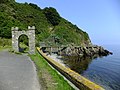
 Marine Drive Gateway - geograph.org.uk - 4306338.jpg 640 × 474; 81 KB
-
 Marine Drive showing scree and folds - geograph.org.uk - 3636152.jpg 640 × 480; 86 KB
-
 Marine Drive towards Little Ness - geograph.org.uk - 5724961.jpg 1,600 × 1,065; 447 KB
-
 Marine Drive towards Port Soderick - geograph.org.uk - 5724997.jpg 1,600 × 1,065; 472 KB
-
 Marine Drive towards Port Wallberry - geograph.org.uk - 5724921.jpg 1,600 × 1,065; 384 KB
-
 Marine Drive, Douglas - geograph.org.uk - 5724901.jpg 1,600 × 1,065; 638 KB
-
 Millcroft near Ballawyllin - geograph.org.uk - 5722645.jpg 1,600 × 1,065; 769 KB
-
 Millennium Path heading NNE - geograph.org.uk - 3642193.jpg 640 × 480; 87 KB
-
 Millennium Way at West Baldwin - geograph.org.uk - 5738002.jpg 1,600 × 1,065; 898 KB
-
 Millennium Way at West Baldwin - geograph.org.uk - 5738009.jpg 1,600 × 1,065; 891 KB
-
 Millennium Way towards Baldwin - geograph.org.uk - 5737966.jpg 1,600 × 1,065; 934 KB
-
 Moorland Path - geograph.org.uk - 1252919.jpg 640 × 480; 97 KB
-

-

-
 Motors Ahead - geograph.org.uk - 4428740.jpg 640 × 424; 77 KB
-
 Mount Murray (Richmond Hill) - geograph.org.uk - 3415891.jpg 2,560 × 1,920; 2.58 MB
-
 Mountain Road - geograph.org.uk - 2388827.jpg 640 × 480; 129 KB
-
 Natural arch - geograph.org.uk - 4412678.jpg 4,608 × 3,456; 4.35 MB
-
 Nesting Material - geograph.org.uk - 5346498.jpg 424 × 640; 50 KB
-
 New Ballacottier Meadow Estate - geograph.org.uk - 2305824.jpg 3,456 × 2,592; 3.36 MB
-
 New Ballacottier Meadow Estate - geograph.org.uk - 2305859.jpg 3,456 × 2,592; 3.4 MB
-
 New Estate, Ballacottier Meadow - geograph.org.uk - 2305787.jpg 3,456 × 2,592; 3.39 MB


_-_geograph.org.uk_-_2383393.jpg)


_-_geograph.org.uk_-_3415891.jpg)


