Category:Boundary wall and gateways of Christ Church, Waterloo
Jump to navigation
Jump to search
| Object location | | View all coordinates using: OpenStreetMap |
|---|
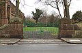
wall in Sefton, Merseyside, UK  | |||||
| Upload media | |||||
| Instance of | |||||
|---|---|---|---|---|---|
| Part of | |||||
| Location | Sefton, Merseyside, North West England, England | ||||
| Heritage designation |
| ||||
 | |||||
Media in category "Boundary wall and gateways of Christ Church, Waterloo"
The following 4 files are in this category, out of 4 total.
-
 North gate of Old Christ Church, Waterloo.jpg 5,052 × 2,968; 20.91 MB
-
 South gate of Old Christ Church, Waterloo.jpg 4,911 × 3,199; 20.39 MB
-
 Wall of Old Christ Church, Waterloo 1.jpg 5,092 × 3,067; 22.45 MB
-
 Wall of Old Christ Church, Waterloo 2.jpg 4,839 × 3,405; 23.37 MB


