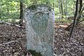
Category:Boundary stone (GDH - GDF) No136
Jump to navigation
Jump to search
| Object location | | View all coordinates using: OpenStreetMap |
|---|
Media in category "Boundary stone (GDH - GDF) No136"
The following 3 files are in this category, out of 3 total.
-
 Grenzstein 136 GH - GF(1).jpg 3,456 × 5,184; 6.55 MB
-
 Grenzstein 136 GH - GF(2).jpg 5,184 × 3,456; 7.01 MB
-
 Grenzstein 136 GH - GF(3).jpg 5,184 × 3,456; 6.48 MB
.jpg)
.jpg)
.jpg)