Category:Bossingham
Jump to navigation
Jump to search
village in Kent, England, UK  | |||||
| Upload media | |||||
| Instance of | |||||
|---|---|---|---|---|---|
| Location | Upper Hardres, Canterbury, Kent, South East England, England | ||||
 | |||||
English: Bossingham is a village in the civil parish of Upper Hardres, and the City of Canterbury District of Kent, England. It is located about five miles (8km) south of Canterbury, and 2 miles (3.2km) north of Stelling Minnis on a parallel road to the Roman road of Stone Street (the A2068 road). There is one public house – the Hop Pocket, named after the large sacks in which hops were transported.

Media in category "Bossingham"
The following 20 files are in this category, out of 20 total.
-
 Bossingham School - geograph.org.uk - 340790.jpg 640 × 480; 151 KB
-
 Bossingham Village Hall - geograph.org.uk - 340785.jpg 640 × 480; 96 KB
-
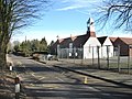
 Entering Bossingham on Hardres Court Road - geograph.org.uk - 340777.jpg 640 × 480; 181 KB
-
 Entrance into Upper Hardres Wood - geograph.org.uk - 1244851.jpg 640 × 480; 218 KB
-

-

-
 Lime Kiln Lane joins the Stone Street - geograph.org.uk - 1245295.jpg 640 × 480; 109 KB
-
 The Hop Pocket, Bossingham - geograph.org.uk - 340378.jpg 640 × 480; 234 KB
-

-
 View from Lime Kiln Lane - geograph.org.uk - 1245285.jpg 640 × 480; 119 KB
-
 View N along the Stone Street - geograph.org.uk - 1244847.jpg 640 × 480; 118 KB
-

-
 Footpath and stile, Bossingham Street - geograph.org.uk - 340788.jpg 480 × 640; 162 KB
-

-
 Houses on Bossingham Street - geograph.org.uk - 340381.jpg 640 × 480; 244 KB
-
 Path into Upper Hardres Wood - geograph.org.uk - 441511.jpg 428 × 640; 460 KB
-

-

-
 Tennis court at Lynsore Court - geograph.org.uk - 330895.jpg 640 × 480; 348 KB
-
 View across Lynsore Bottom - geograph.org.uk - 330897.jpg 640 × 480; 289 KB


