Category:Bos 400 (ship, 1984)
Jump to navigation
Jump to search
| Object location | | View all coordinates using: OpenStreetMap |
|---|
| Information about the vessel may be found at IMO 8758495. A ship can change name and flag state through time, but the IMO number remains the same through the hull's entire lifetime. As a result, it can be useful to identify a ship by using the IMO number. |
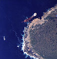
historic wreck and dive site at Duiker Point on the Cape Peninsula west coast   | |||||
| Upload media | |||||
| Instance of |
| ||||
|---|---|---|---|---|---|
| Part of | |||||
| Location | Table Mountain National Park Marine Protected Area, Western Cape, RSA | ||||
| Manufacturer | |||||
| Country of registry | |||||
 | |||||
Media in category "Bos 400 (ship, 1984)"
The following 10 files are in this category, out of 10 total.
-
 Bos 400 banner 1.JPG 2,100 × 300; 426 KB
-
 Bos 400 banner 2.JPG 2,100 × 300; 382 KB
-
 Bos 400 banner 3.JPG 2,100 × 300; 419 KB
-
 BossSept2010FW Saul G.jpg 500 × 397; 76 KB
-
 Colonial ascidians at the Boss DSC09100.JPG 2,048 × 1,536; 1.31 MB
-
 Oakburn and Bos400 map.png 9,565 × 7,053; 3.83 MB
-
 Oakburn Boss400 and Die Perd 300dp1.jpg 2,220 × 2,309; 3.43 MB
-
 Wreckage of the Bos 400 PA031703.jpg 3,648 × 2,736; 2.12 MB
-
 Wreckage of the Boss 400 PA031705.JPG 3,648 × 2,736; 2.17 MB
-
 Wreckage under the Boss DSC09097.JPG 2,048 × 1,536; 1.03 MB


