Category:Bonnavoulin
Jump to navigation
Jump to search
human settlement in Highland, Scotland, UK | |||||
| Upload media | |||||
| Instance of | |||||
|---|---|---|---|---|---|
| Location |
| ||||
 | |||||
English: Bonnavoulin or Bunavullin is a village on the Morvern peninsula in the Highlands of Scotland. Situated at the northern terminus of the B849, it is about ten miles from Lochaline and on the eastern shore of the Sound of Mull opposite the isle of Mull and is in the Highland Council area.
Media in category "Bonnavoulin"
The following 34 files are in this category, out of 34 total.
-
 Auchnasaul - geograph.org.uk - 50680.jpg 640 × 479; 89 KB
-
 Bogha Bhuilg - geograph.org.uk - 4575925.jpg 640 × 410; 199 KB
-
 Caravan by the Post Office, Bunavullin - geograph.org.uk - 2616650.jpg 3,888 × 2,592; 4.64 MB
-
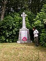 Celtic Cross on Drimnin road - geograph.org.uk - 688307.jpg 480 × 640; 142 KB
-
 Drimnin slipway - geograph.org.uk - 3170819.jpg 3,000 × 2,237; 5.34 MB
-
 Drimnin, memorial cairn - geograph.org.uk - 4147736.jpg 640 × 480; 85 KB
-
 Drimnin, Port nam Freumh - geograph.org.uk - 4147716.jpg 640 × 480; 81 KB
-
 Drimnin, the ferry waiting room - geograph.org.uk - 4147725.jpg 480 × 640; 58 KB
-
 Drimnin, work in progress - geograph.org.uk - 4147728.jpg 640 × 480; 98 KB
-
 House and Wigwam, Bunavullin - geograph.org.uk - 2615225.jpg 1,704 × 2,272; 1.19 MB
-
 House with wigwam, Bunavullin - geograph.org.uk - 2617311.jpg 3,888 × 2,592; 4.63 MB
-
 Part built house, Bunavullin - geograph.org.uk - 2615230.jpg 1,704 × 2,272; 1.21 MB
-
 Port nam Freumh beyond ruined boat - geograph.org.uk - 5633327.jpg 1,500 × 1,100; 2.17 MB
-
 Post Office, Bunavullin - geograph.org.uk - 2616655.jpg 3,480 × 2,316; 2.1 MB
-
 Slipway and shelter, Bunavullin - geograph.org.uk - 2615229.jpg 2,272 × 1,704; 1.09 MB
-
 Slipway for the Tobermory ferry - geograph.org.uk - 51060.jpg 640 × 480; 61 KB
-
 Telephone box, Bunavullin - geograph.org.uk - 2344998.jpg 1,600 × 1,003; 560 KB
-
 The Tobermory lifeboat with a boat in tow - geograph.org.uk - 5153995.jpg 3,264 × 2,448; 3.86 MB
-
 Across to Drimnin House. - geograph.org.uk - 51103.jpg 640 × 480; 154 KB
-
 Deserted Church off Drimnin road - geograph.org.uk - 688254.jpg 640 × 480; 125 KB
-
 Farm in Morvern - geograph.org.uk - 50728.jpg 640 × 479; 59 KB
-
 Farmland along the coast of Morvern - geograph.org.uk - 50831.jpg 640 × 480; 57 KB
-
 From track beside Auchnasaul - geograph.org.uk - 50675.jpg 640 × 479; 132 KB
-
 Graveyard, Killundine River - geograph.org.uk - 682015.jpg 640 × 427; 111 KB
-

-
 Mhungasdail River - geograph.org.uk - 51036.jpg 359 × 480; 59 KB
-
 Mhungosdaill - geograph.org.uk - 51044.jpg 359 × 480; 67 KB
-
 Mhungosdaill River - geograph.org.uk - 51041.jpg 359 × 480; 65 KB
-
 Morvern coastline - geograph.org.uk - 50725.jpg 640 × 480; 75 KB
-
 Path from Graveyard, Killundine - geograph.org.uk - 682462.jpg 640 × 427; 125 KB
-
 Post office near Bonnavoulin - geograph.org.uk - 51033.jpg 640 × 480; 61 KB
-
 Ruin, Carnacailliche - geograph.org.uk - 682029.jpg 640 × 427; 133 KB
-
 Sheep grazing - Morvern - geograph.org.uk - 50823.jpg 640 × 480; 45 KB
-
 Waterfall in Morvern - geograph.org.uk - 50816.jpg 480 × 640; 155 KB


